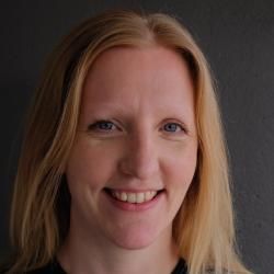
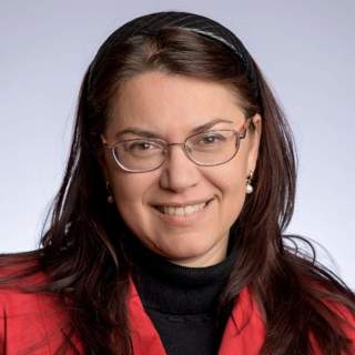
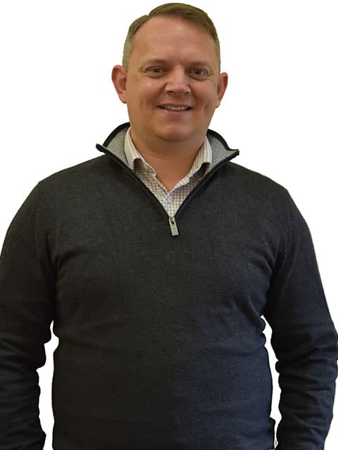
Zahra Gharineiat is an Associate Professor at the University of Southern Queensland , affiliated with the School of Surveying and Built Environment . She has over 8 years of tertiary teaching experience and 11 years of administrative responsibilities. Bachelor of Surveying (BSurv), University of Tabriz Master of Engineering Management (MEngMgt), University of Melbourne PhD, University of Newcastle Research Interests : Zahra specializes in Geomatic Engineering and Machine Learning , with a focus on applications like Unmanned Aerial Vehicles (UAVs) , LiDAR , Digital Twins , and Remote Sensing . Her work spans Earth Science Observations , Satellite altimetry , and Geodetic data capturing , integrating Computational Modelling and Geoinformatics for innovative solutions. Professional Affiliations : She is a member of the Surveying and Spatial Sciences Institute (SSSI) and the International Union of Geodesy and Geophysics (IUGG) . Her research affiliations include the Centre for Future Materials (CFM) , Institute for Advanced Engineering and Space Sciences (IAESS) , and Centre for Astrophysics (CA) .
Cyrill Stachniss is a Full Professor at the University of Bonn , where he heads the Lab for Photogrammetry and Robotics and is affiliated with the Lamarr Institute for Machine Learning and Artificial Intelligence . He was previously a Visiting Professor in Engineering at the University of Oxford until 2025. His academic journey includes positions at the University of Freiburg, University of Zaragoza, and the Swiss Federal Institute of Technology. University: University of Bonn School: Faculty of Engineering Department: Department of Photogrammetry Academic Rank: Professor His research spans robotics, photogrammetry, SLAM, autonomous navigation, perception systems, agricultural robotics, and unmanned aerial vehicles . He emphasizes probabilistic techniques for mobile robots and has made significant contributions to visual and LiDAR-based localization, scene understanding, and 3D reconstruction. The recent publications highlight a strong trend toward neural implicit representations, agricultural phenotyping, radar-based perception, and active learning . His team develops robust systems for real-world deployment in dynamic and unstructured environments, particularly in precision farming and autonomous vehicles. Scientific Awards: IEEE RAS Early Career Award (2013) Microsoft Research Faculty Fellow (2010) 7th EURON Georges Giralt Award (2008) Multiple Best Paper Awards at ICRA, IROS, RSS, and RAL Faculty Teaching Award, University of Freiburg He has advised numerous students and leads the DFG Cluster of Excellence PhenoRob and Research Unit FOR 1505 Mapping on Demand . His lab has co-founded three startups, reflecting strong industry and societal impact. He also runs the educational video series 5 Minutes with Cyrill , explaining key robotics concepts.
Bharat Lohani is a Professor at the Department of Civil Engineering in Indian Institute of Technology Kanpur . His work focuses on Geoinformatics , utilizing LiDAR and GIS for 3D modeling and spatial analysis. Education : PhD (University of Reading, UK), ME (IIT Roorkee), BE (MMM Engineering College Gorakhpur) Research Interests : LiDAR simulation, motion correction in scanning, flood propagation modeling, historical urban mapping, GPS signal analysis, agricultural land consolidation Article Trends : His publications emphasize LiDAR data processing , sensor integration , and optimization algorithms for geospatial applications. Scientific Awards : ISRS National Award (2012), Best Paper at INCA Congress (2012), Silver Award at ISPRS (2008) Advising : Mentored 8+ students in LiDAR and spatial data analysis Labs/Teams : Leads a research group at IITK including Aswani Kumar Munnangi and Salil Goel, affiliated with the Wadhwani School of AI & Intelligent Systems .
Prof. Christian Heipke is a distinguished academic serving as Dean of the Faculty of Civil Engineering and Geodetic Science at Leibniz University Hannover, Germany. He also holds the position of Executive Director at the Institute of Photogrammetry and GeoInformation (IPI), one of the leading research institutions in geospatial sciences within the faculty. His leadership extends across multiple committees including the Curriculum and Teaching Committee, Admissions and Examination Boards for Geodetic Science and Geoinformatics, and Navigation and Environmental Robotics. As a Professor at IPI, he maintains active research while overseeing significant academic and administrative responsibilities at the university. Professor Heipke's research spans multiple domains within geospatial sciences, with particular emphasis on: Advanced photogrammetric techniques and algorithms Remote sensing applications for environmental monitoring Computer vision approaches for geospatial data analysis Urban development monitoring using satellite imagery Machine learning applications in geoinformatics Disaster prediction and management systems His recent scholarly output reveals a strong focus on integrating cutting-edge computer vision and deep learning techniques with traditional photogrammetric methods. Analysis of his 15 most recent publications shows a clear trajectory toward more sophisticated AI-driven approaches for processing geospatial data, with particular attention to time-series analysis, uncertainty quantification, and multi-view systems. His work bridges theoretical advancements with practical applications in flood forecasting, deforestation monitoring, urban planning, and construction materials analysis. The geographic scope of his research has expanded significantly, with recent projects focusing on international case studies in the Philippines and tropical regions. Professor Heipke leads the Institute of Photogrammetry and GeoInformation, a major research hub that has celebrated 75 years of contributions to the field. His leadership extends to the Graduiertenkolleg 2159: "Integrity and Collaboration in Dynamic Sensor Networks," where he serves as a professor overseeing doctoral research. The institute maintains state-of-the-art facilities for processing satellite imagery, aerial photography, and developing novel algorithms for geospatial data analysis. Under his direction, the institute has strengthened its international collaborations and interdisciplinary research approaches, particularly in addressing Sustainable Development Goals through geospatial technologies.
Jan Skaloud serves as an Adjunct Professor at École Polytechnique Fédérale de Lausanne (EPFL), affiliated with the School of Architecture, Civil and Environmental Engineering (ENAC). He holds positions across multiple departments including SSIE (Institute of Earth Surface Dynamics), EDCE (Doctoral Program in Environmental Sciences and Engineering), and leads the Earth Sensing and Observation (ESO) Lab. His office is located at GC C2 397 in the EPFL campus in Lausanne, Switzerland. Dr. Skaloud's research expertise spans satellite positioning, inertial and integrated navigation systems, sensor orientation and calibration, attitude determination, mobile mapping, airborne laser scanning, and Kalman filtering techniques. His work bridges theoretical development with practical applications in UAV navigation, photogrammetry, and remote sensing. He teaches across three EPFL sections and two faculties, demonstrating his interdisciplinary approach to education. His publication record shows consistent contributions to the field, with recent work (2023-2025) focusing on vehicle dynamic model-based navigation for various UAV platforms, including delta-wing and fixed-wing drones. His research demonstrates a clear trajectory toward increasingly sophisticated navigation systems that integrate aerodynamic modeling with traditional sensor fusion approaches. This trend reflects the growing importance of model-based navigation in achieving higher precision and autonomy in UAV operations. 2021: Samuel Gamble Award for career contribution in photogrammetry & sensing (ISPRS) 2020: U.V. Helava Award for best paper in ISPRS Journal (2016-2019) 2017: Best Demo Award at IEEE International Workshop on Metrology & Aerospace 2014: Hansa Luftbild Award for best paper in PFG journal 2012: Karl Kraus Medal for best textbook in Photogrammetry 2009: GNSS Leader to Watch Innovation Award (GPS World) Dr. Skaloud has supervised numerous PhD students whose work focuses on advanced navigation systems, sensor calibration, and UAV applications. His research has received funding for projects involving direct georeferencing, mobile mapping systems, and UAV-based search and rescue operations. The ESO lab he directs serves as a hub for cutting-edge research in Earth observation technologies. The Earth Sensing and Observation Lab under Dr. Skaloud's direction brings together researchers working on navigation systems, sensor integration, and data processing techniques for geospatial applications. The lab maintains strong connections with industry partners and international research organizations, facilitating technology transfer and collaborative research projects.
Dr. Matthew Brookhouse is a Senior Lecturer at the Fenner School of Environment & Society, part of the Australian National University's Institute for Climate, Energy & Disaster Solutions. With a PhD in Dendroclimatology from ANU, he specializes in using forest structural complexity and tree-ring analysis to understand climate interactions and ecological responses in Australian subalpine environments. Research Focus: Sub-alpine ecology, Dendrochronology, CO2 responsiveness in eucalypt species Teaching: First-year research methods with emphasis on statistical application, advanced modeling and field botany Projects: Leading collaborative snow-gum dieback research and dendrochronological monitoring initiatives His publications span 2006-2025 with recent emphasis on machine learning applications for forest monitoring, tropical tree-ring chronologies for climate change, and climate sensitivity in Australian alpine ecosystems. Key collaborations include institutions like Australian Nuclear Science and Technology Organisation and University of Canberra researchers. Current projects focus on snow-gum woodland dieback mechanisms, high-resolution dendrometric monitoring, and integrating dendrochronology with environmental policy frameworks. He maintains active supervision of research students and contributes to both undergraduate and postgraduate curriculum development.
Dr. Samuel Cheng is an Associate Professor at the Gallogly College of Engineering , University of Oklahoma , specializing in Electrical and Computer Engineering . He holds a Ph.D. in Electrical Engineering from Texas A&M University (2004), preceded by M.S. and M.Phil. degrees from the University of Hawaii and Hong Kong University of Science and Technology. Education: B.S. (University of Hong Kong, 1995), M.Phil. (HKUST, 1997), M.S. (University of Hawaii, 2000), Ph.D. (Texas A&M, 2004) Professional Experience: Senior Research Engineer at Advanced Digital Imaging Research (2004-2005), prior internships at Microsoft Asia and Panasonic Technologies His research focuses on Information Theory , Signal and Image Processing , and Pattern Recognition , with applications in remote sensing, urbanization analysis, and disaster monitoring. His publications span topics including urban impervious surface mapping , nighttime light analysis , and machine learning for environmental data . His work often integrates multi-source datasets (e.g., Landsat, LiDAR, social media) for spatiotemporal modeling. Technical Expertise: Spectral unmixing, machine learning, thermal remote sensing, GIS integration Key Applications: Power outage detection, vegetation-crime correlation, PM2.5 estimation, smart meter data fusion Dr. Cheng holds three US patents in digital watermarking and is affiliated with IEEE, Sigma Xi, and AAAS. His recent articles demonstrate a trend toward leveraging AI for remote sensing challenges and analyzing urbanization impacts on ecosystems.
Lars-Olof Johansson is a Senior Lecturer at Halmstad University's School of Information Technology, specializing in Informatics. His research focuses on digital service innovation from a learning perspective, emphasizing collaboration between diverse stakeholders and knowledge exchange in innovation processes. He is actively involved in the LeaDS research program (Learning in a Digitalized Society) and teaches in the bachelor's program 'Digital Business Development' and the master's program 'Digital Learning'. His work bridges educational methodologies and technological innovation, particularly in fostering environments where interdisciplinary learning drives successful digital service creation. Notably recognized as an 'Excellent Teacher in Informatics,' he integrates practical experience with academic rigor, contributing to both scholarly discourse and pedagogical advancements. Key projects include SESMA (2019-2021), exploring sustainable mobility solutions, and ongoing collaborations in boundary practices for ICT innovation. His publications span topics like knowledgeability in digital service innovation, ethics in autonomous systems, and collaborative learning frameworks. His awards highlight his pedagogical impact, while his research addresses systemic challenges in innovation through interdisciplinary approaches.
Roya Nasimi, Ph.D., is an Assistant Professor in the Department of Engineering at California State University, East Bay, where she joined in Fall 2023. Her expertise spans structural engineering, computer vision, and artificial intelligence, with a focus on developing innovative solutions for infrastructure monitoring and safety. Dr. Nasimi's educational background includes: Ph.D. with distinction in Structural Engineering from the University of New Mexico Master’s degree in Structural Engineering from the University of Tabriz Bachelor’s degree in Civil Engineering from the University of Tabriz Her research focuses on structural health monitoring using advanced technologies. She integrates computer vision , artificial intelligence , and machine learning to develop systems for monitoring aging infrastructure, particularly bridges. Her work includes designing low-cost and high-end sensor systems, conducting full-scale bridge experiments, and collaborating on interdisciplinary projects to enhance infrastructure safety and resilience. Her recent publications (2021-2025) demonstrate a strong emphasis on non-contact monitoring techniques using drones, lasers, and computer vision. Key trends include the application of deep learning for displacement measurement, digital twinning for infrastructure, and rockfall prevention through machine learning. Her work bridges civil engineering with cutting-edge technology to address critical infrastructure challenges. Dr. Nasimi's research is supported by multiple grants: U.S. Army Corps of Engineers Transportation Research Board (TRB) Transportation Consortium of South-Central States (Tran-SET) New Mexico Consortium She serves on two TRB standing committees and mentors students in structural health monitoring and infrastructure technology. Dr. Nasimi leads interdisciplinary research teams focused on infrastructure monitoring, utilizing drones, lasers, and computer vision systems. Her work involves field experiments on bridges and rail systems, often in collaboration with government agencies and research consortia.
Emily Lines is a forest ecologist affiliated with the University of Cambridge, Department of Geography. She specializes in remote sensing (ground to satellite) and data science techniques to study forest structure, function, and dynamics. Her research addresses ecological and conservation questions, ranging from fundamental forest processes to applied challenges like climate change, deforestation, and forest management effectiveness. Department of Geography, University of Cambridge DLA Supervisor, Cambridge NERC Doctoral Landscape Awards Collaborator with geomorphologists, computer scientists, geneticists, and paleoecologists Her group employs fieldwork using terrestrial and drone laser scanning, photogrammetry, and traditional forest mensuration. Methodologically, she integrates deep learning, computer vision, and computational modeling to analyze forests at multiple scales. Priority topics include biodiversity assessment, structural dynamics, competitive interactions, dieback/disease monitoring, microclimate effects, radiative transfer, and regeneration patterns. Key tools: Terrestrial LiDAR, TLS validation, PlotToSat, FOR-species20K dataset, Deadtrees.earth database Recent work spans 3D remote sensing benchmarking, AI applications in forest monitoring, and climate change impacts on European forests Her publications highlight forest-landscape interactions, scalability of data science methods, and cross-disciplinary integration of ecological and computational approaches. She advocates for environmental sustainability in AI applications through initiatives like the C-CLEAR Doctoral Training Programme.
Mila N. Koeva is a Vice Dean Research and senior Associate Professor at the University of Twente's Faculty of Geo-Information Science and Earth Observation (ITC), Department of Urban and Regional Planning and Geo-Information Management. Her research focuses on 3D modeling and Digital Twins for land management and urban planning, integrating geospatial technologies, UAV data, and AI/ML methods. PhD in architectural photogrammetry MSc in Engineering (Geodesy) Research Themes: Digital Twinning for urban ecosystems AI-driven cadastral boundary extraction 3D modeling with LiDAR and satellite data Global partnerships in Rwanda, Kenya, and Ethiopia Interoperability standards for local digital twins Scientific Contributions: Geospatial World Innovation Award 2021 Copernicus Masters Competition (3rd place 2016) Editorial roles in Photogrammetric Records and MDPI journals Keynote speaker at 3D GeoInfo, GI Forum, and FIG events Her educational impact includes developing courses, lecturing, and supervising students whose work has received top awards in The Netherlands and international competitions.
George Vosselman is a Full Professor at the University of Twente, Faculty of Geo-Information Science and Earth Observation (ITC), specializing in Geo-Information Extraction with Sensor Systems. Educated with honours at Delft University of Technology (1986) and PhD in Photogrammetry from Rheinische Friedrich Wilhelms University of Bonn (1991), he has held academic roles at the University of Stuttgart, University of Washington, and Delft University of Technology (1993–2004). Since 2004, he has been a key figure at ITC, serving as department head (2012–2018, 2023–). Education: Delft University of Technology (BSc with honours, 1986), Rheinische Friedrich Wilhelms University of Bonn (PhD with honours, 1991) His research focuses on leveraging sensor technology advancements for large-scale geo-information production. Key expertise includes quality analysis of laser altimetry data, point cloud segmentation/classification, 3D building/road modeling, and model-driven imagery analysis. He has published over 220 papers and co-edited the textbook Airborne and Terrestrial Laser Scanning (2010). Recent work integrates deep learning with geospatial data, addressing semantic segmentation, visual question answering, and drone-based mapping. Recent publications (2025–2023) highlight trends in deep learning for remote sensing , including multimodal question answering benchmarks (HRVQA), vectorized building extraction (RoIPoly), latent diffusion for road modeling (LDPoly), and drone obstacle avoidance systems. His work bridges photogrammetry , computer vision , and robotic mapping , with applications in urban planning, disaster management, and informal settlement monitoring. Scientific Awards : Hansa Luftbild (1993), ISPRS Otto von Gruber (2000), Schwidefsky Medal (2012), Karl Kraus Medal (2012), ASPRS Fairchild Award (2015), ISPRS Fellow (2020) As an educator, Vosselman has taught photogrammetry, remote sensing, and laser scanning at Delft University of Technology and globally. He chaired the ITC Examination Board (2015–2023) and modernized geo-information education in Asia/Africa. His software for point cloud processing is commercialized in Europe, and he currently leads ISPRS working groups on point cloud methodologies. Labs/teams include the Earth Observation Science Chair Group at ITC, collaborating on UAV-based datasets (UAVid, UAVPal) and indoor laser scanning systems. Recent activities (2025) involve invited talks on pulse matching limitations in laser scanning and deep learning for point cloud classification.
Dr. Craig Hancock is a Research Professor in Geospatial Engineering with 15 years of research experience in Surveying and Geodesy. His expertise spans GNSS error mitigation, structural monitoring, and geospatial techniques for digital construction. He has supervised 10 PhD students and published over 80 academic papers. Education: BSc and PhD in Surveying/Geomatics Key Projects: Principal Investigator for projects on GNSS error mitigation, structural health monitoring, and marine economy technology. His research focuses on three core areas: GNSS error categorization and mitigation (particularly ionospheric effects), structural and environmental change monitoring, and geospatial data acquisition for BIM and digital construction. Recent work includes improving 3D modeling accuracy, UAV-based GNSS spoofing detection, and BIM-enabled facility management in healthcare infrastructure. His articles explore topics like sensor optimization, structural dynamics, and geospatial data fusion. Grants include £150k for bridge deformation studies and £9k for ionospheric error analysis. He actively contributes to teaching and enterprise initiatives, integrating geospatial technologies with industry needs.
Margaret Kalacska is an Associate Professor in the Department of Geography at McGill University, leading the Applied Remote Sensing Lab. Her research focuses on advancing remote sensing technologies like hyperspectral imaging, Remotely Piloted Aircraft Systems (RPAS), LiDAR, and thermal imaging for environmental science and natural hazard monitoring. She has pioneered the use of RPAS-HSI systems, including developing Canada’s first fully operational RPAS-HSI for the Canadian Airborne Biodiversity Observatory (CABO) since 2018. Dr. Kalacska holds a PhD and MSc in Earth and Atmospheric Sciences from the University of Alberta. Her interdisciplinary work spans Canada, Brazil, Tanzania, Ghana, the Peruvian Amazon, Panama, Madagascar, and Costa Rica. Notable achievements include being the first Canadian woman to lead an airborne hyperspectral mission (MAC-13) in Costa Rica (2013) and receiving the Silver Medal from the Canadian Remote Sensing Society (2018). Her lab specializes in integrating cutting-edge remote sensing tools for biodiversity conservation, ecosystem monitoring, and disaster response. Recent projects include the Fish + Forest initiative studying aquatic habitats in Brazil and advancing custom RPAS for hyperspectral imaging. She also collaborates with the National Research Council of Canada and international organizations like NATO. Awards: Fessenden Prize (2014), Silver Medal (2018), Steacie Prize Nomination (2020) Key Projects: CABO, Fish + Forest , RPAS-HSI System Development Technologies: UAV LiDAR, Structure-from-Motion Photogrammetry, Satellite Data Validation Her research bridges environmental science and technology, emphasizing global applications in conservation and climate resilience.
Leszek Ludwik Gawrysiak is a Professor at the Department of Geology, Soil Science, and Geoinformatics , affiliated with the Faculty of Earth Sciences and Spatial Management at Maria Curie-Skłodowska University in Lublin, Poland. His academic career includes habilitation in Earth and Environmental Sciences (2019), a PhD in Geomorphology (2003), and a master’s in Physical Geography (1993), all from UMCS. Education: Master’s in Physical Geography (1993), UMCS PhD in Geomorphology (2003), UMCS Habilitation in Earth and Environmental Sciences (2019), UMCS His research focuses on Geomorphology , Geomorphometry , and Geoinformatics , with applications in Loess Erosion , Gully Dynamics , and Environmental Risk Assessment . He employs GIS, LiDAR, and remote sensing techniques to analyze terrain segmentation, forest cover changes, and geomorphological impacts on land use planning. Projects include studies on extreme meteorological events, geopark development, and Polish-Belarusian-Ukrainian water policy in the Bug River basin. Recent publications emphasize Loess Landscapes , Proglacial Valley Morphology , and Gully Erosion , with methodological advancements in Digital Terrain Modeling and Geomorphon Analysis . His work bridges computational methods (e.g., GPU-accelerated topographic parameter evaluation) with field-based geomorphological studies in Svalbard and Eastern Europe. Scientific Awards: Award from the Polish Geomorphological Society for best PhD thesis (2002) Team Award from the Rector of UMCS (2010) Individual Award from the Rector of UMCS (2013) He has contributed to understanding Loess Area Geomorphodiversity , Forest Cover Dynamics , and Climate Change Impacts on landscapes. His collaborations span interdisciplinary studies in gully erosion, geotourism, and Holocene soil erosion rates. Contact: leszek.gawrysiak@mail.umcs.pl | Phone: +48 81 537 68 71