معرفی
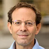
Prof. Tao Chen is a faculty member at the School of Geophysics and Geomatics, China University of Geosciences, specializing in advanced remote sensing and data analysis techniques. His research bridges Image Processing, Machine Learning, and Geo-environmental Monitoring.
- Focus on Geo-hazards (e.g., flood mapping, landslide susceptibility)
- Develops hybrid methods for texture enhancement and spatiotemporal change detection
- Active in IEEE GRSS professional networks
Recent publications highlight multi-source data fusion (e.g., SAR + social media) and model interpretability in geospatial risk assessment. Collaborates with experts like Jun Li and Antonio Plaza.
۰مقاله منتشرشده