معرفی
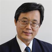
Simon Jones is a Professor of Remote Sensing and Director of the Remote Sensing and Photogrammetry Research Centre at RMIT University's School of Science. His expertise spans remote sensing applications in terrestrial environments, including spatial analysis, vegetation mapping, and wildfire monitoring. He holds dual roles in academia, leading research initiatives and teaching undergraduate and postgraduate courses such as Remote Sensing and Photogrammetry. Jones has received accolades for his contributions to education and professional development in spatial sciences, including awards from the Asia-Pacific and Victorian Spatial Excellence programs. His research focuses on biophysical remote sensing, in situ observations, and scaling ground data to landscape levels, with a strong emphasis on spatial data uncertainty. Jones collaborates on projects addressing environmental challenges like plastic debris mapping, forest fuel dynamics, and flood modeling. His work bridges theoretical advancements and practical applications, supported by partnerships with industry and government agencies.
- Education & Teaching: Courses include GEOM2084/2086 (undergraduate) and GEOM1009/2128 (postgraduate).
- Research Interests: Remote sensing of coastal ecosystems, fire behavior modeling, and geospatial AI for sustainability.
- Awards: Asia-Pacific and Victorian Spatial Excellence Awards (2011) for education contributions.
- Labs/Teams: Leads the Remote Sensing and Photogrammetry Research Centre, fostering innovation in geospatial technologies.