معرفی
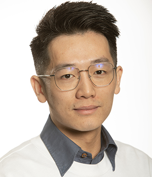
Qing Yang is a Research Fellow at the School of Freshwater Sciences, University of Wisconsin-Milwaukee, affiliated with the Great Lakes Research Facility. His work focuses on advancing flood monitoring and environmental remote sensing technologies. He develops innovative systems for near-real-time flood mapping using multi-source satellite data, with applications in snow-covered, arid, coastal, and urban environments. His research integrates SAR imagery, optical sensors, and machine learning to improve flood detection accuracy and operational response.
Key research interests include:
- Operational flood modeling and disaster preparedness
- Satellite data fusion techniques (e.g., Sentinel-1, VIIRS, RadarSat)
- Climate change impacts on hydrology and flood risk
- GIS-based flood vulnerability assessments
Recent studies analyze flood insurance adoption patterns in the U.S., evaluate evapotranspiration products over China, and investigate pre-failure dam anomalies using satellite data. Yang’s work supports decision-making frameworks for flood management in regions like Saudi Arabia, Greece, and the Red River basin.
Laboratory affiliations include the Great Lakes Research Facility and collaborative efforts with international agencies. His methodologies bridge hydrology, geospatial analysis, and machine learning to address global environmental challenges.