معرفی
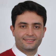
Mohammad Tourian is a Lecturer and Head of the Research Group HydroGeoCoPE at the University of Stuttgart's Institute of Geodesy (Faculty 06). His work focuses on advancing satellite-based geodetic techniques for hydrological applications, particularly in monitoring water storage, river discharge, and climate-related phenomena. He leads initiatives integrating multi-satellite data (e.g., GRACE/GRACE-FO, SWOT, Sentinel-3) with numerical models to address challenges in water resource management and environmental sustainability.
Research interests include satellite altimetry, data assimilation, and the application of geodetic sensors to understand global hydrological cycles. He has contributed to projects like HydroSat, STREAMRIDE, and St3TART, which aim to enhance satellite mission requirements and validation methods for inland water, cryosphere, and ocean topography observations. His team develops innovative algorithms for waveform retracking, uncertainty quantification, and integrating remote sensing with in situ measurements.
Notable collaborations involve improving river discharge estimation through SWOT satellite observations and refining GRACE-derived terrestrial water storage products. His work emphasizes bridging gaps between satellite-derived Essential Climate Variables and actionable insights for policymakers and local communities.