
معرفی
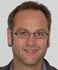
Dipl.-Ing. Klaus Mechelke has served as a scientific staff member at the Geodetic Laboratory of HafenCity University Hamburg since March 16, 1992. Previously affiliated with the Hamburg University of Applied Sciences (Department of Geomatics/Surveying), his career spans development work in Ethiopia (1987-1991) and industry experience as a surveying technician in Germany (1981-1983).
- Education: Surveying (Dipl.-Ing.), Hamburg University of Applied Sciences (1983-1987)
- Current Role: Lecturer and researcher at HafenCity University Hamburg
Research Focus: Specializing in terrestrial laser scanning (TLS) and photogrammetry, Mechelke contributes to archaeological documentation, structural monitoring, and 3D modeling of heritage sites. His work includes:
- Monitoring ancient temples in Ethiopia (Yeha)
- Documenting Moai statues on Easter Island
- Coastal cliff analysis with UAS photogrammetry
- Accuracy investigations of TLS systems
- 3D reconstruction of historical mining sites
Collaborations: Partnerships with the German Archaeological Institute, TU Braunschweig, and KAAK Bonn support his international projects in Yemen, Ethiopia, and Easter Island. His publications since 2004 focus on TLS accuracy, sensor comparison, and cultural heritage preservation.
Klaus Mechelke در جاهای دیگر
جستجوهای مرتبط
شاید اینها هم به کارتان بیاید
- TThomas P. KerstenHafenCity University Hamburg · استاد
- AAlessio CalantropioPolytechnic University of Turin · پژوهشگر
 Gero SteffensResearch Institute for Mining History and Mining Museum · پژوهشگر
- PPetra HelmholzCurtin University · دانشیار
 Heidi HastedtJade University of Applied Sciences · پژوهشگر
- KKate WelhamBournemouth University · استاد