معرفی
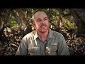
Dr. Chris Owers is a Lecturer in Earth Sciences at the University of Newcastle's School of Environmental and Life Sciences. He specializes in spatial science and remote sensing applications for environmental change analysis, with a focus on coastal dynamics, carbon storage, and ecosystem services. His work integrates advanced technologies like LiDAR, TLS, and machine learning to study spatiotemporal patterns in vegetation and water ecosystems.
Education:
- Doctor of Philosophy, University of Wollongong
- Master of Science in Spatial Information Science, University of Sydney
- Bachelor of Science (Chemistry and Environmental Studies), University of Sydney
Research Interests: Dr. Owers explores coastal wetlands, carbon sequestration, and remote sensing methodologies. His projects include continental-scale land cover mapping (DEA Land Cover), supratidal forest mapping, and mangrove restoration impact assessments. He emphasizes translating science into policy, with 18% of his work cited in national/international policies.
Awards:
- 2021 Big Earth Data Best Paper Award (Taylor & Francis)
- 2018 NSW Coastal Conference Student of the Year
- 2023 Teaching Excellence Award (University of Newcastle)
Grants & Collaborations: Lead researcher on $760k+ projects including National Mapping of Coastal Blue Carbon Supratidal Forests and Papua New Guinea Blue Carbon Dynamics. Collaborates internationally with CSIRO, Aberystwyth University, and the UK's Open Data Cube initiatives. Supervises 4 current PhD/Master's students in geospatial analysis and environmental science.
Labs & Teams: Engaged with Digital Earth Australia, Living Earth initiatives, and the Pacific Blue Carbon Project. Active in developing spatial tools for ecosystem condition monitoring through frameworks like FACTE.