Dongwook Kim is affiliated with the Korea Advanced Institute of Science & Technology (KAIST) as a faculty member in the Department of Business and Technology Management under the College of Business. His research spans multiple domains including machine learning, robotics, signal processing, and biomedical engineering. Key contributions in Computer Vision (CNN-based semantic segmentation, 3D point cloud analysis) Significant work in Hardware Design (energy-efficient processors, neuromorphic computing) Interdisciplinary expertise in Medical Imaging (bone age assessment, retinal biomarkers) and Cybersecurity (attack detection, network analytics) Publications since 2015 demonstrate sustained innovation in AI applications , Signal Processing , and Smart City Governance . His work often integrates theoretical advances with practical implementations in real-world systems. No scientific awards or student mentorship details are explicitly documented in the provided records.
Nabil Aouf is a Professor of Robotics and Autonomous Systems in the Department of Electrical and Electronic Engineering at City, University of London, a position he has held since January 2019. Previously, from 2006 to 2018, he was Professor of Autonomous Systems at Cranfield University’s Defence and Security campus, where he also served as Head of the System and Autonomy Group and Research Lead of the Centre of Electronic Warfare, Information and Cyber. He earned his PhD in Electrical Engineering from McGill University Faculty of Engineering between 1999 and 2002. His research focuses on Robotics, Autonomous Systems, UAV Navigation, Computer Vision, and Fault-Tolerant Control . Key areas include visual odometry, sensor fusion (vision/IMU, RGBD, thermal-visible), robust control for UAVs, fault diagnosis in inertial systems, 3D perception, and autonomous landing. His work integrates theoretical control methods with real-time implementation in aerospace and defense contexts. His recent publications reflect a strong emphasis on robust optimization, multispectral vision, and real-time autonomous navigation. Trends indicate a focus on enhancing autonomy under uncertainty—through illumination-invariant stereo matching, L∞ optimization, and robust feature matching—particularly for UAVs operating in challenging environments. Nabil Aouf has collaborated extensively with researchers such as M. Richardson, O. Araar, T. Mouats, and M. Boulekchour across numerous projects in UAV control, sensor fusion, and autonomy. While no scientific awards are listed in the provided text, his leadership roles and sustained publication record in high-impact journals and conferences underscore his academic contributions. He has supervised or collaborated with several advisees including S.H. Almutairi, L. Chermak, I. Vitanov, and D. Nam, contributing to both theoretical developments and practical implementations in autonomous systems. His work has applications in aerospace, defense, planetary exploration, and critical infrastructure inspection.
Professor Brian Surgenor is a faculty member at Queen's University's Department of Mechanical and Materials Engineering, part of the Smith Engineering faculty. He holds a B.Sc. (1977), M.Eng. (AECL/Whiteshell), and Ph.D. (1983) in Mechanical Engineering from Queen's University. His research focuses on machine vision systems for automation, autonomous vehicle navigation, and mechatronic system design education. He has held key administrative roles including Department Head (1993-2002), Associate Dean (2008-2013), and Vice-Dean (2013-2016). His work emphasizes interdisciplinary innovation, such as the Mitchell Hall design project and contributions to Ingenuity Labs. Education: B.Sc. Mechanical Engineering, Queen's University (1977) M.Eng. Engineering Physics, McMaster University (AECL/Whiteshell) Ph.D. Mechanical Engineering, Queen's University (1983) Research interests include: - Pneumatic servosystems - Intelligent algorithms for machine vision - Off-road autonomous vehicle systems - Mechatronics education methodologies - Hybrid powertrain systems for vehicles His recent publications (2017–2024) explore autonomous systems, machine vision applications, and fuel cell hybrid technologies. Notable trends include advancements in UAV-based infrastructure inspection, terrain-adaptive autonomous driving, and low-cost machine vision solutions for small part sorting. His work bridges theoretical control systems with practical industrial automation challenges. He has contributed to laboratory design for CDIO curricula and pioneered mechatronics education through problem-based learning. His administrative leadership has shaped Queen's engineering graduate programs and research infrastructure. Currently involved in Ingenuity Labs, fostering cross-disciplinary innovation.
Chaopeng Shen is a Professor in the Department of Civil and Environmental Engineering at Pennsylvania State University. His research bridges hydrology with state-of-the-art deep learning and differentiable modeling techniques, focusing on advancing our understanding of hydrologic cycles and their interactions with ecosystems, energy, and carbon cycles. He leads the Multi-scale Hydrology, Processes and Intelligence group (MHPI) and has developed the Process-based Adaptive Watershed Simulator (PAWS) for large-scale hydrologic modeling. Shen's work emphasizes physics-informed machine learning , where deep learning components are integrated with process-based equations through differentiable modeling. This approach enables training neural networks using big data while respecting physical laws, leading to improved generalizability and robustness. His group has demonstrated advantages of differentiable models in rainfall-runoff prediction, routing, ecosystem modeling, and water quality studies. Notably, his team's deepLDB project addresses landslide prediction using AI and big datasets. Recent publications highlight his contributions to global water modeling (grid-LSTM, differentiable Muskingum-Cunge routing), extreme flood forecasting (probabilistic diffusion models), and hydrologic uncertainty quantification . Shen actively engages in interdisciplinary collaborations through the PRISM Cooperative Institute, which aims to integrate multi-domain data for systemic risk assessment. His group has advised students including Dapeng Feng, Wen-Ping Tsai, Kuai Fang, Xinye Ji, and Tasnuva Mahjabin. Shen's research is supported by the National Science Foundation (NSF), Department of Energy (DoE), USGS, Google.org, and the Gates Foundation. He serves as Editor for the Journal of Geophysical Research - Machine Learning & Computation and Chief Editor for Frontiers in Water: Water & AI. His open-source software tools like PAWS and deepLDB are available through dedicated project websites.
Bernadette Bucher is an Assistant Professor in the Robotics Department (primary) and Computer Science and Engineering Department at the University of Michigan. Her research focuses on embodied AI, vision-language grounding, and mobile manipulation, with an emphasis on interpretable visual representations and uncertainty estimation for robotics tasks. She previously worked at Boston Dynamics AI Institute, NVIDIA Research, and Lockheed Martin Corporation. Her academic background includes a PhD in Computer Science from the University of Pennsylvania (GRASP Lab) under advisors Kostas Daniilidis and Nikolai Matni, alongside MA degrees in Mathematics and Economics from the University of Alabama (2014). Research interests include robotics, computer vision, and machine learning intersections, particularly autonomous mobile manipulation. Her work emphasizes uncertainty-aware systems and deployable learning-based methods. Notable achievements include the Best Paper in Cognitive Robotics at ICRA 2024. Her research spans projects like EVORA for off-road autonomy and ASHiTA for hierarchical task analysis. She has contributed to open-source projects like RoboNet and actively publishes in top conferences (CVPR, CoRL, ICRA). Key projects: EVORA, ASHiTA, Vision-Language Frontier Maps (VLFM) Grants and funding: Honda Research Institute (Curious Minded Machines project) Labs/Teams: Active participation in robotics labs at University of Michigan and prior collaborations with industry partners
Michael Everett is an Assistant Professor at Northeastern University with a joint appointment in the Department of Electrical & Computer Engineering and the Khoury College of Computer Sciences. He directs the Autonomy & Intelligence Laboratory, focusing on certifiable learning machines at the intersection of robotics, deep learning, and control theory. His research emphasizes safety, reliability, and efficiency in robotics applications like off-road navigation and social environments. Education: PhD in Mechanical Engineering, Massachusetts Institute of Technology (2020) SM in Mechanical Engineering, MIT (2017) SB in Mechanical Engineering, MIT (2015) Research Interests: Robotics and motion planning Control theory and neural network verification Reinforcement learning applications Certifiable safety guarantees for autonomous systems Navigation in dynamic/human environments Awards: Runner-Up: Best Paper Award (ICML 2022) Winner: Best Student Paper (IROS 2017/2023) Editors’ Top 5 Published Articles (IEEE Access 2021) Lab & Contributions: The Autonomy & Intelligence Lab develops algorithms for high-speed off-road autonomy, socially aware navigation, and neural feedback verification. His work includes the RAMP planning pipeline and Evora traversability learning framework. He collaborates with Google’s PAIR team on trustworthy AI.
Joshua Marshall is a Professor of Electrical & Computer Engineering at Queen’s University, Canada, and Director of the Offroad Robotics research group. He holds a PhD from the University of Toronto and has cross-appointments in Mechanical & Materials Engineering and the Robert M. Buchan Department of Mining. His expertise spans field robotics, autonomous systems, control engineering, and harsh-environment applications in mining, space, and marine domains. He led the Ingenuity Labs Research Institute (2018–2024) and served as a Visiting Professor at Örebro University (2016–17). Dr. Marshall’s work focuses on autonomous vehicle navigation, robotic excavation, and spatiotemporal mapping. He has received the 2025 OPEA Engineering Medal and has commercialized technologies through partnerships with companies like Epiroc and RockMass Technologies. Education: PhD, Electrical & Computer Engineering, University of Toronto (2005) MSc(Eng), Mechanical Engineering, Queen’s University (2001) BSc (Hons), Engineering, (details not specified) Research Interests: Autonomous robotics in mining, space, and marine environments Data-driven control systems and model predictive control Proprioceptive sensing and terrain classification Multi-robot coordination and task planning Underground navigation and SLAM Professional Activities: Senior Member, IEEE Editorial roles: International Journal of Robotics Research , IEEE Transactions on Mechatronics Co-founded the NSERC Canadian Robotics Network (NCRN) Contributions to the IEEE Medal for Environmental & Safety Technologies Committee Labs/Teams: Offroad Robotics Group (Queen’s University) Ingenuity Labs Research Institute (founding Director) Advisor to Queen’s AutoDrive Challenge II Team and aQuatonomous ASV Design Club
Professor Marina Gashinova, Chair in Pervasive Sensing at the University of Birmingham, leads the Pervasive Sensing Group within the Microwave Integrated Systems Laboratory (MISL). Her research spans radar sensing for autonomous vehicles, space domain awareness (SDA), and sub-THz/mmWave technology, with international recognition for advancing cognitive radar and space-borne ISAR systems. Research Focus: She pioneers the use of mmWave/sub-THz frequencies for long-range sensing, applying AI to redefine radar capabilities in automotive and aerospace domains. Her EPSRC-funded projects (e.g., PathCAD, EP/Y022092/1) and Innovate UK collaborations (CORTEX, COSMOS) highlight her leadership in cognitive radar and quantum-enabled SDA. Scientific Awards: Lead of REF 2021 Impact Case Study on Advanced Driver Assistance Systems Founding Chair of EMSIG Focus Groups: MODEST (Modern Trends in Medium/Short Range Sensing) and Radar for Space Associate Editor, IEEE Transactions on Aerospace and Electronic Systems Member of EPSRC ICT, EU, and Canadian funding panels Education & Teaching: With a PhD in Physics and Mathematics from St. Petersburg Electrotechnical University and PGCert in Learning and Teaching, she coordinates the MSc module Digital Communication and Signal Processing and contributes to radar and satellite communication curricula.
Mikael Rinne serves as Associate Professor in Rock Mechanics within the Department of Civil Engineering at Aalto University, Finland. Holding a Doctor of Science in Technology (D.Sc. Tech.), he brings extensive industry experience from Finnish and Swedish consulting firms (1988-2008) where he specialized in rock engineering and project management for tunneling and geological disposal of radioactive waste. His research focuses on rock and fracture mechanics with direct applications to rock engineering, mining, and tunneling. Current investigations center on digital characterization methods including photogrammetry, videogrammetry, and virtual reality systems for both practical engineering solutions and educational advancement. His work addresses critical challenges in fracture hydro-mechanics, rock mass characterization, and sustainable mining practices. Analysis of his 15 most recent publications (2023-2025) reveals a strong emphasis on digital transformation in rock mechanics. Key trends include non-contact surveying techniques for rock mass characterization, scale effects in fracture properties, and virtual learning environments for engineering education. His research bridges theoretical modeling with field applications in tunneling, mining, and radioactive waste disposal, demonstrating consistent innovation in measurement technologies and computational methods. No scientific awards were mentioned in the source materials. While specific advising details and grant information were not provided, his leadership of the Mineral-based materials and mechanics research group indicates active supervision of graduate students and management of research projects. His industry background suggests strong connections with tunneling and mining sectors for applied research collaboration. He directs the Mineral-based materials and mechanics research group at Aalto University, which develops advanced methodologies for rock characterization and engineering applications. Current initiatives integrate digital tools like smartphone LiDAR, 360-degree cameras, and virtual reality systems to enhance both field practices and educational outcomes in rock engineering.
Aaron Maxwell is an Associate Professor in the Department of Geology and Geography at West Virginia University (WVU). He serves as the principal investigator of West Virginia View, a member of AmericaView, and director of the WV GIS Technical Center. His research focuses on spatial predictive modeling, geohazard mapping, machine/deep learning applications in remote sensing, and thematic map accuracy assessment. He holds degrees from Alderson Broaddus University (B.S. in Biology, Chemistry, Environmental Science) and WVU (M.S. and Ph.D. in Geology), with a GIS Professional (GISP) certification. Education: Bachelor of Science in Biology, Chemistry, and Environmental Science – Alderson Broaddus University Master of Science in Geology – West Virginia University Doctor of Philosophy in Geology – West Virginia University Research Interests: Dr. Maxwell’s work emphasizes computational methods to extract insights from geospatial data. Key areas include: Deep learning for geomorphic feature extraction (e.g., LIDAR-based semantic segmentation) Machine learning applications in forest fuel load estimation and slope failure modeling Best practices for assessing deep learning outputs in remote sensing Synthetic data generation for predictive modeling Community flood resiliency and participatory GIS Publications: His recent work highlights advancements in geospatial deep learning (e.g., the geodl R package), accuracy assessment metrics for imbalanced datasets, and modeling post-mining landscape evolution. Articles often blend theoretical frameworks with applied case studies across environmental and geotechnical domains. Grants & Funding: Supported by NSF (CAREER Award) and AmericaView, his work trains students and develops open-source geospatial tools. Current projects include synthetic forest stand modeling and flood resiliency initiatives. Labs & Teams: Leads WV View, fostering remote sensing education and data sharing. Collaborates on geospatial workforce development and open-source software initiatives (e.g., GIScience courses, ArcGIS Pro labs).
Leszek Ludwik Gawrysiak is a Professor at the Department of Geology, Soil Science, and Geoinformatics , affiliated with the Faculty of Earth Sciences and Spatial Management at Maria Curie-Skłodowska University in Lublin, Poland. His academic career includes habilitation in Earth and Environmental Sciences (2019), a PhD in Geomorphology (2003), and a master’s in Physical Geography (1993), all from UMCS. Education: Master’s in Physical Geography (1993), UMCS PhD in Geomorphology (2003), UMCS Habilitation in Earth and Environmental Sciences (2019), UMCS His research focuses on Geomorphology , Geomorphometry , and Geoinformatics , with applications in Loess Erosion , Gully Dynamics , and Environmental Risk Assessment . He employs GIS, LiDAR, and remote sensing techniques to analyze terrain segmentation, forest cover changes, and geomorphological impacts on land use planning. Projects include studies on extreme meteorological events, geopark development, and Polish-Belarusian-Ukrainian water policy in the Bug River basin. Recent publications emphasize Loess Landscapes , Proglacial Valley Morphology , and Gully Erosion , with methodological advancements in Digital Terrain Modeling and Geomorphon Analysis . His work bridges computational methods (e.g., GPU-accelerated topographic parameter evaluation) with field-based geomorphological studies in Svalbard and Eastern Europe. Scientific Awards: Award from the Polish Geomorphological Society for best PhD thesis (2002) Team Award from the Rector of UMCS (2010) Individual Award from the Rector of UMCS (2013) He has contributed to understanding Loess Area Geomorphodiversity , Forest Cover Dynamics , and Climate Change Impacts on landscapes. His collaborations span interdisciplinary studies in gully erosion, geotourism, and Holocene soil erosion rates. Contact: leszek.gawrysiak@mail.umcs.pl | Phone: +48 81 537 68 71
Dr. Yun Zhang is a Professor and Canada Research Chair in the Department of Geodesy and Geomatics Engineering at the University of New Brunswick. He holds a PhD from the Free University of Berlin and has pioneered research in remote sensing, image processing, and computer vision since 2000. His patented technologies are licensed to global companies including PCI Geomatics and DigitalGlobe. Research Focus: Optical/radar image processing, digital photogrammetry, AI applications in geomatics, and sensor fusion for UAV systems. His work enables advanced geospatial analysis across environmental, urban, and defense sectors. Distinctions: First Giuseppe Inghilleri Award (ISPRS 2012) NSERC Synergy Innovation Award from Governor General of Canada (2011) ASPRS Talbert Abrams Grand Award (2005) Featured in CFI 20th Anniversary Book for breakthrough innovations Technology Impact: Solutions deployed by NASA, USGS, Google Earth, and DND Canada across five continents. Recognized among top 9 Canadian research achievements in AUTM's global case studies alongside MIT and Stanford innovations.
Samsung Lim serves as an Associate Professor of geographic information systems (GIS) in the School of Civil and Environmental Engineering at the University of New South Wales (UNSW) Sydney. With expertise spanning data science, artificial intelligence, and machine learning, Lim applies geospatial technologies to critical real-world challenges in natural disaster management and public health research. Lim's interdisciplinary work bridges engineering, computer science, and public health domains to develop practical decision-making tools for emergency response and disease surveillance. Ph.D. in Aerospace Engineering and Engineering Mechanics, University of Texas, Austin, TX, USA M.A. in Mathematics, Seoul National University, Seoul, South Korea B.A. in Mathematics, Seoul National University, Seoul, South Korea Lim's research focuses on applying GIS to natural disaster management and public health challenges. Key areas include machine learning methods for bushfire susceptibility mapping, spatial clustering for landslide susceptibility analysis, city-scale evacuation management in flood scenarios, and social media-based natural disaster assessment. In public health, Lim investigates geo-correlations between environmental factors and asthma occurrence, computational approaches to avian influenza outbreaks, emerging hot spot analysis of COVID-19, and early detection systems for emerging infectious diseases. This work combines advanced spatial analytics with machine learning to address complex environmental and health challenges. The recent publication record demonstrates a clear interdisciplinary trajectory where geospatial science intersects with public health emergency response and natural hazard management. Lim's work consistently applies machine learning techniques to geospatial data, with particular emphasis on disaster susceptibility mapping, disease outbreak detection, and infrastructure monitoring. The research spans multiple continents and addresses both immediate emergency response needs and long-term environmental health challenges, reflecting a commitment to practical applications of geospatial science. Associate Editor of Geospatial Information Science National Delegate of Commission 3 of International Federation of Surveyors (FIG) National Representative of the International Cartographic Association (ICA) Commission on Sensor-driven Mapping Senior Member of Institute of Electrical and Electronics Engineers (IEEE) Lim actively contributes to the development of early warning systems for emerging infectious diseases through collaborations with public health researchers. The work on EPIWATCH demonstrates how AI can enhance surveillance capabilities for outbreak detection. Lim's research on cruise ship transmission of diseases and the spread of avian influenza through bird migration patterns and poultry trade networks shows strong engagement with real-world public health challenges. These projects often involve multidisciplinary teams spanning engineering, computer science, epidemiology, and veterinary medicine. Lim's work integrates multiple geospatial data sources and analytical techniques to address complex environmental and public health challenges. This includes developing frameworks for performance analysis of OpenStreetMap data, creating specialized road datasets for pedestrian navigation, and applying Persistent Scatterer Interferometry for land motion monitoring. The research combines traditional geospatial methods with cutting-edge machine learning approaches to extract meaningful insights from complex spatial datasets.
Gunho Sohn is an Associate Professor and Department Chair in the Earth and Space Science and Engineering (ESSE) Department at York University's Lassonde School of Engineering. His research focuses on advanced geomatics engineering applications, including 3D urban modeling, photogrammetric computer vision, and geospatial data integration. He specializes in developing innovative solutions for navigation systems, energy optimization, and autonomous robotics through interdisciplinary approaches. Dr. Sohn's work emphasizes practical implementations of remote sensing technologies, with notable contributions to LiDAR data processing, SLAM systems, and BIM-GIS integration. His research has addressed real-world challenges such as improving air quality models using industrial plume observations and creating inclusive pedestrian navigation tools using open geospatial datasets. Recent trends in his publications highlight advancements in deep learning for geospatial tasks, including semantic segmentation of aerial LiDAR data, noise reduction in sensor networks, and UAV positioning systems. His work also explores digital twin applications for simulating urban environments and optimizing building energy consumption through BIM data analysis. While no specific awards or grants are listed, his extensive publication record reflects significant contributions to the fields of geomatics and computer vision. His research group collaborates on large-scale datasets like YUTO MMS and Yuto Semantic, advancing mobile mapping and semantic understanding of urban infrastructure.
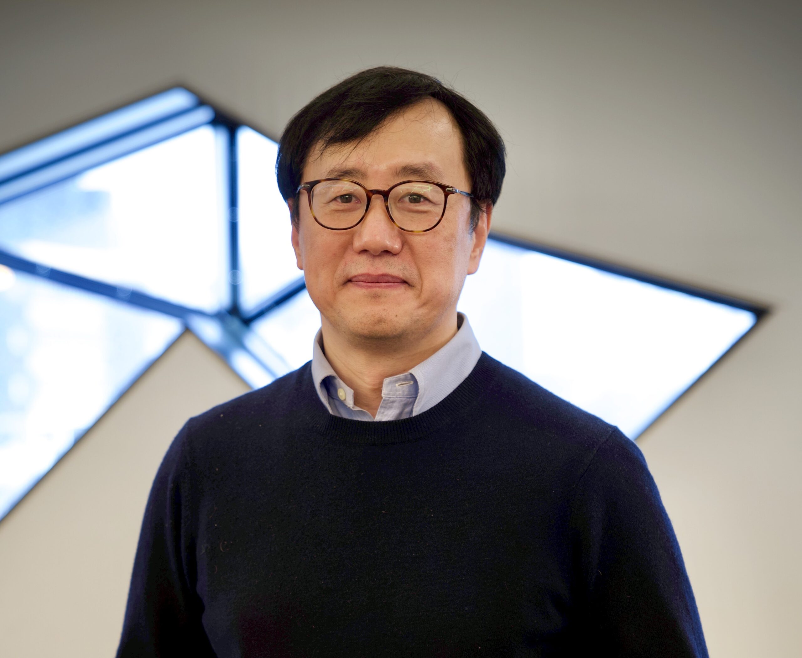
Tønnes Nygaard is an Associate Professor at the Department of Technology Systems, University of Oslo, affiliated with the Faculty of Mathematics and Natural Sciences. His research focuses on evolutionary robotics, morphological adaptation, and embodied artificial intelligence. He leads projects like COCOMO (Co-evolution of Control and Morphologies) and works extensively with the DyRET (Dynamic Robot for Embodied Testing) platform. Key research interests include robot control systems, adaptive morphology design, and real-world implementation of evolutionary algorithms. His work bridges theoretical computer science with practical robotics applications, emphasizing hardware-software co-evolution and embodied cognition principles. Publications span topics like morphological adaptation in quadruped robots, semi-supervised learning for terrain classification, and overcoming convergence issues in multi-objective evolutionary algorithms. Nygaard collaborates internationally and contributes to both academic journals and conferences in robotics and AI. No scientific awards are explicitly listed, though his impactful contributions to real-world evolutionary robotics suggest potential recognition pending explicit mentions. Advising and grant activities are central to his role, though specific student names or grant amounts are not detailed in the provided texts. Labs/Teams: Core contributor to the DyRET project and affiliated with the Section for Autonomous Systems and Sensor Technologies at UiO.



/tonnesfn/t.jpg)