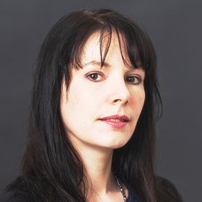
Melody Alsaker is an Associate Professor in the Department of Mathematics at Gonzaga University, where she has held this position since January 2016. Her research focuses on medical imaging and applied inverse problems, particularly in the field of electrical impedance tomography (EIT). She specializes in mathematical modeling, algorithm design, and biomedical image processing, with applications in pulmonary and thoracic imaging. Her work emphasizes improving EIT reconstruction techniques using the D-bar method, incorporating spatial priors, and developing real-time solutions for clinical applications. Notable contributions include the ACE1 EIT system for thoracic imaging and studies on stroke classification, air trapping in lungs, and surrogate measures of pulmonary function in children with cystic fibrosis. Alsaker's research bridges mathematics and engineering, addressing challenges in medical imaging accuracy and computational efficiency. Her collaborations span disciplines, including biomedical engineering, respiratory physiology, and clinical medicine.
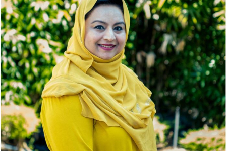
Dr. Farha Sattar is a Lecturer in Education (Mathematics) at the Faculty of Arts and Society, Charles Darwin University. With over thirty years of teaching experience in Mathematics, Science education, GIS, Remote Sensing, and e-Learning technologies at undergraduate and postgraduate levels, Dr. Sattar brings extensive expertise to her academic role. She holds a PhD in Geospatial Science from Charles Darwin University, focusing on Spatial Mathematical Modelling for 3D Gully Mapping and Erosion Quantification. Her educational background includes: PhD in Geospatial Science (Three Dimensional Gully Mapping and Erosion Quantification within a Geoinformatics Framework), Charles Darwin University (2012) Prior academic experience at several Asian and European universities Dr. Sattar's research spans multiple interdisciplinary fields with a strong focus on the intersection of education and technology. Her primary research interests include Mathematics Education, STEM Education, Geoscience Education, Spatial Mathematical Modelling, Drone Technology, Remote Sensing, Geographic Information Systems, and Innovative Pedagogies such as experiential learning and inquiry-based approaches. She has developed expertise in cognitive development, particularly in fostering critical and creative thinking skills through iSTEM approaches. An analysis of Dr. Sattar's recent publications reveals a consistent trajectory toward integrating emerging technologies like drones, augmented reality, and geospatial artificial intelligence into educational contexts. Her work demonstrates a progression from foundational geospatial research on erosion mapping to innovative applications in STEM education. Recent publications increasingly focus on drone technology for educational purposes, spatial data infrastructure for policy development, and computational thinking development through technology-enhanced learning. Dr. Sattar has received numerous accolades for her contributions to education and research: NT Science Week Awards – Inspired NT STEM Hero of the Year award (2021) Long Service Recognition Award (2023) Finalist, CDU Alumni Award (2023) Multiple Best Presentation Awards (2008, 2010, 2017) Australian College of Educators - 2021 College Medal Nominee As a supervisor, Dr. Sattar mentors postgraduate research students including Ayesha Farhan, who is working on "A Framework for Cognitive Development: Fostering Critical and Creative Thinking Skills, Using iSTEM Approach." She actively secures research funding through various projects such as "DBELaSTEM: Drone-Based Experiential Learning and STEM Education," "STEM_D & VR: Youth STEM Learning and Empowerment with Drones and VR," and "CodProg Drone Lab." Her research is supported by grants from NT Government projects and other external funding sources. Dr. Sattar leads the CodProg Drone Lab, an innovative research space exploring drone technology applications in education. She is a certified drone pilot and aeronautical radio operator, which enables her to bridge theoretical knowledge with practical applications. Her work with the "Flying Forward: Drones, STEM Equity, and Indigenous Empowerment" initiative demonstrates her commitment to community engagement and addressing educational disparities through technology.
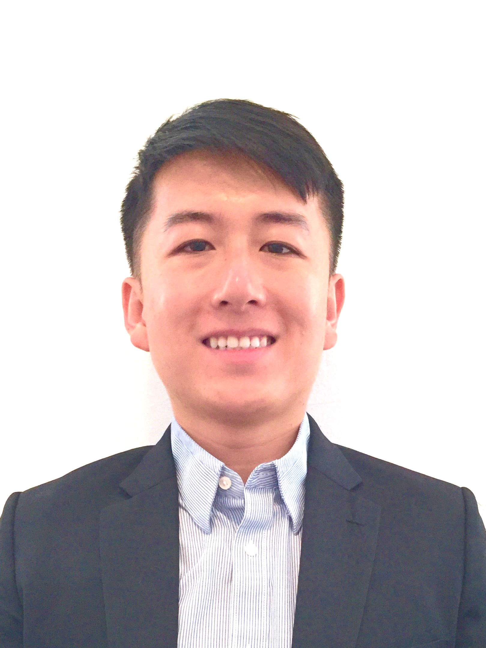
Dr. Ian Yi Han is an Assistant Professor at the Saw Swee Hock School of Public Health, National University of Singapore (NUS), and Co-Director of the Center for Health Intervention and Policy Evaluation Research (HIPER). His research focuses on evaluating community-based health interventions, telehealth programs, and the impact of built environments on health behaviors. He holds a Ph.D. in Behavioral Nutrition from Columbia University, an M.A. in Psychology in Education, and a B.Sc. in Neural Science & Psychology from New York University. Key research areas include programme evaluation, population health, health services research, and dietary behaviors. He explores how interventions can improve patient experiences and population health outcomes, particularly through telemedicine and lifestyle modifications. His work has been published in journals like npj Digital Medicine, Metabolism, and the Journal of Nutrition Education and Behavior. Notable projects include studies on blood pressure telemonitoring, diabetes management during the pandemic, and supermarket intervention strategies for obesity prevention. Dr. Han has contributed to policy initiatives through roles such as Senior Research Fellow at the National University Health System and Lecturer at Columbia University. He advises on primary care research and collaborates on global health projects, emphasizing interdisciplinary solutions to public health challenges.
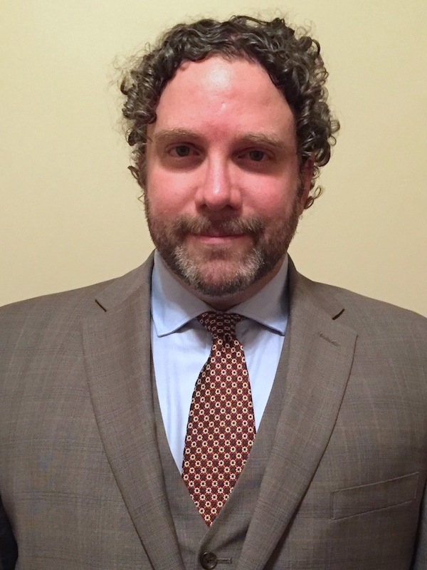
Dr. Anthony Filippi is an Associate Professor and Director of Graduate Programs at Texas A&M University. His research focuses on remote sensing, geographic information systems (GIS), and machine learning applied to aquatic and terrestrial environments. He leads the Fluvial-GEOS Lab, studying riverine/floodplain systems using remote sensing and GIS technologies. Educational Background: Ph.D. in Geography, University of South Carolina (2003) M.S. in Geography, University of South Carolina B.A. in Geography, Kansas State University Research Interests: Imaging spectroscopy, hyperspectral remote sensing of rivers and coastal oceans, GIS-based modeling, data fusion, aquatic optics, and machine learning. His work addresses coastal ocean bathymetry estimation, floodplain dynamics, and applications in environmental monitoring, including hazardous waste site tracking and agricultural studies. Recent Research Trends: Recent publications highlight advancements in UAS-based image analysis, LSTM networks for floodplain classification, and environmental policy impacts on forest resources. His work integrates machine learning with remote sensing to improve ecological and geomorphological understanding. Labs/Teams: Director of the Fluvial-GEOS Lab, focusing on remote sensing and GIS applications in riverine environments.
Assoc Prof Ying Chen is an Associate Professor at the National University of Singapore , affiliated with the Department of Mathematics, Asian Institute of Digital Finance (as Academic Director of PhD Program in Digital FinTech 2022–2024), Risk Management Institute (2019–2023), Department of Statistics and Data Science (2019–2023), and Department of Economics (2018–2023). She also contributes to NUS Graduate School for Integrative Sciences and Engineering since 2016. Research Interests include: AI forecasting and quantum computing for finance Nonstationary time series and functional data analysis Energy data analytics and precision medicine Network autoregression and spatial-temporal modeling Explainable AI and citation metrics Portfolio liquidation and market-making algorithms Article Trends demonstrate expertise in: Adaptive forecasting for gas flows and electricity prices Blockchain network influence detection Quantum computing applications in finance Functional autoregression with mixed predictors Credit rating fairness and explainability High-resolution implied volatility modeling Scientific Awards include: ISI Elected Member (2016–) International Statistical Institute Council (2023–2027) IASC Scientific Secretary (2017–2019, 2023–2025) Advisory roles for EU FIN-TECH and xAIM projects
Jason Ritt is an Associate Professor of Brain Science (Research) and Scientific Director of Quantitative Neuroscience at the Robert J. and Nancy D. Carney Institute for Brain Science, Brown University. He holds affiliations with the Data Science Institute and collaborates across disciplines on quantitative research methods. Education : B.S., M.A., and Ph.D. in Neuroscience from Boston University (1997–2003). Research : Focuses on neural processing during active sensing and neuroengineering for neurostimulation. Combines electrophysiology, optogenetics, and theoretical approaches in rodent models. Develops closed-loop systems for studying sensory neural prosthetics and brain-machine interfaces. Key areas include synaptic diversity, neurocontrol algorithms, and sensory restoration. Teaching : Instructs NEUR 2100 NeuroPracticum, integrating hands-on neuroscience research training.
Witold J. Henisz serves as Vice Dean and Faculty Director of the Impact, Value, and Sustainable Business Initiative at The Wharton School, University of Pennsylvania, holding the Deloitte & Touche Professorship in Management. His research centers on political and social risk identification, ESG impact materiality, and corporate diplomacy frameworks that transform stakeholder relationships into strategic assets. His educational background includes a Ph.D. in Business and Public Policy from UC Berkeley's Haas School and an M.A. in International Relations from Johns Hopkins SAIS. Henisz has served as Departmental Editor at Journal of International Business Studies and Associate Editor at Strategic Management Journal , reflecting his scholarly influence. Research interests converge on geopolitical risk quantification, stakeholder engagement optimization, and sustainable business model innovation. His work demonstrates how political hazards materially impact firm valuation and how corporate diplomacy can mitigate conflict through strategic stakeholder alignment. Recent publications leverage massive media datasets (4+ billion articles) to model populism dynamics, indigenous land conflicts, and ESG-credit risk linkages. Award highlights include the Aspen Institute Ideas Worth Teaching Award (2020), Iron Prof recognition (2019), and Academy of International Business Fellowship. His geostrategy framework Geostrategy by Design (2024) provides executives with actionable methods for navigating geopolitical volatility. Aspen Institute Ideas Worth Teaching Award (2020) Iron Prof recognition (2019) Academy of International Business Fellow (2014-present) Multiple Wharton Excellence in Teaching Awards (2006-2021) Industry Studies Association Best Paper Award (2019) Henisz consults through PRIMA LLC for multinational firms (Rio Tinto, Shell), financial institutions (Eaton Vance, World Bank), and NGOs. His executive education programs train leaders in ESG integration and geopolitical risk management, while his KEROVKA crisis simulation develops real-time strategic response capabilities. Media frequently cites his expertise on ESG controversies, with 50+ major publications featuring his analysis since 2022 including Financial Times , Bloomberg , and Wall Street Journal .
Mani Golparvar Fard is a Professor at the University of Illinois at Urbana-Champaign, holding joint appointments in the Siebel School of Computing and Data Science and the Department of Civil and Environmental Engineering. He also contributes to the Technology Entrepreneur Center. His research focuses on integrating artificial intelligence, computer vision, and data analytics to advance construction management, infrastructure monitoring, and automation. Key areas include BIM integration, reality capture systems, and deep learning-based progress tracking. His work emphasizes automated construction progress monitoring through semantic segmentation, vision-language models, and UAV-based data collection. He has pioneered methods like Scan2BIM-NET for converting point clouds into BIM models and developed frameworks for worker safety analysis using machine learning. Awards: Walter L. Huber Civil Engineering Research Prize (2018) Daniel W. Halpin Award for Scholarship (2016) Advising & Grants: While no specific grant details are provided, his research is supported by collaborations with industry and government initiatives, such as the Japanese national bridge inspection project. He advises a team focused on AI-driven construction solutions and maintains active partnerships with engineering firms. Labs & Teams: Leads research groups in vision-based construction analytics, automated scheduling systems, and BIM integration. His work is disseminated through platforms like the VisualSiteDiary system and the InstaDam open-source platform for structural damage analysis.
Ahmed Eldawy is an Associate Professor in the Department of Computer Science at the University of California, Riverside. He leads groundbreaking research in databases, big data management, and spatial data processing, with a focus on scalable exploratory analytics through systems like Beast , UCR-Star , Raptor , and Spider . His work spans geospatial data infrastructure, distributed computing, and computational geometry. Research Interests : Databases, big data management, spatial data processing, geospatial analytics, distributed systems, computational geometry. Awards : NSF CAREER award (2021), 10-year Influential Paper Award (ICDE 2025), Best Demo award (SIGSPATIAL 2020). Grants : NSF (IIS-2046236, IIS-1954644, CNS-1924694), USDA (USDA NIFA 2020-69012-31914), UC Office of the President (M21PL3368). Labs & Centers : RAISE@UCR, Data Science Center, Center for Robotics and Intelligent Systems (CRIS), Affiliate of Center for Geospatial Sciences and Winston Chung Global Energy Center. His recent publications focus on LLM-driven geospatial visualization (LASEK), distributed raster analytics (RDPro), learned spatial query optimization, and scalable spatiotemporal systems. He advises numerous PhD and Master’s students, many of whom now work at top tech companies like Amazon, Microsoft, and Meta.
Claudia R. Binder is Full Professor at EPFL's School of Architecture, Civil and Environmental Engineering, leading the Laboratory for Human-Environment Relations in Urban Systems (HERUS) since 2016. Previously, she held professorships at the University of Munich (2011-2016), University of Graz (2009-2011), and University of Zurich (2006-2009). She served as Dean of EPFL's ENAC School from 2020-2023 and holds advisory roles with Swiss federal institutions including the Mercator Foundation since 2024. Her academic foundation includes a Biochemistry degree and PhD in Environmental Sciences from ETH Zurich, followed by postdoctoral research at the University of Maryland. This interdisciplinary background underpins her research approach spanning natural and social sciences. Professor Binder's work centers on urban sustainability transitions, examining urban metabolism dynamics through systems science frameworks. She investigates energy-food-transport interdependencies in cities using transdisciplinary methods that integrate material flow analysis, spatial modeling, and socio-technical assessments. Her research particularly emphasizes regulatory mechanisms and transformation drivers in human-environment systems, with case studies across Swiss and global urban contexts. Recent publications reveal evolving focus from foundational urban metabolism studies toward actionable transition strategies. Her 2024-2025 work increasingly addresses social tipping dynamics, circular decarbonization, and spatially explicit waste management, demonstrating methodological innovation through geo-referenced material flow analysis and participatory backcasting frameworks. Key thematic clusters include energy innovation diffusion, plastic waste governance, and demand-side flexibility in residential systems. She actively mentors 7 current PhD candidates while supervising 11 graduates since 2018, with research spanning urban metabolism modeling, sustainability assessment, and transition governance. Her leadership extends to Swiss National Science Foundation committees and National Research Program 71 on energy consumption management. At EPFL, she directs the HERUS laboratory which develops the Sustainability Solution Space methodology for urban assessment. The lab operates at the intersection of data science, environmental engineering, and social theory, maintaining strong field connections in Switzerland, Indonesia, and Germany for empirical validation of transition models.
Prof. Christian Heipke is a distinguished academic serving as Dean of the Faculty of Civil Engineering and Geodetic Science at Leibniz University Hannover, Germany. He also holds the position of Executive Director at the Institute of Photogrammetry and GeoInformation (IPI), one of the leading research institutions in geospatial sciences within the faculty. His leadership extends across multiple committees including the Curriculum and Teaching Committee, Admissions and Examination Boards for Geodetic Science and Geoinformatics, and Navigation and Environmental Robotics. As a Professor at IPI, he maintains active research while overseeing significant academic and administrative responsibilities at the university. Professor Heipke's research spans multiple domains within geospatial sciences, with particular emphasis on: Advanced photogrammetric techniques and algorithms Remote sensing applications for environmental monitoring Computer vision approaches for geospatial data analysis Urban development monitoring using satellite imagery Machine learning applications in geoinformatics Disaster prediction and management systems His recent scholarly output reveals a strong focus on integrating cutting-edge computer vision and deep learning techniques with traditional photogrammetric methods. Analysis of his 15 most recent publications shows a clear trajectory toward more sophisticated AI-driven approaches for processing geospatial data, with particular attention to time-series analysis, uncertainty quantification, and multi-view systems. His work bridges theoretical advancements with practical applications in flood forecasting, deforestation monitoring, urban planning, and construction materials analysis. The geographic scope of his research has expanded significantly, with recent projects focusing on international case studies in the Philippines and tropical regions. Professor Heipke leads the Institute of Photogrammetry and GeoInformation, a major research hub that has celebrated 75 years of contributions to the field. His leadership extends to the Graduiertenkolleg 2159: "Integrity and Collaboration in Dynamic Sensor Networks," where he serves as a professor overseeing doctoral research. The institute maintains state-of-the-art facilities for processing satellite imagery, aerial photography, and developing novel algorithms for geospatial data analysis. Under his direction, the institute has strengthened its international collaborations and interdisciplinary research approaches, particularly in addressing Sustainable Development Goals through geospatial technologies.
Devis Tuia serves as Associate Professor at the Swiss Federal Institute of Technology Lausanne (EPFL), holding appointments in the Institute of Environmental Engineering (IIE) within the School of Architecture, Civil and Environmental Engineering (ENAC). He leads the Environmental Computational Science and Earth Observation Laboratory (ECEO) since 2020 and contributes to EPFL's Doctoral Program in Civil and Environmental Engineering. His academic journey began in Lausanne with studies at UNIL and EPFL, culminating in a PhD in remote sensing from UNIL. Postdoctoral research followed at institutions in Valencia, Boulder, and EPFL, focusing on machine learning model adaptation. He progressed from Research Assistant Professor at University of Zurich to Associate and Full Professor at Wageningen University before joining EPFL. Tuia's research bridges Earth observation with artificial intelligence, specializing in interpretable deep learning for environmental applications. His lab develops algorithms for making remote sensing accessible, with particular emphasis on digital wildlife conservation through automated censuses using drone and satellite imagery. Current projects tackle the 'black box' problem in environmental modeling while advancing spatial intelligence for sustainable urban development. His 2023-2025 publication portfolio reveals three dominant trends: (1) species distribution modeling using incomplete observations, (2) multimodal fusion of satellite/drone data with textual descriptions, and (3) interpretable AI frameworks for environmental decision-making. This work consistently addresses real-world challenges like wildfire forecasting and biodiversity monitoring. As an educator, Tuia supervises 12 current PhD students and has graduated 4 former EPFL doctoral candidates. His teaching portfolio includes Frontiers of Deep Learning for Engineers , Sensing and Spatial Modeling for Earth Observation , and Image Processing for Earth Observation courses. The ECEO laboratory maintains active collaborations with ESA-NASA initiatives and conservation organizations globally.
Dr. Yang Liu is the Chair and Gangarosa Distinguished Professor in the Gangarosa Department of Environmental Health at Emory University's Rollins School of Public Health. His research focuses on satellite remote sensing applications for public health, climate change impacts, and air pollution exposure modeling. He leads federally funded projects integrating satellite data into health studies and serves as a PI for the NIH-funded Climate & Health Actionable Research and Translation (CHART) Center. Education: Ph.D. (Harvard University), M.S. (University of California), B.S. (Tsinghua University). Professional Affiliations include NASA mission science teams and the ORISE Faculty Fellowship at CDC. Research interests span satellite aerosol retrieval, climate-health linkages, and machine learning in environmental statistics. Notable work includes advancing wildfire smoke health impacts, PM2.5 modeling, and climate dashboard development for Georgia. Awards include Gangarosa Distinguished Professorship, ORISE CDC Fellowship, and leadership in NIH/NASA initiatives. His lab develops innovative tools for environmental health monitoring and policy translation.
Jim Hall is a Professor of Climate and Environmental Risk at the University of Oxford's School of Geography and the Environment, and serves as Director of Research there. He is also a Visiting Fellow at Linacre College and holds leadership roles including Chair of the Science Advisory Committee at IIASA, and Expert Advisor to the UK's National Infrastructure Commission. His work focuses on systemic risk analysis, infrastructure resilience, and policy implications of climate change adaptation. Prof Hall has pioneered methodologies like the National Infrastructure Systems Model (NISMOD) and chairs the Data and Analytics Facility for National Infrastructure (DAFNI). His research spans flood risk management, energy systems decarbonization, and transboundary water resource conflicts in regions such as the Eastern Nile Basin and the Caribbean. Key research areas include robust decision making under uncertainty, info-gap theory applications, and integrated assessments of human-environmental systems. He has contributed to major international assessments, including the IPCC's Fourth Assessment Report, and developed frameworks for multi-hazard stress testing of infrastructure networks. Scientific Awards: George Stephenson Medal (2001), Prince Sultan Prize for Water (2018), Royal Academy of Engineering Fellowship (2010) His advising and grants work includes mentoring a DPhil student Erin Canning and leading projects like MARIUS and ENHANCE. He has also developed innovative modeling tools for coastal erosion prediction and probabilistic assessments of global shipping fuel transitions. Prof Hall’s research groups actively engage in interdisciplinary projects, including the Oxford Martin Programme on Resource Stewardship and the UK Infrastructure Transitions Research Consortium. His work emphasizes bridging scientific analysis with actionable policy solutions for climate adaptation.
Associate Professor Mohsen Kalantari is a Geospatial Engineering academic at the University of New South Wales (UNSW) School of Civil and Environmental Engineering , with concurrent roles as co-founder of the startup Faramoon . His career spans roles at the University of Melbourne's Department of Infrastructure Engineering and Victorian government's land administration initiatives through DELWP. Education : PhD in Geomatics Engineering (2008, University of Melbourne), Master of GIS Engineering (2004), Bachelor of Surveying Engineering (2001) His research bridges geospatial engineering with construction automation , focusing on 3D cadastre , BIM-GIS integration , and smart cities . Recent publications show trends in underground land administration , digital twins , and LADM standard implementations . Scientific Awards : National educational recognition (2019), Victorian educational grants (2018), and prestigious fellowships (2012) As a supervisor , he guides PhD candidates in topics ranging from BIM for waste management to underground cadastral systems . His industry engagement includes partnerships with the United Nations , Open Geospatial Consortium , and Singapore Land Authority .