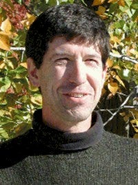
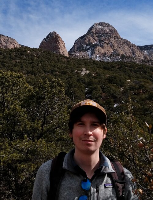
Lee Liberty is a Research Professor in the Department of Geosciences at Boise State University. His research focuses on seismic reflection imaging of active tectonic processes, including earthquake hazards, fault systems, and geothermal exploration. He leads projects funded by agencies such as the US Geological Survey, NSF, and the Research Council of Norway. Education: M.S. in Geosciences from the University of Wyoming (1992); B.S. in Geosciences from Syracuse University (1987). Key research areas include neotectonics, basin-scale geophysical studies, and humanitarian geophysics. His tools include seismic reflection, gravity/magnetic surveys, and ground-penetrating radar. Recent projects address earthquake hazards in Idaho, fault characterization in Nevada and Alaska, and CO2 containment monitoring in Utah. Publications span seismic imaging, fault dynamics, and geothermal resource assessment. He is an active member of the American Geophysical Union (AGU), Geological Society of America (GSA), and Society of Exploration Geophysicists (SEG).
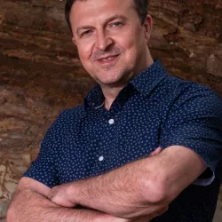
Iraklis Simos is an Associate Professor in the Department of Electrical and Electronics Engineering at the University of West Attica, where he is a member of the WaveComm laboratory. Previously, he served as a Lecturer in the Department of Electronics Engineering at the Technological Education Institute of Piraeus (2012–2018) and conducted research at the Optical Communications Laboratory of the National and Kapodistrian University of Athens (2002–2012). He holds a B.Sc. in Informatics, M.Sc. in Telecommunications Engineering, and Ph.D. in Photonic Devices from the National and Kapodistrian University of Athens (1998–2007). His research focuses on semiconductor and fiber laser dynamics, ultrafast lasers, photonic devices for optical networks, and advanced fiber-optic sensing techniques such as Distributed Acoustic Sensing (DAS) and Microwave Frequency Fiber Interferometry (MFFI) for earthquake monitoring. His work integrates theoretical modeling, experimental validation, and applications in telecommunications, environmental sensing, and infrastructure monitoring. With over 60 peer-reviewed publications, his contributions span high-speed communication systems, optical signal processing, and novel fiber-optic sensor technologies. Recent studies emphasize leveraging commercially deployed fiber-optic cables for seismic monitoring in urban environments (e.g., Athens, Greece), demonstrating the potential of DAS and MFFI for cost-effective earthquake early warning systems. His publications also address synchronization dynamics in laser frequency combs, fiber Bragg grating interrogation, and nonlinear effects in optoelectronic systems. Dr. Simos has advised numerous diploma and doctoral theses, focusing on cutting-edge topics in photonics and optical communications. His research aligns with national and European-funded projects, emphasizing translational applications of photonics in sensing and telecommunications.
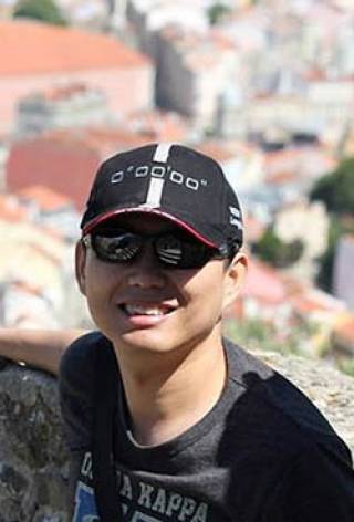
Dr. Teh-Ru Alex Song is a Reader in Seismology at the Department of Earth Sciences, University College London. He leads the Seismolab research group and teaches the course GEOL0029: Seismology I. His work focuses on observational seismology, including seismic anisotropy, volcano dynamics, and tectonic processes. Key research interests include magma chamber interactions, core-mantle boundary structure, and earthquake behavior near plate boundaries. His recent studies involve Aso Volcano seismic monitoring and post-seismic velocity changes in Sumatra subduction zones. Research highlights include investigating magma dynamics through repetitive volcanic seismic signals and analyzing temporal variations in seismic anisotropy. His work bridges seismological observations with tectonic and volcanic processes across spatial and temporal scales. Collaborative efforts include global seismic array data analysis and volcano remote sensing techniques. Dr. Song’s publications span over two decades, addressing topics like mantle discontinuities, induced earthquakes, and seismic waveform modeling. His contributions have advanced understanding of seismic wave propagation, subduction zone dynamics, and the interplay between magmatic and tectonic systems.
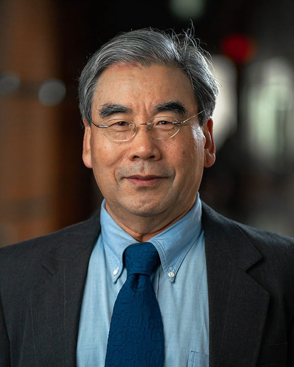
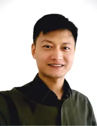
Dr. Lanbo Liu is a Professor at the University of Connecticut specializing in geophysics and engineering geology. His research focuses on advanced geophysical methods for subsurface imaging, including seismic and electromagnetic techniques applied to urban infrastructure, permafrost environments, and fault detection. He holds a Ph.D. in Geophysics from Stanford University, complemented by M.S. degrees in Environmental Engineering and Geophysics from Stanford and Peking University, as well as a B.S. in Geophysics from Peking University. Research interests include engineering site characterization, wave propagation modeling, environmental geophysics, and the integration of passive and active seismic data. Notable work involves using ambient noise for urban subsurface imaging and developing novel GPR and radar techniques for infrastructure assessment. His projects span global locations such as Tibet, South Korea, and Inner Mongolia, addressing challenges in permafrost thawing, fault zone analysis, and tunnel prospecting. Dr. Liu’s work emphasizes practical applications of geophysical methods for civil engineering and environmental sustainability. He has published extensively on topics including ground-penetrating radar innovations, seismic hazard assessments, and subsurface structure characterization. His contributions advance both theoretical geophysics and applied engineering solutions in complex environments.
Nikas Thomas is an External Instructor at the Department of Informatics (DI) of the National and Kapodistrian University of Athens (NKUA). His work spans multiple interdisciplinary areas including quantum cryptography, fiber optic sensing technologies, and seismic monitoring. Key roles include advancing secure communication protocols through quantum key distribution (QKD) and developing novel Li-Fi transceivers using perovskite photodiodes. He also pioneers applications of Distributed Acoustic Sensing (DAS) for urban earthquake monitoring in Athens, leveraging existing fiber-optic infrastructure for environmental and geophysical studies. His research bridges theoretical frameworks (e.g., phase transmission analysis) with practical implementations in optical communication systems and seismic detection. Research interests focus on: Secure optical communication systems leveraging quantum principles Fiber optic-based seismic and acoustic sensing Emerging Li-Fi technologies for high-speed wireless networks Phase-sensitive fiber optic analysis for geophysical applications Publications from 2022-2024 highlight trends in: Quantum security protocols for optical and radio-over-fiber systems Urban DAS applications for earthquake monitoring Microwave frequency interferometry for low-cost seismic sensors No scientific awards are explicitly listed in the provided materials. His work often involves collaborative projects with industry and academic partners, though specific grants are not detailed here. Current projects include optimizing DAS for real-time urban seismic networks and exploring novel modulation formats for secure optical transmission.
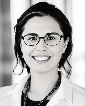
Hefeng Dong is a Professor in Acoustic Remote Sensing at the Department of Electronic Systems (IES) at NTNU since 2002. She leads the Acoustics Group and focuses on underwater acoustics, geoacoustic modeling, and marine environmental impact studies. Her research integrates signal processing, seismic inversion, and distributed sensing technologies. Education: BSc/MSc in Physics (Northeast Normal University, 1983/1986), PhD in Geoacoustics (Jilin University, 1994). She held positions at SINTEF Petroleum and conducted research visits at the University of Victoria (2008–2009) and University of Delaware (2014–2015). She is a member of IEEE and the Acoustical Society of America. Research interests span underwater acoustic communication, fiber-optic sensing for geophysics, and environmental monitoring. Recent work includes advancements in distributed acoustic sensing (DAS) for seabed monitoring and underwater localization using vector sensors. Her publications emphasize machine learning applications in geophysical data analysis and signal processing. Notable contributions include studies on shear wave velocity estimation via deep learning and the development of underwater communication protocols using fiber-optic cables. She has also explored the environmental impact of low-frequency sound on marine life, integrating acoustic measurements with ecological studies. Grants and collaborations include projects on quick clay monitoring and geophysical sensing technologies for energy applications. Her academic outreach includes hands-on acoustics training courses at NTNU and international conference participation.
Romain Feron is a researcher at the Laboratoire d'Acoustique de l'Université du Mans (LAUM) and a teacher-researcher within the ESEO Group , where he leads the GSII team . His work focuses on optical instrumentation , signal processing , and data analysis for geophysical applications. Key affiliations: LAUM, ESEO Group, PREST Project, EPOS-France Research specialties: Optical seismometers, Volcanic hazard monitoring, Geophysical instrumentation His publications demonstrate expertise in optical sensor development for extreme environments, including deployments at La Soufrière volcano and Caribbean subduction zones . Recent work (2024) details the first cabled optical ocean-bottom seismometer installation, combining 1.5km fiber optics with real-time seismic monitoring . Collaboration networks include IPGP , GEOAZUR , and OVSM-IPGP-PREST consortia. He has contributed to ANR projects on optical geohazard monitoring and participated in marine seismic campaigns like FIBROSAINTES-2021 .
Stephen S. Gao is the Curator's Distinguished Teaching Professor and Department Chair of Geosciences, Geological and Petroleum Engineering at Missouri University of Science and Technology. He also serves as Professor of Geophysics and Earth Sciences and Engineering Chair of the Geology and Geophysics Program. With over 250 scholarly works published throughout his career, Dr. Gao is a prominent figure in geophysics specializing in earthquake seismology, crustal deformation, and Earth's deep interior structure. Dr. Gao received his educational foundation from prestigious institutions: Ph.D. in Geophysics and Space Physics, University of California, Los Angeles (1995) M.S. in Geophysics and Space Physics, University of California, Los Angeles (1993) B.S. in Marine Geology and Geophysics, Ocean University of China (1984) Dr. Gao's research integrates multiple scientific disciplines to explore Earth's structure and dynamics. His work combines geology, physics, mathematics, and computer science to investigate Earth's interior using seismic waves generated by earthquakes. His research spans six continents including Brazil, China, Egypt, Ethiopia, Japan, Kenya, Mongolia, Russia, South Africa, the United States, and Zimbabwe. Key research areas include earthquake seismology and hazard prediction, mantle and crustal structure imaging using seismic tomography, seismic anisotropy and mantle flow patterns, continental rifting processes, and application of machine learning to seismic data analysis. Dr. Gao's recent publications demonstrate continued focus on understanding mantle dynamics and crustal deformation across diverse tectonic settings worldwide. His work increasingly incorporates advanced computational methods including convolutional neural networks for seismic event classification. The research spans from deep Earth structure to practical applications in exploration geophysics for locating oil, gas, and minerals, as well as environmental protection applications. Dr. Gao has received significant recognition for his contributions: Elected Fellow of the Geological Society of America h-index of 40 according to citation metrics As Department Chair and research leader, Dr. Gao oversees multiple research initiatives with substantial funding for geophysical investigations. His work has practical applications in earthquake hazard prediction and mitigation, as well as resource exploration. He maintains active international collaborations across six continents and contributes significantly to the field through his role as an educator, mentoring students and developing curriculum in geophysics and exploration techniques.
Ross Maguire is an Assistant Professor in the Department of Earth Science & Environmental Change at the University of Illinois, affiliated with the School of Earth, Society & Environment. His research focuses on planetary seismology, with a strong emphasis on Mars and Earth's magmatic systems. He employs advanced techniques like deep learning, seismic tomography, and waveform analysis to study seismic events, core-mantle interactions, and volcanic structures. Key research areas include Marsquake analysis, mantle dynamics, and the application of machine learning to seismic data. His work on the InSight mission to Mars has contributed significantly to understanding Martian interior structure through seismic wave studies. He also explores volcanic systems such as Yellowstone and Changbaishan, using seismic imaging to map magma reservoirs and crustal anomalies. Recent publications highlight advancements in classifying seismic events (e.g., earthquakes vs. explosions), resolving Mars' crustal and core structures, and modeling seismic wave propagation in diverse geologic settings. His interdisciplinary approach bridges geophysics, planetary science, and computational methods. Maguire collaborates on international projects like the InSight mission and contributes to initiatives such as the CRESCENT velocity model for the Cascadia subduction zone. His research addresses fundamental questions about planetary evolution, seismic hazards, and Earth's dynamic processes.
Professor Hrvoje Tkalčić is a renowned geophysicist at The Australian National University's Research School of Earth Sciences, specializing in global seismology and deep Earth structure. As Head of Geophysics and Director of the Warramunga Seismic & Infrasound Facility, he leads research into Earth's core-mantle dynamics, planetary seismology, and seismic source physics. His work integrates advanced observational techniques and computational models to explore Earth's interior and other planetary bodies. Affiliations: ANU since 2007; Elected Fellow of the Australian Academy of Science (2024); Member of the IUGG/IASPEI Executive Committee (2023–2027). Education: PhD in Geophysics from UC Berkeley (2001); Diploma in Physics from University of Zagreb (1996). Research Interests: Focus on the Earth's inner core anisotropy, planetary core imaging, and lithospheric structure using seismic and correlation wavefields. Recent breakthroughs include discoveries of distinct anisotropy in the innermost inner core and Mars' core structure using InSight mission data. Grants & Awards: Recipient of the 2023 CAS Distinguished Scientist Fellowship, Royal Astronomical Society Price Medal (2022), and multiple ARC grants. His team's work has advanced seismic inversion techniques and global core-mantle boundary imaging. Labs/Teams: Leads the Warramunga Array Facility and collaborates with international teams on Mars seismology (InSight) and Antarctic seismic deployments. Supervises a dynamic group of PhD students and postdocs exploring Earth's deep structure and planetary processes.
Samantha E. Hansen is a Professor in the Department of Geological Sciences within the College of Arts and Sciences at the University of Alabama. She maintains an active research program focusing on fundamental geodynamic processes and accepts MS/PhD advisees. Her research employs earthquake seismology, active tectonics, and seismic data analysis to investigate Earth structure and processes across diverse geographic locations including Antarctica, Africa, and other global regions. Dr. Hansen's primary research interests center on advancing understanding of fundamental geodynamic processes such as volcanism, mountain building, continental rifting, and craton formation. Her work particularly emphasizes earthquake seismology, active tectonics, and deep Earth structure, with significant contributions to the study of ultra-low velocity zones along the core-mantle boundary. She has conducted extensive field research in diverse locations including Hawaii, Costa Rica, Saudi Arabia, Africa, Greece, Greenland, and Antarctica. Her recent publications demonstrate a strong focus on Antarctic geophysics, mantle structure, and core-mantle boundary phenomena. The publication trends reveal consistent contributions to high-impact journals in geophysics and Earth sciences, with particular emphasis on seismic imaging techniques, mantle heterogeneity, and geodynamic modeling. Her work often involves large collaborative research teams and international scientific partnerships. As an educator, Dr. Hansen teaches several courses including GEO 101: The Dynamic Earth, GEO 369: Introduction to Geophysics, GEO 407/507: Seismology, GEO 435/535/635: Honors and Graduate Seminar in Geology, and GEO 542: Geodynamics. She has advised numerous graduate students through completion of their degrees, with recent graduates including Hesam Saeidi (Ph.D., August 2025), Kayode Agboola (M.S., August 2023), and Ashish Kumar (M.S., June 2021).
Yinshuai Ding is a University Researcher in the Department of Geosciences and Geography at the University of Helsinki's Faculty of Science. His research focuses on applied geophysics for natural resources exploration and near-surface investigation. Ding serves as responsible teacher for four courses: GEOM-2008 Field course of solid Earth geophysics, GEOM-2003 Applied geophysics, GEOM-2015 Ground-penetrating radar: theory and applications, and BSPH-2011 Introduction to solid Earth physics. PhD in Geophysics, University of Houston (2012-2019) Ding's research centers on applied geophysics with emphasis on mineral exploration and near-surface investigation. His work involves seismic imaging techniques, particularly for deep ore deposits, and utilizes both legacy seismic data and modern acquisition methods. He specializes in 3D seismic processing of 2D crooked lines, reflection imaging of massive sulphide deposits, and ground-penetrating radar applications. His research has practical applications in mining geophysics, particularly in the Outokumpu mining area in Finland and the Neves-Corvo mining site in Portugal. His recent publications (2023-2025) demonstrate a consistent focus on mineral exploration geophysics, particularly seismic methods for detecting deep ore deposits. Ding's work shows a progression from traditional 2D seismic analysis toward more advanced 3D imaging techniques applied to legacy datasets. A significant portion of his research involves the Neves-Corvo mining site in Portugal, where he applies innovative tunnel-to-surface acquisition setups and orthogonal geometry seismic profiles. He is also involved with FINNSIP, the mobile Finnish Seismic Instrument Pool, contributing to national research infrastructure development. Ding serves as Principal Investigator for the project 'Targeting deep ore deposits in Outokumpu by refining seismic images – the potential of 2D legacy datasets leveraged by 3D imaging algorithms and seismic attribute analysis' (2023-2024). He also participates in the FINNSIP facility as 'Other' contributor. His teaching portfolio is substantial, with responsibility for four courses and assistant teaching in two additional courses related to geophysics and petrophysics. Ding is actively involved with the FINNSIP (Finnish Seismic Instrument Pool) facility, which represents a significant national research infrastructure for seismic monitoring and geophysical research. His work bridges academic research with practical mineral exploration applications, particularly through collaborations with mining operations in Finland and Portugal.
Dr. Lucia McCallum is a Senior Lecturer in Geodetic VLBI at the School of Natural Sciences, Physics, University of Tasmania. She specializes in Very Long Baseline Interferometry (VLBI) for Earth observation, focusing on measuring the Earth's shape, rotation, polar motion, and plate tectonics. Her work connects geodetic techniques (GNSS, SLR, VLBI) via space tie satellites, with leadership in the ARC DECRA-funded project and the AuScope VLBI collaboration with Geoscience Australia. PhD from Technische Universität Vienna Active since 2014 in UTAS radio astronomy group Her research bridges geodesy and astrophysics, advancing the next-generation VLBI Global Observing System (VGOS) for millimeter-level precision. This technology addresses critical geoscientific challenges like sea level rise prediction and terrestrial reference frame stability. Recent publications (2025-2014) span VGOS optimization, GNSS satellite tracking, atmospheric signal corrections, and space tie methodologies. Her work emphasizes international collaboration through the International VLBI Service for Geodesy and Astrometry (IVS) and leadership roles in the Asian Oceania VLBI Group (AOV) and IVS Working Group 7. Scientific Awards Australian Research Council DECRA Fellowship Austrian Science Fund (FWF) Schrödinger Fellowship She supervises doctoral and master's students in geodetic VLBI projects, including topics like space weather effects, dynamic scheduling, and satellite signal calibration. Her full description includes global network operations, technical innovations, and societal impact through precision geodetic infrastructure.
Yongshun Chen is a Chair Professor at Southern University of Science and Technology (SUSTech), where he serves as the founding director of the Department of Marine Science and Engineering. Previously, he was a Professor at Peking University's School of Earth and Space Sciences and an Associate Professor at Oregon State University's Institute of Oceanography. He is currently the President of InterRidge, the international association for mid-ocean ridge studies. Chair Professor, Southern University of Science and Technology (2013-present) Professor, Peking University, School of Earth and Space Sciences (2001-2013) Associate Professor, Oregon State University, Institute of Oceanography (1990s-2001) PhD in Geophysics, Princeton University (1989) Bachelor's degree in Geophysics, University of Science and Technology of China (1982) Professor Chen's research focuses on marine geophysics and seismotectonics, with particular emphasis on the dynamics of oceanic spreading plate boundaries and the formation mechanisms of the oceanic crust. His pioneering work has provided explanations for seismic observations of mid-ocean ridges and continental ophiolite suites. After returning to China in 2001, he pioneered the field of "seismic geotectonics" in mainland China, conducting mobile seismic array observations and developing seismological methods to study the three-dimensional structure of the crust and upper mantle in key tectonic regions. His research has led to several significant contributions, including the "corner flow" model for the asthenosphere in southern Tibet, a new model of Indian lithosphere subduction beneath Tibet, and a "local upper mantle convection model" to explain intraplate volcanism in Northeast China. His work has had substantial impact on the international geoscience community, with his oceanic crust formation model being widely adopted by marine geologists. Professor Chen has published over 130 academic papers with more than 2,038 citations, including a single paper with 270 citations. His research spans marine geophysics, seismic tomography, crustal and mantle structure, plate tectonics, and volcanic processes, with a particular focus on the Tibetan Plateau and Northeast China. National Science Fund for Distinguished Young Scholars (2002) Editor-in-Chief of Marine Geophysical Researches (2004-2008) Editor of Journal of Geophysical Research-Solid Earth Reviewer for the Earth Science Department of the National Natural Science Foundation of China Professor Chen has supervised numerous graduate students and postdoctoral researchers. He has led more than ten major research projects, including those funded by the National Natural Science Foundation of China, 973 and 863 programs of the Ministry of Science and Technology, and special projects for earthquake research. His research group utilizes advanced seismic techniques and collaborates with international institutions to study Earth's structure and dynamics. As the founding director of the Department of Marine Science and Engineering at SUSTech, Professor Chen has established research teams focusing on marine geophysics, ocean dynamics, and seafloor exploration. His department conducts field observations using mobile seismic arrays and collaborates on international ocean drilling programs to advance understanding of Earth's structure and evolution.
Dani Mendoza DellaGiustina is an Assistant Professor at the University of Arizona's Lunar and Planetary Laboratory (LPL), with research focused on surface and near-surface structure of small airless worlds. She serves as Principal Investigator for OSIRIS-APEX and Deputy Principal Investigator for OSIRIS-REx missions, while also contributing to Artemis III LEMS, Hera, and Martian Moons eXplorer as a science team member. Ph.D., University of Arizona (2021) Current faculty since 2014 Teaching courses: PTYS 416/516 (Planetary Surface Processes) Her research interests include planetary geophysics , asteroid surface evolution , space weathering , and water distribution in the solar system . She combines remote-sensing data, geophysical instruments, and terrestrial analog field studies to investigate airless body processes. Recent publications focus on Bennu's seismic activity , carbonate vein analysis , regolith dynamics , and planetary analog seismology . Her work reveals insights into rubble-pile asteroid interiors, impact resurfacing, and low-cohesion surface physics. Awarded The Brilliant 10 (2022) by Popular Science, she mentors graduate students and leads spacecraft mission instrument development. Current advisees include Rishi Chandra, Carson Fuls, and Robin Van Auken.