California Institute of Technology (Caltech)United States
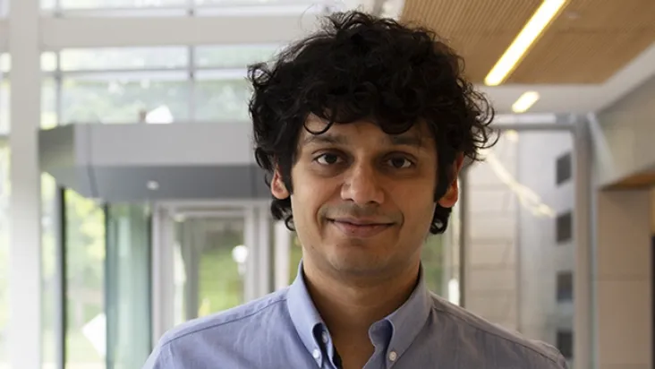
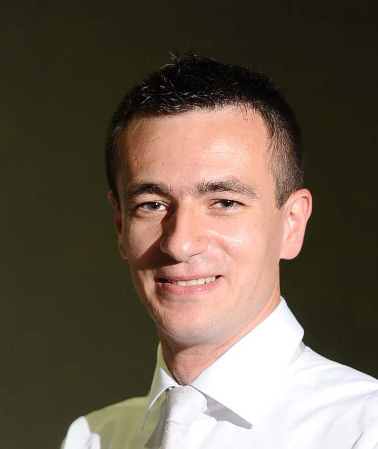
Xingxing Zuo is an Assistant Professor (tenure-track) in the Robotics Department at MBZUAI. He holds a PhD from Zhejiang University (2021) and a Bachelor’s from UESTC (2016). Previously, he was a Postdoctoral Scholar at Caltech (2024–2025), a Postdoc at ETH Zurich (2019–2021), and held visiting roles at TU Munich, University of Delaware, and University of Technology Sydney. His research focuses on robotics, 3D computer vision, and embodied AI, with emphasis on robot-human collaboration, state estimation, and sensor fusion. Educations: PhD in Robotics, Zhejiang University (2021, with honors) Bachelor’s in Computer Science, University of Electronic Science and Technology of China (2016, with honors) Research Highlights: Develops novel methods for LiDAR-camera-inertial fusion, neural radiance fields, and radar-cameras systems Pioneered techniques like Flying Co-Stereo (long-range aerial mapping) and FMGS (vision-language embedded 3D splatting) Focuses on real-time SLAM, robust depth estimation, and photorealistic scene reconstruction Awards & Recognition: Best Paper Finalist at ICRA 2021 (CodeVIO) Oral Presentation at ICCV 2021 (MBA-VO) Recipient of Google Visiting Faculty Researcher (2023) Grants & Labs: Organized Thermal Infrared in Robotics workshop at ICRA 2025 Leads research on embodied AI and multi-sensor SLAM systems Develops open-source tools like LIC-Fusion and Coco-LIC frameworks
Ram Vasudevan is an Associate Professor and Associate Chair of Graduate Studies in the Department of Robotics at the University of Michigan. His research focuses on developing tools for safe and robust deployment of robotic systems, emphasizing optimization, nonlinear control, and real-world applications. Key areas include legged robot locomotion, shared control systems, and safety-critical autonomous systems. Research Interests: Optimization and control of nonlinear systems, locomotion of legged robots, shared control active safety systems, and automation of diagnostic/rehabilitative tasks. His ROAHM Lab prioritizes mathematical guarantees for robotic performance, with applications in medical robotics, autonomous vehicles, and soft robotics. Recent work emphasizes trajectory optimization, sensor fusion, and safety-aware control strategies. He has contributed to benchmarks for autonomous vehicle perception and novel methods in thermal image restoration using neural radiance fields. Awards: None explicitly listed in provided text. Labs/Teams: Directs the ROAHM Lab, collaborating on projects like robotic tail mechanics, real-time motion planning, and sensor data analysis. Active in academic conferences including RSS and ICRA.
Lars Ulander is a Professor at Chalmers University of Technology specializing in radar remote sensing. His research focuses on synthetic aperture radar (SAR) signal processing, particularly for applications in forest biomass mapping and ground imaging using VHF/UHF-band systems. He is a key proposer for ESA's BIOMASS satellite mission (launching 2025) and leads the BorealScat project, utilizing a 50-meter tower-based tomographic radar to study boreal forest dynamics. His work spans radar system development, SAR tomography techniques, and environmental monitoring of forests and sea surface currents. Current research areas include vegetation water content estimation, bistatic radar configurations, and optimization of SAR data processing algorithms for multi-temporal analysis. Recent publications demonstrate expertise in P-band/L-band SAR for biomass retrieval, passive radar systems, and interferometric techniques. His articles investigate radar backscatter sensitivity to forest structure, moisture parameters, and seasonal changes, while contributing to mission design frameworks like SLAINTE and SESAME.
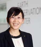
Xiaoxiang Zhu is a Professor for Data Science in Earth Observation at the Technical University of Munich (TUM) and serves as the Director of the International AI Future Lab - AI4EO. She is also on the Board of Directors of the Munich Data Science Institute (MDSI) and has held various leadership positions in research institutions including as Spokesperson for Helmholtz AI Research Field "Aeronautics, Space and Transport" (MASTr). Her educational background includes a doctorate (Dr.-Ing.) and habilitation from TUM. She has held positions as Private Dozent at TUM (2013-2015), TUM Junior Fellow (2013-2015), and Research Group Leader for "SparsEO" at Munich Aerospace (2011-2016). Professor Zhu's research focuses on the intersection of remote sensing, artificial intelligence, and data science. Her work primarily addresses global urban mapping, sustainable development goals, and climate change monitoring through Earth observation technologies. She develops advanced signal processing techniques and machine learning algorithms specifically tailored for satellite imagery and geospatial data analysis. Her research has significant applications in urban planning, environmental monitoring, and disaster management. Her team has pioneered approaches that combine synthetic aperture radar (SAR) with deep learning for improved Earth observation capabilities. Professor Zhu has received numerous prestigious awards including being named an IEEE Fellow (2021), receiving the Geodesy Award of the Nico Rüpke Foundation (2020), and being awarded an ERC Proof of Concept Grant (2020, 2022). She is also a Fellow of the Academia Europaea (2024) and AAIA Fellow (2024). Her publication record includes highly cited works such as "Deep Learning in Remote Sensing: A Comprehensive Review and List of Resources" (2017). She leads a substantial research team comprising numerous PhD students and postdoctoral researchers working on various projects including Horizon Europe - ThinkingEarth, EarthCare, and AI4TWINNING. Her research group, the Chair of Data Science in Earth Observation, is actively involved in multiple large-scale European and German research initiatives focused on Earth observation and AI applications.
Professor Emily So serves as Deputy Head of the School of Arts and Humanities at the University of Cambridge and directs the Cambridge University Centre for Risk in the Built Environment (CURBE). A chartered civil engineer with extensive field experience, she holds leadership roles in the Open-Oxford-Cambridge AHRC Doctoral Training Partnership and chairs the Faculty EDI Committee. Her research focuses on urban risk and resilience , particularly in earthquake-prone regions. Combining structural engineering with epidemiological approaches, she develops innovative casualty estimation models and engages directly with affected communities worldwide. Her work spans seismic safety, disaster epidemiology, and remote sensing applications for rapid damage assessment. Professor So's publication trends reveal strong emphasis on machine learning for disaster risk modeling , with recent work featuring graph neural networks, deep clustering for urban morphology, and LSTM-based population forecasting. Her research bridges engineering, social sciences, and data science to address resilience in developing nations. 2010 Shah Family Innovation Prize (Earthquake Engineering Research Institute) Fellow of the Institution of Civil Engineers (FICE) Scientific Advisory Group for Emergencies (SAGE) member advising UK government As Director of CURBE, she leads interdisciplinary collaborations with EEFIT, Global Earthquake Model (GEM), World Bank, and USGS. Her field investigations following major earthquakes inform practical solutions for vulnerable communities, notably contributing to the 2017 World Building of the Year design in China. Current work includes sabbatical research for 2025-2026 focused on decolonizing architectural approaches to disaster resilience. Professor So maintains active roles in professional organizations and international disaster response frameworks, with her CURBE team developing methodologies now implemented globally for seismic safety improvements.
Tobias Bolch is a full Professor at the Institute of Geodesy, Graz University of Technology (TU Graz), Austria, specializing in cryospheric research with a focus on High Mountain Asia and the Tibetan Plateau. His work integrates advanced geodetic and remote sensing methodologies to address critical climate change impacts on glaciers and related systems. His research spans: Glacier dynamics and mass balance monitoring using InSAR and optical satellite data Rock glacier kinematics and permafrost interactions Glacial lake evolution and outburst flood hazards Climate-glacier-hydrology linkages in Central Asian river basins Long-term cryosphere reconstruction using historical satellite archives Analysis of his 2023-2025 publications reveals dominant trends in quantifying ice loss acceleration, particularly from lake-terminating glaciers, and the application of multi-sensor approaches (Sentinel, ASTER, UAV) for decadal-scale change detection. His work consistently emphasizes the hydrological consequences of glacier retreat for downstream water security across High Mountain Asia. No scientific awards or specific grant programs were documented in the provided materials. While student supervision details are absent, his position at TU Graz's Institute of Geodesy indicates active mentorship within geospatial and cryospheric research programs. His homepage (https://ifg.tugraz.at) serves as the primary hub for research dissemination through the university's PURE portal.
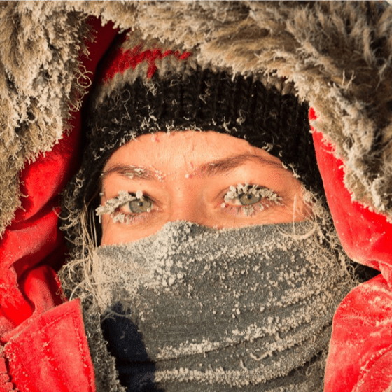
Britney Schmidt is Associate Professor in Earth and Atmospheric Sciences and Astronomy at Cornell University, where she leads the Planetary Habitability and Technology Lab. She develops robotic tools like the Icefin underwater vehicle to study Earth's ice shelves and glaciers, providing insights into climate change and analogs for ocean worlds like Europa. Her research bridges glaciology, planetary science, and astrobiology. Research focuses on ocean world habitability, ice-ocean interactions, and Antarctic climate systems. Fieldwork includes extensive campaigns in Antarctica and the Arctic using robotic explorers. Recent publications explore Europa's habitability, Thwaites Glacier dynamics, microbial communities in hypersaline environments, and planetary analog studies. Technical developments include novel instrumentation for under-ice exploration. Awarded the 2024 Blavatnik National Award for groundbreaking research. Leads multiple international collaborations including NASA's Europa Clipper mission and Thwaites Glacier projects.
Leif Eriksson is a Professor at Chalmers University of Technology , specializing in Radar Remote Sensing within the Department of Space, Earth and Environment . His career at Chalmers began in 2004, and he was promoted to Professor in 2022 after serving as Group Leader (2012–2017) and Head of Faculty Assembly (2017–2020). His research focuses on developing advanced methods for environmental monitoring using radar data, particularly synthetic aperture radar (SAR) from satellites and aircraft. Leadership Roles: Group Leader (Radar Remote Sensing), Faculty Assembly Head Key Collaborations: Rymdstyrelsen, EU Horizon, VINNOVA, European Space Agency Research Interests : Dr. Eriksson’s work spans forest biomass estimation , sea ice dynamics , and ocean surface current/wind retrieval . He integrates SAR data with in situ observations and climate models to study: Forest degradation (clear cuts, storm damage) via multi-temporal SAR Sea ice concentration, drift patterns, and thickness in Arctic regions Wind vectors and surface currents using interferometric SAR techniques Applications for maritime navigation safety and polar shipping optimization Article Trends : His recent publications emphasize SAR’s role in transport infrastructure monitoring (e.g., Iron Ore Line degradation), pan-Arctic landfast ice stability , and multi-frequency SAR fusion for enhanced sea ice observations. Collaborative work with teams across Europe and the U.S. highlights interdisciplinary approaches to climate and marine research. Projects & Grants : Dr. Eriksson leads or contributes to projects such as: CAISA (2022–2024): Air-ice-sea data assimilation EONav (2016–2019): Copernicus data for maritime navigation SEDNA (2017–2020): Safe Arctic shipping Forest Biomass Monitoring (2017–2018): Spaceborne SAR applications His work is supported by Rymdstyrelsen, EU Horizon, and industry partners like Trafikverket. Labs & Teams : He is central to the Radar Remote Sensing Group at Chalmers, collaborating with institutions like Lund University and international bodies such as ESA. His research often involves satellite campaigns (e.g., TanDEM-X, Sentinel) and field studies in polar regions.
University of North Carolina at Chapel HillUnited States
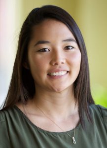
Miyuki Hino is an Assistant Professor in the Department of City and Regional Planning and an Adjunct Assistant Professor in the Environment, Ecology, and Energy Program at the University of North Carolina at Chapel Hill. She holds a Ph.D. in Environment and Resources from Stanford University and a B.S. in Chemical Engineering from Yale University. Her research focuses on climate hazards, governance, and public policy , with emphasis on equitable adaptation to climate change. Key areas include sea level rise impacts, flood risk on property markets, and managed retreat strategies. She has conducted extensive work on floodplain development policies, household relocation programs, and community resilience frameworks. Dr. Hino's interdisciplinary approach integrates environmental science, urban planning, and social equity . She collaborates with academic and municipal partners, such as the Center for Urban and Regional Studies and Annapolis, MD local governments, to develop actionable solutions for climate adaptation. Her work bridges technical analyses (e.g., sensor networks, machine learning) with policy design to ensure both effectiveness and justice in climate responses. Recent projects emphasize preventing future 'trapped households' by analyzing zoning policies and market dynamics that drive risky development. She advocates for climate-smart growth strategies to balance economic needs with environmental safety, while addressing disparities in vulnerability across communities. Her research has been featured in Science Advances , Nature Climate Change , and interdisciplinary journals. She actively engages with policymakers to translate findings into practical measures, such as equitable buyout programs and floodplain management reforms.
Swiss Federal Institute of Technology in LausanneSwitzerland
Alexis Berne is an Associate Professor at the Environmental Remote Sensing Laboratory (LTE) within the School of Architecture, Civil and Environmental Engineering (ENAC) at École Polytechnique Fédérale de Lausanne (EPFL). He co-directs the SSIE-GE program and serves as a member of the CDS (Commission for Doctoral Studies) . His research spans radar meteorology, precipitation microphysics, polar precipitation, and geostatistics, with a focus on mountainous and polar regions. Current Positions Associate Professor, LTE, EPFL (2013–present) Co-Director, SSIE-GE, EPFL PhD Program Committee Member, EDCE-GE, EPFL Research Interests include the remote sensing of precipitation, particularly snowfall and ice production mechanisms, using radar and geostatistical methods. His work addresses atmospheric processes in extreme environments like Antarctica and the Swiss Alps, leveraging machine learning and numerical modeling for climate analysis. Teaching encompasses courses on remote sensing, atmospheric processes, and climate change, emphasizing interdisciplinary approaches and spatiotemporal variability. He advises current PhD students such as Heather Anne Corden and Gionata Ghiggi, alongside mentoring past students like Jacopo Grazioli and Timothy Hugh Raupach.
Habib Ullah is an Associate Professor in Data Science at the Norwegian University of Life Sciences (NMBU), Norway, where he conducts research at the intersection of computer vision and machine learning. He is affiliated with the Institute of Data Science under the Faculty of Science and Technology. He has previously held academic positions at COMSATS University Islamabad, Pakistan, and the University of Ha'il, Saudi Arabia, and served as a postdoctoral researcher at The Arctic University of Norway. Educational Background: PhD in Information and Communication Technology (Computer Vision), University of Trento, Italy (2011–2015) MSc in Electronics and Computer Engineering, Hanyang University, South Korea (2007–2009) BSc in Computer Systems Engineering, NWFP University of Engineering and Technology, Pakistan (2002–2006) Habib Ullah's research is primarily focused on computer vision and machine learning, with applications in aquaculture, agriculture, and human behavior analysis. He investigates underwater fish feeding sounds using audio classification, develops zero-shot learning models for recognizing unseen classes, and applies deep learning to detect stress in salmon via skin dot patterns. He also explores AI-driven controlled environment agriculture, leveraging sensors and automation for optimal crop growth. His work emphasizes practical AI solutions for real-world challenges in environmental and biological domains. The recent publications highlight a strong trend in leveraging deep learning for zero-shot and semi-supervised learning, particularly in computer vision tasks such as sea ice classification, crowd anomaly detection, and agricultural monitoring. His research spans remote sensing, biomedical signal processing, and human activity recognition, demonstrating interdisciplinary versatility. The keywords reflect a focus on robust feature representation, knowledge transfer, and model generalization. Scientific Awards and Funding: Industrial PhD grant 'Advancing Controlled Environment Agriculture AI' from The Research Council of Norway (Project number 354125, 2 million NOK, 2024) Team member (Coordinator-Participant) in the Battery Cell Assembly Twin (BatCAT) project funded by Horizon Europe (7 mEuro, 2023–2027) Development of an AI-Based Image Analysis System for Monitoring Plant Status (Funding: 1.8 mNOK, starting 2025) Habib Ullah actively supervises PhD projects and contributes to academic service through editorial and organizational roles. He has served as an Associate Editor for IEEE Access, Guest Editor for MDPI Remote Sensing, and Editor of the Springer book Machine Learning Techniques and Sensor Applications for Human Emotion, Activity Recognition, and Support (ML-SHEARS) . He has also been a Track Chair and Program Committee Member for several international conferences, reflecting his leadership in the academic community. His research is supported by significant grants and collaborative projects, indicating strong institutional and international engagement. He is involved in multiple research teams and projects, including the BatCAT project on battery manufacturing and AI applications in controlled environment agriculture with RIFT LABS AS. His lab work integrates deep learning, sensor fusion, and data analytics for environmental and biological monitoring systems.
Matej Varga is a Scientific Assistant and Postdoctoral Researcher at ETH Zurich's Department of Civil, Environmental and Geomatic Engineering, working in the Geosensors and Engineering Geodesy group under Prof. Andreas Wieser since 2021. His research spans geometrical geodesy, physical geodesy, and satellite geodesy, with applications in both theoretical and practical domains. Dr. Varga's research interests focus on spatial, temporal and spectral analysis of geodetic data, with particular expertise in geodetic reference systems and frames, gravity and geomagnetic field modeling at all temporal and spatial scales, and multi-GNSS multi-frequency positioning and monitoring. His work integrates geometrical and physical aspects of geodesy to address complex Earth observation challenges, particularly in infrastructure monitoring and geophysical applications. His recent publications demonstrate a strong trend toward high-precision geodetic applications for major scientific infrastructure, most notably the Future Circular Collider project, alongside important contributions to earthquake impact analysis, geomagnetic network development, and gravity field modeling. His research bridges traditional geodetic methods with modern computational approaches, including machine learning applications for point cloud registration. Dr. Varga is actively involved in the GSEG research group at ETH Zurich, contributing to the development of geodetic infrastructure and reference systems. His work has practical applications in infrastructure monitoring, earthquake analysis, and scientific projects requiring extreme geodetic precision.
Cathryn Mitchell is a Professor of Radio Science and Royal Society Industry Fellow at the University of Bath, specializing in ionospheric physics, position, navigation, and timing (PNT). She leads research in the Space & Telecoms Research Group (STAR), focusing on radio propagation, data assimilation, and space weather impacts on communication systems. Her work bridges theoretical, computational, and experimental approaches, with applications in satellite navigation, climate monitoring, and defense sectors. Her research interests include ionospheric tomography, HF communications, and the development of robust PNT systems. Mitchell collaborates extensively with industry partners like Spirent Communications on future navigation technologies and space weather resilience. She has held roles such as Academic Director of the Doctoral College and contributes to interdisciplinary projects like the DRIIVE initiative exploring ionospheric variability with EISCAT-3D radar. Recent work emphasizes ionospheric effects during geomagnetic storms (e.g., the 2024 Gannon Storm) and cooperative autonomous systems under communication constraints. Her projects are funded by the Royal Society, Natural Environment Research Council (NERC), and ESA, addressing challenges in space weather forecasting and PNT system reliability. Awards: Royal Society Industry Fellow (2022–present) Key Projects: Royal Society Industry Fellowship on Future PNT Technologies DRIVERS (DRIIVE): Ionospheric Variability Studies EISCAT-3D FINESSE: Ionospheric Structuring Analysis Mitchell’s lab, STAR, integrates academic and industrial partnerships to advance space weather applications and sustainable navigation systems, contributing to UN Sustainable Development Goals related to climate action and innovation.
Dr. Samuel Cheng is an Associate Professor at the Gallogly College of Engineering , University of Oklahoma , specializing in Electrical and Computer Engineering . He holds a Ph.D. in Electrical Engineering from Texas A&M University (2004), preceded by M.S. and M.Phil. degrees from the University of Hawaii and Hong Kong University of Science and Technology. Education: B.S. (University of Hong Kong, 1995), M.Phil. (HKUST, 1997), M.S. (University of Hawaii, 2000), Ph.D. (Texas A&M, 2004) Professional Experience: Senior Research Engineer at Advanced Digital Imaging Research (2004-2005), prior internships at Microsoft Asia and Panasonic Technologies His research focuses on Information Theory , Signal and Image Processing , and Pattern Recognition , with applications in remote sensing, urbanization analysis, and disaster monitoring. His publications span topics including urban impervious surface mapping , nighttime light analysis , and machine learning for environmental data . His work often integrates multi-source datasets (e.g., Landsat, LiDAR, social media) for spatiotemporal modeling. Technical Expertise: Spectral unmixing, machine learning, thermal remote sensing, GIS integration Key Applications: Power outage detection, vegetation-crime correlation, PM2.5 estimation, smart meter data fusion Dr. Cheng holds three US patents in digital watermarking and is affiliated with IEEE, Sigma Xi, and AAAS. His recent articles demonstrate a trend toward leveraging AI for remote sensing challenges and analyzing urbanization impacts on ecosystems.
Professor Göran Broström works at the Department of Marine Sciences at the University of Gothenburg . His research focuses on physical oceanography, marine turbulence, tidal energy systems, and biophysical processes in marine ecosystems. Current research themes include methane emissions from ocean infrastructure, turbulence in tidal flows, and wave-current interactions He utilizes advanced numerical modeling (e.g., Large Eddy Simulation, Bayesian inversion) and field observations Recent publications emphasize climate impacts (methane plumes), tidal energy innovations, and marine ecological connectivity His work appears in high-impact journals like Nature , Molecular Ecology , and Frontiers in Marine Science . Collaborative projects span oceanographic modeling, environmental monitoring, and marine renewable energy. No specific student advising information appears in the provided text.