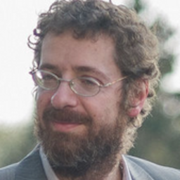
Silvia Katsarska-FilipovaView profile
Associate Professor
Silvia Katsarska-Filipova is an Associate Professor at the Department of Photogrammetry and Cartography within the Faculty of Geodesy at the University of Architecture, Civil Engineering and Geodesy (UACEG) in Sofia, Bulgaria. She holds a Doctor of Science degree in Photogrammetry and Remote Sensing Methods (2014) and a Master of Science in Geodesy from the same institution (1995-2000). Currently, she teaches courses including Unmanned Aerial Photogrammetry and Transformation and Interpretation of Space Images, and conducts exercises in Digital Photogrammetry, Close-range Photogrammetry and Laser Scanning. Doctor of Science in Photogrammetry and Remote Sensing Methods (2014) Master of Science in Geodesy, University of Architecture, Civil Engineering and Geodesy (1995-2000) Dr. Katsarska-Filipova's research focuses on digital photogrammetry, image processing, 3D modeling of surfaces and volumetric bodies, methods for obtaining and analyzing geospatial information, unmanned aerial systems for image capture and processing, applications of remote sensing, and GIS. Her work bridges theoretical advancements with practical applications in cultural heritage documentation, environmental monitoring, and urban planning. She has developed expertise in using drone technology for precise geospatial measurements and analysis, particularly for volume computations in quarries and other applications. Her recent publications (2022-2024) demonstrate a strong focus on integrating photogrammetry with remote sensing for diverse applications including urban heat island analysis, forest fire monitoring, water body assessment, and photovoltaic park efficiency evaluation. She has increasingly incorporated digital twin technology and multi-sensor approaches in her research, showing a progression from traditional photogrammetric techniques to more integrated, technology-driven solutions that combine close-range photogrammetry, laser scanning, and satellite imagery. Her work frequently involves practical applications in environmental monitoring and cultural heritage preservation. Dr. Katsarska-Filipova has supervised numerous diploma students on topics ranging from photogrammetric documentation of architectural heritage to analysis of burned territories using satellite imagery. She has served as Quality Manager for her department since 2017 and has participated in multiple research projects including 'Information platform for research and monitoring of the environment' (2018-2019), 'Use of multispectral and thermal images in analysis and assessment of energy efficiency' (2021-2022), 'Creation of 3D models of architectural objects based on hybrid technology for laser scanning' (2022-2023), and 'Digital geodetic twins in UACEG' (2023-2024). She is a member of the Union of Geodesists and Land Surveyors in Bulgaria and has received positive assessment from the Commission for the Attestation of the Academic Staff at the Faculty of Geodesy of UACEG (375.9 points) dated January 7, 2020. Her research has been widely cited internationally, particularly her 2016 work on volume computation of stockpiles using UAV measurements, which has become a reference in the field of drone-based surveying applications.