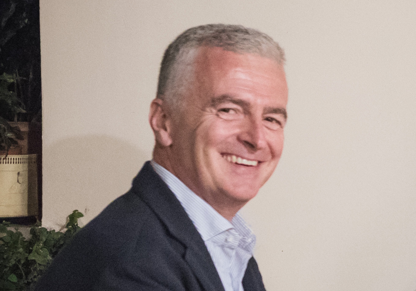
Alexandros Savvaidis is a Research Professor at the Bureau of Economic Geology, part of the Jackson School of Geosciences at The University of Texas at Austin. He serves as the Manager of the Texas Seismological Network (TexNet) and has over 30 years of experience in seismology and applied geophysics. His expertise spans earthquake physics, induced seismicity, engineering seismology, and geophysical data modeling. Savvaidis leads real-time seismic monitoring efforts across Texas, managing a network of 210 stations, and previously managed Greece's largest seismographic network. His research focuses on causal factors of induced seismicity linked to oil/gas operations, geothermal projects, and wastewater disposal, alongside developing machine learning tools for seismic data analysis. His technical work includes advanced inversion algorithms for crustal modeling using Texas Advanced Computing Center (TACC) resources, and he has pioneered methods like EQCCT for earthquake detection and phase picking. Savvaidis is also involved in disaster risk reduction initiatives and contributes to the Center for Collective Impact in Earthquake Science (C-CIES), emphasizing interdisciplinary approaches to earthquake science. Recent research trends highlight his focus on integrating AI into seismology, including earthquake forecasting datasets (AEFA), deep learning for seismic event classification, and real-time monitoring systems. His work bridges academic research with industrial applications, collaborating on projects funded by European and U.S. agencies. He advocates for improved seismic monitoring infrastructure in regions like New Jersey and Texas, emphasizing the need for precise data-driven strategies to address anthropogenic seismic hazards.
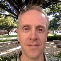
Timothy Melbourne is a Professor at Central Washington University, specializing in seismology, continental dynamics, and GNSS geodesy. He holds a Ph.D. from the California Institute of Technology (1999). His research focuses on advancing real-time geodetic monitoring systems for earthquake early warning and tsunami forecasting, leveraging Global Navigation Satellite System (GNSS) technologies. He is a key contributor to initiatives like the Pacific Northwest Geodetic Array and the ShakeAlert system. His work emphasizes integrating geodetic data with seismological observations to improve disaster risk reduction strategies. Major contributions include developing algorithms for rapid earthquake source characterization and enhancing the performance of GNSS networks in detecting tectonic deformation during seismic events. Melbourne collaborates internationally on projects such as the GeTEWS Oceania workshop and the CRESCENT Working Group, aiming to standardize global Earth observation systems (GGOS). His publications highlight advancements in noise mitigation for real-time GNSS data, spatial analysis of crustal deformation, and vertical land motion studies related to sea-level rise. He has been pivotal in demonstrating the operational feasibility of GNSS-based early warning systems through synthetic testing and real-world applications like the 2019 Ridgecrest earthquakes.
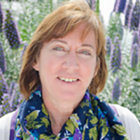
Warner Marzocchi is Professor of Geophysics and Natural Hazard Forecasting at the University of Naples Federico II and Scuola Superiore Meridionale. He holds a PhD in Physics (1992) and a degree in Earth Sciences (1987) from the University of Bologna. Previously, he served as Chief Scientist at the Istituto Nazionale di Geofisica e Vulcanologia (2003-2018) and held visiting positions at the University of Southern California and the Institute of Statistical Mathematics in Tokyo. His research focuses on seismic/volcanic hazard analysis, earthquake forecasting, statistical seismology, and hazard model validation. He coordinates international projects in natural hazard assessment and serves on advisory panels including the International Atomic Energy Agency, US National Seismic Hazard Model, and Global Volcano Model. Marzocchi's recent publications demonstrate advances in probabilistic forecasting models, operational earthquake forecasting systems, and statistical validation methods. His work frequently applies machine learning and complex systems theory to seismic and volcanic processes across Italy, California, and New Zealand. Honors: Ranked among world's top 2% scientists (2019-present) Member of Academia Europaea (2018) Editorial awards from Geophysical Journal International (2010) and Geophysical Research Letters (2003) He teaches graduate courses in geophysics, statistics, and hazard forecasting, and has advised numerous PhD students. He leads research teams focused on seismic risk mitigation and volcanic unrest management.
California Institute of Technology (Caltech)United States
Mateo Acosta is an Assistant Professor of Geomechanics at Virginia Tech, specializing in earthquake mechanics, crustal deformation, and geomorphic processes. He serves as Center Director of the Center for Geomechanics and Mitigation of Geohazards (GMG) and Associate Director of the Center for Autonomous Systems and Technologies, bridging geoscience with engineering applications. His research integrates field observations, seismological and geodetic measurements, remote sensing, and laboratory experiments to develop kinematic and dynamic models. Key projects include seismicity forecasting in subsurface engineering operations, hydrology-crustal deformation interactions, Martian dune dynamics, Himalayan and Tibetan tectonic studies, and postseismic deformation analysis. Recent publications focus on induced seismicity mitigation, geothermal reservoir optimization, fault hydraulic properties, and earthquake nucleation mechanisms. These works span 2017-2025 with recurring themes in geothermal energy applications, CO2 storage safety, and computational geomechanical modeling. Scientific awards : Resnick Graduate Scholar Acosta contributes to earthquake physics outreach through media appearances, including a PBS Interview on geothermal systems. His work connects geological processes with practical engineering solutions for geohazard mitigation.
University of North Carolina WilmingtonUnited States
Scott Nooner is a Professor of Geophysics at the University of North Carolina Wilmington, leading the Crustal Dynamics and Geophysics Laboratory. His research focuses on mid-ocean ridge systems, seafloor geodesy, and crustal deformation processes. He specializes in using geophysical techniques like seafloor gravity, compliance measurements, and pressure gauges to study magma dynamics at Axial Seamount and other volcanic systems. His work includes studying the interplay between tectonics and hydrothermal systems, monitoring CO₂ sequestration at the Sleipner Project in the North Sea, and analyzing deformation caused by monsoonal flooding in Bangladesh. He teaches courses such as Natural Disasters, Geological Oceanography, and Introduction to Geophysics. Key Research Areas: Axial Seamount eruption dynamics, magma chamber compartmentalization, seafloor geodetic monitoring, CO₂ storage, and crustal deformation in subduction zones. Notable Projects: Collaborative monitoring of Alaska and Cascadia subduction zones, long-term studies at Axial Seamount, and Bangladesh delta subsidence analysis. Nooner advises a diverse group of graduate and undergraduate students, including Audra Sawyer, Will Hefner, and Kevin Lally. His lab maintains active partnerships with oceanographic institutions and operates advanced seafloor instrumentation networks.
Tapan Mukerji is a Professor (Research) at Stanford University with joint appointments in the Department of Energy Science & Engineering, the Department of Earth & Planetary Sciences, and the Department of Geophysics within the School of Earth Sciences. He co-directs the Stanford Center for Earth Resources Forecasting (SCERF), the Basin Processes and Subsurface Modeling (BPSM) consortium, and the Stanford Rocks and Geomaterials Project (SRGP), and previously co-directed the Stanford Rock Physics and Borehole Geophysics Project (SRB). His educational background includes: Ph.D. in Geophysics from Stanford University (1995) M.Sc.(Tech) in Geophysics from Banaras Hindu University, India (1989) B.Sc. in Physics from Banaras Hindu University, India (1986) Tapan Mukerji's research focuses on integrating rock physics, wave propagation physics, spatial data science, and machine learning to address challenges in remote sensing of subsurface systems, stochastic geomodeling, uncertainty quantification, and value of information analysis in Earth sciences. His work uses theoretical, computational, and statistical methods to discover fundamental relations between geophysical data and rock properties, quantify uncertainty in subsurface models, and address decision making under uncertainty. He is particularly interested in forging links between geosciences, engineering, and decision sciences, believing these interdisciplinary connections are critical for the future of energy resources research. His research has broad applications in hydrocarbon exploration, geothermal energy, carbon sequestration, and critical mineral exploration. His recent publications demonstrate a strong trend toward integrating advanced machine learning techniques with traditional geophysical methods. There's increasing focus on physics-informed neural networks, generative models for geological facies simulation, and uncertainty quantification in subsurface characterization. His work bridges the gap between theoretical rock physics and practical applications in energy resource development, with particular emphasis on making robust decisions under uncertainty. Professor Mukerji has received numerous scientific awards and recognitions: Karcher Award for Outstanding Young Geophysicist, Society of Exploration Geophysicists (2000) ENI Award 2014: New frontiers of Hydrocarbons - upstream, ENI - Italy (2014) Best paper, honorable mention, Society of Exploration Geophysicists (2020) Best paper, International Association of Mathematical Geosciences (2010) Multiple best paper awards from various geophysical societies Invited keynote speaker at numerous international conferences Haider Fellowship and Green Fellowship from Stanford University Professor Mukerji actively advises and mentors graduate students, serving as Doctoral Dissertation Advisor for Jaehong Chung and Jiayuan Huang, Doctoral Dissertation Reader for several students, and Postdoctoral Faculty Sponsor for Qi Hu and Suihong Song. His research has been supported by multiple industrial consortia including the Stanford Rock Physics and Borehole Geophysics Project (SRB), Stanford Center for Earth Resources Forecasting (SCERF), Basin Processes and Subsurface Modeling (BPSM), Stanford Rocks and Geomaterials Project (SRGP), and Smart Fields Consortium (SFC). He has also received funding from the Department of Energy and various fellowship programs throughout his career. Professor Mukerji co-directs several major research groups at Stanford including the Stanford Center for Earth Resources Forecasting (SCERF), the Basin Processes and Subsurface Modeling (BPSM) consortium, and the Stanford Rocks and Geomaterials Project (SRGP). These groups bring together faculty, researchers, and industry partners to tackle complex problems in subsurface characterization, reservoir modeling, and energy resource development. His labs focus on developing computational methods for integrating geophysical data with rock physics models, creating advanced uncertainty quantification frameworks, and building decision support tools for subsurface resource management.
José Antonio Huesca Tortosa is an Assistant Professor Doctor in the Department of Architectural Constructions at the University of Alicante , Spain. Since 2004 (with a brief interruption from 2019–2020), he has taught over 2,500 hours of official courses in Architectural Technology, Construction Materials, Quality Control, Heritage Management, and Seismic Risk Prevention. He is a member of the Architectural Restoration Research Group (GIRAUA-CICOP) and co-founder of the spin-offs Arquinversa (heritage digitization) and Sismo Edificación (seismic research and outreach). Education PhD in Materials, Structures & Soil Engineering: Sustainable Construction, University of Alicante, 2021 Master’s in Secondary Education Teaching (specialty Civil Construction & Drawing), University of Alicante, 2020 Post-graduate specialization in Digital Heritage Documentation, CSIC-Incipit, 2019 Graduate in Architectural Technology & Technical Architecture, University of Alicante, 1994–2011 Master in Building Management (Heritage Management track), University of Alicante, 2008 Research Interests His core research revolves around sustainable construction , seismic vulnerability assessment , heritage restoration , and the digitalization of built heritage through advanced surveying technologies (LiDAR, UAV photogrammetry, HBIM). He integrates geomatics, materials science, and structural engineering to develop methodologies for preventive conservation, emergency intervention, and risk mitigation in historic and contemporary buildings. Current projects focus on earthquake early-warning systems, rapid damage assessment protocols, and eco-compatible consolidation treatments for calcareous stones. Recent Publications & Trends Over the last five years he has authored 12 journal papers and 4 book chapters. The works exhibit a clear trajectory from technological innovation (LiDAR, UAV photogrammetry) to applied heritage engineering (structural health monitoring, restoration of Gothic and Renaissance buildings) and multi-hazard assessment (seismic–radon correlations). Interdisciplinary collaboration is a hallmark, with studies spanning from archaeological sites in Italy and Spain to real-time seismic monitoring networks in southeastern Spain. Scientific Awards & Recognition One six-year research period (sexenio) accredited by ANECA Two five-year teaching periods (quinquenios) recognized by University of Alicante Coordinator or collaborator in 15 competitive research projects funded by Spanish Ministries and regional governments Grants, Projects & Advising He has participated in 15 publicly funded R&D projects (PID, CGL, ARQ, GV programs) and 36 private contracts, coordinating 4 technology-transfer actions since 2023. Notable projects include the European Seismological Commission studies on radon-seismicity correlations and the development of an earthquake early-warning system for Alicante province. He has supervised or co-supervised 27 bachelor’s and master’s theses in the last five years, fostering student involvement in heritage digitization and seismic risk scenarios. Labs & Teams He operates within the Architectural Restoration Research Group (GIRAUA-CICOP) , leveraging the University of Alicante’s Geomatics & Heritage Conservation Laboratory . The group maintains high-precision terrestrial and aerial laser scanners, UAV platforms, and advanced materials testing equipment, enabling integrated workflows from field data capture to structural modeling and conservation treatment design.
Virginia Polytechnic Institute and State UniversityUnited States
Manoochehr Shirzaei is an Associate Professor of Geophysics and Remote Sensing at Virginia Tech's Department of Geosciences (College of Science). His research focuses on satellite geodesy, inverse theory, and modeling techniques to understand crustal deformation processes, including seismic/aseismic faulting, anthropogenic hazards, groundwater dynamics, and sea-level rise impacts. He develops advanced InSAR and numerical modeling methods to quantify deformation mechanisms and mitigate natural hazards. Education: PhD (2010) in Potsdam University (Germany), M.S. (2003) in Geodesy from Tehran University, and B.A. (2001) in Surveying Engineering from Amir-Kabir University of Technology. His work bridges geophysical observations with theoretical models to address real-world challenges like subsidence, induced seismicity, and coastal vulnerability. Research Interests: Remote Sensing of Earth Deformation Induced Seismicity from Fluid Injection Subsidence Mitigation Strategies Climate-Driven Coastal Hazards Poroelastic Stress Modeling Recent Work Trends: His publications emphasize interdisciplinary approaches to quantify subsidence risks in US coastal regions, groundwater depletion impacts, and geothermal operations' seismic effects. He advocates for rigorous data integration and policy-relevant research through initiatives like the International Panel on Land Subsidence (IPLS). Labs/Teams: Leads the Earth and Atmospheric Dynamics Analysis Research (EADAR) Lab at Virginia Tech, focusing on innovative geodetic methods for environmental monitoring.
Dr. Timothy C. Bartholomaus serves as Associate Professor in the Department of Earth and Spatial Sciences within the College of Science at the University of Idaho. Leading the Glacier Dynamics Group in Moscow, ID, his research integrates seismology and geophysics to investigate glacier dynamics, ice-ocean interactions, and sea level rise projections. His work spans field sites in Alaska, Greenland, Antarctica, and Svalbard with emphasis on subglacial hydrology, iceberg calving mechanisms, and rapid ice loss processes. His educational background includes: PhD in Geophysics (2013), University of Alaska Fairbanks MS in Geological Sciences (2007), University of Colorado Boulder AB in Earth Sciences (2002), Dartmouth College Bartholomaus' research focuses on the fundamental processes driving glacier acceleration and mass loss. His group employs seismic monitoring to map subglacial water systems, revealing how conduit branching and pressure gradients control ice flow. Seminal work demonstrated that changes in subglacial water storage—not total throughput—govern glacier velocity, overturning prior assumptions. Current projects examine glacier surges through enthalpy-based modeling, ice mélange impacts on fjord stratification, and calving style differentiation using terminus change time series. Analysis of his recent publications reveals strong emphasis on interdisciplinary approaches combining seismology, hydrology, and remote sensing. Key trends include seismic mapping of subglacial hydrology during surge cycles, quantification of submarine melt effects on calving, and development of applied ice sheet modeling frameworks for policy relevance. His work increasingly addresses societal implications through sea level rise projections and community engagement initiatives. As principal investigator, Bartholomaus has secured funding from the National Science Foundation and the University of Alaska Fairbanks Center for Global Change. His Glacier Dynamics Group mentors graduate students through field campaigns in Alaska and Greenland, with recent graduates including Dr. Chris Miele (PhD dissertation: 'Shearing shelves, mathematical modeling, and fracture factories'). The group actively participates in major workshops including the Future of Greenland Ice Sheet Science (FOGSS) and Northwest Glaciologists meetings. The Glacier Dynamics Group operates through collaborative networks including the International Glaciological Society and multi-institutional projects like the 2023 FOGSS workshop hosted at UI. Field operations span the St. Elias Range, Greenland fjords, and Antarctic ice shelves, utilizing seismic arrays, GPS monitoring, and oceanographic sensors to capture ice-ocean interactions at process scales.
Dr. Glenn Thompson is a Research Assistant Professor in the School of Geosciences at the University of South Florida, specializing in volcano seismology and real-time monitoring systems. With extensive field experience at Montserrat and Alaska Volcano Observatories, he develops innovative seismic software for eruption forecasting and hazard mitigation. Research focuses on volcanic earthquake swarms, tremor classification, debris flow detection, and rainfall-induced dome collapses. Pioneering work includes development of flowHDBSCAN for seismic clustering and novel alarm systems for observatory operations. Publications demonstrate expertise in signature volcanic events including the 2009 Redoubt eruption and Soufrière Hills dome collapses. Recent work advances understanding of seismic-amplitude relationships and transient aquifer storage in volcanic systems. Fieldwork spans Alaska's Redoubt Volcano, Montserrat's Soufrière Hills, and Bahamian blue hole systems. Maintains active collaborations with USGS volcano observatories and international monitoring networks. Teaching includes Volcano-Seismology topics and programming for geoscientists. Advises graduate students on seismic data analysis and volcanic processes. Certified full-cave diver and divemaster supporting subaqueous research.
Dr. Pascal Horton is a Senior Scientist at the Mobiliar Lab for Natural Risks and Hydrology within the Institute of Geography at the University of Bern , focusing on debris flow susceptibility, hydrological modeling, and climate impact research. Research Interests: Debris Flow Susceptibility Mapping Hydrological Processes and Modeling Precipitation Downscaling Meteorological Process Analysis GIS and Modeling Deep Learning Applications in Environmental Science Recent Publication Trends: His 2025–2024 work spans glacier hydrology, debris flow risk assessment, deep learning for precipitation extremes, and national-scale water resource modeling, emphasizing climate change impacts and data infrastructure development. Laboratory & Collaborations: Affiliated with the Mobiliar Lab for Natural Risks and Hydrology, he collaborates on projects involving glacial meltwater, flood damage prediction, and multi-hazard scenarios in alpine and transboundary regions.
Dr. Vanille Ritz is a postdoctoral researcher at the Swiss Seismological Service (SED), ETH Zurich, with a split position between the Modelling Group and the GeoBest team. Her expertise lies in developing hydro-geomechanical and statistical models to understand and forecast induced seismicity in geothermal systems. She focuses on projects like GeoBest, which provides seismological support for Swiss geothermal energy initiatives, and has been a key contact for cantons Vaud, Jura, and Geneva. She holds a Ph.D. from ETH Zurich (2023) and a M.Sc. in Seismology from Université de Strasbourg (2017). Research interests include induced seismicity mitigation, geothermal reservoir engineering, and real-time seismic monitoring. Her work integrates data-driven approaches with physics-based models to optimize energy production while minimizing seismic risks. Notable contributions include the 'Transient Evolution of Earthquake Size Distributions' study (2022), recognized with the SSA Student Award. Education: Ph.D., ETH Zurich (2018–2023): Modelling Induced Seismicity in Deep Geothermal Systems M.Sc., Université de Strasbourg (2015–2017): Seismology Geophysical Engineering, Ecole et Observatoire des Sciences de la Terre (2014–2017) Professional activities include leadership in projects like DEEP (2021–2024), COSEISMIQ (2018–2021), and DESTRESS (2017–2018), advancing de-risking strategies for geothermal energy. Awards include the 2023 SSA Student Presentation Award for seismic risk indicator research. Her work bridges geoscience and engineering, emphasizing collaboration with cantonal governments and energy stakeholders to ensure sustainable geothermal development. Current efforts focus on synthetic benchmark datasets and real-time forecasting tools for induced seismicity management.
Ankit Chakraborty is a Postdoctoral Fellow at the Bureau of Economic Geology, University of Texas at Austin. His research focuses on energy-environment intersections, including carbon capture and storage, unconventional resource recovery, and hydrological systems. Fields of Interest: Energy Research, Environmental Science, Geology, Hydrology Research Trends: Recent publications highlight CO₂ storage optimization, induced seismicity from energy operations, Arctic permafrost dynamics, and Permian Basin environmental impacts. His work combines field studies, geospatial analysis, and computational modeling. Contact: ankit.chakraborty@beg.utexas.edu
Jennifer Haase is a Professor at the Institute of Geophysics and Planetary Physics (IGPP) within Scripps Institution of Oceanography at UC San Diego. Her research spans atmospheric science and geophysics, focusing on atmospheric rivers, tropical wave interactions, seismic hazard analysis, and remote sensing using GNSS technology. She leads a multidisciplinary team with expertise in geodesy, meteorology, and data assimilation. Education : B.S. in Geophysics, California Institute of Technology (1985) Ph.D. in Earth Science, Scripps Institution of Oceanography (1992) Research Interests : Atmospheric Science : Atmospheric river dynamics, stratospheric remote sensing, airborne data assimilation, and hurricane development. Geophysics : Seismogeodesy for earthquake early warning, seismic hazard assessment, and tomography. Recent Research Trends : Her work emphasizes innovative observational techniques like airborne radio occultation (ARO) to improve weather forecasting and climate models. Key contributions include applying GNSS for real-time surface deformation monitoring during earthquakes and advancing atmospheric river reconnaissance to address data gaps in extreme weather events. Awards : No specific awards listed in the text. Advising & Grants : Current advisees include PhD candidates Haley Lowes-Bicay and Kate Lord, among others. Collaborations involve the Center for Western Weather and Water Extremes (CW3E) and NASA initiatives. Recent grants focus on seismic risk assessments and tsunami hazard modeling under climate change. Teams & Labs : Research team includes staff scientists (e.g., Bing Cao), postdocs (e.g., Nghi Do), and engineers (John Souders). Former members now hold faculty positions at institutions like SDSU and Wroclaw University of Technology.
Zak Varty is a Senior Lecturer in Statistics at the Department of Mathematics, Faculty of Natural Sciences, Imperial College London. His research focuses on applied and methodological statistics, particularly in environmental and industrial contexts. He teaches courses in statistics, data science, and data ethics, emphasizing extreme value theory, Bayesian statistics, and point processes modeling. His research interests intersect statistical theory and practical applications, with a focus on non-standard data mechanisms and environmental/industrial projects. Key areas include induced earthquakes modeling, seismic risk assessment, and statistical methods for network analysis. Recent publications highlight contributions to extreme value analysis (e.g., automated threshold selection), seismological modeling using ETAS frameworks, and optimization techniques like simulated annealing. These works reflect a blend of methodological innovation and real-world problem-solving. No scientific awards are listed, but his contributions to statistical education and applied research are notable. He has advised students on research projects but no specific advisees are named here. His work often involves collaborations in environmental and industrial statistics, though specific grants or labs are not detailed in the provided text.