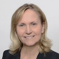
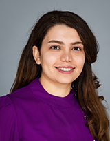
Margret Plank is a Researcher at the German National Library of Science and Technology (TIB) , where she leads the Lab for Non-Textual Materials . Her work focuses on developing user-centered services for scientific videos, 3D models, and research data, with a strong emphasis on discoverability and reuse.
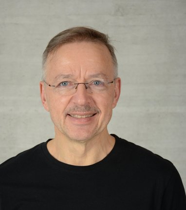
Prof. Dr.-Ing. Franz-Josef Behr serves as Senior Professor of Geospatial Information at Stuttgart University of Applied Sciences, specializing in Spatial Data Infrastructure (SDI), Standards, Open Source solutions, data modelling, and disaster mapping. His academic leadership includes serving as Study Dean for the Master Programme Photogrammetry and Geoinformatics (2009-2022) and founding the internationally recognized AGSE conference series focused on geoinformatics for societal and environmental challenges. Behr's research centers on geospatial interoperability, with expertise spanning SDI implementation, OGC standards evolution, and open source geospatial technologies. His work bridges theoretical frameworks with practical applications in disaster management, urban planning, and international development, particularly through capacity-building initiatives in Indonesia and India. Current investigations examine OpenStreetMap integration for official cadastres and modern API-based service architectures replacing traditional OGC web services. Recent publications reveal strong trends toward practical implementations of open standards in governmental systems, UAV data processing for developing nations, and disaster response applications. His work consistently emphasizes interoperability, open data principles, and technology transfer to address real-world challenges in geospatial information management. Scientific recognition includes: Best Poster Award at ISPRS Conference, Prague (2016) Academic leadership extends globally through roles as Co-chair of the ICA Commission on SDI and Standards (2017-2023), membership in ISO/TC 211 standards committees, and service on Kerala's Digital University Board of Studies. He has significantly advanced geospatial education through the AGSE conference network spanning 12 countries and numerous international workshops. As founder and chair of the AGSE conference series since 2009, Behr has cultivated a global network connecting academia, government, and industry across India, Peru, Kenya, Malaysia, Germany, Iran, Namibia, and Nepal. This initiative specifically focuses on applying geoinformatics to societal challenges including disaster management, sustainable development, and environmental monitoring through practical open-source implementations.
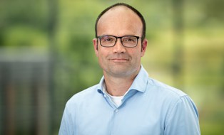
Lars Bernard is Full Professor for Geoinformatics at the Faculty of Environmental Sciences, Technische Universität Dresden since 2015. He also holds the position of Chief Digitalization and Information Management Officer (CDIO) at TU Dresden since 2020 and serves as member of the TUD Rectorate. PhD in Geoinformatics (University of Münster, 2001) Diploma in Physical Geography (University of Münster, 1995) His research focuses on (Geo-)Information Infrastructures , Distributed Geoprocessing , and Smart Environmental Monitoring . He has extensive experience in developing geospatial standards through roles in AGILE, EuroSDR, and INSPIRE initiatives. His publications demonstrate a consistent emphasis on: Metadata provision and data quality frameworks Interoperability solutions for geospatial systems Climate information service architectures User-driven provenance mechanisms As co-chair of RFII (2020-) and spokesperson for NFDI4Earth (2019-), he leads major German research data initiatives. He has advised numerous students and coordinated TU Dresden's Master Geoinformation Technologies program until 2018. Current leadership roles include serving on scientific editorial boards for Environmental Modelling & Software and International Journal of Spatial Data Infrastructures Research .
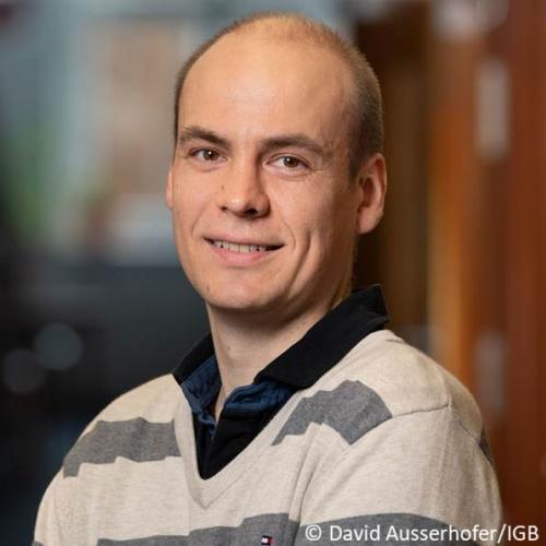
Dr. Sami Domisch is a Research Group Leader at the Leibniz-Institute of Freshwater Ecology and Inland Fisheries (IGB) in Berlin, leading the Global Freshwater Biodiversity, Biogeography and Conservation (GLOWABIO) research group since 2024. He previously held a Leibniz Junior Research Group Leader position (2019–2024) and completed a postdoc at IGB (2016–2019). His academic journey includes a PhD at Senckenberg Research Institutes (2009–2012) and postdoctoral work at Yale University (2013–2016). Domisch specializes in freshwater biodiversity, climate change impacts, and hydrological modeling, with a focus on macroinvertebrates and ecosystem services. Education: PhD in Biodiversity and Climate Research (2012), Senckenberg Research Institutes Postdoc at Yale University (2013–2016) Advanced studies in biology at Carl von Ossietzky Universität Oldenburg (2005–2007) Basic studies in biology at Technische Universität Kaiserslautern (2001–2005) His research interests span freshwater biogeography, conservation strategies, and the integration of geospatial tools for environmental data analysis. Domisch has co-developed influential tools like the hydrographr R package and the GeoFRESH platform. He is an Associate Editor for Scientific Data and Journal of Biogeography , and a member of multiple editorial boards. Key grants include DFG-funded projects on freshwater fish diversity and NFDI4Earth initiatives for geospatial data interoperability. His work addresses global challenges like dam impacts, climate change effects, and invasive species dynamics. Domisch has received the EFFS-Award (2011–2012) for his PhD work and hosts international researchers through DAAD programs. Notable collaborations include the AquaINFRA and SOS-Water Horizon Europe projects, focusing on infrastructure for water research and safe operating spaces for water systems. His lab develops geospatial solutions to bridge data gaps in freshwater science.
Prof. Dr.-Ing. Youness Dehbi is a Professor for Computational Methods at HafenCity University Hamburg. His academic career includes roles as a postdoctoral researcher and scientific assistant at the University of Bonn's Institute of Geodesy and Geoinformation. He holds a Ph.D. in Computer Science from the University of Bonn (2016). His research focuses on geoinformatics, 3D city modeling, remote sensing, and applications in urban planning and disaster management. He has led projects such as VisioChick (enhancing animal welfare via mixed reality) and FPOplus (5G-based passenger flow management). Education: Ph.D. in Computer Science, University of Bonn (2016) M.Sc. and B.Sc. in Computer Science and Communication Research, University of Bonn (2008) Research Interests: Prof. Dehbi specializes in computational methods for spatial data analysis, including laser scanning, UAV missions, and semantic segmentation of historical maps. He explores applications in BIM, flood risk communication, and smart city technologies. His work bridges geoinformatics with urban sustainability and mixed reality. Awards: Best Paper Awards at multiple international conferences (2018–2024) Best Reviewer Award, ISPRS Congress (2021) Advising & Projects: He advises projects like NGCN (Next Generation City Networking) and collaborates with institutions like TU München and the University of Osnabrück. His team includes researchers like Dr. Son H. Nguyen and M.Sc. Lukas Arzoumanidis. Lab & Teams: His Computational Methods Lab at HCU develops tools for 3D city modeling and spatial data analysis, contributing to open-source geospatial software and collaboration with industry partners.
Prof. Dr. Anna-Lena Lamprecht is a Chair of Software Engineering at the University of Potsdam, Institute of Computer Science. Her work focuses on interdisciplinary research software engineering, scientific workflows, and FAIR principles for computational materials science and bioinformatics. University of Potsdam Department of Software Engineering Research Interests Lamprecht explores the intersection of domain-specific languages, automated workflow composition, and agile methodologies for scientific computing. She emphasizes reproducibility, sustainability, and semantic validation in research software, particularly through projects like Workflomics and TopoToolbox3. Publications Her recent work spans multi-dimensional software categorization, workflow modeling patterns, and FAIR adoption in GitHub repositories. She also investigates benchmarks for bioinformatics workflows and semantic constraints in geospatial service composition. Projects Current projects include VERSECLOUD, Workflomics, and TopoToolbox3. She leads initiatives in automated workflow composition and has contributed to the FAIR4RS principles. Teaching and Supervision Supervised student works Full-semester RSE courses Computational thinking education Contact anna-lena.lamprecht@uni-potsdam.de | +49 331 977-3040 | Campus Golm, Building 70, Room 1.35
Dr. Susanne Feistel is a Researcher at the Leibniz Institute for Baltic Sea Research (IOW) in Warnemünde, Germany, affiliated with the IT & Data Management department under the Directorate. She holds a Dr. rer. nat. from Ludwig Maximilian University of Munich (2012) and a Dipl. Biol. from the University of Rostock (2004). Her research focuses on marine data management systems, with specialization in research data curation, metadata frameworks (notably IOWMETA), and oceanographic database development (IOWDB/ODIN2). Key domains include: Research data lifecycle management for marine science Baltic Sea hydrographic and hydrochemical data analysis Data provenance and reproducibility frameworks Development of FAIR data standards for ocean research Her publications demonstrate consistent focus on marine data systems, with recent work emphasizing standardized data management practices for large-scale research collaborations, geospatial analysis of Baltic Sea conditions, and reproducible data workflows. Publications show strong thematic clustering around metadata systems, hydrographic assessment methodologies, and research data governance. As Data Steward, she contributes to institutional and national research data management strategies, including DAM (German Marine Research Alliance) initiatives. No awards or student supervision information was found in the source materials.
Lars Bilke is a Researcher at the Department of Environmental Informatics , Helmholtz Centre for Environmental Research - UFZ, Germany. His work focuses on software development for the OpenGeoSys simulation platform, build engineering for multiplatform systems, scientific 3D visualization, and virtual reality applications in environmental modeling. He leads the Software Engineering and Visualization workgroup and contributes to projects like TESSIN VISLab. Research interests include: Open-source geosimulation software development Multiplatform build systems Scientific visualization techniques Virtual reality for environmental data His publications from 2021-2025 cover advancements in geoscientific software tools, with a focus on OpenGeoSys and OGSTools versions. These works emphasize environmental system modeling, computational hydrosystems, and 3D data visualization methodologies. Bilke collaborates with teams on projects related to subsurface engineering, reactive transport modeling, and environmental risk assessment. Contact: lars.bilke@ufz.de
Felix Pohl is a postdoctoral researcher at the Helmholtz Centre for Environmental Research (UFZ) in Leipzig, Germany, affiliated with the Department of Computational Hydrosystems . His work focuses on data-driven analysis of ecosystem fluxes and the impact of extreme weather events, particularly droughts, on environmental systems. Education : M.Sc. in Applied Physical Geography, University of Würzburg (2013-2016) B.Sc. in Geography with minor in Philosophy, University of Würzburg Dr. Pohl’s research investigates climatic and environmental changes , the impact of weather extremes on ecosystems , and mitigation strategies for climate change. He also emphasizes science communication and addressing climate change skepticism through interdisciplinary dialogue. His recent publications highlight trends in drought legacy effects , hydrometeorological modeling , and ecosystem phenology across temperate forests. Articles span topics like soil moisture dynamics , carbon cycling , and remote sensing applications for environmental monitoring. Scientific Recognition : Co-author on ASCE-EWRI 2023 Award-winning study (Mai et al., 2021) for Best Case Study in Hydrologic Engineering Dr. Pohl collaborates with teams at ICOS , TERENO , and 4DHydro projects, contributing to robust drought forecasting systems and high-resolution environmental data infrastructure .
Laetitia Chapel is a full professor in computer science at Institut Agro Rennes-Angers , conducting research within the OBELIX team at IRISA , a mixed research unit in computer science, signal/image processing, and robotics. Her work focuses on machine learning for structured data (time series, graphs, hierarchical representations) with applications in remote sensing, and she obtained her HDR in 2022. Research Interests center on advancing optimal transport theory for structured datasets, including time series alignment, hyperbolic embeddings, and Riemannian neural networks. She actively participates in international workshops and conferences, delivering invited talks at venues like NeurIPS and IEEE MLSP. Ambroise Odonnat (2024, Huawei-funded PhD) Léo Buecher (2024, supervised with Nicolas Courty) Sergio Osson (2025, supervised with Charlotte Pelletier) Guillaume Mahey (2024, with Gilles Gasso) Manal Hamzaoui (2023, with Sébastien Lefèvre and Minh-Tan Pham) Titouan Vayer (2020, now at INRIA) Pierre Gloaguen (2017, now assistant professor at UBS) Scientific Awards include the Best paper award at MajecSTIC 2005 and Best paper award at ICPRAI 2022 . Her research projects span from theoretical foundations (e.g., hyperbolic metric learning) to applied remote sensing tasks (e.g., cropland mapping in the Brazilian Amazon).
Dr. Jan R.K. Lehmann is a postdoctoral researcher at the Institute of Landscape Ecology, University of Münster, Germany. He is actively affiliated with two research groups: Applied Landscape Ecology and Ecological Planning and Remote Sensing and Spatial Modelling . He holds a PhD in Landscape Ecology and has been continuously engaged in research and teaching since 2012. His work is centered on drone-based environmental monitoring and geospatial analysis. PhD in Landscape Ecology, University of Münster (2017) MSc in Landscape Ecology, University of Münster (2012) BSc in Environmental Sciences, University of Oldenburg (2009) Dr. Lehmann's research focuses on remote sensing using Unmanned Aerial Systems (UAS) , multispectral image analysis , object-based image classification , invasive plant species monitoring , and ecological applications in Brazilian ecosystems . He applies cutting-edge drone technology to address environmental challenges such as biodiversity loss, ecosystem degradation, and climate change impacts. His recent publications highlight the integration of UAS in diverse ecological contexts—from peatland hydrology and polar soil functioning to invasive species detection and archaeological site mapping . The articles span disciplines including remote sensing , ecology , environmental science , and geospatial modeling , emphasizing scalable, low-cost, and high-resolution monitoring solutions. BIOBRAS: Research-based learning in Brazilian biodiverse ecosystems (funded by DAAD) INSPECTED.NET: EU Marie Curie IRSES project on invasive species evaluation and education Dr. Lehmann actively supervises student theses, teaches courses such as Principles of Drone-Based Remote Sensing and Field Methods in Remote Sensing , and is responsible for managing the institute’s field equipment rental platform. He collaborates with institutions in Brazil, Portugal, and across Europe, contributing to an international research network focused on ecological monitoring and sustainable landscape planning.
Daniel Gritzner is a researcher at the Institute for Information Processing (Leibniz Universität Hannover) , specializing in computer vision, remote sensing, and scenario-based software engineering. His work bridges academic research with real-world applications in renewable energy, geospatial analysis, and automated code generation. Studied Computer Science (B.Sc. 2010, Diploma 2014) at the University of Mannheim Focus areas: Deep Learning, Semantic Segmentation, Remote Sensing, Formal Specifications His research integrates computer vision with remote sensing , applying techniques like transfer learning and domain adaptation to aerial/satellite imagery. Key projects include SegForestNet for segmentation and WindGISKI for wind turbine site selection. Recent publications highlight advancements in semantic segmentation, hyperspectral band optimization, and scenario-based controller synthesis. Collaborative work with Jörn Ostermann and others demonstrates interdisciplinary approaches across IEEE, Springer, and arXiv platforms. Technical contributions include the open-source SegForestNet framework, implementing binary space partitioning trees for geospatial analysis. This toolchain combines Python/Rust with PyTorch, emphasizing reproducibility and practical deployment in industrial/energy domains.
Johannes Vogel is a PostDoctoral Researcher at the Helmholtz Centre for Environmental Research (UFZ) in Leipzig, Germany, affiliated with the Department of Computational Hydrosystems and the Center for Scalable Data Analytics and Artificial Intelligence (ScaDS.AI) . He investigates drivers of forest mortality using explainable AI and remote sensing imagery, focusing on compound weather and climate events. PhD in Earth Sciences (2018-2022), University of Potsdam & Technical University of Berlin M.Sc. Global Change Ecology (2015-2018), University of Bayreuth B.Sc. Environmental Science (2012-2015), University of Oldenburg His research integrates hydrological modeling , remote sensing , and climate change impacts to analyze forest mortality , compound climate events , and ecological vulnerabilities . Recent work includes impact-based flood forecasting , soil moisture dynamics , and AI-driven environmental analysis . Key projects involve the 4DHydro initiative and MW³ monitoring system for forest growth responses to climate extremes. Article trends highlight compound climate risks , hydrological forecasting , and remote sensing applications in Germany and Europe, with cross-disciplinary links to climate policy , disaster management , and smart monitoring . He contributes to operational drought monitoring and hyperresolution hydrological models under the EU Destination Earth initiative and German Drought Monitor projects.
Prof. Werner Stempfhuber is a Professor at Beuth University of Applied Sciences in Berlin, specializing in Practical Geodesy. His academic journey includes a PhD from TU Munich (2004) and roles such as Senior Assistant at ETH Zurich (2007–2010) and Senior Engineer at Leica Geosystems (2005–2007). He leads research projects like the Zamani Project (heritage documentation), Angkor Center Cambodia (architectural preservation), and JIRP (glacier studies). Current Position: Professor of Geodetic Metrology at Beuth University Key Expertise: Low-cost RTK GNSS systems, structural monitoring, geodetic automation, and precision agriculture Laboratory Management: Laboratory for Geodetic Metrology His research focuses on geodetic sensor networks, multi-sensor systems, and applications in transportation, environmental monitoring, and heritage conservation. He has authored over 100 publications and collaborates internationally, including with the University of Cape Town during his 2016/17 sabbatical.
Sara Nazari is a Researcher at the Leibniz Center for Tropical Marine Research (ZMT) , affiliated with the Working Group: Submarine Groundwater Discharge . She integrates interdisciplinary methodologies to address climate change, land use, and socio-economic impacts on water resources. Education: MSc in Water Resources Management and Engineering, Isfahan University of Technology (2015–2018) Her research emphasizes: Groundwater modeling Integrated and adaptive water resources management Sustainability analysis Big-Data analysis Conflict resolution theories Her publications focus on global groundwater recharge trends, computational models, and conflict resolution frameworks. She developed open-source tools for hydrological assessments and contributed datasets on global recharge patterns. She is based at Fahrenheitstr. 6, Bremen, Germany, and can be reached at sara.nazari@leibniz-zmt.de .