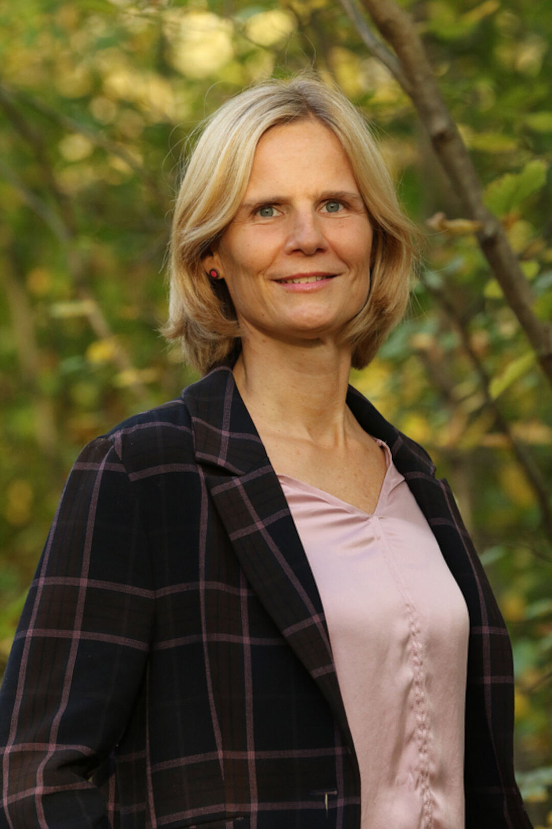
Prof. Birgit Kleinschmit is a Professor and Head of the Department of Geoinformation in Environmental Planning at Technische Universität Berlin. Her research focuses on remote sensing applications for analyzing human-environment systems, particularly in the context of climate and land-use changes. She leads projects on spatio-temporal modeling of landscapes, drought impacts, and wildfire dynamics using AI and satellite data. Member of the Scientific Advisory Board for Forest Policy (Bundesministerium) Co-Speaker of the DFG Urban Water Interfaces Research Group Recipient of the 2024 '100 Most Influential Minds in Berlin Science' award Her work integrates multisensor data (e.g., Sentinel-2, SAR) with machine learning to assess forest health, wildfire susceptibility, and urban evapotranspiration. Recent studies include drought responses in Central Europe, wildfire driver analysis, and sustainable land-use strategies. Publications emphasize environmental monitoring innovations, with over 20 peer-reviewed articles since 2022. Active in policy advising through Geo.X Research Network and federal committees.
Asgeir Johan Sørensen is a Professor of Marine Control Systems at NTNU's Department of Marine Technology, Faculty of Engineering. He also serves as an adjunct professor at UiT the Arctic University of Norway. His roles include Director of NTNU VISTA CAROS and former Director of NTNU AMOS (2013-2023). Sørensen holds an MSc (1988) and PhD (1993) in Marine Technology and Engineering Cybernetics from NTNU. He has extensive industry experience, co-founding companies like Marine Cybernetics AS, Eelume AS, and Zeabuz AS. His research focuses on marine robotics, autonomous systems, and hybrid power systems. He leads labs such as the Marine Cybernetics Laboratory (MC-Lab) and Applied Underwater Robotics Laboratory (AUR-Lab), emphasizing innovation and entrepreneurship. Over 280 publications and 153 students (41 PhDs) reflect his scholarly impact. Current projects include Oppdrag Mjøsa, aiming to map freshwater ecosystems via autonomous systems. Education: MSc (Marine Technology, NTNU, 1988), PhD (Engineering Cybernetics, NTNU, 1993) Research: Autonomous marine operations, underwater robotics, marine cybernetics, and zero-emission propulsion systems Labs: MC-Lab, AUR-Lab, NTNU AMOS His work bridges fundamental research with practical applications, driving advancements in marine autonomy and sustainability.
Dr. Sorin Popescu is a Professor in the Department of Ecology and Conservation Biology (ECCB) at Texas A&M University, affiliated with the College of Agriculture & Life Sciences. He serves as Principal Investigator on NASA’s ICESat-2 mission team, focusing on lidar remote sensing of vegetation structure and UAS applications. His research integrates spatial sciences and remote sensing to address environmental challenges like forest biomass estimation, carbon sequestration, and habitat conservation. Education : Bachelor’s in Forest Engineering from Transylvania University, Romania PhD in Forestry from Virginia Polytechnic Institute and State University (Virginia Tech) Postdoctoral study at Virginia Tech Research Interests : Remote sensing of vegetation structure, lidar and UAS technologies, forest biophysical parameters (e.g., biomass, tree height), land-use change, and environmental monitoring. He develops algorithms and software tools for multisensor data fusion and lidar analysis. Recent Research Trends : Articles emphasize ICESat-2 applications in canopy height mapping, biomass estimation, and climate change impacts. Studies include hurricane damage assessment, sea level rise effects on habitats, and agricultural precision technologies. Awards : 2018 Dean’s Outstanding Achievement Award 2017 ESSM Excellence Award 2014 ASPRS Outstanding Workshop Instructor 2008 NASA New Investigator Award Teaching & Advising : Teaches remote sensing courses (ESSM 444/655/656) and co-develops UAS curriculum. Advised 16 graduate students (7 doctoral) since 2003. Active in interdisciplinary research and graduate education. Labs & Teams : Leads the Lidar Applications for the Study of Ecosystems with Remote Sensing (LASERS) Lab, collaborating on global environmental projects with NASA and international partners.
Dr. Mark Holton is a Research Officer at Swansea University, affiliated with the School of Biosciences, Geography and Physics, and the Colleges of Engineering and Science. His work focuses on data logging systems, sensor circuit design, and biotelemetry technologies, particularly for animal monitoring and Human-Computer Interaction (HCI) devices. He has contributed to projects involving animal behavior analysis, environmental framing studies, and the development of algorithms for big data visualization and categorization. His research spans disciplines such as ecology, marine biology, and biomechanics, with applications in wildlife conservation, animal welfare, and technology integration. Key research areas include: animal movement tracking via accelerometers and magnetometry, biotelemetry for behavioral studies, and sensor-based solutions for non-invasive wildlife tagging. Holton has collaborated on projects analyzing the effects of tourism on whale sharks, reptile behavior, and the impact of environmental cues on animal navigation. His work often bridges engineering and ecology, emphasizing practical applications such as multisensor collar design and orientation sphere visualization tools. Notable publications highlight innovations in dead-reckoning algorithms, energy expenditure modeling in terrestrial animals, and the use of angular velocity metrics for metabolic analysis. While no formal awards are listed, his contributions to biotelemetry and animal behavior research have been widely cited in ecological and engineering journals. Holton’s research extends to HCI, including tactile feedback systems and sustainable technology prototyping with everyday materials.
Professor Graham Heinson is a leading geophysicist at the University of Adelaide's School of Physics, Chemistry and Earth Sciences, within the Faculty of Sciences, Engineering and Technology. He holds a Professorial appointment and specializes in magnetotellurics (MT), with a focus on crustal structure imaging and mineral exploration. His research group operates the national AuScope MT facility and leads initiatives like the AusLAMP mapping program. Notable achievements include Eureka Awards recognition and an Australian Innovation Challenge win for mineral exploration innovations. Research interests span continental tectonics, geothermal systems, and hydrocarbon development. He pioneered the National Exploration Undercover School (NExUS), a national training program for minerals industry students. Key projects involve 4D monitoring of subsurface fluids and defining lithospheric boundaries using MT data. His work bridges geophysics with practical applications in resource discovery and energy systems. Awards: Eureka Awards finalist (Land and Water), Australian Innovation Challenge Winner (2013) Key Projects: AuScope MT Facility, AusLAMP, NExUS Summer School Expertise: Magnetotelluric imaging, crustal conductivity modeling, mineral system exploration His publications extensively cover MT applications in continental-scale studies, subsurface fluid dynamics, and geothermal systems. Current work emphasizes interdisciplinary approaches to unravel lithospheric architecture and fluid pathways critical for resource exploration.
Francisco Javier Acevedo Rodríguez is an Associate Professor at the University of Alcalá's Department of Signal and Communications Theory. Specializing in Robotics, Artificial Intelligence, and Sensor Systems , his research focuses on bioanalysis, multisensory integration, assistive technologies, and embedded AI systems . He leads the BAB_Group (Bioanalysis and Biosensors Group) and GRAM (Multisensorial Recognition and Analysis Group). He holds a PhD in Signal Processing from the University of Alcalá (2009), with a thesis on signal processing techniques for gas/liquid sensor systems. His work bridges theoretical signal processing with practical robotics applications, emphasizing real-world deployments in healthcare and navigation domains. Key technical contributions include semantic navigation systems, action recognition algorithms, and low-cost assistive robots for neurodevelopmental disorder patients. His research has addressed challenges in indoor localization, fall detection, and real-time video processing using ROS and AI-driven perception frameworks. He has published extensively in robotics, computer vision, and sensor systems since 2000. Notable work includes the SEMNAV navigation framework (2025) and a validated assistive robotics platform for daily living support (2021-2022).
Mehmet Kurum is an Associate Professor in the School of Electrical & Computer Engineering at the University of Georgia and holds the Paul B. Jacob Endowed Chair. He concurrently serves as an Adjunct Professor at Mississippi State University (MSU). His roles include academic leadership, research, and teaching in electrical engineering and remote sensing. Dr. Kurum earned his B.S. from Bogazici University (Turkey), M.S. and Ph.D. from George Washington University (USA), followed by postdoctoral work at NASA Goddard. He previously served as Assistant and Associate Professor at MSU from 2016 to 2023. His research focuses on microwave remote sensing , particularly using satellite and UAS-based systems for environmental sustainability in agriculture. Key projects involve NASA missions (SMAP, SNOOPI, NISAR, CYGNSS) and developing spectrum-efficient technologies to address modern challenges like soil moisture estimation under forest canopies and RFI mitigation. Dr. Kurum has secured grants from DOD, NASA, NSF, and USDA. His work emphasizes GNSS reflectometry , LiDAR integration , and deep learning for precision agriculture and environmental monitoring. Awards include the NSF CAREER Award for innovative spectrum recycling research. His recent efforts include the SNOOPI CubeSat mission for P-band remote sensing and the SWIFT-SAT project addressing radiometer/communication coexistence. He collaborates with interdisciplinary teams on forest canopy modeling, soil moisture retrieval algorithms, and UAS-based sensor development.
David Messinger is a Professor and the Xerox Chair at the Chester F. Carlson Center for Imaging Science within RIT’s College of Science. He served as Center Director (2014-2022) and led the Digital Imaging and Remote Sensing Lab (2007-2014). His dual appointment as Visiting Professor at Durham University’s Institute of Medieval and Early Modern Studies highlights his interdisciplinary expertise. With $8M in research funding, he advises over 35 graduate students and focuses on spectral imaging applications across national security, archaeology, and cultural heritage. Ph.D. in Physics, Rensselaer Polytechnic Institute B.S. in Physics, Clarkson University His research integrates hyperspectral/multispectral imaging , AI-driven pigment mapping , and virtual artifact restoration , with recent work on convolutional networks and spectral fusion techniques. Publications span journals like Heritage Science and IEEE Transactions , emphasizing technical rigor and cultural applications. Fellow of SPIE Over $8M in external research funding Key projects include the MISHA imaging system for cultural institutions, National Missile Defense Program collaboration, and SHARE 2012 data campaign leadership. His teaching portfolio includes courses on Imaging Systems Analysis and Cultural Heritage Imaging , reflecting his technical and humanities-oriented contributions.
Giacomo Patrucco is an Associate Professor at the Department of Architecture and Design (DAD) of the Polytechnic University of Turin, Italy. He specializes in geomatics for cultural heritage, focusing on 3D metric survey, artificial intelligence, and multispectral imaging. His research integrates machine learning and deep learning techniques into photogrammetric pipelines for heritage degradation identification, museum artefact digitization, and archaeological site monitoring. Education: PhD in Geomatics (2023, Polytechnic University of Turin), MSc in Architecture for Sustainable Design (2016, Polytechnic University of Turin) His recent publications highlight advancements in synthetic training datasets for decay detection, airborne LiDAR classification for landscape morphologies, and multisensor 3D documentation. Key trends include AI-driven automation, thermal-optical data fusion, and UAV-based heritage mapping. He actively collaborates with international labs (GiFLE, Valencia; MAIER, Hierapolis) and leads the LabG4CH at Polytechnic University of Turin. Awards: Best Poster SIFET2017 Best Paper ARQUEOLÓGICA 2.0 2021 CIPA HD Video Contest 2023 Professional Memberships: Effective Member, SIFET (2023–) Effective Member, CIPA Heritage Documentation (2020–) Effective Member, ISPRS (2019–) Patrucco advises PhD students Marco Avena and Marco Cappellazzo, participates in commercial projects (e.g., Iraqi Ministry of Culture training, Casale Monferrato restoration), and contributes to editorial boards like HERITAGE (2023–). His work aligns with SDGs 4 (Quality Education), 5 (Gender Equality), and 11 (Sustainable Cities).
Dr. Sarah Cang is a Senior Lecturer (Education) in Mathematics and Statistics at Brunel University London, within the College of Engineering, Design and Physical Sciences. She has extensive experience in both industry and academia, having worked for a leading UK software company, a UK Government Research Laboratory, Central Government Department as Senior Statistician, and at Exeter University and Bournemouth University prior to joining Brunel. Her educational background includes: PhD in Applied Mathematics (UK) MSc in Mathematics (Distinction) (UK) BSc (Hons) in Mathematics (First Class) (China) PG Cert in Research Degree Supervision (UK) PG Cert in Education Practice (UK) (Fellowship of the Higher Education Academy) PG Cert in Computer Software (UK) Dr. Cang's research focuses on Digital Healthcare & Wellbeing, particularly for the ageing society, promoting healthy living for senior citizens. She applies advanced techniques in Artificial Intelligence (data mining, machine learning, pattern recognition) and Big Data to address challenges in activity recognition, assistive technologies for dementia care, and tourism demand forecasting. Her work bridges mathematical statistics with real-world applications in health and tourism. Analysis of her recent publications reveals a strong emphasis on interdisciplinary research at the intersection of healthcare technology and data science. Key trends include the development of wearable sensor systems for elderly activity monitoring, the application of machine learning for feature selection and classification in multi-sensor environments, and innovative approaches to tourism demand forecasting using copula-GARCH models and ensemble methods. Her work consistently targets improving quality of life for the elderly through technological solutions. Her scientific achievements have been recognized with: World's Top 2% scientists by Stanford University (2020-present) Fellowship of the Higher Education Academy Dr. Cang has supervised numerous PhD students on topics ranging from activity recognition systems for assisted living to tourism demand forecasting and robotic control. She has secured substantial research funding as Principal Investigator, including multiple EU projects such as H2020-MSCA-ITN (€2.7M), CHARMED (€2.2M), Erasmus Mundus cLINK (€2.5M), FUSION (€3.05M), SMOOTH (€0.9M), and RABOT (€310.8K), all addressing challenges in digital health tourism and elderly well-being. She collaborates with researchers including Dr. Fang Wang, Mr. Tianhao Wang, Dr. Mayo Adetoro, Mr. Amir Ashrafi, and Dr. Zoi Krokida on projects related to digital healthcare, ageing society, and forecasting, forming a dynamic research team focused on innovative solutions for societal challenges.
JUHÁSZ Attila is an Associate Professor at the Department of Photogrammetry and Geoinformatics, Budapest University of Technology and Economics. His research focuses on geoinformatics, remote sensing, and GIS applications for military historical reconstruction, particularly using LiDAR data to detect World War II-era objects and landscapes. Department: Photogrammetry and Geoinformatics University: Budapest University of Technology and Economics Email: juhasz.attila@emk.bme.hu His research integrates LiDAR, photogrammetry, and GIS to analyze historical military sites, including bomb craters, defense lines, and battlefield topography. Key methodologies include spatial data fusion, digital surface modeling, and automated feature detection. JUHÁSZ Attila’s publications reveal trends in applying geospatial technologies to historical reconstruction, with a focus on World War II-era military objects, terrain analysis, and spatiotemporal data management. His work bridges digital archaeology and military history through advanced geospatial techniques.
Prof. Dr. Tobias Ullmann has served as Full University Professor (W2) for Remote Sensing in Geography at the Department of Remote Sensing, University of Würzburg since October 2022. His research integrates Earth observation archives with physical geographic investigations, focusing on polar, semiarid, and arid regions using SAR data, multispectral optical satellite imagery, and digital terrain models. Key projects include climate change impact assessment, interdisciplinary cooperation with biology/ecology fields, and UAV-based environmental data collection. PhD from University of Würzburg (2011-2015) Habilitation at University of Würzburg (2021) Research interests span: Multi-sensor approaches for tropical climate-landscape interactions (Pol)(In)SAR classification/change detection techniques Periglacial dynamics in alpine/polar regions Machine learning and cloud processing applications Recent publications highlight: 2025 work on landscape-scale SAR phenology analysis 2024 NDVI time series for East African crop systems 2023 Arctic snowmelt and wildfire modeling Current affiliations: Chair of Remote Sensing, University of Würzburg Earth Observation Research Cluster Faculty of Philosophy, Institute of Geography and Geology
Manuela Zude-Sasse is a Research Professor at the Leibniz Institute for Agricultural Engineering and Bioeconomy (ATB) in Potsdam, Germany, and former Professor at Beuth University of Applied Sciences Berlin (2009–2017). As Working Group Leader for Precision Horticulture, she focuses on spectro-optical measurement methods (LiDAR, hyperspectral analysis) for fruit quality assessment, canopy modeling, and data science applications in bioeconomy. M.Sc. in Chemistry/International Agronomy (1996, TU Berlin) Ph.D. in Horticulture summa cum laude (1999, TU Berlin) Habilitation in Applied Plant Physiology (2004, Humboldt University) Her research spans Precision Fruit Production , Plant Phenotyping , and 3D Sensor Integration , with projects like CrackSense (fruit cracking prediction) and horDIGrow (resource-efficient horticulture). She employs LiDAR, hyperspectral imaging, and time-resolved fluorescence to analyze temperate and tropical fruits. Recent publications in Plant Phenomics and Horticulturae demonstrate her work on spatial chlorophyll estimation via LiDAR and fruit water stress indices. Her studies in the Journal of Food Engineering (2024) and Postharvest Biology and Technology (2023) highlight machine learning applications for ripeness detection and 3D canopy analysis. Technology Transfer Award (State of Brandenburg, 2003) Silver Medal for Innovation (Agritechnica, 2017) She leads the SMART Farming Technology Research Center (SFTRC) collaboration in Malaysia and serves on editorial boards for Plant Phenomics , International Agrophysics , and Biosystems Engineering . Her 3D point cloud methodologies enable non-contact fruit biomechanics and nutrient management studies.
Gilles Delmaire is an Associate Professor specializing in signal processing, hyperspectral imaging, and environmental science. His research spans topics like super-resolution hyperspectral multisensor fusion , tensor decomposition , and butterfly species classification using advanced computational methods. Key research areas: Signal Processing, Remote Sensing, Environmental Science, and Machine Learning. Recent work focuses on hyperspectral data restoration , insect tracking algorithms , and air quality analysis in Mediterranean regions. Collaborations include institutions in France, Greece, Portugal, and Cyprus, with publications in IEEE, Pattern Analysis and Applications, and Science of the Total Environment.
Antti Lajunen is an Associate Professor at the Department of Agricultural Sciences , Faculty of Agriculture and Forestry , University of Helsinki . His research focuses on farming automation , remote sensing , sensor data fusion , and vehicle simulation . Supervisor for Doctoral Programmes: Interdisciplinary Environmental Sciences and Sustainable Use of Renewable Natural Resources Research fields: Agronomy (Field of Science 4111), Mechanical Engineering (Field of Science 214), and Other Agricultural Sciences Recent projects include: Electrification of Non-Road Mobile Machinery (2018, Invited Talk) Smart Farming K2 Erasmus Project (2017-2021) Automated Soil and Crop Measurement (2020-2022, Research Council of Finland) Meidän Data Ecosystem (2024-2026, Business Finland funded) His 33 research outputs include studies on: Agricultural robot energy efficiency Deep learning for crop and soil analysis UAV-based vegetation monitoring Thermal management in electric vehicles