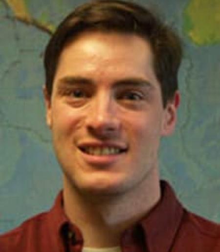
Prof. Matt Pritchard is a Professor in Earth & Atmospheric Sciences at Cornell University, based at Snee Hall. His research focuses on volcanology, geodesy, and remote sensing, with a particular emphasis on using satellite data to monitor volcanic activity, deformation, and glacial interactions. He leads studies on global volcanic systems, including Indonesia's Semeru and Raung volcanoes, Chile's Cordón Caulle, and Bolivia's Uturuncu, applying techniques like InSAR, SAR, and thermal imaging. Key research interests include volcanic eruption dynamics, magma-hydrothermal systems, and the integration of multi-sensor datasets. He has contributed to developing tools like Hotspotter for automated volcanic thermal feature detection and has explored planetary volcanism (e.g., Venus). His work bridges geophysics, glaciology, and computational methods, addressing both Earth and extraterrestrial systems. Prof. Pritchard has received recognition such as the William Bowie Lecture (2022, 2023). His projects often involve international collaborations, including the CEOS Volcano Demonstrator initiative and the EarthDEM/ArcitcDEM projects. He also engages in geothermal energy research and seismic monitoring in Ithaca, NY.
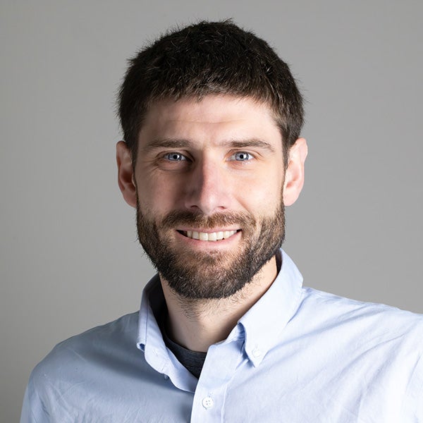
Brandon Schmandt is a Professor in the Department of Earth, Environmental and Planetary Sciences at Rice University, where he leads research using seismology to investigate Earth systems. His work integrates interdisciplinary approaches, data science, and numerical modeling to study tectonic processes, magmatic systems, and environmental interactions. His educational background includes a PhD in Geological Sciences from the University of Oregon (2011) and a BA in Environmental Studies from Warren Wilson College (2006). Dr. Schmandt's research focuses on seismology, tectonics, volcanology, and surface processes , with emphasis on seismic imaging of subsurface structures. His group employs innovative time-series analysis and field projects to resolve geologic history and contemporary Earth dynamics, particularly examining fault zones, magmatic reservoirs, and deep convective processes. Key methodologies include dense seismic arrays and machine learning applications. Analysis of his recent publications (2023-2025) reveals dominant trends in seismic event discrimination (earthquakes vs. explosions), magmatic system imaging (Yellowstone, Cascades), and global mantle structure studies. There is strong emphasis on induced seismicity, machine learning applications, and high-resolution imaging of Earth's discontinuities using dense arrays. His distinguished honors include: Aki Award of the AGU Seismology Section GSA Donath Medal AGU Macelwane Medal Body Dr. Schmandt directs an active research group conducting field projects across diverse settings including the Raton Basin, Yellowstone, Antarctica, and the Caribbean. While specific student advisees and grant details aren't provided in available materials, his group's work involves collaborative data collection, advanced computational modeling, and development of novel seismic analysis techniques applicable to both natural and anthropogenic seismic sources. The research program maintains focus on magmatic systems beneath volcanic regions, induced seismicity mechanisms, and global mantle structure using dense node arrays and interdisciplinary approaches to address fundamental questions in Earth dynamics.
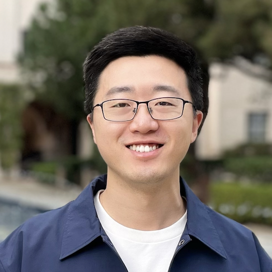
Jiaxuan Li is an Assistant Professor of Geophysics in the Department of Earth and Atmospheric Sciences at the University of Houston's College of Natural Sciences and Mathematics. His research focuses on developing fiber-optic sensing technologies for seismic monitoring across diverse geological environments including volcanic, crustal, and glacial settings. Dr. Li's educational background includes a Ph.D. in Geophysics from the University of Houston (2015-2020) and a B.S. in Geophysics from Peking University (2011-2015). He previously held a postdoctoral position at Caltech Seismolab under Prof. Zhongwen Zhan. His research program centers on distributed acoustic sensing (DAS) applications, with major contributions in volcanic eruption forecasting through minute-scale magma migration imaging, earthquake rupture dynamics via high-frequency fault asperity analysis, and subsurface characterization for carbon sequestration and geothermal energy. Recent work demonstrates DAS capabilities as dense geodetic arrays for real-time volcanic monitoring systems deployed in Iceland through collaborations with the Icelandic Met Office and Reykjavik University. Analysis of Dr. Li's publication record reveals a strong emphasis on operationalizing fiber-optic networks for geophysical monitoring, with significant advancements in eruption early warning systems, earthquake source characterization, and subsurface imaging techniques. His work bridges fundamental seismological research with practical hazard mitigation applications. Dr. Li actively mentors graduate students and recently welcomed postdoc Dr. Tianfan Yan to his research team. His lab operates real-time DAS streaming systems for volcanic eruption monitoring in Iceland, developed through international collaborations involving the University of Houston, Caltech, Ljósleiðarann, and Reykjavik University. Current research directions include expanding DAS applications for carbon sequestration verification and deep geothermal reservoir characterization.
Noel Cressie is a Distinguished Professor of Statistics at the University of Wollongong (UOW), Australia, affiliated with the School of Mathematics and Applied Statistics and the National Institute for Applied Statistics Research Australia (NIASRA). He is also the Director of the Centre for Environmental Informatics (CEI). His academic journey includes a PhD from Princeton University (1975) and a B.Sc. with First Class Honours from the University of Western Australia (1972). His research focuses on spatial and spatio-temporal statistics, Bayesian methods, environmental informatics, and applications in climate science. Notable projects include work on atmospheric CO2 flux inversion (WOMBAT framework), Antarctic environmental research (SAEF initiative), and statistical remote sensing for NASA. He has secured over $20 million in research funding and authored four influential books, including Statistics for Spatial Data . Cressie has received prestigious awards such as the COPSS R.A. Fisher Award (2009), Pitman Medal (2014), and Fellowship of the Australian Academy of Science (2018). He leads interdisciplinary teams addressing global challenges like carbon cycle dynamics and biodiversity modeling. His contributions to statistical methodology and environmental science have been recognized through international collaborations and advisory roles.
Ian Renfrew is a Professor of Meteorology and Head of the School of Environmental Sciences at the University of East Anglia (UEA). His research focuses on polar weather systems, atmosphere-ocean interactions, and climate processes, with expertise in Arctic and Antarctic dynamics. He leads major international projects such as the Iceland Greenland Seas Project and contributes to initiatives like the Year of Polar Prediction (YOPP). Renfrew has held roles including Associate Dean for Research (2017–2022) and REF2021 Lead for the Faculty of Science. His work improves weather and climate models, including updates to surface exchange parameterizations at the Met Office and ECMWF. He has a PhD in Meteorology from the University of Reading and a BSc in Mathematics from the University of Edinburgh. Research Interests: Mesoscale meteorology, air-sea-ice interactions, polar cyclones, and climate modeling. Collaborations span institutions in Canada, Norway, Iceland, and the UK, with over 75% of publications involving international co-authors. Key projects include Arctic Summertime Cyclones (2020–2024), Southern Ocean Clouds (2020–2025), and FOGGI (India weather services). Awards: Adrian Gill Prize (2018), Bjerknes Fellowship (2017), and Law’s Prize (2003). Active in policy and education, Renfrew advises PhD students on polar and climate-related research. His work bridges academic research with operational forecasting, enhancing model accuracy for climate prediction and weather services. Labs/Teams: Member of ClimateUEA and the Centre for Ocean and Atmospheric Sciences. Collaborates with the Met Office, European Centre for Medium-Range Weather Forecasts, and international field campaigns like THINICE and SOC.
Snehamoy Chatterjee serves as Associate Professor and Witte Family Endowed Faculty Fellow in the Department of Geological and Mining Engineering and Sciences at Michigan Technological University. His expertise spans ore reserve estimation, mine planning optimization, and AI-driven safety systems, with significant contributions to remote sensing applications in mining and geological hazard assessment. Chatterjee earned his PhD in Mining Engineering from the Indian Institute of Technology Kharagpur, followed by postdoctoral research at the University of Alaska Fairbanks and the COSMO Stochastic Mine Planning Laboratory at McGill University. His academic journey includes prior faculty positions at India's National Institute of Technology. His research program integrates cutting-edge artificial intelligence with geospatial technologies to solve critical challenges in mining safety and resource management. Key focus areas include: Generative AI frameworks for real-time mining hazard prediction Hyperspectral and InSAR remote sensing for mineral exploration Deep learning applications in geophysical inversion Stochastic optimization of mine planning under uncertainty Machine learning-driven landslide and earthquake hazard mapping Chatterjee's 15 most recent publications (2023-2024) reveal a pronounced shift toward AI-geospatial fusion , with 60% of works applying deep learning to satellite imagery for hazard monitoring. His team's research spans three critical domains: mining safety systems (33%), geological hazard prediction (47%), and resource optimization (20%), demonstrating strong interdisciplinary collaboration across environmental science and engineering disciplines. Professional recognition includes: Editor's Best Reviewer Award 2014 from Mathematical Geosciences Journal APCOM Young Professional Award 2015 at the 37th APCOM conference Chatterjee actively mentors graduate students and leads multiple federally funded research initiatives focused on mine safety innovation and critical mineral exploration. His professional service includes editorial responsibilities for Mining, Metallurgy & Exploration and committee roles in major international conferences through IAMG, SME, and AGU. Current projects emphasize generative AI applications for predictive safety analytics and hyperspectral remote sensing for critical mineral discovery. His research extends through collaborations with the COSMO Laboratory network and industry partners across North America, India, and Australia, with recent fieldwork focusing on Alaskan platinum deposits and Indian coal reserves.
Jihye Park is an Associate Professor in the Department of Civil and Construction Engineering at Oregon State University's College of Engineering. She specializes in GNSS (Global Navigation Satellite System) positioning/navigation and remote sensing applications, focusing on enhancing system performance in harsh environments and leveraging GNSS for atmospheric monitoring. Her research includes detecting ionospheric disturbances caused by earthquakes, volcanic eruptions, and artificial explosions, as well as developing algorithms for real-time anomaly detection and navigation system improvements. Dr. Park holds a Ph.D. in Geodetic Science and Surveying from The Ohio State University (2012), an M.S. in Geodetic Science and Surveying from the same institution (2010), and prior degrees in Geoinformatics from The University of Seoul (B.S. 2004, M.S. 2006). Her research interests span GNSS remote sensing applications such as monitoring ionospheric anomalies, hurricane-induced rainfall trajectories, and coastal hazards. She also explores GNSS-Reflectometry (GNSS-R) for sea level changes, storm surge monitoring, and climate-related phenomena. Her work emphasizes real-time data processing, machine learning integration, and interdisciplinary applications in disaster response and geophysical monitoring. Dr. Park has contributed to advancements in GNSS accuracy through projects like JPL's GUARDIAN system and studies on the Galileo High Accuracy Service. Her recent work highlights automated detection systems and deep learning approaches for TID (Traveling Ionospheric Disturbance) identification, reflecting her commitment to bridging geomatics with environmental and disaster resilience challenges.
Thomas Sheldrake is an SNSF Eccellenza Professorial Fellow (Assistant Professor) at the Department of Earth Sciences, University of Geneva. His research focuses on magmatic processes, volcanic systems, and geochronological methods with applications to understanding eruption dynamics and tectonic interactions. He specializes in integrating geochemical, petrological, and computational approaches to study magma evolution and volcanic hazards. Research interests include: Magmatic system evolution and eruption triggers Zircon-based geochronology and petrochronology Volcanic crystal records of magma storage and degassing Remote sensing of volcanic structures using micro-CT Statistical modeling of volcanic eruption data His work spans field-based studies in the Caribbean, Iceland, and Italy, alongside computational methods for mineral analysis. Notable contributions include linking sea-level changes to magmatic pulses during the Messinian crisis and developing zircon age spectra techniques for magma evolution quantification. His recent 2025 study on Caribbean coral porosity demonstrates interdisciplinary approaches bridging geology and environmental science. Scientific Awards: SNSF Eccellenza Professorial Fellowship Research collaborations involve institutions globally, with frequent co-authorship on topics ranging from Holuhraun eruption geochemistry to Saint Kitts volcanic stratigraphy. His work emphasizes bridging fundamental geoscience with applied volcanic hazard assessment.
Luca Caricchi is a Full Professor at the University of Geneva's Department of Earth Sciences, within the Section of Earth and Environmental Sciences. He serves as Secretary of the VGP AGU, IAVCEI Swiss national representative, and editor for Progress in Earth and Planetary Science and Artificial Intelligence in the Geosciences . His research focuses on understanding magmatic processes, including magma transfer in the crust, eruption dynamics, and the formation of magmatic ore deposits. Current projects include studies on volcanic degassing, mineral zoning, and machine learning applications in geosciences. His administrative roles include membership in the Faculty Council, ELSTE council, and SwissSIMS steering committee. He advises multiple PhD and master's students, including Corin Jorgenson and Alessandro Musu. Research is supported by the Swiss National Science Foundation (SNSF). His fieldwork and teaching include courses on magmatic processes and field trips to active volcanoes like Mt. Etna.
Dr. Shaojun Feng is an Honorary Principal (Professorial) Research Fellow at the Centre for Transport Studies within the Department of Civil and Environmental Engineering, Faculty of Engineering, Imperial College London. He is a leading expert in Global Navigation Satellite Systems (GNSS), with over thirty years of research experience focusing on GNSS integrity, high-accuracy positioning, augmentation systems, and functional safety for autonomous and safety-critical applications. His research interests span a wide range of topics including GNSS integrity monitoring, precise point positioning (PPP), real-time kinematic (RTK), ionospheric modeling, spoofing detection, software-defined receivers, and integrated navigation systems. He has made pioneering contributions to the development of GNSS correction services with integrity, enabling lane-level navigation in smartphones and certified use in autonomous vehicles. His work bridges theoretical advances with real-world deployment, notably through a commercial service benefiting over 1.5 billion users. The recent publications highlight a strong focus on ionospheric modeling and correction using machine learning (e.g., LSTM, ConvLSTM), sparse reconstruction techniques in tomography, and integrity-aware positioning for autonomous systems. There is a clear trend toward integrating AI with GNSS, improving real-time accuracy, and ensuring safety through robust integrity monitoring—especially in multi-constellation environments (GPS, Galileo, BeiDou). Dr. Feng has been recognized with several prestigious honors: Michael Richey Medal, Royal Institute of Navigation ESA certification for leading Galileo receiver development Recognition by UK Space Agency for UK leadership in Galileo adoption SGS certification for safety-critical GNSS correction service He is actively involved in the academic and standards communities, serving as Associate Editor for the Journal of Navigation and GPS Solutions , and as Chairman of WG3 in RTCM Special Committee 134, which develops international standards for GNSS integrity monitoring. He is a Chartered Engineer (CEng) and Fellow of both the Institution of Engineering and Technology (FIET) and the Royal Institute of Navigation (FRIN), the latter presented by HRH Prince Philip. His leadership in research, editorial roles, and standardization underscores his significant impact on the field of navigation and positioning. Dr. Feng leads research initiatives at Imperial College London with strong industry and agency collaborations, including with the European Space Agency and SGS. His work on integrity-certified GNSS services represents a major advancement in positioning for autonomous systems, with implications for future smart mobility, transportation safety, and resilient navigation infrastructure.
Jesús Damián de la Rosa Díaz serves as a Professor in the Department of Earth Sciences within the Faculty of Experimental Sciences at the University of Huelva, Spain. He maintains active affiliations with the Sustainable Chemistry Research Center and was previously associated with the RNM347 research group focused on Geology and Analytical Chemistry. His research expertise spans: Environmental geochemistry with emphasis on trace element behavior in sediments and air particulate matter Advanced source apportionment techniques for PM10 in urban and industrial settings Ecotoxicological assessment of mining and industrial pollution impacts Volcanic emission characterization and atmospheric dispersion modeling Development of low-cost sensor networks for real-time air quality monitoring Analysis of his 15 most recent publications (2023-2025) reveals a dominant focus on Southern European and Latin American environmental challenges. Key trends include quantification of industrial and mining emissions, volcanic plume impacts, North African dust interactions, and innovative monitoring approaches using machine learning and low-cost sensors. His work consistently addresses regulatory needs through source-specific pollution characterization. Scientific Awards: No awards were documented in the provided materials Advising and Grants: Student advising information was not disclosed Research grant details were absent from the source data Labs and Teams: Dr. de la Rosa Díaz operates within the Sustainable Chemistry Research Center infrastructure at the University of Huelva and previously contributed to the RNM347 Geology and Analytical Chemistry research group, focusing on collaborative environmental geochemistry projects across European and Latin American networks.
Professor John Howell is a Chair in Virtual Geosciences at the School of Geosciences, University of Aberdeen. He has been a Professor there since 2012, following academic and industry roles in Norway and the UK. His research bridges sedimentology, digital field methods, and energy transition geoscience. He leads multiple international research initiatives and collaborates widely across academia and industry. Education: BSc in Geology, Cardiff University, 1988 PhD in Geology, University of Birmingham, 1992 — Dissertation: Sedimentology of the Rotliegend of the UK Southern North Sea John Howell's research is centered on virtual geosciences, focusing on digital outcrop modeling using LiDAR and drones, virtual field trips, and the use of geological analogues to improve subsurface models for reservoirs, carbon capture and storage (CCS), and hydrogen storage. His work spans clastic sedimentology, sequence stratigraphy, and reservoir modeling, with field areas including the Colorado Plateau (Utah), the North Sea, and global deep-water systems. He pioneered virtual outcrop geology and co-founded V3Geo, a public repository hosting over 500 virtual models. His recent publications reflect a strong trend toward integrating digital technologies—such as machine learning and photogrammetry—into geological analysis and education. Themes include reservoir heterogeneity, virtual field trip efficiency, and the application of modern depositional systems to ancient subsurface analogues. His work increasingly supports the energy transition, particularly in subsurface storage and sustainable resource management. Scientific Awards: Perce Allen Award (2018) ExxonMobil Young Researcher Award (2000) Alaister Pilkinton Award for Excellence in Teaching (2000) John Howell has supervised 56 PhD students and leads or co-leads five major Joint Industry Projects (JIPs), including the fifth phase of the SAFARI project, funded by nine energy companies and the Research Council of Norway. His research has attracted significant industry and public funding, supporting numerous postdocs and PhD candidates. He collaborates with institutions in Bergen, Leeds, Manchester, Oslo, and Barcelona. He is actively involved in knowledge exchange, having developed V3Geo, presented TEDx talks, and appeared in numerous TV documentaries such as 'The Big Monster Dig', 'Dinosaur Detectives', and 'World's Deadliest Jobs'. He also produced educational content like 'Drone vs Volcano' with over 375,000 views.
Warner Marzocchi is Professor of Geophysics and Natural Hazard Forecasting at the University of Naples Federico II and Scuola Superiore Meridionale. He holds a PhD in Physics (1992) and a degree in Earth Sciences (1987) from the University of Bologna. Previously, he served as Chief Scientist at the Istituto Nazionale di Geofisica e Vulcanologia (2003-2018) and held visiting positions at the University of Southern California and the Institute of Statistical Mathematics in Tokyo. His research focuses on seismic/volcanic hazard analysis, earthquake forecasting, statistical seismology, and hazard model validation. He coordinates international projects in natural hazard assessment and serves on advisory panels including the International Atomic Energy Agency, US National Seismic Hazard Model, and Global Volcano Model. Marzocchi's recent publications demonstrate advances in probabilistic forecasting models, operational earthquake forecasting systems, and statistical validation methods. His work frequently applies machine learning and complex systems theory to seismic and volcanic processes across Italy, California, and New Zealand. Honors: Ranked among world's top 2% scientists (2019-present) Member of Academia Europaea (2018) Editorial awards from Geophysical Journal International (2010) and Geophysical Research Letters (2003) He teaches graduate courses in geophysics, statistics, and hazard forecasting, and has advised numerous PhD students. He leads research teams focused on seismic risk mitigation and volcanic unrest management.
Corentin Caudron is an Associate Professor & Principal Investigator at the WEL Research Institute, Université Libre de Bruxelles (ULB). His research focuses on volcano monitoring through geophysical approaches, with expertise in hydrothermal systems, magma dynamics, seismic noise analysis, volcanic lakes, infrasound, and hydroacoustics. He collaborates internationally with institutions in Indonesia, Iceland, New Zealand, the Philippines, and Hawaii. PhD in Science (2013) from ULB and Royal Observatory of Belgium MSc in Earth Sciences (2009) from ULB His three primary research routes include: Understanding (volcano-)hydrothermal systems using seismic and lake-monitoring approaches, with a focus on precursors to gas-driven eruptions Developing seismic noise-based methodologies (seismic interferometry, amplitude ratios, tremor analysis) for volcanic system monitoring Investigating low-frequency seismic and acoustic signals for underwater volcano degassing quantification Recent publications highlight trends in fiber optic volcano monitoring, machine learning for eruption forecasting, infrasound-seismic integration, and seasonal influences on volcanic activity. His team employs interdisciplinary techniques combining geochemistry and geophysics. Scientific contributions include: FNRS postdoctoral Fellow (2016-2017) Postdoctoral Fellow at University of Cambridge (2015-2016) Postdoctoral Fellow at Earth Observatory of Singapore (2013-2015) He actively supervises 8 PhD students and has co-supervised 2 former PhDs, with projects funded by FWO, FNRS, Wel-T, Fondation Wiener Anspach, and Catalyst. His lab maintains equipment like DAS/FBG interrogators, seismic arrays, and hydrophones. He serves as Co-Leader of the IAVCEI Commission on Volcanic Lakes and Editor for multiple journals.
Dr. Natalie Harvey is a Senior Research Scientist at the Department of Meteorology, University of Reading. She specializes in atmospheric transport processes, volcanic ash dispersion modeling, and uncertainty quantification in natural hazard forecasts. Her work focuses on improving volcanic ash forecasting through advanced model techniques and satellite data integration. She is affiliated with projects like R4Ash, IMPALA, and RACER, addressing volcanic hazards and climate-related risks. Her research interests include boundary layer dynamics, remote sensing applications, and decision-making under uncertainty. She has contributed to over 30 peer-reviewed articles, analyzing volcanic eruptions such as Raikoke 2019 and Grímsvötn 2011. Her methods enhance forecast accuracy by integrating ensemble meteorology and source inversion techniques. Notably, she explores how AI models compare to traditional physics-based approaches in weather prediction, highlighted in a 2024 study on Storm Ciarán. Dr. Harvey holds a PhD from the University of Reading (Boundary-layer type classification and pollutant mixing) and has developed classification algorithms for atmospheric layers using Doppler lidar. She collaborates with institutions like the Met Office and has received international recognition for her work in volcanic ash transport and dispersion modeling.