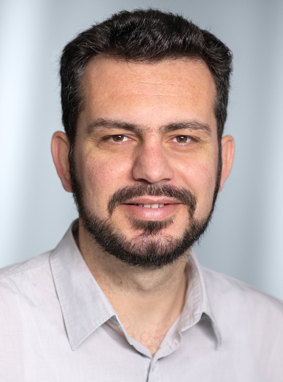
Florian Noichl is a Group Lead in Spatial Computing at the Chair of Computing in Civil and Building Engineering at the Technical University of Munich . His work focuses on methods for creating digital twins of industrial environments, particularly car manufacturing plants, and includes collaborative projects with Siemens . He was a Visiting Researcher at the Department of Geomatics Engineering at the University of Calgary, Canada (May–August 2023). Research interests include Spatial computing Digital twinning Point cloud processing Artificial intelligence in construction Scan planning optimization GeoAI for retrofitting Recent publications emphasize automation in point cloud segmentation, material passport creation for steel structures, semantic facade analysis, and energy efficiency estimation using vision-language models. His work often integrates BIM with laser scanning and AI . Teaching includes Bau- und Umweltinformatik 1 (WS22/23, WS23/24) and Softwarelab . He supervises theses on topics like UAV mission planning Point cloud enrichment Image-based localization CAD model matching BIM design reviews Review activities cover journals such as Automation in Construction , IEEE Sensors Journal , and Remote Sensing . He is listed on OrcID : 0000-0001-6553-9806 Google Scholar ResearchGate Labs associated with include the BIM-Lab and Robotic Fabrication Lab . His work intersects digital construction with industrial AI applications.
Filip Biljecki is an Assistant Professor at the National University of Singapore, jointly appointed in the Department of Architecture (College of Design and Engineering) and the Department of Real Estate (NUS Business School). He founded and leads the NUS Urban Analytics Lab, which serves as a research hub for urban data science and geospatial AI applications. His work bridges architecture, geomatics, and data science to create smarter, more sustainable urban environments. Dr. Biljecki earned his PhD in 3D GIS from Delft University of Technology with highest honors (top 5%) and completed his MSc in Geomatics at the same institution. His educational background in geospatial science forms the foundation for his innovative research in urban analytics. His research focuses on leveraging emerging urban data sources, particularly street view imagery and other visual data, to advance 3D city modeling, urban digital twins, and GeoAI applications. He investigates spatial data quality, crowdsourcing through platforms like OpenStreetMap, and develops methods to assess urban form and human perception of built environments. His work integrates computer vision, machine learning, and geospatial analysis to address pressing urban challenges related to sustainability, comfort, and equity. Analysis of his recent publications reveals a strong trend toward integrating AI with urban analytics, with particular emphasis on using street view imagery to understand urban environments. His work spans from technical aspects of 3D modeling and digital twins to human-centered applications assessing walkability, thermal comfort, and visual perception. A significant portion of his research addresses sustainability challenges through carbon analysis, urban heat island mitigation, and sustainable urban design. Presidential Young Professorship (NUS), 2020 Top 2% scientists worldwide (Stanford University), 2021 Multiple teaching excellence awards (2021-2025) Best paper awards at 3D GeoInfo (2017, 2023) EuroSDR award for best PhD thesis related to GIS in Europe, 2017 Dr. Biljecki actively supervises PhD students and research fellows through his Urban Analytics Lab, with research supported by various grants and collaborations. He serves as Associate Editor for Computers, Environment and Urban Systems and holds editorial positions with several other leading journals in geography and urban studies. His work bridges academia and practice through collaborations with industry and government agencies focused on urban development. As founder of the NUS Urban Analytics Lab, he leads a vibrant research team exploring the intersection of cities and AI. He also chairs the 3D Information Management Domain Working Group at the Open Geospatial Consortium and serves as Chair of WG IV/1 at the International Society for Photogrammetry and Remote Sensing. His leadership extends to the Future Cities Lab Global at the Singapore-ETH Centre where he serves as Principal Investigator.
Eufemia Tarantino is Full Professor of Geomatics at the Polytechnic University of Bari, working within the Department of Civil, Environmental, Land, Building Engineering and Chemistry (DICATECh). She has held academic positions at the university since 2002, progressing from Assistant Professor to Associate Professor and achieving Full Professor status in 2019. Professor Tarantino serves as Coordinator of the MSc Course of Environmental and Territorial Engineering, is a Member of the Executive Council, and oversees the student career fair. Her research expertise spans cartography, GIS, remote sensing, and geomatics, with particular focus on: Analysis of metric characteristics and extraction of 2D/3D geometric primitives from satellite/aerial/UAV data Multi-temporal analysis and change detection for environmental and cultural heritage monitoring Development of web-based GIS for interactive geospatial analysis Professor Tarantino's publication record includes over 180 scientific contributions in international databases. Her recent work (2023-2026) demonstrates continued productivity with numerous book chapters and journal articles focused on soil sealing dynamics, precision viticulture, marine pollution monitoring, urban growth analysis, and advanced remote sensing techniques. Her research shows strong application to environmental monitoring, cultural heritage preservation, and sustainable spatial planning. As an active member of the international geospatial community, she serves on the editorial boards of 'Remote Sensing' and 'ISPRS International Journal of Geo-Information' and reviews for approximately 18 international journals. Her teaching responsibilities include Cartography, GIS, and Remote Sensing courses at undergraduate and graduate levels, as well as Advances in Geomatic Engineering at the PhD level. Professor Tarantino's work demonstrates strong international collaboration and application to real-world environmental challenges, with recent projects addressing soil sealing, marine plastic pollution, precision agriculture, and climate-related phenomena using advanced geospatial technologies.
Thomas Leduc is an Associate Professor at Nantes Université, affiliated with the École Nationale Supérieure d'Architecture de Nantes and the UMR AAU CNRS 1563 research unit. He has been a key figure in urban climate and geospatial research, serving as Director of the CRENAU research team (2015-2019) and Deputy Director of UMR AAU (2014-2019). Currently, he remains an active researcher and member of the Council of UMR CNRS 1563 through 2025, while also contributing to the Scientific Council of École de Design Nantes Atlantique and serving on the Doctoral School Council SIS. Professor Leduc's research focuses on the intersection of urban climate science and geospatial analysis, with particular emphasis on urban thermal comfort, pedestrian mobility, and visibility analysis in urban environments. His work combines advanced GIS methodologies with practical urban planning applications, developing innovative approaches to measuring and modeling urban microclimates. He has made significant contributions to understanding how urban form affects thermal comfort and has developed specialized techniques for analyzing urban visibility using isovists and wavelet transforms. His recent publications (2022-2025) demonstrate a strong research trajectory in urban climate modeling, with a focus on practical applications for climate adaptation. The publications reveal a consistent pattern of interdisciplinary collaboration, particularly with researchers specializing in environmental science, urban design, and computer vision. His work increasingly integrates mobile measurement techniques with geospatial frameworks to provide more nuanced understandings of urban microclimates at pedestrian level. Active participant in multiple research projects including Coolscapes, ResilientGAIA, and Lunne Coordinator of the Urbaclim research action of the GDR MAGIS Organizer of significant scientific events including SCAN'18 and Vu-pas-vu-2017 Co-supervisor of numerous doctoral students working at the intersection of urban climate and geospatial analysis Professor Leduc's research group maintains strong connections with both academic and professional communities, regularly collaborating with urban planners, architects, and environmental scientists to translate research findings into practical urban design strategies. His work on urban cooling strategies and thermal comfort has direct relevance to cities facing increasing heat stress due to climate change.
Alfredo Alcayde García is an Associate Professor in the Engineering Department at the University of Almería, Spain. With an h-index of 21 (Scopus) and 18 (Web of Science), he has established himself as a significant contributor to electrical engineering research, particularly in power systems analysis and renewable energy integration. His academic profile includes directing multiple doctoral theses and leading several research projects with substantial funding from national and international sources. Professor Alcayde García's research primarily focuses on electrical engineering with specialization in power systems under non-sinusoidal conditions, renewable energy integration, and energy efficiency optimization. His work bridges theoretical developments in geometric algebra applications for power theory with practical implementations in smart grid technologies and non-intrusive load monitoring. Recent research directions have expanded to include environmental applications, particularly examining microplastic pollution in agricultural contexts related to energy systems. Analysis of his recent publications (2023-2025) reveals a strong trend toward interdisciplinary research that combines electrical engineering with environmental science and data analytics. His work spans high-impact journals across multiple disciplines, demonstrating both depth in his core field and breadth through successful cross-disciplinary collaborations. The research shows consistent methodological rigor with increasing emphasis on practical applications and real-world implementation of theoretical concepts. Professor Alcayde García actively supervises graduate students and has directed multiple doctoral theses on topics ranging from drone-based power line design to electric vehicle integration. His research group 'Computación, optimización y sensorización en ingeniería y energía' maintains several active projects with significant funding, indicating strong research momentum and institutional support. Current projects demonstrate a strategic expansion into environmental applications of engineering principles while maintaining core strengths in power systems analysis. The research environment led by Professor Alcayde García emphasizes both theoretical innovation and practical implementation, with opportunities for students to engage in field work, computational modeling, and collaborative projects across engineering disciplines. His work continues to evolve with emerging energy challenges, maintaining relevance to both academic research and industry applications.
Dr. Amiri Simkooei is a Professor in the Faculty of Aerospace Engineering at Delft University of Technology, specializing in Operations & Environment. His research spans the application of aerospace engineering principles to environmental monitoring and geospatial analysis, with strong connections to both theoretical and practical aspects of remote sensing and GNSS technologies. Dr. Simkooei's research interests focus on the intersection of aerospace engineering and environmental science, particularly in developing advanced methods for data analysis. His work in least squares variance component estimation has provided significant contributions to GNSS time series processing, while his environmental applications include aircraft noise monitoring systems and marine habitat characterization using remote sensing technologies. His recent publications (2025-2026) demonstrate a strong research trajectory with applications spanning from airport environmental management to marine ecosystem monitoring. The research shows a consistent theme of applying rigorous mathematical and statistical methods to solve practical environmental monitoring challenges using aerospace-derived technologies. Dr. Simkooei actively supervises graduate students, as evidenced by thesis-related datasets, and collaborates extensively within TU Delft and with external partners on environmental monitoring projects. His work bridges theoretical geodetic methods with practical environmental applications, making significant contributions to both aerospace engineering and environmental science communities. His research group focuses on GNSS and remote sensing applications, with particular expertise in data processing algorithms, environmental monitoring systems, and marine habitat mapping. The group maintains strong connections with Dutch environmental agencies and aerospace industry partners, facilitating the translation of research into practical applications.
Dr. Anastasios Kouvelas is a Lecturer at ETH Zurich, where he serves as head of the Road Traffic Engineering research group at the Institute of Transport Planning and Systems (IVT), Department of Civil, Environmental and Geomatic Engineering. He has held this position since August 2018, succeeding Dr. Monica Menendez who moved to New York University in Abu Dhabi. Prior to joining ETH Zurich, he was a research associate at the Urban Transport Systems Laboratory (LUTS) at EPFL (2014-2018) and a postdoctoral fellow at Partners for Advanced Transportation Technology (PATH) at the University of California, Berkeley (2012-2014). Dr. Kouvelas' research focuses on modeling, simulation, optimization and traffic flow control. His work aims to develop real-time solutions based on control theory and operations research methods. The Road Traffic Engineering group develops algorithmic solutions that are components of intelligent transportation systems used in traffic control centers. Recent technological advances in autonomous vehicles have expanded their research topics as the industry seeks efficient operational solutions for autonomous mobility. They are particularly interested in extending their work to the design of advanced management strategies for urban networks that utilize connected vehicles to improve traffic operations and develop network-wide control strategies that minimize environmental impacts. His recent publications (2023-2025) demonstrate strong focus on traffic prediction using deep learning techniques, bike lane allocation impacts on urban networks, transit network resilience against disruptions, vehicle trajectory extraction from aerial recordings, and traffic control for mixed traffic systems with connected and autonomous vehicles. His work bridges theoretical developments in control theory with practical traffic engineering challenges. Scientific Awards No specific scientific awards were mentioned in the provided information. Advising and Grants Dr. Kouvelas supervises PhD and Master's students in traffic engineering and intelligent transportation systems. His research is supported by various grants including a grant from the Hong Kong Research Grant Council (Grant No. GRF 11216323) for research on traffic speed prediction. Laboratories and Teams Dr. Kouvelas leads the multidisciplinary Road Traffic Engineering research group at IVT, which consists of researchers with backgrounds in civil engineering, electrical engineering, mechanical engineering, computer science, control, and operations research. The group's work spans multiple areas including traffic flow theory, traffic operations, connected and automated vehicles, and intelligent transportation systems.