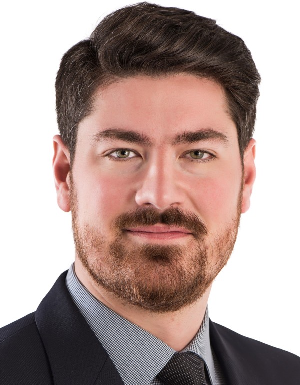
Christopher Storie is a Professor of Geography at the University of Winnipeg, specializing in GIS, Remote Sensing, and Urban Geography. He holds an office in Lockhart Hall (5L03) and teaches courses such as Introduction to GIS, Remote Sensing, and Urbanization in the Developing World. His research focuses on Deep Learning applications for automated land use/land cover mapping, informal settlement mapping, and urban-rural fringe detection. Key research interests include leveraging neural networks for geospatial analysis, urban dynamics in regions like Mexico City, and collaborative international fieldwork. He has contributed to over 20 peer-reviewed articles since 2000, emphasizing satellite imagery analysis and environmental monitoring. His work bridges technical geospatial methods with socio-environmental challenges in urban and developing regions.
John McDonald is a Professor in the Department of Computer Science at Maynooth University, where he has held a faculty position since 2001. He is affiliated with the Maynooth University Hamilton Institute and the Assisted Living and Learning Institute (ALL). His research focuses on computer vision, robotics, and AI, emphasizing spatial perception and autonomous systems. He has contributed to areas such as visual SLAM, intelligent vehicle systems, and digital holography, with funding from SFI, EU, and other agencies. Currently, he is a Funded Investigator in Lero (SFI Research Centre for Software) and collaborates on the SFI Blended Autonomy Vehicles Spoke. Key research themes include simultaneous localization and mapping (SLAM), robotic navigation, 3D reconstruction, and applications in autonomous driving. His work integrates cutting-edge techniques in computer vision and machine learning to address challenges in spatial intelligence and perception. Publications highlight advancements in dense mapping, fisheye camera systems, and geospatial analysis. He has held visiting roles at MIT’s CSAIL and the National Centre for Geocomputation. His contributions span academic journals, conferences, and technical reports, reflecting a strong emphasis on both theoretical and applied robotics research. John McDonald has supervised numerous research projects and contributed to initiatives like the John and Pat Hume Doctoral Scholarships. His work bridges academia and industry, with a focus on real-world applications of autonomous systems and AI-driven robotics.
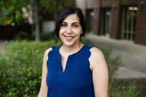
Dr. Yelda Turkan is an Associate Professor in the School of Civil and Construction Engineering at Oregon State University, where she leads research in automation, computer vision, and machine learning for sustainable infrastructure. She holds a PhD from the University of Waterloo and dual BS degrees in Civil Engineering and Geomatics Engineering from Istanbul Technical University. Her work focuses on leveraging lidar, digital twins, and BIM to improve construction operations and decision-making in the built environment. She has secured over $4M in grants from NSF, FHWA, and other agencies, and currently leads the NSF Convergence Accelerator-funded 'Deep Reality' project for AI-driven infrastructure management. Education: Ph.D., Civil Engineering, University of Waterloo, 2012 M.S., Engineering Informatics & Remote Sensing, Istanbul Technical University, 2006 B.S., Civil Engineering (double major in Geomatics Engineering), Istanbul Technical University, 2005/2003 Professional Roles: Vice President, International Association for Automation and Robotics in Construction (IAARC) Chair, ASCE Computing Division Education Committee Associate Editor, ASCE OPEN Journal Her research emphasizes automation in construction quality control, infrastructure inspection via drones and lidar, and immersive education tools using VR/AR. Recent projects include automated curb ramp compliance analysis, wildfire impact modeling, and digital twin development for timber structures. She has published over 80 peer-reviewed articles and actively promotes computing integration in civil engineering education and professional practice.
Dieu Tien Bui is a Full Professor in the Department of Business and IT at the University of South-Eastern Norway (USN) School of Business. His research focuses on Geospatial Artificial Intelligence Machine Learning GIS and Remote Sensing Natural Hazard Modeling Environmental Problems (landslides, floods, soil salinity, biomass) . He has contributed to over 15 recent publications in journals like Science of the Total Environment , Remote Sensing , and Geomorphology , emphasizing hybrid AI models for landslide and flood susceptibility. His work spans Vietnam, India, China, and Iran with applications in climate change adaptation and disaster management. Scientific Awards: Global Highly Cited Researcher PhD Supervision: He has supervised 8 PhD students at institutions including USN, NTNU, and Vietnamese universities.
Professor Qihao Weng is Chair Professor of Geomatics and Artificial Intelligence at The Hong Kong Polytechnic University, where he leads the Research Institute for Land and Space. A globally recognized scholar, he bridges geography, landscape ecology, and environmental science through innovative geospatial analytics, GeoAI, and big data methodologies. His work focuses on urban climatology, sustainability science, and human-environment interactions, with over 279 publications and 14 books. PhD, The University of Georgia MA, The University of Arizona MS, South China Normal University Professor Weng's research explores remote sensing applications for urban environmental challenges, including thermal comfort, heat islands, and land-use changes. He pioneered global-scale urban observation via the Group on Earth Observation (GEO) initiative and developed frameworks integrating geospatial technology with climate resilience strategies. Recent publications highlight advancements in GeoAI for urban thermal stress assessment, road extraction algorithms, and multi-temporal data fusion techniques. His work spans interdisciplinary domains, connecting remote sensing, urban science, and sustainability metrics across diverse climate zones. NASA Senior Fellowship (2008) Taylor & Francis Lifetime Achievements Award (2019) AAG Wilbanks Prize (2024) Lifetime Achievement in Remote Sensing Award (2024) Academia Europaea Foreign Member (2021) As Editor-in-Chief of the ISPRS Journal, Professor Weng has advanced global remote sensing discourse. His research has been supported by NSF, NASA, USAID, Microsoft, and Hong Kong Research Grant Council. He has delivered over 130 invited talks and established visiting professorships in Japan, France, and China.
Dr. Pascale Biron is a Professor in the Department of Geography, Planning and Environment at Concordia University, Montreal. Her research focuses on river dynamics, stream restoration, flood modeling, and climate change impacts. She has been at Concordia since 1998 and holds professional affiliations with key organizations like the Canadian Geomorphology Research Group and the American Geophysical Union. Education: PhD from Université de Montréal and Leeds University (fluvial geomorphology) Research Interests Her work integrates fluvial geomorphology, computational fluid dynamics, and societal aspects of river management. Key themes include: River restoration for fish habitat Floodplain modeling using LiDAR Climate adaptation strategies Socio-hydrological dimensions of restoration Hydrodynamic processes at river confluences Recent Research Trends Recent publications emphasize global salmonid habitat analysis, machine learning for fluvial hazard detection, and the socio-environmental impacts of urban flooding. Her work bridges technical hydrology with policy-relevant solutions for sustainable water management. Grants & Advising Supervises over 15 graduate students (PhD/MSc) in topics ranging from flood modeling to bioengineering. Active in collaborative projects like the 'Freedom Space for Rivers' initiative and large-scale floodplain mapping. Labs & Teams Member of GRIL (Limnology Research Group) and RIISQ (Quebec Flood Network), contributing to interdisciplinary water security research.
Dr. Adnan Rajib is an Assistant Professor of Civil Engineering at The University of Texas at Arlington, leading the H2I Lab (Hydrology & Hydroinformatics Innovation Lab). His research focuses on large-scale hydrology, water quality modeling, and integrating artificial intelligence with remote sensing data to address climate change impacts on water resources. He actively advises doctoral, master's, and undergraduate students in projects related to flood resilience, wildfire hydrology, and nature-based solutions. Dr. Rajib has secured significant grants from NASA, NSF, and USDA, totaling over $4 million, including a major NASA initiative to predict wildfire effects on freshwater supplies and a DOE-funded Coastal Bend Climate Resilience Center. His work spans collaborations with international organizations like the United Nations University and The Nature Conservancy. Key contributions include global studies on floodplain alterations, wetland-mediated nitrate reductions, and the development of cyberinfrastructure tools for open science. He serves on the editorial board of environmental journals and professional committees, including the American Society of Civil Engineers' Wetland Hydrology Technical Committee. His teaching emphasizes advanced topics in civil engineering and research mentorship, with courses like 'Topics in Civil Engineering' and dissertation advisement. Dr. Rajib's lab integrates cutting-edge hydroinformatics to advance climate resilience strategies for vulnerable communities.
Thierry Badard is an Associate Professor at the Department of Geomatics Sciences , Université Laval, where he also serves as Director of the Center for Research in Geospatial Data and Intelligence (CRDIG) . With over 28 years of experience in geospatial science, he leads research initiatives at the intersection of GeoAI , LiDAR processing , and smart city technologies . Director, CRDIG (2016-2022) Steering Committee Member, Big Data Research Centre (CRDM) Researcher, Institute for Intelligence and Data (IID) Research Expertise spans geospatial big data, GeoNLP, and IoT applications for digital twins. His work addresses flood risk modeling , 3D urban analytics , and environmental monitoring through AI-driven solutions. Recent publications focus on contrastive learning for LiDAR segmentation and geospatial ontologies for early warning systems. Grant Leadership includes collaborative projects on smart insurance analytics (2018-2025), Arctic bioaerosol research (2019-2025), and Quebec-Morocco digital twin partnerships (2022-2023). He has advised 15+ graduate students in geomatics and related fields.
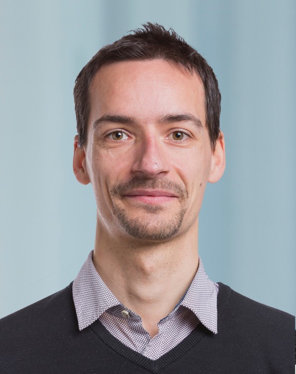
Andreas Müller is a Lecturer at ETH Zürich's Department of Civil, Environmental, and Geomatic Engineering. He holds a Master of Science in Civil Engineering from the Technical University Munich (TUM, 2015) and has worked as a bridge engineer at BUNG Ingenieure AG in Munich (2016–2017). Since 2017, he has been pursuing a PhD under Prof. Taras, initially at Bundeswehr University Munich (UniBw) and later continuing at ETH Zürich's Chair of Steel and Composite Structures. His research focuses on structural stability, particularly the buckling behavior of high-strength steel hollow sections, post-buckling rotation capacity, and the influence of initial imperfections analyzed via 3D surface scans (Reverse Engineering). He also investigates spiral-welded tubes' imperfection assessment and strain hardening effects on aluminum structural sections. Education: Master of Science in Civil Engineering, Technical University Munich (2015) Research interests emphasize bridging experimental and computational methods in structural engineering. He employs machine/deep learning for predictive modeling of buckling phenomena, particularly leveraging Deep Neural Networks (DNN) to enhance accuracy in structural analysis. His work addresses practical challenges in steel and composite structures, including standard compliance (e.g., prEN1993-1-1 updates) and real-world geometry imperfections' impact on load capacities. Advising and grants: As a current PhD candidate, he is supervised by Prof. Taras but has not yet listed advisees. His research is supported by institutional resources at ETH Zürich's Chair of Steel and Composite Structures. Labs/Teams: Active member of the Chair of Steel and Composite Structures at ETH Zürich, contributing to advanced structural mechanics research and engineering innovation initiatives.
Professor Washington Yotto Ochieng serves as Head of the Department of Civil and Environmental Engineering and Chair Professor in Positioning and Navigation Systems at Imperial College London. He directs the Centre for Active Resilience and Security (CARS) and maintains key affiliations with the Centre for Systems Engineering and Innovation, Centre for Transport Engineering and Modelling, Institute for Molecular Science and Engineering, and Space Lab. His extensive advisory roles include the Science Museum Group Board of Trustees, Royal Institute of Navigation Presidency, and Royal Academy of Engineering Africa Steering Committee. His educational background includes a BSc (First Class) in Engineering from the University of Nairobi and MSc (Distinction) and PhD in Civil Engineering from the University of Nottingham. He received an honorary DSc from Technical University of Kenya in 2023. Ochieng's research pioneers critical infrastructure resilience, user-centric mobility, and positioning/navigation/timing (PNT) systems. He has designed satellite navigation systems (including Europe's EGNOS and GALILEO) for multi-domain applications and advanced Air Traffic Management and Intelligent Transport Systems. His work integrates geomatics, transportation engineering, and sustainable mobility to solve global urban infrastructure challenges, with recent emphasis on decarbonization and AI-driven solutions. His 2024-2025 publications reveal strong trends in sustainable transportation decarbonization, AI-optimized traffic management, and resilient urban positioning systems. Research focuses on hydrogen fuel cell trains, carbon-efficient aviation, and deep reinforcement learning applications for emission reduction, demonstrating interdisciplinary integration of engineering, environmental science, and artificial intelligence to address climate challenges. Fellow of the Royal Academy of Engineering (2013) Harold Spencer-Jones Gold Medal from Royal Institute of Navigation (2019) Doctor of Science (honoris causa) from Technical University of Kenya (2023) Elder of the Order of the Burning Spear (EBS) from Kenya (2023) Commander of the Order of the British Empire (CBE) (2024) Ochieng provides strategic guidance to UK Government bodies (Government Office for Science, Department for Transport, FCDO), European Parliament, and European Court of Auditors. His advisory work shaped the Blackett Review on Satellite-derived Time/Position, UK Space Strategy, and Future of Mobility report. He chairs the Science Museum London Advisory Board and leads FCDO's Sustainable Urban Economic Development program in Africa, with significant grant influence through UK National Physical Laboratory and Department for International Development. He directs the Centre for Active Resilience and Security (CARS) and leads Space Lab initiatives, focusing on mission-critical PNT systems and infrastructure resilience. His teams collaborate with international consortia including RTCM Special Committee 134 and US Institute of Navigation, developing next-generation navigation solutions for safety-critical applications across transport, aviation, and urban environments.
Prof. Harald Sternberg is a distinguished academic at HafenCity University Hamburg, holding the position of University Professor for Hydrography and Geodesy. His affiliations include the Department of Geodesy and Geoinformatics, where he leads research in hydrographic education and advanced geomatics technologies. He previously served as Vice President for Teaching and Studies (2009-2022) and Acting President (2010) of HCU. Education: Ph.D. in Geodesy from University of the Bundeswehr Munich (1999), specializing in trajectory determination of land vehicles using hybrid systems. Early career included roles as scientist at Bundeswehr University (1991-2001) and academic leadership at HAW Hamburg (2005-2009). Research focuses on underwater mapping, navigation systems, and sensor integration. Key projects include: Level 5 Indoor Navigation (5G-based positioning), hydrothermal vent exploration using deep-towed multibeam systems, and low-cost mobile mapping solutions. He also investigates smartphone-based inertial navigation and autonomous underwater vehicles for infrastructure monitoring. Publications span underwater vision systems, satellite-derived bathymetry, and 3D point cloud analysis. Over 200 peer-reviewed articles and book chapters reflect expertise in geomatics applications. Current research emphasizes 5G-enabled indoor navigation and environmental sensor networks. Grants include BMWK-funded autonomous deep-sea monitoring and BGR exploration projects in the Indian Ocean. His lab develops innovative tools like the HOMESIDE sled for seafloor surveys. Supervises Ph.D. research on hydrothermal vent analysis and data-driven inertial localization.
Dr. Zhenyu Zhang is a Lecturer in Surveying and Spatial Science at the School of Surveying and Built Environment , University of Southern Queensland (Springfield Campus). With over 20 years of tertiary teaching experience, he specializes in geomatic engineering, GIS programming, remote sensing, and machine learning applications for geospatial data analysis. His work focuses on LiDAR technologies (terrestrial and airborne) for environmental management, 3D modeling, and high-resolution DEM generation. Member of Surveying and Spatial Science Institute (SSSI), Australia Member of Modelling and Simulation Society of Australia and New Zealand Member of International Global Navigation Satellite Systems (IGNSS) His research integrates geomatics with environmental geoscience, emphasizing forest biomass estimation, carbon accounting, and BIM development using laser scanning. He teaches foundational and advanced courses in surveying, geodetics, GIS programming, and research projects at both undergraduate and postgraduate levels.
Sriram Subramanian is an Assistant Professor at the School of Computer Science in Carleton University since July 2025. He holds affiliations with the Vector Institute for Artificial Intelligence and the Schwartz Reisman Institute for Technology and Society in Toronto, and serves as a mentor in the Indigenous Black Engineering and Technology (IBET) PhD Project . Ph.D. in Electrical and Computer Engineering, University of Waterloo (2022) MASc in Electrical and Computer Engineering, University of Waterloo (2018) BE in Geomatics Engineering, Anna University (2016) His research focuses on advancing Multi-agent Systems and Reinforcement Learning through intersections with Game Theory , with applications in generative AI , robotics, finance, and autonomous driving. Recent work emphasizes cooperation mechanisms, constraint learning, and theoretical robustness in large-scale environments. Articles demonstrate cross-disciplinary impacts in chemistry (ChemGymRL) and societal systems. Notable awards include the MITACS Globalink Research Award , Pasupalak Fellowship in AI , and the CAIAC Best Doctoral Dissertation Award (2023) . Publications span top venues like AISTATS, ICML, AAAI, IJCAI, JAIR , and TMLR . He has collaborated with Microsoft, Royal Bank of Canada, Denso, ESRI, and Borealis AI. As a Distinguished Postdoctoral Fellow at the Vector Institute (2022-2025), he advanced algorithmic frameworks while maintaining active roles in conference reviewing and committee work. His advocacy for equity and diversity drives mentorship initiatives in Canadian institutions.
Daniel Farinotti is a Professor of Glaciology at the Department of Civil, Environmental and Geomatic Engineering at ETH Zurich and at the Swiss Federal Institute for Forest, Snow and Landscape Research (WSL). His work focuses on understanding glacier evolution and its impacts on water resources across mountainous regions globally. Dr. Farinotti's research interests center on glaciological modeling and its applications to water resource management. His expertise includes estimating glacier ice thickness from surface properties, long-term modeling of glacier mass changes, quantifying runoff contributions from glaciated catchments, and implications for water management in high mountain areas. His research integrates field observations, remote sensing data, and numerical modeling to address critical questions about glacier response to climate change. Dr. Farinotti's scientific achievements have been recognized with prestigious awards including the 2017 Nature Research Award for Outstanding Achievements in Review and the 2013 Award for Outstanding Contributions to Review from the Journal of Geophysical Research - Earth Surface. His publications demonstrate a consistent pattern of high-impact research across glaciology, hydrology, and climate science, with particular emphasis on the interactions between glacier dynamics and water resources. As a principal investigator, Dr. Farinotti has secured significant research funding from organizations including the Swiss National Foundation and German Federal Foreign Office. His work often involves international collaborations across multiple institutions, reflecting the global nature of glacier research and its implications for water security. He maintains active involvement in major scientific initiatives focused on glacier monitoring and climate change impacts. Dr. Farinotti leads the Glaciology research group at ETH Zurich's Laboratory of Hydraulics, Hydrology and Glaciology (VAW), which conducts fieldwork across multiple mountain ranges globally. The group employs advanced techniques including geophysical surveys, remote sensing, and numerical modeling to investigate glacier dynamics and their hydrological impacts.
Negin Alemazkoor is an Assistant Professor at the University of Virginia's School of Engineering and Applied Science, specializing in interdisciplinary research on infrastructure resilience. Her work focuses on developing AI-driven methodologies for analyzing interconnected systems like power grids, urban flood models, and transportation networks under uncertainty. Key areas include enhancing grid reliability through multi-fidelity modeling, hurricane evacuation equity analysis, and precision-compression techniques for large-scale data. She co-leads a NSF-funded initiative to democratize AI education in high schools. Her research integrates graph neural networks, physics-informed models, and machine learning to address challenges in energy systems, environmental monitoring, and disaster response. Notable projects include hurricane-induced power outage risk analysis under climate change and precision guarantees for smart-meter data analytics. She emphasizes computational efficiency and multi-fidelity approaches to balance accuracy with resource constraints. Recent contributions span AI applications in flood forecasting, renewable energy integration, and infrastructure cybersecurity. Her NSF grant aims to create inclusive AI curricula, reflecting her commitment to education and societal impact. She is affiliated with UVA Engineering’s research initiatives on resilient systems and data-driven decision-making.