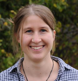
Hanna MeyerView profile
Professor
Prof. Dr. Hanna Meyer is a Professor of Remote Sensing and Spatial Modeling at the Institute of Landscape Ecology, University of Münster (WWU). She leads the Remote Sensing and Spatial Modeling Group and is actively involved in teaching and research in geospatial data science, machine learning, and environmental monitoring. Her work is supported by multiple national and international funding bodies including the DFG, EU Horizon Europe, and internal university grants. B.Sc. Geography, Philipps University Marburg (2007–2010) M.Sc. Environmental Geography, Philipps University Marburg (2010–2013) Ph.D., Philipps University Marburg (2014–2018) Her research focuses on machine learning methods for spatial data, optical remote sensing, environmental monitoring, and spatio-temporal modeling. She develops and applies advanced statistical and machine learning techniques to satellite and drone-based data for mapping ecological variables, land cover, and environmental change. Her work emphasizes methodological rigor, model transferability, and uncertainty quantification in spatial predictions. The recent publications reflect a strong trend in developing and validating machine learning models for environmental mapping, with applications in soil science, peatland hydrology, forest ecology, and polar climatology. She contributes both to theoretical advancements in spatial model validation and to practical software tools in R for geospatial analysis. She has secured competitive research funding for projects such as PRISM, Carbon4D, Uebersat, and BEyond, focusing on spatial pattern recognition, carbon modeling, AI model transferability, and biodiversity prediction. She teaches courses on remote sensing, spatial data analysis with R, and environmental modeling, and supervises students and early-career researchers. She collaborates widely with researchers across institutions and leads a dynamic research group including postdoctoral researchers and students. Her open-source contributions, particularly R packages like CAST and uavRst, support reproducible research in geospatial machine learning.