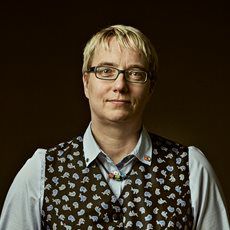
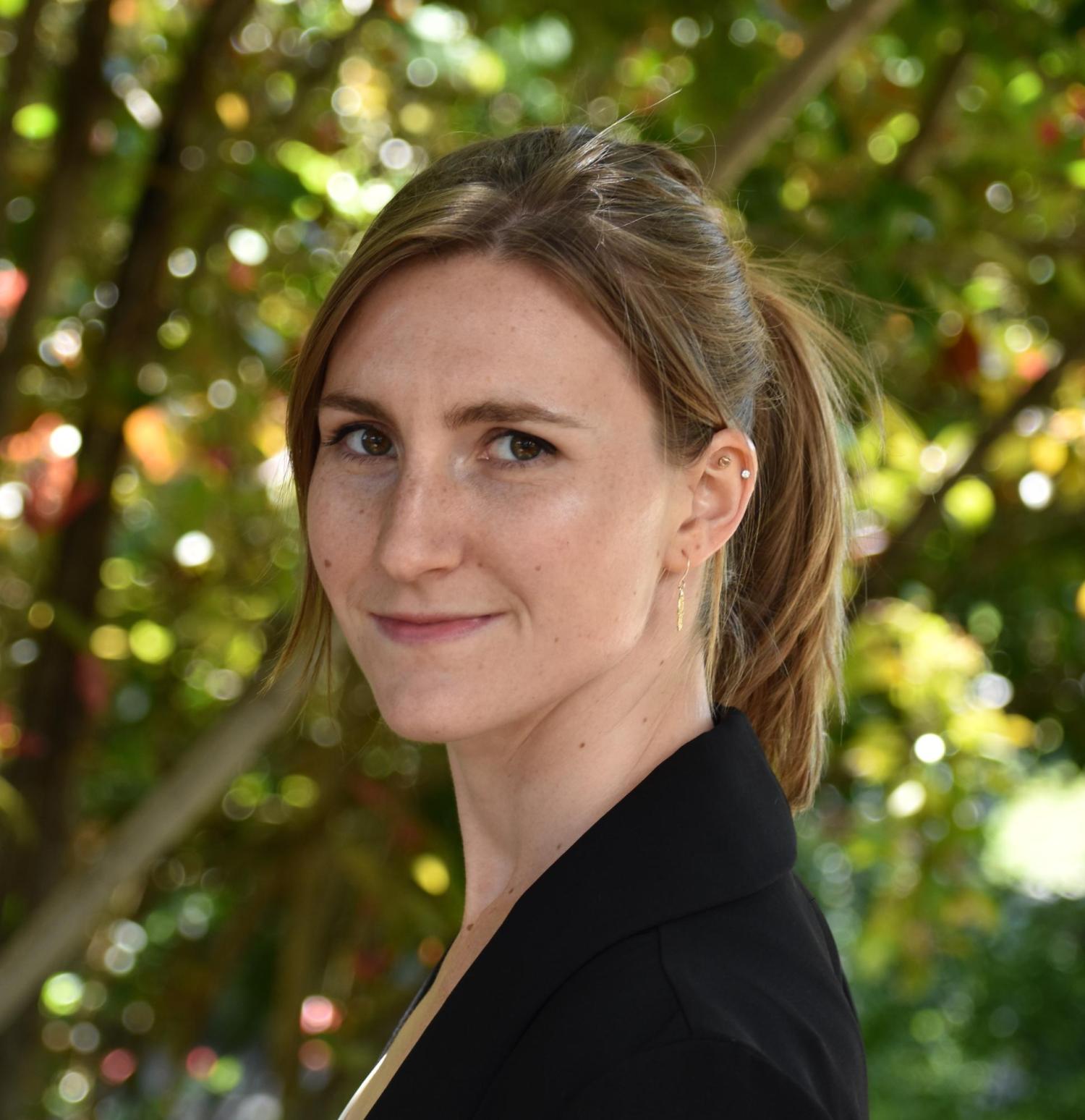
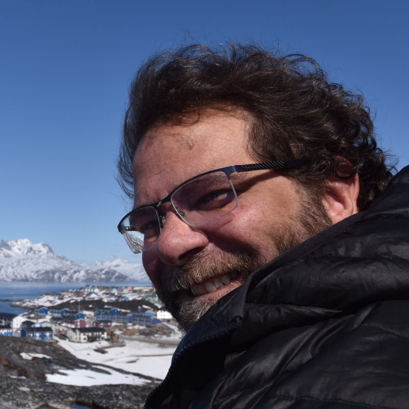
Associate Professor Jiwon Kim is a leading researcher in Transport Engineering at the University of Queensland's School of Civil Engineering. She serves as Director of Higher Degree by Research and was a DECRA Fellow from 2019-2022. Holding degrees from Korea University and Northwestern University, she specializes in AI/ML applications for transportation systems. PhD, Northwestern University BS & MS, Korea University Her research focuses on Artificial Intelligence and Machine Learning applications in transportation, including: Deep learning for traffic management Reinforcement learning in mixed traffic environments Multi-agent systems for urban mobility optimization Spatiotemporal trajectory analysis Recent publications demonstrate expertise in: Eco-driving strategies Traffic incident prediction Queue length estimation Crash risk modeling Scientific recognition includes: ARC DECRA Fellowship (2019-2022) She supervises doctoral students in: Transportation data analytics Autonomous vehicle systems Intelligent traffic management Current projects explore real-time traffic monitoring, synthetic mobility data generation, and connected vehicle technologies.
Anil Madhavapeddy serves as Professor of Planetary Computing at the University of Cambridge's Department of Computer Science and Technology and directs the Cambridge Centre for Carbon Credits (4C). A Fellow of Pembroke College, he integrates systems research with environmental conservation through the Computer Laboratory's Environment and Energy Group. His career spans industry leadership (NetApp, Citrix, Intel), academic appointments (Cambridge, Imperial, UCLA), and entrepreneurial ventures (XenSource, Unikernel Systems, Docker). Madhavapeddy earned his PhD at Cambridge's Computer Laboratory in 2006. His research bridges computational systems and planetary-scale environmental challenges, with deep expertise in open-source development (OCaml, Xen, Docker, OpenBSD) and technology strategy advising for organizations including Zededa, Tezos Foundation, and Tarides. His work centers on environmental computing and climate informatics, leveraging distributed systems and functional programming to develop sensing infrastructure for conservation. Recent projects focus on carbon credit systems, AI-driven biodiversity monitoring, and sustainable computing architectures that minimize ecological footprints while maximizing analytical capability. Analysis of his 2025 publications reveals a concentrated effort on AI-integrated conservation tools, privacy-preserving carbon accounting, and energy-efficient computing. Key themes include spatial networking for ecological data, LLM-enhanced evidence retrieval in conservation science, and novel metrics for extinction risk assessment—demonstrating computational innovation applied to urgent planetary boundaries. No scientific awards were documented in the source material. Madhavapeddy advises multiple technology firms on strategic development while leading the Cambridge Centre for Carbon Credits, though specific grant funding details remain unreported. He actively contributes to the Environment and Energy Group at Cambridge's Computer Laboratory and directs the interdisciplinary Cambridge Centre for Carbon Credits (4C). His open-source leadership spans critical infrastructure projects including OCaml, Xen, and Docker, fostering collaborative development communities that underpin modern cloud and container technologies.
Dr. Tomislav Medic is a Lecturer at the Department of Civil, Environmental and Geomatic Engineering at ETH Zürich. His research and teaching focus on geospatial data acquisition and geomatic engineering. He is affiliated with the Geosensorik und Ingenieurgeodäsie group at ETH, located at HIL D 46.1, Stefano-Franscini-Platz 5, Zurich, Switzerland. His contact details include a direct phone line +41 44 633 80 05 and an institutional email address. While no specific research awards or grants are explicitly listed in the provided texts, his academic work aligns with the department's emphasis on environmental and civil engineering applications. No advised students or recent publications under his name are documented here.
Sai Ravela is a Principal Research Scientist in the Department of Earth, Atmospheric and Planetary Sciences (EAPS) at the Massachusetts Institute of Technology (MIT). His research focuses on nonlinear stochastic dynamics, coherent fluid systems, uncertainty quantification, and autonomous observing technologies. He specializes in developing data-driven methodologies for natural hazard detection, climate change impacts, and environmental risk assessment. Ravela’s work integrates computational science with geophysical applications, including storm surge modeling, extreme rainfall analysis, and geothermal exploration. He pioneers techniques like neural dynamical systems and adversarial learning to improve predictive accuracy in nonstationary climate regimes. His contributions span environmental monitoring systems, autonomous aircraft resilience frameworks, and policy-informed climate vulnerability assessments. Key research areas include: Coastal flood risk in Bangladesh and Vietnam Dynamic data-driven applications systems (DDDAS) Machine learning for geosciences and environmental systems Uncertainty quantification in complex fluid dynamics He leads interdisciplinary projects at MIT’s Computational Science and Engineering (CSE) program, advancing methods for data assimilation, surrogate modeling, and real-time environmental observatories. His innovations bridge theoretical frameworks with practical solutions for climate adaptation and disaster resilience.
Aura Istrate is a Lecturer/Assistant Professor in Urban Planning & Sustainable Urbanism at the School of Architecture, Planning and Environmental Policy at University College Dublin (UCD). With an international background spanning multiple continents, she conducts interdisciplinary research on sustainable urban development, focusing on active mobility, nature-based solutions, and climate-neutral cities. She teaches GIS and urban planning modules while coordinating several significant research projects across European and Asian contexts. University College Dublin, School of Architecture, Planning and Environmental Policy Primary Coordinator of C-NEWTRAL (Horizon MSCA-DN 2024-2028) Co-Leader of REALLOCATE (Horizon Europe project 2023-2027) Principal Investigator for BIODIVERSA+ projects (NatureScape and NBS4AQUAMISSION) Educated at the University of Architecture and Urban Planning 'Ion Mincu' in Bucharest (BA and MA) and the University of Liverpool (PhD), Dr. Istrate further enhanced her teaching credentials with a Professional Certificate in University Teaching & Learning from UCD. Her academic journey reflects a strong foundation in architectural and urban planning principles combined with specialized expertise in sustainable urbanism. Dr. Istrate's research focuses on smart and sustainable urbanism, particularly examining active mobility, livable streets, green public spaces, and nature-based solutions in urban planning. Her work employs participatory, geospatial, and mixed methods to inform smart communities and the transition to climate-neutral cities. She has practical international experience in urban design and planning, with ongoing collaborations spanning European and Asian countries, currently teaching and researching across cultures in UCD and UCD's International Colleges (CDIC). Her recent publications reveal a strong focus on street vitality, urban heat adaptation, and nature-based solutions. The research demonstrates methodological diversity combining quantitative spatial analysis with qualitative community engagement approaches. Her work spans multiple geographic contexts, with particular expertise in Chinese urban environments and European cities, showing how urban planning concepts need to be contextualized for different cultural settings. The articles consistently address climate adaptation challenges through innovative approaches like urban nature games and fine-grained street classification systems. Dr. Istrate serves as a PhD thesis supervisor and is actively involved in major research initiatives including C-NEWTRAL (as Primary Coordinator), REALLOCATE (as Co-Leader), and BIODIVERSA+ projects (as PI for NatureScape and NBS4AQUAMISSION). Her grant portfolio includes Horizon Europe projects and other significant funding that supports interdisciplinary research on climate-neutral urban development. She has coordinated multiple teaching modules including Planning Design & Development, GIS & Planning, Intro to Spatial Planning, and Local Planning Studio. She leads international research collaborations and maintains active partnerships across various European and Asian countries. Her work bridges academic research with practical urban planning applications, particularly through her focus on research-by-design approaches and participatory methods that engage communities in the planning process. She has served as a lecturer, tutor, or teaching assistant across departments of Architecture, Planning, Environmental Studies, Global Studies, and Human Geography in Ireland, the UK, Czechia, Sweden, China, and Romania since 2010.
Tuuli Toivonen is a Professor of Geoinformatics at the Department of Geosciences and Geography, University of Helsinki. She leads the transdisciplinary Digital Geography Lab , which addresses human-scale spatial analytics for sustainable societies. She serves as Vice-Director of Geography Degree Programs (post-2022) and previously held the Director role (2020-2022). After receiving the ERC Consolidator Grant in 2022, she continues advancing open science through active memberships in HELSUS and URBARIA . PhD in Geography (University of Turku, 2006) Specialist Vocational Qualification in Leadership (2023) Life Member, Clare Hall, University of Cambridge (since 2021) Her research focuses on Human-Place Interactions through accessibility/mobility lenses, combining Open Data , Machine Learning , and Spatial Analytics . Key application areas include Urban Geography , Conservation Science , and Governance Policy . Recent publications address Dynamic Cities (2018), Social Media for Conservation (2019), and Environmental Exposure During Travel (2021). Her lab produces datasets like the Helsinki Region Travel Time Matrix series (2014-2023). Scientific Awards: European Open Data Champion (2017) Open Science Price (2017) University of Helsinki Geography Award (2018) She supervises Master's thesis work and serves as Opponent for doctoral defenses across Europe. Her teaching portfolio includes Advanced Geoinformatics and Digital Geographies courses.
Marketta Kyttä is a Professor of Land Use Planning at Aalto University's Department of Built Environment. She holds a PhD in Architecture from Helsinki University of Technology (2004) and leads the Spatial Planning and Transportation Engineering Master’s program. Research Interests: Child- and age-friendly urban environments SoftGIS methodology for participatory mapping Social sustainability and urban health Public participation in planning Activity space modeling Scientific Awards: Lea Pulkkinen award Tapio Nummenmaa award Geospatial World Forum's WebGIS Innovation Award (2010) Oskari Vilamo award (2020) Oppikirja-palkinto for urban planning literature Methodological Contributions: SoftGIS (PPGIS innovation) Commercialization as Maptionnaire software International Collaborations: Affiliated with universities in Italy, Australia, and the US. Her work spans 80+ countries through Maptionnaire’s global adoption.
Ian Ewart is an Associate Professor at the University of Reading's School of the Built Environment, serving as Head of Construction and Engineering Management and Research Group Lead for Organisation, People and Technology. He chairs the Research Ethics Committee since 2016 and supervises undergraduate/postgraduate dissertations. His academic journey spans engineering and anthropology: DPhil Social and Cultural Anthropology, University of Oxford, St Hugh's College (2007-2012) MSc Material Anthropology and Museum Ethnography, University of Oxford, St Hugh's College (2006-2007) BA (Hons) Archaeology and Anthropology, University of Oxford, Harris Manchester College (2003-2006) Diploma in Management Studies, University of the West of England (1990-1994) BEng (Hons) Mechanical Engineering, Staffordshire University (1983-1987) Ewart's research integrates ethnographic methods with digital technology studies, examining human-technology interactions in construction and domestic settings. His work bridges engineering practice and social anthropology, focusing on skill transmission, sustainable design, and multisensory experiences in virtual environments. Publications from 2025-2013 reveal a dominant trajectory in digital twins for socio-ecological sustainability, VR-based occupant behavior prediction, and HBIM for heritage conservation. The corpus demonstrates consistent cross-disciplinary innovation, merging archaeological reconstructions with healthcare applications while maintaining anthropological rigor. Key recognition: ESRC Future Research Leader fellowship (2013) for Designing Healthy Homes project He supervises PhD candidates like Afolabi Dania (Nigerian sustainable construction) and Joanna Hull (Heritage BIM), leveraging ESRC funding for ethnography-VR health studies. His grants emphasize participatory design and real-world impact assessment in built environments. Leaders the Organisation, People and Technology research group, developing multisensory Roman town reconstructions with sound/smell integration to advance archaeological and architectural experience modeling.
Chee-Wooi Ten is a tenured Professor in the Department of Electrical and Computer Engineering at Michigan Technological University, where he has served since 2010 and achieved tenure in 2016. He concurrently holds an Affiliated Professor appointment in Applied Computing and directs both the PSERC Site and ICC CPS Center. His institutional roles emphasize cyber-physical security integration within power infrastructure. His educational background includes: PhD in Electrical Engineering from University College Dublin (2009) MSc in Electrical Engineering from Iowa State University (2001) BSc in Electrical Engineering from Iowa State University (1999) Ten's research pioneers cyber-informed security engineering strategies for bulk power systems, focusing on quantifying rare events through system risk models and data science. His work bridges power grid interactions with robotics and transportation systems to advance decarbonization and electrification. Key methodologies include validating cyber-physical security frameworks against steady-state and dynamic grid approaches, with emphasis on attack/defense combinatorics and smart home technologies. This transdisciplinary approach supports the fourth industrial revolution's resilience requirements. His publication trends reveal strong focus on risk-aggregated substation testbeds using generative adversarial networks, cyber insurance models for power systems, and cascading failure analysis from switching attacks. Recent works increasingly integrate machine learning with physics-based modeling to address cybersecurity threats in inverter-based resource integration and distribution emergency operations. Ten has secured over $6.5M in active funding including: $2M DOE grant (MTU portion $105,000) for CyDERMS Center on DERs/Microgrids cybersecurity $704,409 CyManII award for secure digitalization in smart manufacturing $1.05M DOE ARPA-E grant for decarbonized freight transportation modeling NSF CyberCorps Scholarship for Service program ($3.38M) His grants consistently address risk management through data-driven and physics-based modeling, with industry partnerships through PSERC and utility collaborations. As ICC CPS Center Director, he leads research on cyber-physical security testbeds and coordinates the PSERC Summer Transformation School. His team develops validation frameworks for NERC CIP compliance while addressing practical pain points in OT cybersecurity for grid operators.
Nicolas Federico Martin is an Associate Professor in the Department of Crop Sciences at the University of Illinois at Urbana-Champaign, with additional appointments as Associate Professor in the Center for Latin American and Caribbean Studies, Center for Digital Agriculture, and the National Center for Supercomputing Applications (NCSA). His interdisciplinary work bridges traditional agricultural science with cutting-edge computational approaches. Dr. Martin's research focuses on the intersection of agriculture and data science, with particular emphasis on: Precision agriculture and on-farm experimentation methodologies Machine learning applications for crop management and yield prediction Nitrogen and nutrient management optimization Soybean and corn breeding and production systems Remote sensing and UAV applications in agriculture Sustainable agricultural practices including cover crop management His publication record demonstrates a clear trajectory toward increasingly sophisticated integration of artificial intelligence with agricultural science. Recent work shows heavy emphasis on using machine learning algorithms (particularly reinforcement learning, convolutional neural networks, and generalized additive models) to solve practical farming challenges related to crop management decisions, yield prediction, and resource optimization. This research has significant implications for both scientific understanding of crop-environment interactions and practical farm management. Dr. Martin actively collaborates across disciplines and institutions, as evidenced by his extensive co-authorship network spanning agronomy, computer science, environmental science, and economics. His work has garnered attention from numerous news outlets and social media platforms, indicating its relevance to current agricultural challenges. He is a key contributor to the Data-Intensive Farm Management project, which aims to transform agronomic research through on-farm precision experimentation. His affiliation with NCSA provides access to high-performance computing resources essential for processing large agricultural datasets. Additionally, his work in Latin American agriculture (particularly in Mexico and Argentina) reflects his commitment to addressing global food security challenges.
Professor Nicole Metje is a Professor of Infrastructure Monitoring at the Department of Civil Engineering, University of Birmingham, and Director of the National Buried Infrastructure Facility. She also serves as Co-director of the Institute of Quantum Technology. Her research focuses on quantum sensing, geotechnical engineering, and infrastructure monitoring, with a particular emphasis on buried infrastructure detection and sustainable urban development. Education: PhD in Civil Engineering (University of Birmingham, 2001); Dipl.-Ing. in Civil Engineering (Hannover University, Germany, 1998). Key roles and affiliations include membership in EPSRC Infrastructure Strategic Advisory Team, Chartered Institution of Civil Engineering Surveyors, and international advisory boards for Hong Kong Polytechnic University. She has authored/co-authored over 50 journal papers and a textbook on tunnel construction. Research areas include quantum sensor applications for buried asset detection, geophysical soil properties, and sensor development for infrastructure monitoring. She leads projects such as UKCRIC National Buried Infrastructure Facility and Quantum Technology Hub in Sensors and Metrology. Awards and fellowships include FICE, FCInstCES, CEng, FHEA, and multiple committee memberships in national/international bodies. Teaching includes MSc courses on underground construction and geotechnical engineering. She supervises doctoral research on quantum sensors, soil-structure interactions, and sustainable infrastructure.
Jan Skaloud serves as an Adjunct Professor at École Polytechnique Fédérale de Lausanne (EPFL), affiliated with the School of Architecture, Civil and Environmental Engineering (ENAC). He holds positions across multiple departments including SSIE (Institute of Earth Surface Dynamics), EDCE (Doctoral Program in Environmental Sciences and Engineering), and leads the Earth Sensing and Observation (ESO) Lab. His office is located at GC C2 397 in the EPFL campus in Lausanne, Switzerland. Dr. Skaloud's research expertise spans satellite positioning, inertial and integrated navigation systems, sensor orientation and calibration, attitude determination, mobile mapping, airborne laser scanning, and Kalman filtering techniques. His work bridges theoretical development with practical applications in UAV navigation, photogrammetry, and remote sensing. He teaches across three EPFL sections and two faculties, demonstrating his interdisciplinary approach to education. His publication record shows consistent contributions to the field, with recent work (2023-2025) focusing on vehicle dynamic model-based navigation for various UAV platforms, including delta-wing and fixed-wing drones. His research demonstrates a clear trajectory toward increasingly sophisticated navigation systems that integrate aerodynamic modeling with traditional sensor fusion approaches. This trend reflects the growing importance of model-based navigation in achieving higher precision and autonomy in UAV operations. 2021: Samuel Gamble Award for career contribution in photogrammetry & sensing (ISPRS) 2020: U.V. Helava Award for best paper in ISPRS Journal (2016-2019) 2017: Best Demo Award at IEEE International Workshop on Metrology & Aerospace 2014: Hansa Luftbild Award for best paper in PFG journal 2012: Karl Kraus Medal for best textbook in Photogrammetry 2009: GNSS Leader to Watch Innovation Award (GPS World) Dr. Skaloud has supervised numerous PhD students whose work focuses on advanced navigation systems, sensor calibration, and UAV applications. His research has received funding for projects involving direct georeferencing, mobile mapping systems, and UAV-based search and rescue operations. The ESO lab he directs serves as a hub for cutting-edge research in Earth observation technologies. The Earth Sensing and Observation Lab under Dr. Skaloud's direction brings together researchers working on navigation systems, sensor integration, and data processing techniques for geospatial applications. The lab maintains strong connections with industry partners and international research organizations, facilitating technology transfer and collaborative research projects.
Esther Rolf is an Assistant Professor in the Department of Computer Science at the University of Colorado Boulder. Her research focuses on blending methodological and applied machine learning techniques to address social and environmental challenges, emphasizing usability, data-efficiency, and fairness. Her work includes developing algorithms for environmental monitoring with satellite imagery and advancing geospatial ML systems. Her research explores the multifaceted role of data representation in machine learning, particularly how spatial distribution and data acquisition impact model fairness and efficacy. Projects include formalizing representivity in training data and tackling evaluation challenges in geospatial ML applications. Recent publications highlight her expertise in satellite-based poverty mapping, multimodal data efficiency, and geospatial foundation models. She integrates specialized architectures and domain-specific benchmarks into her work. Best Paper Award, ICML (2018) Best Paper Award, NeurIPS Workshop on AI for Social Good (2019) NSF Graduate Research Fellowship Google Research Fellowship Esther's lab at CU Boulder recruits PhD students and postdocs interested in statistical/geospatial ML and context-driven research for real-world problems. She teaches graduate courses in machine learning and geospatial ML at CU Boulder.
Mike Willis is an Associate Professor of Cryospheric Science, Geodesy & Remote Sensing at the Department of Geosciences, Virginia Tech's College of Science. His research focuses on advancing remote sensing techniques to study Earth's cryosphere, coastal environments, and natural hazards. He leads projects on glacial dynamics, sea level rise impacts, landslide monitoring, and the application of GNSS and InSAR technologies. His work combines field instrumentation (e.g., OrangePi-GNSS systems) with satellite data analysis to address climate and geohazard challenges in polar regions and coastal communities. Education background: Not explicitly stated in provided text. Research interests include cryospheric science, geodetic monitoring, and environmental remote sensing applications. His lab group maintains a dedicated website at https://sites.google.com/view/4datvt/ . Key research themes include: Glacier and ice shelf mass balance Coastal vulnerability to sea level rise Disaster monitoring using GNSS-IR and InSAR High-resolution digital terrain modeling Recent projects highlight work in Greenland (landslide monitoring, sea level measurements), the Pacific Northwest (subduction zone hazards), and the Dominican Republic (coastal inundation modeling). His interdisciplinary approach bridges geophysical observations with computational geospatial analysis.
Dr. Alireza Nili is a Senior Lecturer in Service Science at QUT's School of Information Systems within the Faculty of Science. His expertise spans digitization of customer-centric services, AI/chatbots, IoT/IIoT, and sustainable technologies. He holds a PhD from Victoria University of Wellington and has coordinated large-scale courses like IT Systems Design (IFB103), achieving top teaching scores. Nili's research focuses on service ecosystems, trust in digital services, and public/retail sector innovations. He has secured over $1.4M in industry grants for projects involving Cisco, Amazon, and Services Australia. His awards include the 2023 Educator of the Year and multiple top conference paper recognitions. Nili supervises PhD students at Level 3 mentoring status and contributes to major conferences as track chair/associate editor. Research highlights include frameworks for chatbot governance, IOT in agriculture, and AI ethics. His work appears in IEEE Software , Communications of the ACM , and MIT Sloan Management Review . Current projects address consumer trust in AI technologies and spatial data systems. Nili's interdisciplinary approach combines design science with empirical methodologies to bridge theory and practice in digital service innovation.