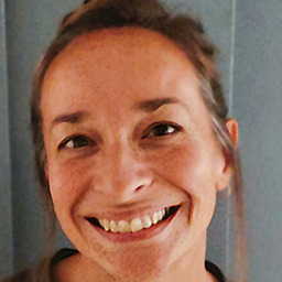
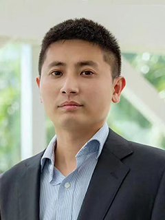
Hanna Breunig is a Research Scientist at Lawrence Berkeley National Laboratory and Deputy of the Sustainable Energy & Environmental Systems Department. She holds a secondary appointment in the Earth Systems and Society Domain within the Climate and Ecosystem Science Division. Her work focuses on validating emerging energy technologies through process design, techno-economic modeling, and market analysis. Education: PhD in Civil and Environmental Engineering from UC Berkeley (2015), MSc (2011), and BSc from Cornell University (2010). Her research spans hydrogen storage , CO2 capture/utilization , brine management , and technoeconomic modeling for systems in data centers, hospitals, mines, aviation, and ports. She co-leads the DOE HyMARC consortium and the systems analysis team for the ARCHES California Hydrogen Hub. Recent publications highlight advancements in metal-organic frameworks (MOFs) for hydrogen storage, solar hydrogen production , and high-temperature thermal energy storage . She has received accolades like the 2023 Energy & Environmental Science Lectureship and 2014 Schmidt MacArthur Fellowship. Scientific Awards: 2023 Energy & Environmental Science Lectureship 2021 Early Scientific Career Award 2019 CEC Bioenergy Project Leadership 2017 LDRD Early Career Award 2014 Schmidt MacArthur Fellowship Hanna mentors graduate and undergraduate students and contributes to tools like the BioSiting v2 software for U.S. bioeconomy resource analysis.
Tina Delahunty is an Assistant Professor in the Department of Physical and Environmental Sciences at Bloomsburg University, where she contributes to the academic and research mission in geography and environmental sciences. Her work bridges geospatial technologies with environmental change analysis. Education: Ph.D. in Geography — University of Florida M.A. in Geography — Florida Atlantic University Her research focuses on the spatial and temporal dynamics of Holocene land cover and environmental change. She employs advanced tools such as GIS, remote sensing, and palynology to investigate long-term ecological transformations. Her interdisciplinary approach integrates geospatial data with paleoenvironmental proxies to reconstruct past landscapes and assess modern environmental impacts. The recent publications highlight consistent engagement in remote sensing applications, including agricultural monitoring, urban extent mapping using nighttime lights, and ecological assessment via environmental DNA. These works reflect a strong methodological foundation in multiscale geospatial analysis and environmental monitoring across diverse ecosystems. Scientific Contributions: Co-authored research in high-impact journals such as International Journal of Remote Sensing , Freshwater Biology , and International Journal of Applied Earth Observation and Geoinformation . Active contributor to interdisciplinary environmental research involving geography, ecology, and geospatial science. She is involved in mentoring and research supervision, though specific advisees are not listed. Her work is supported by institutional affiliation and access to geospatial laboratories and field resources. She contributes to advancing methodologies in land cover classification and environmental change detection. Dr. Delahunty leads research in GIS and remote sensing laboratories at Bloomsburg, where she likely supervises student projects and collaborates on regional and global environmental studies.
Sidonie Christophe is a Senior Researcher (Directrice de Recherche, DR1) at UMR LASTIG, a joint research unit of Université Gustave Eiffel, IGN-ENSG, and EIVP. She serves as co-director of the LASTIG laboratory and leads research in geovisualization, map design, and interactive spatial data exploration. She also holds a part-time advisory role (60%) at the French Ministry of Higher Education and Research in the domain of digital technology, environment, climate, and sustainable urban development. PhD in Geographic Information Sciences Senior Researcher, DR1, MTECT Co-Director, LASTIG Laboratory (since 2021) Former Team Leader, GEOVIS (Geovisualization, Interaction, and Immersion) Advisor, Environment and Urban Climate, French Ministry of Higher Education & Research Her research centers on innovative methods for 2D/3D and nD geospatial data visualization, with a focus on enabling spatio-temporal understanding through visual and non-visual spatial thinking. Her work integrates principles from geographic information science, human-computer interaction, and computer graphics. Key areas include urban climate visualization, tactile and augmented reality for accessibility, expressive cartographic rendering, and cognitive aspects of map design. She investigates how aesthetic and semiotic choices impact map comprehension and utility. The 15 most recent publications reflect a strong trend in interactive and accessible geovisualization, particularly for urban and environmental applications. Topics include neural map style transfer, 3D urban climate analysis, tactile maps for the visually impaired, augmented reality in geography, and visual analytics for crisis and climate data. There is a consistent emphasis on user-centered design, interdisciplinary integration, and the development of tools for decision-making under uncertainty. Scientific Recognition and Service: Invited speaker at major conferences (IEEEVIS, AGILE, ICC, CPGIS) Co-organizer of international workshops (e.g., GeoVIS, ISPRS AR/VR sessions) Leader of national research projects (ANR ORACLES, ANR ACTIVmap, ANR ECOCIM) Recipient of international mobility grants (AMICI I-SITE FUTURE) Contributor to national glossaries and research strategy (e.g., French photogrammetry glossary) Advising and Grants: Sidonie Christophe actively supervises PhD students and postdoctoral researchers, including Markie Jiang, Maria-Jesus Lobo, and Alexandre Mielniczek. She leads or participates in multiple funded research projects such as ANR ORACLES (marine flooding visualization), ANR ACTIVmap (tactile 3D maps), and ANR ECOCIM (eco-design of city information models). Her advisory role at the MESR involves shaping national research strategy in digital and environmental sciences. Labs and Research Teams: She is a core member of the GEOVIS team (Geovisualization, Interaction, and Immersion) at LASTIG and previously served as its leader. As co-director of LASTIG, she plays a central role in the leadership and strategic direction of the entire laboratory, which comprises over 100 researchers across four teams: ACTE, GEOVIS, MEIG, and STRUDEL.
Aatishya Mohanty is a Lecturer in Economics at the University of Aberdeen Business School, where she contributes to research and teaching in economic development and cultural economics. She joined the university in 2023 and is affiliated with the Department of Economics, actively publishing in high-impact interdisciplinary journals. Ph.D. in Economics, Nanyang Technological University, Singapore (2023) M.Sc. in Applied Economics, Nanyang Technological University, Singapore Her research centers on the interplay between culture and economic outcomes, particularly in development and environmental contexts. She investigates how cultural norms affect public health behaviors, responses to pandemics, environmental regulations, and disaster resilience. Her work combines rigorous econometric methods with interdisciplinary insights from sociology, public health, and environmental science. The analysis of her recent publications reveals a strong thematic focus on the socio-economic dimensions of global crises, especially the COVID-19 pandemic. Her research consistently explores how cultural and institutional factors mediate policy effectiveness and environmental outcomes. She employs large-scale datasets and cross-national comparisons to draw robust conclusions, contributing significantly to the fields of cultural economics and development policy. Aatishya Mohanty has not been publicly recognized with any scientific awards or fellowships based on the available information. There is no publicly available information about her advising graduate students or securing research grants. Her teaching responsibilities include courses such as Environmental Economics, Applied Economic Policy Evaluation, Industrial Economics, and The Global Economy, indicating a strong engagement with both undergraduate and postgraduate education. No specific laboratory or research team affiliation is mentioned in the provided texts. However, her work appears to be collaborative, involving researchers from various institutions, suggesting participation in broader academic networks and research consortia.
Enrico Macii is a Full Professor at the Politecnico di Torino, affiliated with the Interuniversity Department of Regional and Urban Studies and Planning (DIST) and the Department of Control and Computer Engineering (DAUIN). He leads the Electronic Design Automation (EDA) research group and holds key roles as Scientific Advisor for the Politecnico-STMicroelectronics partnership and Scientific Contact for the European Chips Joint Undertaking. Research Interests: His work spans digital circuits and systems, energy efficiency, smart cities, Industry 4.0, and smart manufacturing. He focuses on embedded and cyber-physical systems, low-power design, neuromorphic computing, AIoT, and sustainable urban development. Recent Publications: His recent research demonstrates strong trends in edge AI, neuromorphic computing, and smart energy systems. Articles highlight innovations in low-power hardware acceleration, federated learning, physics-informed AI, and digital twin applications for urban and industrial systems. There is a clear emphasis on deploying AI efficiently on constrained devices and integrating physical models with machine learning. J. William Fullbright Fellowship (1993) Best paper award IEEE European Design Automation Conference (1996) Best paper award ACM/IEEE Great Lakes Symposium on VLSI (2008) DAC Service Award (2014) IEEE Fellow (2006) DATE Fellow (2014) Advising and Grants: He has supervised over 25 PhD students in computer engineering, AI, and urban systems. His research is funded by major EU programs (Horizon 2020, PNRR, KDT JU), national (PRIN, FAR), and regional grants, as well as industrial contracts with STMicroelectronics, Michelin, and Cefriel. He leads numerous high-impact projects in smart manufacturing, energy efficiency, and digital twins. Labs and Teams: He is a core member of the EDA Group, an interdepartmental research team at Politecnico di Torino focusing on VLSI-CAD, bioinformatics, smart cities, and Industry 4.0. He also contributes to IAM@PoliTo (Integrated Additive Manufacturing) and leads multiple EU and national research consortia.
Dong Ngo Duy is an Associate Professor in the Department of Civil & Environmental Engineering at Monash University, where he serves as the Head of the Transport Section. He holds a PhD in Traffic Flow Theory and Simulation from Delft University of Technology and has held academic positions at the University of Leeds (UK), University of Canterbury (NZ), and now Monash University (Australia). PhD, Traffic Flow Theory, Technische Universiteit Delft (2006) MSc, Traffic Engineering, Linköpings Universitet (2002) His research focuses on Connected and Autonomous Vehicles (CAVs) , Traffic Flow Theory , Data Fusion , and Urban Network Optimization . He applies AI and machine learning to model, predict, and control multi-modal traffic systems, aiming to develop smart city platforms for sustainable transport in mega-cities. The recent trend in his publications (2022–2025) reflects a strong focus on intelligent transportation, including trajectory planning, risk-aware control, car-following modeling using neural symbolic regression, and intercity mobility analysis. His work bridges theoretical modeling with practical applications in emerging connected environments. Scientific Awards: UK Research Council (EPSRC) Advanced Fellow Award (2011–2016) in Connected and Autonomous Vehicles Dong Ngo Duy actively supervises PhD students and contributes to major research initiatives in intelligent transport systems. His work aligns with UN Sustainable Development Goals, particularly in sustainable cities and transport. He previously chaired the Connected Traffic Systems Lab at the University of Canterbury and continues to lead impactful research in transport innovation.
Dr. Vincent Hiribarren is a Reader in Modern History at the Department of History , King's College London , with expertise in African history, archival studies, and digital humanities. He has held visiting positions at UCLA and served as director of IFRA-Nigeria (University of Ibadan). Education : PhD in History (University of Leeds, 2012) Research Interests : African History, Archives, Cartography, Digital Humanities, Borno, Nigeria His research focuses on the history of Borno , colonial archiving , and historical cartography , often informed by fieldwork and interviews. He has published extensively on topics ranging from precolonial Nigerian kingdoms to postcolonial governance and colonial intelligence operations . Recent work includes the 2025 book La France au Cameroun (1945-1971) , analyzing colonial archival policies. His 15 most recent publications span African history, digital humanities, and the intersections of colonialism and cultural identity. Scientific Awards : Leverhulme Teaching Fellowship (2013) Grants and Public Engagement : He has received funding from the British Library Endangered Archives Programme for digitization projects in Madagascar and Benin. He co-edited the Africa4 blog for Libération and developed an online archive catalog for Madagascar.
David Olefeldt is an Associate Professor and Director of Graduate Studies in the Renewable Resources Department at the University of Alberta's Faculty of Agricultural, Life and Environmental Sciences. His research focuses on catchment carbon cycling in boreal and Arctic landscapes, emphasizing wetland functions, permafrost thaw impacts, and greenhouse gas fluxes. He investigates both terrestrial and aquatic aspects of carbon dynamics, including methane emissions and dissolved organic carbon transport. Olefeldt combines fieldwork, laboratory analysis, and remote sensing to address climate change feedbacks in northern ecosystems. Affiliations: Catchment and Wetland Sciences Research Group (CAWS) Teaching: Courses include BIOL 333 (Wetland Science and Management), REN R 250 (Water Resource Management), and REN R 333 (Wetland Sciences and Management). His work bridges soil and aquatic sciences, with recent studies on permafrost carbon vulnerability, wildfire effects on carbon export, and global wetland methane synthesis. He emphasizes connecting small-scale studies to large-scale climate projections, particularly in peatland-rich regions. Labs/Teams: Active in the CAWS group, focusing on integrated catchment studies and wetland science.
Peter Johnson is an Associate Professor at the University of Waterloo, affiliated with the Department of Geography and Environmental Management and the Waterloo Civic Map Lab. His research focuses on geospatial technology intersections with open data, the Geoweb, mobile devices, and crowdsourcing for governance and planning. His work evaluates how geospatial tools reshape citizen-government-corporate collaboration, with projects on open data value assessment civic hackathons and smart cities Geoweb platform development climate change adaptation in tourism agent-based modeling for tourism vulnerability Recent publications highlight open data governance models drone imagery repositories disaster response crowdsourcing smart city participatory tools trends in 2019–2016. Awards include: Fellow at Balsillie School of International Affairs He supervises graduate students in topics like open data smart cities technology adoption , with funded opportunities via SSHRC Geothink grants.
Volker Markl is a Professor at Technische Universität Berlin in the Institute of Software Engineering and Theoretical Computer Science, with additional affiliations at the Berlin Institute for the Foundations of Learning and Data (BIFOLD) and the German Research Center for Artificial Intelligence (DFKI). His research spans database systems, stream processing, and distributed data management with significant contributions to both theoretical foundations and practical implementations. Markl's research interests focus on next-generation data management systems, particularly for streaming and IoT environments. His work addresses critical challenges in distributed query processing, system integration, and performance optimization. He has pioneered approaches for stream processing in volatile infrastructures and developed innovative techniques for GPU-accelerated database operations. His NebulaStream project represents a major contribution to distributed stream processing systems. His publication record demonstrates consistent impact across top database venues including VLDB, SIGMOD, and ICDE. Recent work shows increasing focus on machine learning integration with database systems, privacy-preserving query processing, and educational approaches for teaching large-scale data management. Markl has mentored numerous researchers who have become prominent in the database community, with frequent collaborators including Steffen Zeuch, Tilmann Rabl, and Philipp Grulich. His leadership extends to major research initiatives and collaborations across European institutions.
Mengqiu Cao is a Lecturer in Urban Systems Predictive Analytics and Machine Learning at the University College London (UCL) within the Bartlett School of Environment, Energy and Resources . He integrates academia and industry expertise to advance interdisciplinary research at the intersection of transport analysis and urban studies. Research Focus : Sustainable transport, urban mobility, logistics, social equity, and low carbon transitions. Teaching : Coordinates modules on climate sciences, data-driven consumer behavior analysis, and transport policy. Awards : Holds fellowships with the Royal Geographical Society, Royal Statistical Society, and Royal Society of Arts. Publications : Recent works examine green space impacts on mobility, equitable EV charging access, dockless bike-sharing patterns, and 15-minute city frameworks.
Dr. Christine Beitl is an Associate Professor of Anthropology at the University of Maine , with affiliated roles in the School of Marine Sciences , School of Economics , and the Senator George J. Mitchell Center for Sustainability Solutions . Her research focuses on environmental governance, social-ecological resilience, and sustainable livelihoods in coastal and mangrove ecosystems. Ph.D. in Ecological and Environmental Anthropology from the University of Georgia (2012) M.A. in Latin American and Caribbean Studies/Environmental Studies from Florida International University (2005) B.A. in Spanish from Ohio University (1997) Over two decades, she has studied collective action frameworks in Latin American mangrove forests and small-scale fisheries. Recently, her work expanded to Maine, examining climate change impacts on fisheries and offshore wind development. Her research integrates qualitative and quantitative methodologies , including ethnographic fieldwork , fishery data analysis , and geographic information systems . Key themes span political ecology , economic anthropology , and human dimensions of environmental change . Recent publications analyze mangrove-fishery dynamics, climate adaptation strategies, and participatory governance models. Collaborative works with interdisciplinary teams appear in journals like Human Ecology and Environmental Values .
Dr. Krishna P. Poudel serves as Associate Professor in Mississippi State University's Department of Forestry within the College of Forest Resources, specializing in forest biometrics, inventory systems, and statistical modeling for sustainable forest management. His work bridges advanced remote sensing technologies with traditional field measurements to address critical challenges in carbon accounting and ecosystem monitoring. His educational foundation includes: Ph.D. in Forestry, Oregon State University M.S. in Statistics, Oregon State University M.S. in Forestry, Louisiana State University B.S. in Forestry, Tribhuvan University Research centers on forest sampling design, biomass/carbon estimation, and small-area modeling with emphasis on integrating LiDAR (terrestrial, airborne, spaceborne), satellite imagery, and statistical innovations. Current projects span temperate forests in the Lower Mississippi Alluvial Valley and tropical ecosystems in Southeast Asia, focusing on species-specific allometry, short-rotation woody crops, and uncertainty quantification in forest attribute prediction. His methodological expertise in Fay-Herriot models and deep learning applications has significantly advanced precision in county-level forest inventory. Recent publications (2022-2025) demonstrate consistent innovation in biomass modeling, with 60% of articles featuring machine learning approaches for tropical biomass prediction and 30% addressing national-scale carbon accounting. Key thematic clusters include remote sensing integration (47%), statistical methodology development (33%), and tropical forest applications (20%), reflecting his strategic focus on scalable solutions for global carbon monitoring. Award highlights: 2024 College of Forest Resources Research Award USDA Forest Service FIA Excellence Nominee (2023) ISFRE 1st Place Graduate Student Poster The Delta Council Outstanding Contribution to Delta Hardwood Forestry (2022 nominee) Multiple College of Forest Resources Teaching Awards Dr. Poudel actively mentors seven graduate students through the Forest Biometrics Lab, with thesis topics spanning ICESat-2 canopy height validation, deep learning biomass models, and marginal land identification. His lab maintains strong partnerships with USDA Forest Service programs including Forest Inventory and Analysis (FIA) and the Center for Bottomland Hardwoods Research, securing collaborative funding for projects on carbon dynamics in Conservation Reserve Program lands and shortleaf pine restoration. Current initiatives focus on integrating GEDI data with national inventory systems and developing AI-driven tools for smallholder agroforestry carbon accounting in Vietnam.
Han Li is an Associate Professor in the Department of Geography and Sustainable Development at the University of Miami's College of Arts and Sciences. Their research bridges urban geography, sustainable development, and policy analysis, with a focus on climate resilience, pandemic-induced behavioral shifts, and socio-spatial dynamics in urban environments. Affiliation: University of Miami (College of Arts and Sciences), previously associated with Chinese institutions like Shanghai's urban research ecosystem. Research Themes: Climate policy impacts on labor markets, renewable energy adoption in education, pandemic effects on commuting and residential preferences, and cultural/economic drivers of urban transformation. Han's work spans interdisciplinary domains, including urban sustainability , spatial diffusion models , and policy evaluation . Their recent studies highlight: Quantitative analysis of solar PV adoption in U.S. schools amid cost-alleviation policies Geospatial modeling of flood risk counterfactuals in Germany Post-lockdown commuting behavior shifts in Shanghai using phone signal data Evolution of residential preferences for parks and coastal amenities during/after the pandemic Interplay between peer social networks and psychological resilience in migrant children's school adaptation
Luís Moreira de Sousa is an Assistant Professor at the Department of Computer Engineering, Higher Technical Institute (Instituto Superior Técnico), University of Lisbon. His academic work bridges computer science and geography, with a focus on Geoinformatics rather than traditional GIS. He is affiliated with the Information and Decision Support Systems research unit and teaches Data Administration and Information Systems. His research spans several interconnected domains: spatial simulation, semantic web technologies for geospatial data, hexagonal grid systems, and resource depletion studies. Dr. de Sousa has developed innovative approaches to spatial simulation through his DSL3S (Domain Specific Language for Spatial Simulation Scenarios) and has contributed significantly to the Semantic Web through the GloSIS web ontology for soil data. His current major project is the book Spatial Linked Data Infrastructures , which bridges geospatial science and semantic web technologies. His publication record shows consistent contributions to spatial simulation tools, semantic web applications in geospatial domains, and resource depletion analysis. His work demonstrates a clear trajectory from practical spatial simulation tools toward more sophisticated semantic web applications for geospatial data. The recent focus on spatial linked data infrastructures represents the culmination of his interdisciplinary approach, combining computer science rigor with geospatial domain knowledge. Dr. de Sousa is a strong advocate for open source tools and maintains an active presence in the FOSS4G (Free and Open Source Software for Geospatial) community. His professional digital footprint includes Codeberg, Mastodon, ORCID, Google Scholar, LinkedIn, ResearchGate, and StackExchange. Outside his academic work, he maintains interests in resource depletion (having created the Portuguese Peak Oil website PicoDoPetroleo.net in 2005 and contributed to TheOilDrum), cycling (covering thousands of kilometers annually), music, and literature. His Goodreads profile shows an active engagement with science fiction, history, and science literature.