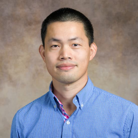
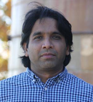
Jiabi Du is an Assistant Professor at Texas A&M University at Galveston, specializing in coastal oceanography and environmental modeling. His research focuses on understanding how coastal systems respond to climate change, extreme weather events like hurricanes, and human activities, with particular emphasis on hypoxia, flooding, and habitat loss. He employs advanced numerical models and long-term observations to study processes such as pollutant dispersion and larval transport in estuaries. Dr. Du holds a Ph.D. in Physical Oceanography from the Virginia Institute of Marine Science (2017), an M.S. in Oceanography from Nanjing University (2012), and a B.S. in Physical Geography from Nanjing University (2010). His awards include the 2019 Institutional Postdoc Fellowship and recognition for academic excellence during his undergraduate and graduate studies. His research interests span coastal hydrodynamics, hurricane impacts, and microplastic transport. Notable contributions include studies on Galveston Bay's hydrodynamic responses to Hurricane Harvey and the role of baroclinic processes in estuarine flushing. He teaches courses in Physical Oceanography and computing. Awards: Best Student Paper (2018), Zengxianzi Scholarship (2007-2009), National Inspiration Scholarship (2007-2008). Labs/Teams: Coastal Modeling Group, Galveston Oyster Larvae Tracker Project. Future research directions include expanding microplastic pollution studies and investigating compounding climate-hurricane effects on coastal systems.
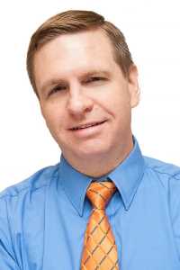
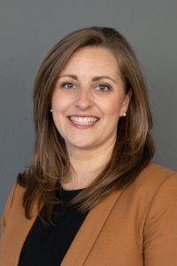
Kevin Ash is an Associate Professor at the University of Florida's School of Natural Resources & Environment, co-leading the Climate Risk and Storm Hazards (CRASH) Lab. His research focuses on environmental hazards, actionable earth system science, and geospatial analysis of weather-related risks. He emphasizes interdisciplinary approaches to study human-environment interactions, particularly vulnerability assessment and policy implications for communities facing flood, wind, and sea-level rise threats. Education includes a PhD in Geography (University of South Carolina, 2015), MS in Geography (University of Florida, 2010), and BA in Geography (University of Oklahoma, 2004). Postdoctoral work included the National Center for Atmospheric Research (2017–2018) and University of South Florida (2015–2017). Teaching spans hazards geography, GIS analysis, and GeoAI. Courses like GIS 4324/6325 and GEO 2006 emphasize geospatial data analysis and decision-making frameworks. His funded projects include a NSF NCAR/UCAR grant for weather warning frameworks and NOAA-funded studies on tornado sheltering during the pandemic. Key research themes include climate mobility, socio-hydrology, and probabilistic weather communication. The CRASH Lab collaborates across disciplines to address adaptation strategies for vulnerable populations in hazard-prone regions. His publications often bridge physical and social sciences, highlighting geospatial tools for resilience planning. Advising current graduate students include Donal Bissainte, Michelle Ruiz, Jawata Saba, and Christopher Williams. Recent advisee Caley Feemster contributed to tornado warning design studies. Labs/Teams: CRASH Lab (co-led), Florida Climate Institute affiliate.
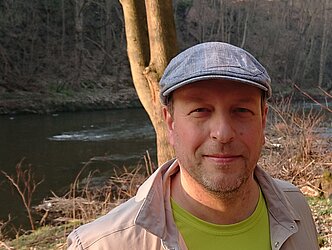
Félicia Norma Rebecca TEFERLE is a Full Professor in Geodesy at the University of Luxembourg's Faculty of Science, Technology and Medicine (FSTM), Department of Engineering. She leads the Geodesy and Geospatial Engineering research group, focusing on high-precision GNSS applications, remote sensing, and digital engineering technologies. Her work integrates geodetic, geophysical, and environmental methodologies. PhD in high-precision vertical land movement monitoring for sea level studies from the University of Nottingham. Industry experience in GPS systems for offshore geophysical investigations. Research interests include: GNSS processing strategies and atmospheric water vapor monitoring 3D land movement monitoring via SAR and photogrammetry BIM/GIS integration and machine learning for 3D city modeling No specific scientific awards or grant details are provided in the text. She maintains active roles in teaching, mentoring, and research innovation.
Dr. Michael Thiel is a Senior Scientist at the Chair of Remote Sensing at Julius-Maximilians-Universität Würzburg, affiliated with the Philosophische Fakultät and the Department of Remote Sensing within the Institute of Geography and Geology. His academic career includes leadership roles in projects like WASCAL, TelePAtH, and AgriSens DEMMIN 4.0, focusing on climate change impacts in West Africa, remote sensing applications for agriculture, and urban development analysis. He holds a PhD in Remote Sensing from the University of Trier (2013), specializing in SAR data texture analysis for urban area characterization. His research integrates satellite data with geospatial tools to study land use dynamics, climate adaptation strategies, and environmental conservation across Africa and Central Asia. Key research areas include: Climate change impacts on agriculture and urban systems Remote sensing of land cover/land use changes Satellite-based monitoring of soil sealing and impervious surfaces GIS applications for sustainable resource management Decision support systems for climate-resilient agriculture His 2025 publications highlight advancements in spatial decision support systems for West African agriculture, climate adaptation strategies in urban areas, and the use of Earth observations to assess maize cropping systems' vulnerability to climate variability. Recent work also addresses rural industrialization effects on migration patterns and biodiversity conservation. Dr. Thiel is affiliated with organizations like the African Studies Association Germany and serves on the advisory board of the AWARD - One Planet Fellowship. He contributes to international collaborations such as the Climate Change and Land Use Graduate School at Kwame Nkrumah University of Science and Technology (Ghana). His research outputs include over 50 peer-reviewed articles since 2007, focusing on remote sensing techniques for environmental monitoring, urban dynamics analysis, and agricultural sustainability in developing regions.
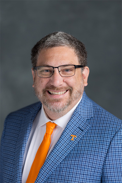
Kevin Heaslip is a Professor and Director of the Center for Transportation Research in the Department of Civil and Environmental Engineering at the University of Tennessee, Knoxville. He joined the university in 2022, bringing extensive experience from his prior role as Professor and CACI Faculty Fellow at Virginia Tech. Education: PhD in Civil and Environmental Engineering, University of Massachusetts Amherst, 2007 MS in Civil and Environmental Engineering, Virginia Tech, 2003 BS in Civil and Environmental Engineering, Virginia Tech, 2002 Dr. Heaslip's research focuses on the intersection of transportation engineering, intelligent systems, and cybersecurity. His work spans future transportation concepts such as electrified and automated vehicles, transportation operations including freeway and transit management, and cybersecurity for transportation and critical infrastructure. He applies advanced data analytics, machine learning, and cyber-physical systems modeling to real-world challenges in mobility and national security. The recent articles highlight a strong trend in leveraging big data and artificial intelligence for transportation mode detection, traffic event identification, and security risk assessment. His work increasingly integrates cybersecurity into transportation systems, particularly in autonomous and connected vehicles, reflecting the evolving technological landscape and national priorities in infrastructure protection. Scientific Awards and Recognitions: Virginia Tech G.V. Loganathan Faculty Achievement Award for Excellence in Civil Engineering Education (2019) Virginia Tech Favorite Faculty Award (2017) Outstanding Alumni, University of Massachusetts Institute of Transportation Engineers Student Chapter (2015) Outstanding Young Alumni, Virginia Tech Department of Civil & Environmental Engineering (2013-2014) USU Civil & Environmental Engineering Teacher of the Year (2014) USU Civil & Environmental Engineering Undergraduate Research Mentor of the Year (2013) USU Civil & Environmental Engineering Outstanding Researcher (2011, 2012) USU College of Engineering Undergraduate Research Mentor of the Year (2011) Dr. Heaslip has secured over $25 million in research grants and contracts from federal and state governments as well as industry partners. He has advised numerous students and mentored undergraduate researchers, receiving multiple awards for teaching and mentorship. His professional service includes membership in the American Society of Civil Engineers (ASCE), Institute of Transportation Engineers (ITE), and Transportation Research Board (TRB), as well as serving as an Appointed Member of the Resilient America Roundtable of the National Academy of Sciences from 2014 to 2020. He leads the Center for Transportation Research at UT Knoxville, a multidisciplinary lab focused on advancing transportation technologies and policies. The lab's research is organized around three thrusts: future transportation systems (electrified, connected, and automated vehicles), transportation operations (freeway, transit, and corridor management), and cybersecurity of transportation and critical infrastructure.
Brenda Bowen is a Professor in the Department of Geology & Geophysics at the University of Utah, where she also serves as Chair of Atmospheric Sciences. She previously directed the Global Change and Sustainability Center from 2015 to 2024, reflecting her leadership in interdisciplinary environmental research. Her academic home is within the College of Mines and Earth Sciences. She earned a PhD from the University of Utah, an MS from the University of California, Santa Cruz, and a BS from the same institution. Her research focuses on sedimentology, geochemistry, and environmental change, aiming to understand landscape evolution across geological and human timescales. She employs field observations, remote sensing, and advanced laboratory techniques to study systems like the Bonneville Salt Flats and Great Salt Lake. Her work emphasizes interdisciplinary collaboration, integrating natural and social sciences to address sustainability challenges in water and energy. She actively promotes applied research in partnership with communities, government, and industry. Her recent publications reveal a strong trend in studying evaporite systems, hydrological dynamics, microbial ecology, and human-environment interactions using remote sensing, geochemical analysis, and social science methods. She explores both natural processes and anthropogenic impacts, such as mining and climate change, on fragile saline landscapes. Fellow of the Geological Society of America (2023) Outstanding Faculty Research Award, Department of Geology and Geophysics (2022) Outstanding Teaching Award, College of Mines and Earth Sciences (2021) Top Researcher Honoree, University of Utah (2017) Career Services Award, University of Utah (2016) Dr. Bowen mentors graduate students through thesis research and leads major externally funded projects, including an NSF ENGINES grant for sustainability innovation in the Southwest. She is deeply involved in institutional change, workforce development, and public engagement. Her work with the Wasatch Environmental Observatory highlights her commitment to long-term environmental monitoring and education. She also explores innovative science communication through art-science collaborations, such as the 'Evaporated' exhibition.
Guillermo Quintero Perez is a Senior Lecturer at the Department of Mechanical Engineering , Technical University of Catalonia . His work focuses on acoustic pollution , low-cost noise sensors , digital signal processing , and noise mapping . He collaborates with researchers like Jordi Romeu and Andreu Balastegui on urban noise monitoring projects. Research Interests : Developing low-cost noise sensors for scalable urban monitoring Optimizing noise mapping through mobile sampling and data stratification Applying digital signal processing to environmental acoustics Investigating sound insulation properties of metamaterial structures Publications : His recent work (2024) includes studies on broadband noise reduction in acoustic windows and compliance testing for low-power sensors. Earlier contributions (2023-2017) explore statistical models for noise estimation, cluster analysis for temporal stratification, and sensor network deployment.
Mitra Baratchi is an Associate Professor at the Leiden Institute of Advanced Computer Science (LIACS) , Leiden University. She leads the Spatio-temporal data Analysis and Reasoning (STAR) research group, co-leads the Automated Design of Algorithms (ADA) group, and founded the Special Interest Group on Spatio-Temporal Data Mining (SIG-SDTM) . PhD from University of Twente (Mobility Data) Master’s/Bachelor’s in Computer Engineering, Iran Research Interests focus on automated pattern extraction from spatio-temporal data across urban, environmental, and industrial domains. Key applications include: Automated Machine Learning (AutoML) for Earth Observations Time-Series Forecasting for public health (e.g., pandemic modeling) Urban Mobility Optimization with ESA, Honda, and municipalities Reliable Vehicular Communication Systems Smart Garments for Health Risk Detection Geocast Protocols for Internet-wide Communication Grant Highlights include €120K NWO-Aspasia, €2.9M Marie Skłodowska-Curie, €350K NWO-KLEIN, and €135K Center for BOLD Cities funding. She has supervised 12 PhD students and 4 current Master’s students since 2011, with notable best paper award at WWIC'16. Teaching includes Machine Learning (2020-present) and Urban Computing (2018-present) at Leiden, plus past courses in Data Visualization, Software Engineering, and Research Methods.
Dessislava Georgieva Petrova-Antonova is a Professor at Sofia University's Faculty of Mathematics and Informatics , specializing in the Department of Software Technologies . Her work focuses on service-oriented architectures, web services, and big data systems for smart cities. She holds a PhD in Software Technologies from Technical University of Sofia (2007) and an MSc in Computer Systems and Control (2000). PhD: Technical University of Sofia, Faculty of Computer Systems and Control (2007) MSc: Technical University of Sofia, Faculty of Computer Systems and Control (2000) Research Interests: She pioneers methodologies for testing web service compositions (e.g., TASSA ), develops big data platforms for smart governance, and explores digital twin modeling for urban environments. Her projects integrate IoT, quality of service (QoS) frameworks, and data-driven policy tools. Projects: Leads initiatives like National CogniTwin (National Science Fund, 2019–2022) and Big4Smart (NSF, 2017–2020). Collaborates in EU programs such as Digital Twin Cities Centre (2020–2025) and People Network+ (FP7, 2012–2013). Labs & Collaborations: Affiliated with the GATE Center of Excellence and contributes to international teams in big data and smart city research. Her work bridges academia and industry through tools like TESSI (Web Service Testing Tool) and faultInjector (BPEL Fault Injection Tool).
Dr. Richard Becker is a Professor in the Department of Environmental Sciences at the University of Toledo , affiliated with the College of Natural Sciences and Mathematics . He directs the Environmental Remote Sensing Lab , where he employs interdisciplinary methods including remote sensing, geochemistry, hydrologic modeling, and UAV technologies to address geological and environmental challenges. Education: Ph.D. (2008) from Western Michigan University, M.A. and B.A. from Washington University Contact: richard.becker@utoledo.edu | 419.530.4571 | Wolfe Hall, Toledo, OH Research Focus Dr. Becker's work spans three decades, concentrating on: Environmental applications of remote sensing and GIS for geohazard mapping Assessment of land subsidence in arid regions and coastal areas Monitoring toxic algal blooms in the Laurentian Great Lakes Hydrological impacts of engineering projects on wetland systems Climate change effects on groundwater resources in Africa and the Middle East Article Trends His recent publications (2018-2024) demonstrate a consistent focus on: Integration of UAV/drone technologies for high-resolution environmental monitoring Application of remote sensing to track climate change impacts on water systems Development of multi-model ensembles for watershed management Analysis of human-environment interactions through geospatial methods
Prof. Kazimierz Bęcek is affiliated with the Wrocław University of Science and Technology as a faculty member in the Faculty of Geoengineering, Mining and Geology , specifically within the Department of Geodesy and Geoinformatics . His research spans multiple domains including geodesy, remote sensing, and geomatics, with a strong focus on elevation data analysis and environmental monitoring. Ecology Photogrammetry Remote Sensing Geodesy Geomatics Prof. Bęcek's work primarily investigates geospatial data accuracy, environmental dynamics, and geodetic methodologies. He has contributed significantly to elevation model validation, land subsidence detection, and vegetation collapse analysis through advanced remote sensing techniques. Recent publications highlight his expertise in Digital Elevation Model evaluation , LiDAR data processing , and environmental monitoring using satellite observations. His research extends to climate-ocean interactions and real-time geospatial mapping challenges. Contact: kazimierz.becek@pwr.edu.pl Physical address: ul. Na Grobli 15, 50-421 Wrocław, building L-1 (Geocentrum), room 366
Th. Udelhoven is a Professor and Head of the Environmental Remote Sensing & Geoinformatics Department at Trier University's Faculty of Regional and Environmental Sciences in Germany. He maintains an active research program in remote sensing technologies and environmental monitoring with extensive publications spanning over two decades. His research interests focus on Remote Sensing , Geoinformatics , Environmental Monitoring , Satellite Data Analysis , and Land Degradation Assessment . His work integrates advanced hyperspectral imaging, UAV technology, and spatial analysis techniques to address environmental challenges related to soil science, precision agriculture, and forest ecology. His methodological expertise spans from traditional remote sensing techniques to cutting-edge machine learning applications in geospatial analysis. Analysis of his recent publications reveals a strong emphasis on practical applications of remote sensing technologies for environmental monitoring, with particular focus on agricultural systems, soil health assessment, and land cover change detection. His research demonstrates consistent innovation in applying remote sensing technologies to solve real-world environmental problems across diverse geographical contexts from European agricultural landscapes to African and Asian ecosystems. Professor Udelhoven actively teaches courses including Pattern Recognition in long term global satellite archives, Statistik I: Statistische Grundlagen für die Bio- und Geowissenschaften, and Umweltwissenschaftliche Projektstudie, demonstrating his commitment to education in environmental sciences and geoinformatics. He has mentored numerous students who appear as co-authors on his publications, particularly in areas of crop monitoring, land cover analysis, and soil science applications. His collaborative research extends across multiple institutions and international boundaries, reflecting the global relevance of his work in environmental monitoring and sustainable land management.
Jeffrey Horsburgh is a Professor in Civil and Environmental Engineering and a Water Researcher at the Utah Water Research Laboratory (UWRL) at Utah State University. His work focuses on hydroinformatics, environmental sensor networks, and watershed hydrology, integrating data models, cyberinfrastructure, and GIS for water quality and hydrology research. Professor, Utah State University (College of Engineering) Utah Water Research Laboratory Research Interests: Dr. Horsburgh develops technology for environmental observatories, emphasizing high-frequency sensor data, reproducibility, and cyberinfrastructure. His research spans watershed hydrology, surface water quality, human dimensions of water use, and standards-based data sharing through platforms like HydroShare and HydroServer. Notable Awards: 2024 USU Outstanding Researcher 2023 Reproducibility Author Award 2019 Outstanding Teacher 2014 Early Career Excellence Award (International Environmental Modelling & Software Society) Education: Ph.D., MS, and BS in Civil/Environmental Engineering from Utah State University (2009, 2001, 1999).
Dr. Chandi Witharana is an Assistant Professor in the Department of Natural Resources and the Environment at the University of Connecticut's College of Agriculture, Health, and Natural Resources. Previously, they served as Assistant Professor in Residence (2020-2023), Assistant Research Professor (2018-2020), and Visiting Assistant Professor (2016-2018) at UConn. Their academic journey includes a Postdoctoral Research Fellowship at SUNY Stony Brook (2014-2016) and graduate work at UConn where they earned their PhD in Remote Sensing in 2014. Dr. Witharana teaches courses in high-resolution remote sensing, geospatial analysis, and introductory geomatics. Dr. Witharana's educational background includes: PhD in Remote Sensing, University of Connecticut (2014) MS in GIScience, University of Connecticut (2009) BS in Geology, University of Peradeniya, Sri Lanka (2005) Dr. Witharana's research focuses on methodological developments for analyzing large volumes of multi-modal remote sensing data for environmental, industrial, and agricultural applications, with special emphasis on Arctic Permafrost remote sensing. They harness sub-meter resolution satellite imagery, AI, and high-performance computing resources to map permafrost landforms, monitor thaw disturbances, and assess risks to human-built infrastructure in the Arctic. Their work extends beyond research to include innovative applications of remote sensing in K-12 STEM education through imagery-enabled lesson plans. Dr. Witharana aims to use cutting-edge geospatial technologies as transformative learning instruments to help students understand complex human-environment interactions. The recent publications of Dr. Witharana demonstrate a strong focus on applying advanced AI and remote sensing techniques to Arctic permafrost monitoring and infrastructure risk assessment. Their work increasingly incorporates vision transformers and deep learning models for more accurate detection of permafrost features and unhealthy tree crowns. There's a clear trend toward developing scalable geospatial datasets with standardized approaches, particularly for retrogressive thaw slumps. Many publications address practical applications including power outage risk modeling, forest management for storm resistance, and infrastructure monitoring in changing Arctic landscapes. The research shows growing interdisciplinary collaboration across environmental science, computer science, and engineering domains. Dr. Witharana has secured significant research funding as PI or Co-PI on numerous grants totaling over $14 million, including: NSF's Permafrost Discovery Gateway project ($3,000,000) Google-funded research on tracking Arctic permafrost thaw ($5,000,000) NSF's role of capillaries in the Arctic hydrologic system ($2,000,000) USDA projects on drone imaging for nutrient deficiency detection ($200,000) Eversource Energy projects on tree risk modeling ($275,000) As an educator, Dr. Witharana mentors students through research projects funded by these grants and teaches specialized courses in remote sensing and geospatial analysis. They serve as Director of the Remote Sensing & Geospatial Data Analytics Graduate Program and as a Steering Committee Member for UConn's Data Science Masters Program. Dr. Witharana is also an Editorial Advisory Board Member for the ISPRS Journal of Photogrammetry and Remote Sensing and regularly reviews proposals for NSF and other agencies. Their research group leverages high-performance computing resources including Frontera/NSF and XSEDE allocations for large-scale geospatial analysis. Dr. Witharana leads research teams focused on Arctic permafrost monitoring and geospatial AI applications, collaborating with institutions including University of Alaska-Fairbanks, Woodwell Climate Research Center, and UC Santa Barbara. Their work involves developing advanced workflows for processing satellite imagery and implementing machine learning models for environmental monitoring. The research group actively engages in developing educational applications of remote sensing technology, particularly for K-12 STEM education.
Antonia Sebastian serves as Assistant Professor in the Department of Earth, Marine and Environmental Sciences at the University of North Carolina at Chapel Hill, where she directs the UNC Sustainable Triangle Field Site and leads the Flood Hydrology and Hazards Lab. Her research focuses on dynamic watershed hydrology and flood hazard assessment under rapidly changing anthropogenic and climatic conditions, with particular emphasis on urban and coastal communities. She earned her B.S. (2011) and Ph.D. (2016) from Rice University. Her research integrates computational hydrology, geographic information systems, and statistical modeling to address critical questions about flood risk evolution, prediction across scales, and resilience strategies. Current projects investigate how development patterns and climate change impact flood risks, leverage physical and statistical models for hazard prediction, and evaluate structural/non-structural risk management solutions. Recent publications reveal a strong interdisciplinary trend combining hydrology with economics, social science, and artificial intelligence. Key themes include machine learning for flood exposure mapping, financial risk assessment of residential flooding, compound flood dynamics in coastal zones, and vulnerability metrics for equitable resilience planning. Her work increasingly addresses systemic risks and policy-relevant frameworks for community adaptation. Dr. Sebastian actively collaborates with major research initiatives including NOAA's Carolinas Collaborative on Climate, Health, and Equity (C3HE); DHS's Coastal Resilience Center; NSF's DEEPP Hub; and state-level partners like the North Carolina Policy Collaboratory and Sea Grant. She mentors graduate students through UNC's Earth, Marine and Environmental Sciences program and secures substantial federal funding for flood resilience research. The Flood Hydrology and Hazards Lab employs advanced computational tools to enhance hazard simulation and risk assessment, with research areas spanning repetitive flood loss, climate adaptation, compound flooding, and multihazard forecasting. The lab's work directly informs land-use planning, risk communication strategies, and policy development for vulnerable communities.