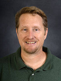
Prof. dr. Nico Van de Weghe is a full Professor of GIScience at the University of Ghent (UGent), affiliated with the CartoGIS research unit. His work bridges computer science, social science, and natural science through geospatial information studies, focusing on enabling machines to reason spatially (GeoAI). Since 2004, he has specialized in knowledge-based AI, particularly spatiotemporal reasoning and moving object analysis, with applications in animal behavior, criminology, healthcare, mobility, and sports. Van de Weghe's research emphasizes hybrid GeoAI systems combining knowledge-driven and data-driven approaches. Keywords include GeoAI, GIScience, Spatiotemporal Analysis, Moving Objects, and Data Mining. Recent publications highlight urban road network analysis, hybrid trajectory modeling, BIM semantic enrichment, and cycling safety studies using virtual reality.
Filip Biljecki is an Assistant Professor jointly appointed at the Department of Architecture within the College of Design and Engineering and the Department of Real Estate at the NUS Business School, National University of Singapore. He is the founder and principal investigator of the NUS Urban Analytics Lab and was awarded the prestigious NUS Presidential Young Professorship in 2020. With over 150 peer-reviewed publications, his research bridges geomatic engineering, geospatial technologies, and urban data science to advance digital twins and data-driven urban planning. Dr. Biljecki's educational background includes: PhD in 3D GIS (cum laude), Delft University of Technology, Netherlands (2017) MSc in Geomatics, Delft University of Technology, Netherlands (2010) BSc in Geodesy and Geoinformatics, University of Zagreb, Croatia (2008) His research interests focus on emerging urban data sources, particularly urban imagery, and their application in 3D city modeling, digital twins, and GeoAI. He explores how crowdsourcing and open science can inform cutting-edge techniques for urban sensing and analytics at city-scale. His work significantly contributes to establishing smart cities through innovative methods that integrate recent advancements in computer science, geomatics, and urban data science. Analysis of his recent publications reveals a strong focus on street view imagery applications for urban analytics, digital twin development, and geospatial AI. His research spans multiple domains including urban morphology, environmental assessment, public health applications, and urban comfort analysis. The interdisciplinary nature of his work is evident in collaborations with researchers from diverse fields, producing impactful studies that address complex urban challenges through innovative methodological approaches. His notable scientific achievements include: Annual Teaching Excellence Award (ATEA), 2025 College Educator Award AY2023/2024, 2025 Urban Informatics Paper of the Year Award, 2023 Top 2% scientists worldwide (Stanford University), 2021 Presidential Young Professorship (NUS), 2020 As an educator, Dr. Biljecki has supervised dozens of students leading to publications in leading journals and placements at top universities and organizations. He has delivered talks at over 120 universities and organizations worldwide including MIT, Stanford, Harvard, and ETH Zurich. His research is supported through various grants and affiliations including his role as Principal Investigator at the Future Cities Lab Global at the Singapore-ETH Centre. The NUS Urban Analytics Lab, which he established, brings together scholars from diverse disciplines to drive research on making cities smarter and more data-driven. The lab has developed innovative tools like ZenSVI for street view imagery analysis and has produced influential research on urban digital twins, urban morphology, and GeoAI applications. Through his leadership, the lab continues to pioneer methods that advance data-driven urban planning and smart city development.
May Yuan is the Ashbel Smith Professor of Geospatial Information Sciences at the University of Texas at Dallas (UT-Dallas), affiliated with the School of Economic, Political and Policy Sciences. She directs the Geospatial Analytics and Innovative Applications (GAIA) Lab. Her research focuses on space-time representation, GIS analytics, and environmental/social problem-solving (e.g., disaster risk, pollution, crime mapping). She holds a Ph.D. in Geography from SUNY Buffalo (1994) and B.S. from National Taiwan University (1987). Previously, she was Brandt Professor and Director of the Center for Spatial Analysis at the University of Oklahoma (1994–2014). Education: Ph.D. in Geography, State University of New York at Buffalo, 1994 M.A. in Geography, State University of New York at Buffalo, 1992 B.S. in Geography, National Taiwan University, 1987 Research Interests: Her work integrates space-time GIS databases with cognitive science, environmental modeling, and social dynamics. Key areas include: - Spatiotemporal query and analytics for geographic processes - GIS-based disaster risk assessment (wildfires, tornadoes) - Urban air quality modeling - Neurogeography and Alzheimer’s disease prediction using environmental complexity metrics - Deep mapping and spatial narratives. Grants & Partnerships: Supported by NSF, NASA, DoD, DHS, NOAA, EPA, and state agencies. Her GAIA Lab explores 'place' concepts in space-time analytics. Awards & Roles: Fellow, AAAS and AAG Editor-in-Chief, International Journal of Geographical Information Science (2017–present) Former President, Cartography and Geographic Information Society (2020–2021) and UCGIS (2011–2012) Member, NOAA Environmental Information Services Working Group (2016–2022) Labs/Teams: Leads the GAIA Lab, collaborating on geospatial AI, environmental health, and urban analytics.
Professor Qihao Weng is Chair Professor of Geomatics and Artificial Intelligence at The Hong Kong Polytechnic University, where he leads the Research Institute for Land and Space. A globally recognized scholar, he bridges geography, landscape ecology, and environmental science through innovative geospatial analytics, GeoAI, and big data methodologies. His work focuses on urban climatology, sustainability science, and human-environment interactions, with over 279 publications and 14 books. PhD, The University of Georgia MA, The University of Arizona MS, South China Normal University Professor Weng's research explores remote sensing applications for urban environmental challenges, including thermal comfort, heat islands, and land-use changes. He pioneered global-scale urban observation via the Group on Earth Observation (GEO) initiative and developed frameworks integrating geospatial technology with climate resilience strategies. Recent publications highlight advancements in GeoAI for urban thermal stress assessment, road extraction algorithms, and multi-temporal data fusion techniques. His work spans interdisciplinary domains, connecting remote sensing, urban science, and sustainability metrics across diverse climate zones. NASA Senior Fellowship (2008) Taylor & Francis Lifetime Achievements Award (2019) AAG Wilbanks Prize (2024) Lifetime Achievement in Remote Sensing Award (2024) Academia Europaea Foreign Member (2021) As Editor-in-Chief of the ISPRS Journal, Professor Weng has advanced global remote sensing discourse. His research has been supported by NSF, NASA, USAID, Microsoft, and Hong Kong Research Grant Council. He has delivered over 130 invited talks and established visiting professorships in Japan, France, and China.
Guofeng Cao is an Associate Professor in the Department of Geography at the University of Colorado . His research integrates GIScience , GeoAI , geostatistics , and remote sensing to develop advanced methodologies for analyzing heterogeneous geospatial data and modeling complex spatiotemporal patterns. Focus areas: Uncertainty-aware geographic knowledge discovery, land cover/land use dynamics, spatiotemporal bias analysis, geospatial cyberinfrastructure development Applications: Natural hazards, environmental science, public health, global change studies Recent publications emphasize generative adversarial networks for climate downscaling, neural processes for uncertainty modeling, and fusion transformers for disaster assessment. His work combines deep learning with Bayesian inference to address scalability challenges in geospatial data processing. Scientific Recognition : NASA and USDA grants for spatiotemporal research Advising : Mentoring graduate students in geospatial data science Laboratory : Leads the STAR lab (Spatiotemporal Pattern Analysis & Research)
Thierry Badard is an Associate Professor at the Department of Geomatics Sciences , Université Laval, where he also serves as Director of the Center for Research in Geospatial Data and Intelligence (CRDIG) . With over 28 years of experience in geospatial science, he leads research initiatives at the intersection of GeoAI , LiDAR processing , and smart city technologies . Director, CRDIG (2016-2022) Steering Committee Member, Big Data Research Centre (CRDM) Researcher, Institute for Intelligence and Data (IID) Research Expertise spans geospatial big data, GeoNLP, and IoT applications for digital twins. His work addresses flood risk modeling , 3D urban analytics , and environmental monitoring through AI-driven solutions. Recent publications focus on contrastive learning for LiDAR segmentation and geospatial ontologies for early warning systems. Grant Leadership includes collaborative projects on smart insurance analytics (2018-2025), Arctic bioaerosol research (2019-2025), and Quebec-Morocco digital twin partnerships (2022-2023). He has advised 15+ graduate students in geomatics and related fields.
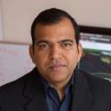
Deepak R Mishra is the Merle C. Prunty, Jr. Professor of Geography at the University of Georgia, where he serves as Professor and Head of the Department of Geography. He directs both the Center for Geospatial Research (CGR) and the UGA Small Satellite Research Laboratory (SSRL), demonstrating leadership across multiple significant research initiatives. His academic career spans geospatial science, remote sensing applications, and environmental monitoring with particular focus on coastal ecosystems. Dr. Mishra earned his PhD in Natural Resources from the University of Nebraska, Lincoln in 2006 and completed his M. Tech in Civil Engineering at the Indian Institute of Technology, Kanpur in 2002. His research focuses on combining field-based remote sensing with satellite technologies to monitor and study coastal and inland water resources. His work addresses critical environmental challenges including harmful algal blooms, salt marsh conservation, carbon sequestration in tidal wetlands, and sea level rise impacts. Dr. Mishra's research portfolio reveals strong trends in geospatial analytics for environmental monitoring, with increasing integration of artificial intelligence and small satellite technologies. His recent publications show a growing emphasis on climate change impacts on coastal ecosystems, particularly salt marsh vulnerability and carbon sequestration capacity. The work demonstrates innovative applications of remote sensing for tracking cyanobacterial blooms and developing early warning systems through platforms like CyanoTRACKER. Outstanding Service Award, SEDAAG 2019 Creative Research Medal, University of Georgia, 2017 Best Poster Award, TROPMET 2016, India Article ranked #4 in Altmetric Attention Score in Nature Climate Change 2016 Mississippi State University Faculty Research Award (2012) GRI Academic Faculty of the year (2011) Dr. Mishra has secured substantial research funding, including a $7.5 million NSF LTER grant and a $4.7 million Army Research Lab grant for autonomous navigation systems. His lab actively mentors graduate students including Tyler Lynn, Lishen Mao, and Chintan Maniyar, who contribute to projects spanning coastal monitoring, small satellite development, and AI applications. The Small Satellite Research Laboratory recently achieved a historic milestone with the launch of SPOC satellite to the International Space Station, marking UGA's first satellite deployment.
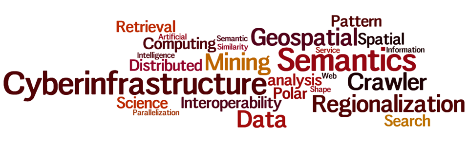
Wenwen Li is a Professor at Arizona State University (ASU), holding roles as Director of the CyberInfrastructure and Computation Intelligence (CICI) Lab and Research Director at the Spatial Analysis Research Center (SPARC). She specializes in geographic information science, cyberinfrastructure, and geospatial big data. Her work focuses on developing intelligent cyberinfrastructure for environmental and urban studies, leveraging AI and semantic technologies. Li's research has been supported by NSF, USGS, and Google.org, among others. Education: Ph.D. in Earth System and Geoinformation Science (George Mason University, 2010), M.S. in Signal and Information Processing (Chinese Academy of Sciences, 2007), and B.S. in Computer Science (Beijing Normal University, 2004). Research Interests : Cyberinfrastructure, spatial-temporal data mining, semantic interoperability, GeoAI applications in climate science, and urban studies. Her lab, CICI, pioneers projects like the Arctic Permafrost Thaw analysis and disaster response systems. Awards : 2023 AAG and UCGIS Fellowships, 2021 NSF Mid-Career Award, 2015 NSF CAREER Award, and the 2024 Greg Leptoukh Lecture Award (AGU). She chairs AAG's Cyberinfrastructure Specialty Group and serves on editorial boards of key journals. Grants & Service : Leads NSF-funded projects on GeoAI, climate modeling, and Arctic science. Active in AAG leadership roles and global initiatives like the Polar Cyberinfrastructure Portal. Recruits Ph.D. students in Geography and Computer Science. Labs & Teams : Directs the CICI Lab, advancing interdisciplinary GeoAI research and training. Collaborates with global partners on environmental and computational geography projects.
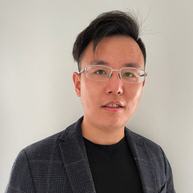
Di Zhu is an Assistant Professor of Geographic Information Science at the University of Minnesota's Department of Geography, Environment and Society. He directs the Geospatial Data Intelligence (GeoDI) Lab, focusing on GeoAI and social sensing to analyze human-environment interactions in urban systems, public health, and socioeconomic dynamics. His educational background includes a PhD in Cartology and GIScience from Peking University, complemented by a BSc in GIS and a BA in Economics from the same institution. Key research interests include spatial regression models, human mobility patterns, and GeoAI applications. He has collaborated on projects funded by NIH, NSF, and other agencies, exploring topics like spatiotemporal data imputation, urban flow analysis, and pandemic spatial dynamics. His work bridges traditional GIScience with modern machine learning techniques, emphasizing actionable insights from big geospatial data. Teaching focuses on advanced GIS, numerical spatial analysis, and urban sensing. He actively mentors students through the University of Minnesota's Master of GIS program and serves on academic boards including CPGIS. Current projects include analyzing Twin Cities mobility networks and developing intelligent spatial prediction frameworks.
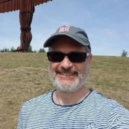
Jeremy Crampton is an Adjunct Professor focusing on the societal and political implications of geolocational technologies. He is a leading scholar in critical cartography, surveillance studies, and spatial big data governance. His work explores how technologies like AI, blockchain, and geoweb platforms shape everyday life and power dynamics. He is a Fellow of the Alan Turing Institute and Royal Geographical Society (UK), and a member of the American Association of Geographers. His research spans over three decades, including a seminal 2010 monograph on critical cartography and ongoing projects on counter-GeoAI. He is currently writing The Map and the Spyglass: The New Geographical Analytics of Everyday Life , to be published by Verso. Crampton teaches GEOG 3146 - Political Geography , addressing how spatial technologies influence political structures and governance. Key themes in his work include algorithmic decision-making, geospatial surveillance ethics, and the interplay between technology and sovereignty. His recent articles analyze smart cities, festival security, and the societal impacts of locational data. He critiques techno-utopian narratives, advocating for equitable and transparent geospatial systems. Scientific awards include recognition for his contributions to critical GIS theory and digital geography. His interdisciplinary approach bridges human geography, technology studies, and policy analysis, influencing debates on data governance and spatial justice.
Dr. Hannah Sirianni is an Assistant Professor of Geographic Information Science & Technology in the Department of Geography, Planning & Environment at East Carolina University. She leads the Coastal Geography & Terrain Analysis Lab, which specializes in advanced mapping, monitoring, and modeling of coastal environments to support sustainable development and resilience decision-making. Her research employs cutting-edge geospatial technologies including airborne/terrestrial laser scanning, RTK-GNSS, sUAS, and geospatial AI techniques. Education: Ph.D. in Geosciences from Florida Atlantic University M.A. in Geography from University of Hawaiʻi at Mānoa B.A. in Geography (Highest Honors) from University of Hawaiʻi at Mānoa Research Focus: Dr. Sirianni's research integrates geomatics, GeoAI, OBIA, SfM photogrammetry, and Monte Carlo simulation to address coastal challenges. Her work focuses on shoreline dynamics, bluff erosion, living shoreline effectiveness, and coastal carbon capture monitoring. Current projects include the Sugarloaf Island Restoration and monitoring olivine sand placement for climate mitigation. Publication Trends: Her recent publications demonstrate strong focus on coastal vulnerability assessment, LiDAR/UAS applications, shoreline classification, storm impact quantification, and machine learning applications in geospatial analysis. Research consistently addresses practical coastal management solutions. Grants & Projects: Co-PI for NOAA Sea Grant/USCRP project: "Co-developing a community and data-driven framework for coastal protection decision-making" Living shoreline restoration research at NC Aquarium at Pine Knoll Shores Coastal Carbon Capture™ monitoring using UAS technology Student Advising: Dr. Sirianni actively mentors graduate and undergraduate researchers in coastal geospatial applications. Current advisees include 3 MS students and 1 PhD candidate, with 12 former students now working in environmental science and GIS positions. Lab Operations: The Coastal Geography & Terrain Analysis Lab conducts extensive fieldwork including sUAS surveys, RTK-GNSS measurements, and bathymetric mapping, supported by collaborative partnerships with NC Coastal Federation and other institutions.
Ali Mansourian is a Professor of Geomatics at Lund University's Department of Physical Geography and Ecosystem Science, where he serves as Director of the Lund University GIS Centre and Coordinator of the GIS & RS Master Programme. He is actively involved with the United Nations Global Geospatial Information Management (UN-GGIM) Academic Network and previously served on the European Association of Geographic Information Laboratories in Europe (AGILE) council. His academic leadership spans large-scale international research initiatives and capacity-building projects funded by Erasmus+ and SIDA. Mansourian's research focuses on Geospatial Artificial Intelligence (GeoAI), Spatial Data Infrastructures (SDI), and Multi-Criteria Decision Analysis (MCDA) using multi-objective optimization techniques. His work extends to applying GIS in epidemiology and public health, disaster risk management, land-use planning, climate change, environmental management, and sustainability. His research portfolio demonstrates a strong interdisciplinary approach, bridging geospatial technology with critical societal challenges. His recent publications reveal a clear trend toward integrating advanced machine learning techniques with geospatial analysis, particularly in health applications, environmental monitoring, and climate change impacts. The research shows increasing emphasis on spatial ensemble learning, remote sensing applications, and the development of GeoAI tools that make geospatial analysis more accessible through natural language interfaces. His work spans multiple continents, with significant contributions in Africa, Europe, and Asia. Mansourian has extensive experience supervising PhD students and postdoctoral researchers, though specific student names aren't listed in the provided materials. He has coordinated numerous large-scale international projects including Geo-Academy, INTEGRAL, CADEO, and SWEMENA, demonstrating significant grant acquisition and management expertise. His leadership extends to evaluating proposals for major European research grant programs and serving as an invited evaluator for PhD theses. As Director of the Lund University GIS Centre and active member of multiple international networks, Mansourian leads a dynamic research environment focused on advancing geospatial technologies and their applications. His teams work at the intersection of traditional GIScience and emerging artificial intelligence approaches, creating innovative solutions for complex spatial problems across multiple domains including public health, environmental management, and sustainable development.
John Derek Morgan is an Associate Professor in the Department of Earth and Environmental Sciences at the University of West Florida, within the Hal Marcus College of Science and Engineering. He serves as the primary faculty for the online Master of Science in GIS Administration program, contributing significantly to geospatial education and research. His work bridges urban environmental geography, GIS, cartography, and public policy. PhD in Geography, Florida State University MS in Management Information Systems, University of Central Florida BA in Economics (with Computer Science minor), University of Central Florida Dr. Morgan's research centers on the application of advanced geospatial methodologies to urban and environmental challenges. His work spans participatory mapping, crime mapping using time-geographic models, hazard modeling, land use planning, and cartographic visualization. He emphasizes user-centered design in Web GIS and explores how spatial tools can promote safer communities and equitable decision-making. His projects often integrate satellite imagery, social vulnerability indices, and community input to inform resilience and policy. The recent publications reflect a strong trend in applying GIS to social and environmental issues, including disaster response, urban park safety, illegal logging detection using GeoAI, and wildfire monitoring. His work combines technical innovation in geovisualization with real-world applications in public safety, environmental justice, and urban sustainability. Scientific Awards: NSF Doctoral Dissertation Research Grant #0927850 Dr. Morgan advises graduate students in the MS GIS program and has been involved in significant research grants, including the Florida Sea Grant 2024 project focused on training GIS graduates for coastal resilience. His collaborations span interdisciplinary teams, including environmental scientists, urban planners, and computer scientists. He has also contributed foundational content to the UCGIS Geographic Information Science & Technology Body of Knowledge. He leads research initiatives involving Web GIS development, hazard modeling post-hurricanes, and participatory mapping for community engagement. His lab work includes the use of satellite imagery, Bayesian networks for infrastructure failure, and deep learning for environmental monitoring. Future work continues to focus on transboundary viewshed changes, GeoAI applications, and improving spatial tools for public decision-making.
M. Farnaghi is an Assistant Professor at the University of Twente's Faculty of Geo-Information Science and Earth Observation (ITC), specifically within the Department of Geo-Information Processing (GIP). Their research focuses on the integration of artificial intelligence (AI) and geospatial data processing, with expertise in GeoAI, semantic web technologies, machine learning (ML), and deep learning (DL). Develops automated geospatial data processing workflows using AI Specializes in spatiotemporal modeling for environmental monitoring, disaster management, and spatial epidemiology Current research includes Large Language Models (LLMs), MLOps, and explainable AI in geospatial contexts Explores blockchain applications for geospatial data security and accountability
Varuni Jayasooriya is an Assistant Professor at the School of Environment and Sustainability (SENS), University of Saskatchewan. Her research focuses on Geospatial Artificial Intelligence (GeoAI), urban sustainability, and the interplay between urban design and microclimates. She holds a PhD in Environmental Engineering from Victoria University, Australia, and a BSc in Earth Resources Engineering from the University of Moratuwa, Sri Lanka. Research Interests Dr. Jayasooriya explores innovative solutions for green and smart cities through data-driven approaches. Her work addresses urban heat islands, microclimate dynamics, and the role of green infrastructure (e.g., trees, green roofs) in enhancing thermal comfort. Recent studies include tropical urban canyon thermal environments and pavement material impacts on urban climates. Publications Her recent works (2021–2024) span urban climate modeling, green infrastructure efficacy, and smart city technologies. Key themes include GeoAI applications, sustainable rooftop technologies, and tropical urban bioclimatic adaptations. Professional Activities No specific grants or awards listed. She is affiliated with SENS and contributes to interdisciplinary urban sustainability research.