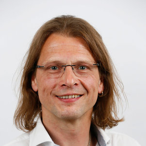
Dr. Olle Järv is an Academy Research Fellow at the University of Helsinki's Department of Geosciences and Geography. As Docent in Human Geography and holder of a joint PhD from University of Tartu and Ghent University, his research focuses on leveraging big data sources like mobile phone records and social media for analyzing human mobility patterns across European cross-border regions. Key research areas: Spatial segregation, urban diversity, transnationalism, and pandemic-induced mobility changes Current projects: BORDERSPACE (2020-2025) – Mapping transnational spaces through mobility data MOBI-TWIN (2023-2026) – Regional mobility patterns in twin transitions WinWin4WorkLife (2024-2027) – Sustainable cross-border remote work His methodological innovations include developing tools for analyzing social media data and mobile phone records to study urban dynamics. Recent recognitions include the 2024 Research Council of Finland Award and 2021 Best Paper Award from Journal of Location Based Services.
Professor Hanumant Singh leads the Electrical and Computer Engineering department at Northeastern University, with a joint appointment in Mechanical and Industrial Engineering , and serves as Program Director for the Master of Science in Robotics. He earned his Ph.D. from MIT/WHOI Joint Program in 1995 and has conducted over 60 expeditions globally, focusing on marine geology, polar studies, and coral reef ecology. His research emphasizes field robotics , including SLAM, underwater manipulation, and imaging in extreme environments. He developed the Seabed AUV and Jetyak ASV , widely used in scientific research. His labs include the Field Robotics Lab and the Institute for Experiential Robotics . Research Interests: Machine Learning for Fisheries SLAM with dynamic objects Underwater imaging and manipulation Autonomous surface and aerial systems Polar and marine robotics Awards: ICRA Best Student Paper Award, IEEE Oceanic Engineering Society Distinguished Faculty Award (2025), Lifetime Achievement Award (2022), and IEEE Fellow status. His work has been featured in Nature Geoscience , Polar Biology , and media outlets like WGBH. Students & Collaborations: Advises students like Srinidhi Pattala (MS Robotics) and Dennis Giaya (PhD Computer Engineering). Collaborates with institutions on projects such as Antarctic sea ice thickness estimation and deep-sea submersible missions.
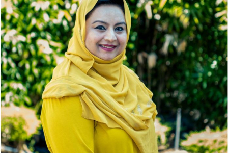
Dr. Farha Sattar is a Lecturer in Education (Mathematics) at the Faculty of Arts and Society, Charles Darwin University. With over thirty years of teaching experience in Mathematics, Science education, GIS, Remote Sensing, and e-Learning technologies at undergraduate and postgraduate levels, Dr. Sattar brings extensive expertise to her academic role. She holds a PhD in Geospatial Science from Charles Darwin University, focusing on Spatial Mathematical Modelling for 3D Gully Mapping and Erosion Quantification. Her educational background includes: PhD in Geospatial Science (Three Dimensional Gully Mapping and Erosion Quantification within a Geoinformatics Framework), Charles Darwin University (2012) Prior academic experience at several Asian and European universities Dr. Sattar's research spans multiple interdisciplinary fields with a strong focus on the intersection of education and technology. Her primary research interests include Mathematics Education, STEM Education, Geoscience Education, Spatial Mathematical Modelling, Drone Technology, Remote Sensing, Geographic Information Systems, and Innovative Pedagogies such as experiential learning and inquiry-based approaches. She has developed expertise in cognitive development, particularly in fostering critical and creative thinking skills through iSTEM approaches. An analysis of Dr. Sattar's recent publications reveals a consistent trajectory toward integrating emerging technologies like drones, augmented reality, and geospatial artificial intelligence into educational contexts. Her work demonstrates a progression from foundational geospatial research on erosion mapping to innovative applications in STEM education. Recent publications increasingly focus on drone technology for educational purposes, spatial data infrastructure for policy development, and computational thinking development through technology-enhanced learning. Dr. Sattar has received numerous accolades for her contributions to education and research: NT Science Week Awards – Inspired NT STEM Hero of the Year award (2021) Long Service Recognition Award (2023) Finalist, CDU Alumni Award (2023) Multiple Best Presentation Awards (2008, 2010, 2017) Australian College of Educators - 2021 College Medal Nominee As a supervisor, Dr. Sattar mentors postgraduate research students including Ayesha Farhan, who is working on "A Framework for Cognitive Development: Fostering Critical and Creative Thinking Skills, Using iSTEM Approach." She actively secures research funding through various projects such as "DBELaSTEM: Drone-Based Experiential Learning and STEM Education," "STEM_D & VR: Youth STEM Learning and Empowerment with Drones and VR," and "CodProg Drone Lab." Her research is supported by grants from NT Government projects and other external funding sources. Dr. Sattar leads the CodProg Drone Lab, an innovative research space exploring drone technology applications in education. She is a certified drone pilot and aeronautical radio operator, which enables her to bridge theoretical knowledge with practical applications. Her work with the "Flying Forward: Drones, STEM Equity, and Indigenous Empowerment" initiative demonstrates her commitment to community engagement and addressing educational disparities through technology.
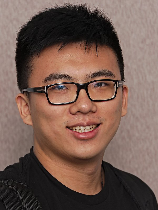
Tiancheng Zhao is a principal researcher at the Binjiang Institute of Zhejiang University and founder of the Om Artificial Intelligence Laboratory (Om AI Lab), dedicated to frontier open multimodal AGI research for building next-generation agents that transform work and life through advanced human-machine interaction. His academic credentials include: Ph.D. in Computer Science from Carnegie Mellon University (2016-2019) under Prof. Maxine Eskenazi, Prof. Louis-Philippe Morency, Prof. William W. Cohen, and Dr. Dilek Hakkani-Tur, with pioneering dissertation “Learning to Converse With Latent Actions” in end-to-end generative conversational models M.S. in Computer Science from Carnegie Mellon University (2014-2016) B.S. in Electrical Engineering from UCLA (2010-2014) with Summa Cum Laude, focusing on speech signal processing under Prof. Abeer Alwan Dr. Zhao’s research centers on multimodal foundation models and agents, tackling three core challenges: Multimodal Models for cross-modal representation learning in high-dimensional data, Learning to Learn for effective skill acquisition from diverse signals (supervised labels, rewards, meta-learning), and AI Agents for open-world understanding and complex decision-making. His work bridges computer vision, natural language processing, and real-world applications including healthcare analytics and remote sensing. Analysis of his 50+ publications reveals accelerating innovation in multimodal large language models (2024-2025), with emphasis on stable vision-language architectures (VLM-R1), agent orchestration frameworks, and domain-specific applications in geospatial analysis and healthcare. Key trends include solving long-tail distribution challenges in satellite imagery, developing human-like zooming capabilities for multimodal LLMs, and creating unified benchmarks for autonomous GUI testing. His scientific recognition includes: National Breakthrough Technology Award by Ministry of Science and Technology (2021) Microsoft Research Best & Brightest PhD (2018) BEST PAPER AWARD at SIGDIAL 2018 Best Paper Nomination at SIGDIAL 2016 Top 1 Outstanding Bachelor of Science Award at UCLA (2014) As Om AI Lab founder, Dr. Zhao leads research teams developing computational building blocks for human-AI collaboration. While specific student mentorship details aren’t public, his extensive publication record with junior co-authors indicates active research supervision. Current projects focus on practical system implementations for real-world multimodal agent deployment across diverse domains.
Prof. Hans van Lint is a Professor of Traffic Simulation and Computing at Delft University of Technology (TU Delft), where he holds the Anthony van Leeuwenhoek Chair since 2013. He is affiliated with the Department of Transport & Planning within the Faculty of Civil Engineering and Geosciences. His research focuses on the intersection of traffic flow theory, data analytics, and traffic simulation, with applications in estimating and predicting traffic states in networks. He has supervised numerous PhD students and contributed to valorization projects translating research into practical solutions. Van Lint earned his MSc in Civil Engineering in 1997 and returned to TU Delft for his PhD, which he completed in 2004 on 'Freeway Travel Time Prediction.' He has held roles including Assistant Professor (until 2009), Associate Professor, and has served as Director of Education for the MSc Transport, Infrastructure and Logistics program from 2010–2016. His research interests include traffic simulation frameworks, data assimilation techniques, and the development of tools for traffic state estimation. He has authored influential papers on topics such as microscopic traffic modeling, congestion pattern analysis, and macroscopic fundamental diagrams. His work emphasizes bridging theoretical models with real-world applications, enhancing traffic management and infrastructure planning. Van Lint teaches courses like 'Transport & Planning' and 'Interdisciplinary Fundamentals,' reflecting his commitment to both research and education. He actively contributes to TU Delft's labs, including the Traffic Dynamics, Modelling and Control Lab, advancing interdisciplinary approaches to mobility challenges.
Dr Duncan Smith is an Associate Professor in GIS and Visualisation at the Centre for Advanced Spatial Analysis (CASA) at University College London (UCL). He serves as Programme Co-Director for the MSc Urban Spatial Science, focusing on digital visualisation and Geographical Information Systems (GIS) education. His research emphasizes urban sustainability, transport accessibility, and interactive urban visualisation, with a particular interest in global mega-cities like London, Singapore, and São Paulo. Dr Smith holds a PhD from UCL (2011), an MSc from the University of Edinburgh (2005), and a BA (2003). His recent projects include leading the ESRC-funded Driving Urban Transitions project (2024) exploring sustainable travel in small cities and outer metropolitan areas. Previously, he was Co-Investigator on the SIMETRI project (NSFC JPI Urban Europe) analyzing urban sustainability in London, the Randstad, and China's Greater Bay Area. His research interests span urban visualisation techniques, transport equity analysis, and polycentric urban development. Key areas include GIS-driven urban modelling, accessibility metrics, and the intersection of housing policy with sustainable urban form. His interactive visualisations, available on citygeographics.org , showcase innovative approaches to spatial data presentation. Dr Smith's work consistently addresses global sustainability challenges through geospatial methodologies. Recent studies highlight inequalities in transport accessibility and the spatial implications of urban policies. Upcoming projects will further investigate small-city mobility dynamics using multi-national collaborations with Amsterdam and Lisbon researchers.
Iain Stewart is Professor of Geoscience Communication at the University of Plymouth, holding the UNESCO Chair in Geoscience and Society. He directs research at the Sustainable Earth Institute and serves as Communications Lead for the UKRI Tomorrow's Cities initiative targeting disaster risk reduction in urban environments. His research bridges Earth science and societal concerns through three key areas: 1) Geoscience communication strategies for complex issues like climate change and energy, 2) Cultural responses to geohazards using film and gaming technologies, and 3) Public perceptions of geological resources and subsurface environments. His work applies cognitive and social science frameworks to geoscience communication challenges. Stewart maintains an extensive public engagement profile through BBC television documentaries including 'Earth: The Power of the Planet' and as science consultant for 'Seven Worlds, One Planet'. He serves as President of the Royal Scottish Geographical Society and Devon Wildlife Trust while advocating for geoscience education globally. His research has been recognized with numerous international awards including an MBE and honors from the Geological Society of America and American Geophysical Union.
Ghassan AlRegib is the John and Marilu McCarty Chair Professor in the School of Electrical and Computer Engineering at Georgia Institute of Technology. He directs the Omni Lab for Intelligent Visual Engineering and Science (OLIVES), the Center for Energy and Geo Processing (CeGP), and previously led Georgia Tech's MENA initiatives (2015-2018). His research spans machine learning, image processing, and seismic interpretation with real-world applications in autonomous vehicles, medical imaging, and subsurface analysis. His research focuses on trustworthy AI systems through three pillars: enhancing interpretability, improving robustness/generalizability, and tackling domain-specific challenges. Key interests include human-in-the-loop frameworks, uncertainty quantification, explainable AI, and physics-driven learning. The OLIVES lab pioneered modern machine learning applications in seismic interpretation and developed open-source datasets for geological fault analysis. Dr. AlRegib's scientific contributions include over 270 publications, multiple U.S. patents, and leadership roles as Technical Program co-Chair for ICIP 2020/2024. His work demonstrates significant impact through awards like the IEEE Fellow designation (2022) and multiple best paper awards at premier conferences. IEEE Fellow (2022) 2023 EURASIP Best Paper Award 2019 ICIP Best Paper Award 2017 Denning Faculty Award for Global Engagement CSIP Research & Service Awards (2003) He has advised numerous PhD students including Dr. Ashraf Alattar (now Auburn professor) and Dr. Zhiling Long (Kennesaw State faculty). His lab structure emphasizes collaborative teams comprising postdocs, senior/junior PhD students, and undergraduates working on high-impact problems from autonomous systems to medical diagnostics. Current research thrusts include trustworthy neural networks, human-in-the-loop frameworks, and deployment of machine learning in seismic interpretation and ophthalmology.
Kathy Fontaine serves as Senior Lecturer in Information Technology and Web Science at Rensselaer Polytechnic Institute and Program Manager for the RPI-IBM AI Research Collaboration. She joined RPI in 2014 after 25 years at NASA Goddard Space Flight Center where she developed international data access policies through CEOS WGISS, GEO, and USGEO. Her educational background includes: B.S. in Physics with Astrophysics Option from New Mexico Institute of Mining and Technology (1984) M.A. in Science, Technology and Public Policy from The George Washington University (2002) Ph.D. in Public Policy and Public Administration from Walden University (2013) Dr. Fontaine's research integrates data science policy with ethical frameworks, focusing on international data sharing cultures and volunteer organization dynamics. She develops courses like Big Data Policy and Ethical Informatics that address data scientists' societal responsibilities. Her work examines how policy implementations affect global earth observation systems and research data ecosystems, with particular attention to cross-cultural collaboration challenges in scientific consortia. Analysis of her publications reveals strong interdisciplinary connections between earth sciences and computer science, with emerging trends in data dexterity training, knowledge graph applications for social equity, and mineral inventory data legacies. Her research increasingly bridges technical data infrastructure with ethical considerations in data sharing. Dr. Fontaine actively contributes to scientific communities through the Earth Science Information Partners (ESIP), where she serves on GEO's Programme Board, and maintains affiliations with AGU, ACM Web Science, IEEE GRSS, and IEEE SSIT. Her current leadership in the RPI-IBM AI Research Collaboration extends her mission to develop responsible AI frameworks.
Jun.-Prof. Dr. Annette Rudolph is an Assistant Professor leading the AI and (Climate-Induced) Land Use Change research group at TU Berlin's Institute of Landscape Architecture and Environmental Planning. She holds a Diplom in Mathematics (TU Berlin, 2011) and a PhD in Meteorology (FU Berlin, 2018), with a habilitation thesis on geophysical fluid dynamics and data-driven methods (2023). Her research integrates AI, climate science, and geophysical fluid dynamics. Academic Roles: Head of FG KI und Landnutzungswandel (since 2023), Postdoc in SFB 1114 (2014–2022) Research interests focus on AI applications in environmental sciences, clouds-climate interactions, and fluid dynamics. Her work bridges theoretical meteorology with data science, including machine learning for precipitation modeling and climate analysis. Publications emphasize AI-driven climate modeling, geostatistical methods, and atmospheric dynamics. Notable contributions include a 2024 paper on deep learning for precipitation nowcasting and a 2023 study on CAPE-precipitation relationships using machine learning. She developed e-learning resources on geodata analysis using Python and R, and led DAAD-funded research in Oslo (2022). Current projects involve AI-driven land-use change analysis and climate impact modeling.
Behzad Alaei serves as an Associate Professor in the Section for Study of Sedimentary Basins within the Department of Geosciences at the University of Oslo's Faculty of Mathematics and Natural Sciences. His office is located in room K38 of the Geology Building at Sem Sælands vei 1, 0371 Oslo, with a professional email contact at behzad.alaei@geo.uio.no. Dr. Alaei maintains an active research profile with publications spanning from 2005 to the present, demonstrating his ongoing contributions to geological sciences. Dr. Alaei's research spans multiple critical areas within structural geology and sedimentary basin analysis, with particular expertise in fault zone architecture, seismic interpretation techniques, and CO2 storage site assessment. His work bridges theoretical geological concepts with practical applications in petroleum geology and carbon sequestration. A significant portion of his research focuses on the Norwegian Barents Sea region, where he has conducted extensive studies on normal fault systems and their geometric characteristics. His recent work increasingly integrates machine learning and deep learning approaches with traditional geological analysis, reflecting the evolving nature of geoscience research methodology. The analysis of Dr. Alaei's publication record from 2018-2024 reveals a strong thematic continuity in fault characterization research, with progressive incorporation of advanced computational methods. Early publications focused primarily on traditional structural analysis of fault systems in sedimentary basins, while more recent work demonstrates increasing integration of machine learning techniques for fault detection and characterization. A notable trend is the application of these geological insights to practical challenges in carbon capture and storage, particularly regarding fault risk assessment for CO2 storage sites in the North Sea region. His collaborative work with Anita Torabi appears consistently throughout this period, suggesting a strong research partnership. Dr. Alaei maintains an active research program with multiple ongoing projects related to sedimentary basin analysis and fault characterization. His work appears to involve significant collaboration with both academic and industry partners, particularly in the context of CO2 storage research. While specific grant details aren't provided in the available information, his consistent publication record across multiple high-impact journals suggests successful funding of his research activities over the past two decades.
Matthew J. Cracknell is a Senior Lecturer in Geodata Analytics at the University of Tasmania's School of Natural Sciences, specializing in Earth Sciences. He holds a PhD in Computational Geophysics (2014) and BSc (Hons) in Geophysics (2009), both from the University of Tasmania. His research integrates geoscience with machine learning to address challenges in mineral exploration, environmental remediation, and sustainable resource management. Key focuses include automated detection of geological features in drillcore imagery, decarbonization of energy systems via ore deposit discovery, and legacy mine waste characterization. Cracknell leads the CODES Research Program 6 (Geophysics and Computational Geosciences) and Module 2 of the AMIRA P1249 project. He has secured significant industry and government funding, including projects with Boliden AB, Anglo American, and the Tasmanian Government. His work emphasizes collaboration with mining partners and agencies like Geoscience Australia and Mineral Resources Tasmania. Teaching roles include developing courses on the mining value chain, climate resilience, and geodata analytics. As Graduate Research Coordinator, he promotes HDR student well-being and supervises over 20 doctoral and masters students. Awards include the 2019 Oz Minerals Explorer Challenge Prize. Key affiliations include the International Association for Mathematical Geosciences, Australian Society of Exploration Geophysicists (Tasmanian Branch Secretary), and Geological Society of Australia.
Dr. Zhenyu Zhang is a Lecturer in Surveying and Spatial Science at the School of Surveying and Built Environment , University of Southern Queensland (Springfield Campus). With over 20 years of tertiary teaching experience, he specializes in geomatic engineering, GIS programming, remote sensing, and machine learning applications for geospatial data analysis. His work focuses on LiDAR technologies (terrestrial and airborne) for environmental management, 3D modeling, and high-resolution DEM generation. Member of Surveying and Spatial Science Institute (SSSI), Australia Member of Modelling and Simulation Society of Australia and New Zealand Member of International Global Navigation Satellite Systems (IGNSS) His research integrates geomatics with environmental geoscience, emphasizing forest biomass estimation, carbon accounting, and BIM development using laser scanning. He teaches foundational and advanced courses in surveying, geodetics, GIS programming, and research projects at both undergraduate and postgraduate levels.
Linda Bailey Hayden is a distinguished Professor and Associate Dean of Mathematics and Computer Science at Elizabeth City State University (ECSU), where she has made significant contributions to mathematics education and geoscience applications since 1980. Originally from Portsmouth, Virginia, she overcame segregation barriers to pursue her academic career, earning degrees from Virginia State University, University of Cincinnati, Old Dominion University, and American University. At ECSU, she founded the Center of Excellence in Remote Sensing Education and Research to increase minority participation in environmental science. Dr. Hayden's research interests span mathematics education, applications of mathematics in geoscience, remote sensing technologies, and environmental science. Her work uniquely bridges theoretical mathematics with practical applications in climate science, ice sheet monitoring, water quality assessment, and Antarctic research. She has pioneered educational approaches that connect mathematics with real-world environmental challenges, particularly through NASA-related programs and the GLOBE initiative. Her publication record reveals a strong focus on mentorship, educational outreach, and interdisciplinary research connecting mathematics with environmental science. The most recent publications demonstrate her ongoing commitment to developing innovative approaches for engaging students in scientific research, particularly through hackathons, remote sensing applications, and climate change education. Her work consistently emphasizes increasing participation of underrepresented groups in STEM fields. Presidential Award for Excellence in Science, Mathematics, and Engineering Mentoring (2003) Emerald Honors for Educational Leadership from US Black Engineer magazine Mathematically Gifted & Black Black History Month 2017 Honoree An Antarctic ice shelf was named after her institution by the Advisory Committee on Antarctic Names Dr. Hayden has dedicated her career to mentoring minorities and women in STEM fields through various programs including the Nurturing ECSU Research Talent (NERT) initiative, the Home-Institution Support Program, and numerous NASA-funded educational projects. Her grant history reflects strong partnerships with federal agencies to offer interdisciplinary training in remote sensing and environmental science. She has established multiple educational partnerships focused on enhancing undergraduate involvement in research, particularly for underrepresented students. As founder of the Center of Excellence in Remote Sensing Education and Research at ECSU, she has built a significant infrastructure for geoscience research and education, developing cyberinfrastructure for remote sensing of ice sheets and creating numerous educational programs from middle school through undergraduate levels. Her work has connected ECSU with major research institutions and federal agencies, establishing the university as a hub for remote sensing education in minority-serving institutions.
Rimjhim Aggarwal is a Professor at the School of Sustainability, Arizona State University (ASU). Her research focuses on sustainability governance, climate risks, and the food-energy-water nexus, with emphasis on urban systems, social-ecological dynamics, and policy design. She explores how institutions and governance structures adapt to environmental challenges, particularly in rapidly urbanizing regions. Her work integrates interdisciplinary approaches, combining policy analysis, systems modeling, and participatory methods. Notable contributions include frameworks for nexus governance in Phoenix and Cape Town, studies on circular economy solutions for waste management, and analyses of climate adaptation strategies in agriculture. She also emphasizes education innovation through virtual field experiences to democratize geoscience learning. Key research themes include institutional fit in governance systems, climate risk integration in development goals, and equitable resource management in urbanizing contexts. Her publications span over three decades, reflecting deep engagement with global sustainability challenges such as biodiversity loss, water scarcity, and socio-environmental justice.