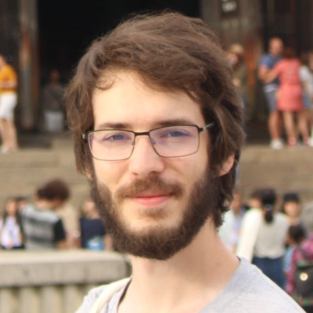
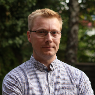
Othmar Frey is a Senior Scientist and Lecturer at ETH Zurich's Department of Civil, Environmental and Geomatic Engineering. He leads the research group on SAR Remote Sensing Technology and is associated with the Chair of Earth Observation and Remote Sensing. His work focuses on developing advanced radar systems and applications, including car-borne and UAV-based SAR for deformation monitoring, multi-static SAR constellations, and tomographic profiling of snow and forest structures. Frey holds a Ph.D. (2010) and M.Sc. (2002) from ETH Zurich and the University of Zurich. Education: Ph.D. (Hons.) in Science (2010) from the University of Zurich, Switzerland; M.Sc. (Hons.) in Geomatic Engineering (2002) from ETH Zurich. Research interests span Synthetic Aperture Radar (SAR) signal processing, interferometry, tomography, and remote sensing applications for environmental and civil engineering challenges. Notable projects include railway substructure monitoring via TerraSAR-X data, development of compact SAR systems (GLSAR/GSSAR), and the Alpine Measurement Lab for studying mass movements. His team collaborates with agencies like ESA, Innosuisse, and the Swiss Federal Office for the Environment. Advising: Supervises PhD students like Magnus Heimpel and Fanyun Xu, with former advisees now at EMPA, Leica Geosystems, and ITU. Research teams include the Earth Observation and Remote Sensing group at ETH Zurich.
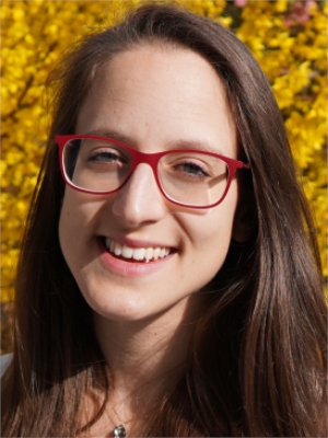
Dr. Jing Huo is a Researcher and PhD candidate at the Chair of Ecological Systems Design, ETH Zurich, within the Department of Civil, Environmental and Geomatic Engineering. She holds a BSc in Environmental Science and Engineering from Shanghai Jiao Tong University (2009-2013) and an MSc in Environmental Engineering from ETH Zurich (2013-2016). Prior to her PhD, she worked as a Sustainability Engineer in China's chemical industry (2016-2021). Her research focuses on life cycle assessment of renewable feedstocks and chemicals, with emphasis on decarbonization strategies, CO2 utilization, and environmental impacts of industrial transitions. Key projects include assessing decarbonization pathways for the chemical industry and waste-to-energy sectors, and evaluating the feasibility of net-zero transitions using CO2 as feedstock. She has contributed to studies on mercury emissions in urban environments and the regional sourcing of lignocellulose residues for sustainable chemical production. Her doctoral thesis, completed in 2024, examines global plastic industry transitions through alternative feedstocks' availability and environmental impacts. Jing collaborates with experts like Prof. Stefanie Hellweg and has published in journals such as Journal of Industrial Ecology and Environmental Science & Technology . Her work bridges technical innovation and environmental stewardship, addressing challenges in industrial sustainability and climate change mitigation.
Christopher Oberschelp is a Lecturer at ETH Zurich's Department of Civil, Environmental and Geomatic Engineering, specializing in environmental systems design. His research develops high-resolution models of industrial systems and global supply chains to assess environmental impacts and sustainability pathways. Current projects focus on sustainable materials, circular economy strategies, and life cycle assessment of critical resources like lithium for batteries. He serves as a life cycle inventory expert for the ecoinvent database and teaches courses in environmental engineering and systems analysis. Research integrates: Life cycle assessment of emerging technologies Industrial ecology approaches Regionalized environmental impact modeling Resource efficiency strategies
Nicolas Audebert is a Computer Vision and Machine Learning researcher working as a junior research director at the French National Institute of Geographic and Forest Information (IGN) in the LASTIG laboratory, STRUDEL team. He is currently on leave from his position as Associate Professor of Computer Science at the Conservatoire national des arts et métiers (Cnam) where he was part of the Vertigo team. His research spans computer vision, machine learning, and Earth Observation with applications in remote sensing and video games. Dr. Audebert earned his PhD in Computer Science from ONERA and IRISA in 2018, followed by an MEng in Computer Science from Supélec and an MSc in Human-Computer Interaction from Université Paris-Sud in 2015. In May 2025, he successfully defended his habilitation à diriger des recherches (HDR) titled "Learning representations from observations". His research focuses on representation learning , where he develops methods to create abstract representations of raw data that allow computers to manipulate high-level concepts numerically. In Earth Observation , he processes and makes sense of large volumes of satellite data for land cover mapping, change detection, and image interpretation. His work in machine learning for games explores how to use reinforcement learning to generate diverse and challenging AI in video games. Additional research interests include generative models, multimodal learning, and domain adaptation techniques. His recent publications demonstrate expertise in cross-sensor learning, super-resolution of satellite imagery, diffusion models for Earth Observation, and robust image retrieval systems. His work bridges theoretical advances in deep learning with practical applications in geospatial analysis, with a particular focus on developing methods that work across different sensor types and environmental conditions. Outstanding Reviewer for ECCV 2024 Outstanding Reviewer for BMVC 2021 Outstanding Reviewer for ICCV 2021 Best Benchmarking Contribution Award at GEOBIA 2016 2nd best student paper award at JURSE 2017 Google Research Scholar Program gift Dr. Audebert currently advises four PhD students: Maxime Merizette (semantic segmentation of 3D point clouds), Georges Le Bellier (domain adaptation for Earth Observation), Léo Géré (generative models for music), and Aimi Okabayashi (super-resolution of satellite image time series). He has successfully supervised two PhD students to completion: Perla Doubinsky (controlling generative models) and Elias Ramzi (robust image retrieval), whose thesis won the AFRIF PhD award 2024. He has mentored numerous MSc students on diverse topics including flood detection, procedural generation of video game levels, and deep learning for communication systems. He leads the MAGE project (2022-2026), funded by the Agence Nationale de la Recherche, which investigates using procedural generation and modern rendering engines to create labeled synthetic data for Earth Observation models, particularly for disaster mapping applications. He also leads the SESURE project (2021-2023) focused on super-resolution of Sentinel-2 time series, and previously led the RL-Games project (2020-2022) exploring reinforcement learning applications for video games.
Ankit Agarwal is an Assistant Professor in the Department of Hydrology at the Indian Institute of Technology Roorkee (IIT Roorkee), where he has been serving since January 2019. He additionally holds concurrent positions as a Visiting Scientist at the Potsdam Institute for Climate Impact Research (Germany) and as a Doctoral Researcher at the University of Potsdam, both positions starting from August 2020. His academic profile reflects strong international collaboration, particularly with German research institutions. His educational background includes a Bachelor of Engineering in Civil Engineering from Jai Narayan Vyas University Jodhpur (2013), followed by a Master of Technology in Water Resource Engineering from IIT Delhi (2015), and culminating in a PhD in Hydrology from the University of Potsdam, Germany (2018). Dr. Agarwal's research spans Hydrometeorological Extreme Events, Water and Climate, Big Data & AI/ML applications in hydrology, Hydrological Modelling, and Impact-based Modelling. His work uniquely integrates complexity science, network analysis, and machine learning approaches to understand climate-hydrology interactions, with a specific focus on the Indian monsoon system, extreme events, and water resource management under climate change. He has developed innovative methodologies using complex networks to analyze precipitation patterns and climate teleconnections. His publication record demonstrates a strong trajectory of high-impact research, with recent work increasingly focusing on compound extremes (particularly dry and hot events), atmospheric moisture transport, flood dynamics in Himalayan river basins, and the application of satellite remote sensing data with hydrological modeling. His research shows a clear progression from theoretical hydro-climatic analysis toward practical applications for water resource management and disaster risk reduction. Dr. Agarwal leads multiple significant research projects funded by various national and international agencies including the Ministry of Education (STARS scheme), THDCIL, Belmont Forum, SERB, NHPC, ISRO, and Microsoft AI4Earth grants. His projects cover diverse areas including predictive modeling of Indian Summer Monsoon considering Arctic teleconnections, operational inflow forecasting systems for dams, assessing vulnerability to flood and drought hazards using machine learning, and studying compound dry and hot extremes in India. His collaborative network spans institutions including the Potsdam Institute for Climate Impact Research, GFZ German Research Centre for Geosciences, Technical University-Dresden, Research Institute for Development (IRD) France, and Indian institutions like IIT Delhi and the Indian Institute of Tropical Meteorology. This international collaboration framework supports his research on hydro-climatic extremes and their societal impacts.
Tomas Ramon Herrero Tejedor is a University Professor in the Department of Agroforestry Engineering at the School of Agricultural and Forestry Engineering, Universidad Politécnica de Madrid (UPM). He has held this position since March 2011 and serves as Principal Investigator for the Research Group on Geovisualization, Unique Spaces, and Heritage since November 2010. Research Focus: Rural heritage preservation, cultural landscape analysis, geovisualization techniques, agricultural engineering, and geomatics applications Interdisciplinary Expertise: Combines environmental engineering, construction technology, and archaeology with physics and architectural principles
Emily Arnold is an Associate Professor in the Department of Aerospace Engineering at the University of Kansas, where she also serves as Graduate Program Director. Her research centers on multifunctional aerospace structures, remote sensing technologies, and unmanned aerial systems (UAS) for glaciological applications. Key trends in her recent publications highlight advancements in reconfigurable radar systems for UAS-based ice and snow sounding, wing-mounted antenna design under flight stress, and 3D-printed microwave components. She merges aerospace structural analysis with electromagnetic simulation to enhance UAV sensor performance in polar environments. NSF CAREER Award (2019) for UAS radar systems NSF MRI Grant (2022) for radar instrumentation Her work at CReSIS (Center for Remote Sensing of Ice Sheets) supports Operation IceBridge and COLDEX projects, focusing on oldest ice core exploration. She explores the intersection of structural dynamics, microwave engineering, and environmental monitoring via airborne platforms.
Bénédicte Bucher is a researcher at the French National Institute of Geographic and Forest Information (IGN France), working in the Research Department of Geographical Information Sciences in Saint-Mandé. With 69 publications and 846 citations, she has established herself as a significant contributor to geospatial information science. Her research spans multiple interconnected domains: Geomatics and spatial data infrastructure Cartography and cognitive aspects of map reading Volunteered Geographic Information (VGI) quality management Knowledge graphs for spatial dataset search 3D city modeling and national coverage implementations Urban climate services and city-scale climate impact assessment Bucher's work demonstrates a progression from foundational cartographic research to cutting-edge applications of semantic web technologies in geospatial contexts. Her recent publications focus on building knowledge graphs for spatial dataset discovery and addressing semantic heterogeneities in European Spatial Data Infrastructures. She has made significant contributions to urban climate services through the URCLIM project, developing approaches to handle uncertainties in city-scale climate projections. Her research has been widely recognized with 10,833 reads across her publications. She collaborates extensively with European researchers including Monika Sester from Leibniz Universität Hannover, Marie-Dominique Van Damme from IGN France, and Mickaël Brasebin from IGN France. Her work is cited by prominent researchers such as Muki Haklay from University College London and Werner Kuhn from University of California, Santa Barbara. Bucher's interdisciplinary approach bridges traditional geographic information science with emerging computational paradigms, making her work relevant to national mapping agencies, urban planners, climate adaptation specialists, and geospatial software developers.
Pavlo Kolodiy is an Associate Professor and Dean of the Faculty of Land Management and Tourism at Lviv National Agrarian University, where he has been employed since September 1998. He holds a PhD from the same institution and maintains an active research profile in geospatial sciences. His research focuses on: Land management and cadastral systems Remote sensing applications in agriculture Geodetic network protection Spatial planning and environmental monitoring Geomatics software development Recent publications (2020-2025) demonstrate a consistent focus on integrating remote sensing and geomatics for solving agricultural and environmental challenges. His work includes developing crop assessment models using multispectral imagery, analyzing mining terrain deformation, improving cadastral methods for disturbed lands, and advancing yield forecasting techniques.
Dr. Laura Crocetti is a Lecturer at the Department of Civil, Environmental and Geomatic Engineering at ETH Zurich. She joined ETH Zurich in 2020 as a Ph.D. student and currently holds a postdoctoral researcher position (2025-present) while serving as faculty. Her research focuses on advanced applications of machine learning in space geodesy, including GNSS data analysis and geophysical pattern detection. Research Interests: Dr. Crocetti develops computational methods for analyzing GNSS time-series data, models environmental impacts on geodetic measurements, and creates data-driven pipelines for detecting anomalies in geophysical datasets. Her work bridges geodesy with AI methodologies. Education: Ph.D. in Space Geodesy, ETH Zurich (2020-2024) MSc in Geodesy and Geoinformation, TU Vienna (2016-2019) BSc in Geodesy and Geoinformatics, TU Vienna (2012-2016) Awards: Best Presentation at ETH IGP Doctoral Day (2022) Best Presentation at D-BAUG Research Day (2021) Early Adopter for Earth System Data Lab (2019) EC Student Grant for ESA Symposium (2019) Excellence Scholarship, TU Vienna (2018)
Dr. Jacek Lebiedź serves as Acting Head of the Department of Intelligent Interactive Systems within the Faculty of Electronics, Telecommunications and Informatics at Gdańsk University of Technology. His research bridges computer science, psychology, and education through innovative virtual reality applications, with current work centered on immersive environments for therapeutic, architectural, and mathematical contexts. His research interests focus on quantifying user immersion in VR systems and developing practical implementations across diverse fields. Key areas include therapeutic interventions for phobias using CAVE and HMD systems, 3D scanning integration in architectural education, and immersive mathematics pedagogy through escape room mechanics. His work consistently emphasizes measurable user engagement and interdisciplinary applications of immersive technologies. Analysis of his 2024 publications reveals a strong trend toward practical VR implementations with quantifiable outcomes, particularly in therapeutic and educational domains. The research demonstrates methodological rigor in immersion measurement while addressing real-world challenges in mental health treatment, professional skill development, and STEM education through carefully designed virtual environments. Dr. Lebiedź leads significant externally funded projects including FREELAND (ERASMUS+ program promoting STEAM through urban regeneration) and MCN (Operational Programme Intelligent Development project creating a Mobile Science Center prototype). His project management focuses on translating academic research into tangible societal applications. His work is closely associated with the Immersive 3D Visualization Lab at Gdańsk University of Technology, where he develops and tests VR applications including the "Flat of Negative Emotions" and "Arachnophobia Treatment Support" systems. This lab serves as the primary environment for his experimental research on user interaction in immersive spaces.
Jerzy Pyrchla serves as an Associate Professor in the Department of Geodesy at the Faculty of Civil and Environmental Engineering, Gdańsk University of Technology. He is based in the HYDRO building (room 114a) and can be contacted via jerpyrch@pg.edu.pl. His research spans fundamental geospatial disciplines including geodesy (Earth measurement science), surveying techniques, spatial information systems for geographic data management, cartography, geomatics, and remote sensing applications. These fields collectively advance precision in land mapping, environmental monitoring, and spatial analysis methodologies.
Dr. Marek Zienkiewicz serves as an Associate Professor at the Department of Geodesy within the Faculty of Civil and Environmental Engineering at Gdańsk University of Technology, where his academic work centers on geospatial sciences and measurement technologies. His research spans critical domains in earth measurement and spatial analysis, including: Geodesy: Precision Earth measurement and reference systems Surveying: Terrestrial and satellite-based positioning techniques Geomatics: Integrated spatial data acquisition and processing Cartography: Digital mapping and visualization systems Spatial Information Science: Geospatial data modeling and applications No scientific awards or honors were documented in the source material. Information regarding graduate student supervision, research grants, laboratory facilities, or collaborative teams was not provided in the available institutional profile.
Dr. Paweł Dąbrowski serves as an Assistant Professor at the Department of Geodesy within the Faculty of Civil and Environmental Engineering at Gdańsk University of Technology, based in the HYDRO building complex. His institutional contact details include direct phone access (+48 58 34 72901) and university email correspondence. Research activities focus on fundamental geospatial disciplines: Geodesy (core theoretical framework) Precision Surveying techniques Geomatics data integration Spatial Information Systems architecture Earth observation methodologies Cartographic representation systems No scientific awards or honors are documented in the available institutional profile. Research output trends cannot be analyzed due to absence of publication records in the source material. Advisory roles and grant funding details remain unspecified in current university records. Laboratory affiliations or research team leadership positions are not mentioned within the provided administrative profile.
Dr. Tadeusz Widerski serves as an Assistant Professor in the Department of Geodesy within the Faculty of Civil and Environmental Engineering at Gdańsk University of Technology, where he contributes to geodetic sciences and spatial data analysis. His research encompasses foundational geospatial disciplines with emphasis on: Geodetic measurement techniques Land surveying methodologies Geospatial data integration Earth observation systems Topographic mapping Geospatial infrastructure development