Juan Pedro Ortiz Sanz is a Professor at the University of Santiago de Compostela, affiliated with the Department of Agroforestry Engineering within the Higher Polytechnic School of Engineering. His research focuses on traditional rural constructions, cultural landscapes, and geomatics applications in civil engineering. He holds a PhD in Agroforestry Engineering from the University of Santiago de Compostela (1999), with a thesis titled Methodology for the characterization of traditional rural constructions as a resource of the cultural landscape, corrals in the mud architecture of the Páramo de León , supervised by Dr. Ignacio Cañas Guerrero and Dr. Justo García Navarro. He is part of the Strategic Grouping in Sustainable Management and Production of Bioresources (BioReDes) and the CIGEO Integrated Civil Engineering and Geomatics Group. His work bridges historical architecture, sustainable construction practices, and geospatial technologies.
Manuel Luis Torres Labandeira is a Professor at the University of Santiago de Compostela, affiliated with the Department of Agroforestry Engineering under the Higher Polytechnic School of Engineering. His research focuses on sustainable bioresource management, geomatics applications in civil engineering, and spatial analysis of leisure areas. He is part of the Strategic Grouping in Sustainable Management and Production of Bioresources (BioReDes) and the CIGEO Integrated Civil Engineering and Geomatics Group. Education: PhD in Agroforestry Engineering from University of Santiago de Compostela (1998) His doctoral thesis, "Analysis of leisure spaces in Galicia," supervised by Dr. Xoan Carlos Carreira Pérez, laid foundational work in spatial planning and recreational infrastructure analysis. Current research emphasizes interdisciplinary approaches combining geomatics technology with environmental sustainability. No recent scientific awards or publications listed in available data. His advising record shows no formal graduate students documented here. Active participation in institutional research groups drives collaborative projects in agroforestry systems and smart urban planning methodologies.
Janusz Wynalek is an academic staff member at the Faculty of Civil Engineering, Wrocław University of Science and Technology, affiliated with the Department of Geotechnology, Hydro Technology, and Underground and Hydro Engineering. His research focuses on geostatistical analysis and monitoring of displacements in hydrotechnical and geotechnical structures using geodetic data. His research interests include: Geostatistical modeling of structural displacements Spatial-temporal analysis of hydrotechnical facilities Geodetic monitoring for infrastructure diagnostics Prediction of vertical settlements and structural risks Applications of geospatial data in civil and urban engineering His recent publications demonstrate a consistent focus on displacement forecasting, structural health monitoring, and risk assessment of hydraulic and civil infrastructure. The works span from foundational geodetic modeling to applied disaster impact analysis, particularly after the 1997 flood event. His methodological approach integrates geostatistics, spatial interpolation, and time-series analysis to assess structural integrity. Scientific contributions and recognitions: No formal scientific awards or fellowships are mentioned in the provided text. Regarding academic advising and funding: No information is available about students supervised or research grants received. Laboratories and research teams: There is no explicit mention of participation in specific labs, research groups, or collaborative teams within the provided content.
Professor Nadja Ray leads the Chair of Geomatics and Geomathematics at the Catholic University of Eichstätt-Ingolstadt. She specializes in multiscale modeling of reactive flow and transport in porous media, with a focus on soil systems. Alumnus of Friedrich-Alexander University Erlangen-Nürnberg (FAU), where she earned her doctorate in 2013 and habilitation in 2020 Key research areas: soil microstructure analysis, mathematical modeling for environmental applications, and computational geosciences Her work addresses critical issues in energy sustainability, climate science, and environmental protection through mathematical frameworks that bridge pore-scale and macro-scale soil behavior. Recent publications emphasize 3D microstructure modeling, machine learning applications for soil physics, and DFG-funded projects on rhizosphere dynamics. Awards include the Dr.-Klaus-Körper Prize (GAMM), Faculty Women’s Award (FAU), and FAU Habilitation Prize. She actively collaborates with geoscientists and leads DFG projects on soil systems, while contributing to the newly established Mathematical Institute for Machine Learning and Data Science (MIDS).
Maria Chizhova is an Assistant Professor in Digital Technologies in Heritage Conservation at the University of Bamberg's Centre for Heritage Conservation Studies and Technologies (KDWT). She holds a Dr.-Ing. degree from Technical University of Munich and has a Dipl. Eng. in Surveying from State Academy of Agriculture in Ivanovo. Doctorate: 2014-2019, Technical University of Munich (Civil, Geo and Environmental Engineering) Diploma: 2006-2011, State Agricultural Academy in Ivanovo Her research focuses on 3D digitalization, photogrammetry, laser scanning, and AI applications for heritage conservation. Key projects include VRScan3D (virtual laser scanner simulator), GeoRek (geodetic methods in Ukraine), and VirScan3D (3D reconstruction of historical objects). She has developed automated systems for timber structure analysis and orthodoxy church reconstruction. Recent publications show expertise in 3D simulation , point cloud segmentation , and multi-sensor integration . She has held research fellowships at Technical University of Warsaw, Fondazione Bruno Kessler (Italy), Carleton University (Canada), and Michigan Tech University (USA). DAAD-funded VRScan3D project (2019-2021) Research on Jewish cemeteries in Franconia Developed methodologies for historic timber analysis Her work combines machine learning , Bayesian networks , and cellular automata for heritage documentation, with applications in digital twins and mixed reality environments.
Prof. Dr. Andreas Wieser is a Visiting Professor at ETH Zurich and a Full Professor at the Department of Civil, Environmental and Geomatic Engineering . His expertise lies in geodetic monitoring, sensor system development, and applications of laser scanning technologies in engineering and environmental contexts. Education: Habilitation in Applied Geodesy (Graz University of Technology, 2007) PhD in Geodesy (Graz University of Technology, 2001) Diploma in Geodesy (Vienna University of Technology, 1995) Andreas Wieser's research focuses on geodetic monitoring of structures and surfaces , terrestrial and hyperspectral laser scanning , and optimization of geodetic sensor systems . His recent publications emphasize applications in avalanche risk assessment, infrastructure deformation analysis, and radiometric calibration techniques. Key contributions include: Development of low-cost lidar monitoring systems for avalanche zones Advancements in automatic radiometric calibration for laser scanners Innovations in 3D displacement estimation with uncertainty quantification Scientific recognition includes: Karl-Rinner Award (Austrian Geodetic Commission, 2006) Erwin-Schrödinger Fellowship (Austrian Science Fund, 2003) Josef Krainer-Award for Young Scientists (Government of Styria, 2002) Multiple Best Presentation Awards at international conferences He has served as: Referee/Co-referee for over 30 doctoral theses Guest Professor at University of Stuttgart (2023) Leadership roles in academic commissions and editorial boards
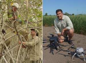
John M. Kovacs is a Full Professor in the Department of Geography, Faculty of Geography-Environmental Earth Sciences, at Nipissing University, Canada. He also serves as an Adjunct Associate Professor at the TropWATER Centre, James Cook University, Australia. His research centers on environmental monitoring and modeling, with a focus on using satellite remote sensing for mapping and monitoring tropical mangrove forests. He also explores local ecological knowledge and coastal resource assessment methodologies. Additionally, he collaborates with Agriculture Agri-Food Canada and local farmers on applying geomatics technologies, including Unmanned Aerial Systems, for agricultural applications. Scientific Awards: The Chancellor’s Award for Excellence in Research (Nipissing University) 2002-20 Professor Kovacs supervises graduate students in Nipissing's Masters of Environmental Science program. His research has been funded by several major grants: Natural Sciences & Engineering Research Council of Canada (NSERC) Individual Discovery Grant (2014-18) as Principal Investigator COSMO-SkyMed/RADARSAT-2 Initiative (Canadian Space Agency & Italian Space Agency) (2013-16) as PI 4th Advanced Land Observing Satellite Research and Application Project (Japan Aerospace Exploration Agency) (2014-2020) as PI Gladstone Ports Corporation, Queensland, Australia (2011-15) as Co-PI with Dr. Norm Duke Emerging Technology Program (Northern Ontario Heritage Fund Corporation) (2011-15) as Co-PI with Dr. Dan Walters He maintains the Nipissing Earth Observation Laboratory (NEOL) in Room R220, which supports remote sensing research.
Dr. Tony Sprent serves as an Adjunct Senior Researcher in the Physics department within the School of Natural Sciences at the University of Tasmania. His interdisciplinary work bridges precision engineering, geospatial technology, and historical astronomy, with significant contributions to industrial metrology and astronomical heritage preservation. His primary research focuses on surveying (including hydrographic applications), geomatic engineering, and astronomical sciences. He has pioneered high-precision alignment techniques for marine infrastructure like towing tanks and industrial facilities such as paper mills using laser scanning and digital video motion analysis. Concurrently, he maintains a distinctive specialization in historical astronomical events, particularly the Transit of Venus, resulting in commemorative sundial designs and archaeological investigations of historical relics across Tasmania. Analysis of his 12 publications (1995-2007) reveals consistent integration of geospatial methodologies with engineering problem-solving and historical inquiry. Key thematic clusters include industrial metrology for dynamic positioning systems, motion analysis through high-speed videography, and the preservation of astronomical heritage through precise documentation of historical instruments and sites. Dr. Sprent's scientific recognition includes: Tasmanian Excellence in Surveying Award (1996) He has successfully supervised nine research students to completion: Doctoral candidates: Christopher Stephen Watson, Ngoc Lau Nguyen, Antonius Bambang Wijanarto, Ali Forghani, Jonathan Edward Osborn, Pieter Roelof Zwart Master's students: Surat Pramualsakdikul, Helen Yingchieh Yang, Vito Dirita His research has been supported by competitive grants including: Survey of Towing Tank (Australian Maritime College, 2004; $1,613) POLARIS/IRIS/GPS/DORIS Program Operations (US NOAA, 1992-1993; $147,000) X-Ray Astronomy Observations Using Balloons (ARC, 1991; $10,000) High Precision Tracking System Development (ARC, 1990-1991; $41,900) Dr. Sprent maintains active collaborations with the Mt Pleasant Radioastronomy Observatory and the Transit of Venus Committee, demonstrating sustained engagement with both scientific infrastructure and community-based astronomical heritage initiatives.
François-Xavier JOANNY is a Teacher-Researcher in Computer Science at UniLaSalle's Beauvais Campus, affiliated with the Department of Humanities, Management, Digital Business and Engineering Sciences. His expertise spans virtual reality, geomatics, photogrammetry, drones, and natural risks. Areas of Expertise: Computer Science, Digital Reality, Geomatics, Photogrammetry, Drones, Natural Risks, 3D Modeling Teaching Focus: Geographic Information Systems, Digital Reality Applications He contributes to research and development of computer tools (C, Java, Python) for VR/AR applications and participates in the EEC center's aerial photography projects.
Dr inż. Piotr Szwed is a Lecturer in the Department of Applied Computer Science at AGH University of Science and Technology, Kraków. He is affiliated with the Faculty of Electrical Engineering, Automatics, Computer Science and Biomedical Engineering (EAIiIB), where he teaches courses ranging from imperative and object-oriented programming to data exploration and computational intelligence. Research Interests: Data mining and knowledge discovery Fuzzy cognitive maps and their applications in transportation, risk assessment, and security Software engineering methodologies, including agile and ontology-driven development Intelligent transportation systems (ITS) and real-time traffic management Natural language processing for Polish texts, stylometry, and authorship attribution Ontology engineering, enterprise architecture verification, and model checking His work often bridges theoretical computer science with practical applications in urban mobility, safety systems, and enterprise software. Scientific Contributions: Pioneered the integration of fuzzy cognitive maps with evolutionary algorithms to predict traffic flows. Developed rule-based and machine-learning approaches to determine speed limits from geospatial data. Contributed to the INSIGMA intelligent transportation system aimed at enhancing urban mobility in Polish cities. Created formal verification techniques for ArchiMate business processes using NuSMV model checking. Advanced stylometric analysis for Polish texts, introducing part-of-speech features for authorship attribution. Teaching & Academic Service: Regularly teaches Programming (C, C++, Java), Software Engineering, Data Exploration, and Computational Intelligence. Supervises engineering and master theses in applied computer science. Maintains a public wiki with course materials, lab exercises, and consultation schedules for students. Utilizes Git-based repositories to streamline code submission and continuous assessment in laboratory classes. Laboratory & Facilities: He is located in building C-2, room 403, at AGH’s main campus, al. Mickiewicza 30, 30-059 Kraków. The lab supports courses that emphasize practical software development, version control, and collaborative project work.
Dr. ABDÜLKADİR FISTIKÇIOĞLU is a Lecturer at Gaziantep University's Oğuzeli Vocational School in the Property Protection and Security Department. His academic work bridges security studies and migration research, with a focus on policy analysis and technological applications in protection systems. M.A. in Migration Studies (2022-2024), Gaziantep University (Evening Education) B.A. in Economics (2007-2009), Anadolu University Associate Degree in Marketing and Advertising (2005-2007), Anadolu University Associate Degree in Construction (1998-2000), Çukurova University His research spans Security Management , Migration Policy , and Cybersecurity , with publications analyzing Turkey's migration strategies and digital payment security systems. Recent academic contributions include studies on human trafficking countermeasures. Professional experience includes: 2019-2021: R&D Chief/Security Coordinator at BMS Defense Technologies Inc. 2017-2019: IHA Technical Service Consultant at Geomatics Surveying Engineering Co. 2001-2017: Gendarmerie General Command service before transitioning to academia Current teaching responsibilities include Unmanned Aerial Vehicle Training, Cybersecurity, and Advanced Office Programs at Gaziantep University.
James Perlt is a Professor of Surveying at the Georg Agricola University of Applied Sciences, where he leads the Surveying Program (Bachelor) and the Surveying Technology Laboratory. His academic career spans multiple institutions, including TU Dresden, TU Braunschweig, and the Federal Office for Cartography and Geodesy in Frankfurt. Education: Dipl.-Ing. in Geodesy from TU Dresden (1995), Doctorate in Engineering from TU Braunschweig (2005) Perlt's research focuses on Surveying , Satellite Geodesy , and Engineering Surveying , particularly in tectonic systems of Iceland and ice dynamics in Antarctica. His work integrates GPS networks, SAR interferometry, and geokinematic modeling to study crustal deformation and polar environmental changes. His publications since 1997 reflect expertise in Geodesy , Geophysics , and Remote Sensing , addressing topics such as earthquake-induced crustal shifts , GPS-based tectonic modeling , and ice velocity estimation in polar regions . Perlt also presented lectures at international conferences, including the European Geophysical Society. Perlt oversees the Surveying Technology Laboratory, contributing to applied research in georesource engineering. No scientific awards or part-time roles are documented in the provided text.
Lauri Uotinen is a Staff Scientist in the Department of Civil Engineering at Aalto University's School of Engineering, where they contribute significantly to rock engineering research and education. They are affiliated with the Mineral Based Materials and Mechanics research group and have established themselves as an expert in digital rock mass characterization techniques. Dr. Uotinen's research focuses on advancing rock engineering through innovative digital tools and educational technologies. Their work spans photogrammetry applications for rock fracture analysis, development of virtual reality learning environments for engineering education, and hydro-mechanical characterization of rock fractures. They have pioneered methods for high-speed vehicle-mounted videogrammetry, tunnel face scanning, and 3D point cloud generation using smartphone LiDAR technology, significantly improving how rock masses are characterized in underground environments. Notable achievements include the development of virtual learning environments that allow engineering students to practice in simulated underground tunnels before entering physical environments. This innovative approach has improved student learning outcomes while promoting wellbeing through increased flexibility in the learning process, earning them the Aalto University School of Engineering Award for Achievements in Teaching in 2019. Young Rock Engineer Award (September 2021) - Recognizing excellence in rock engineering by early-career professionals Aalto University School of Engineering Award for Achievements in Teaching (January 2020) Sinorock prize for Best Paper by Young Person outside China (June 2013) Best poster award (September 2013) - For Semiautomatic characterization of rock masses using photogrammetry Best poster award (September 2012) - For Eurocodes in Hard Rock Engineering in Finland Dr. Uotinen has been instrumental in developing educational technologies that transform rock engineering education. Their collaborative work has created new paradigms for engineering education, allowing students to practice complex tasks in safe, repeatable virtual settings. They have also conducted educational research studying the effectiveness of these new learning environments from students' perspectives. As part of the Mineral Based Materials and Mechanics research group, Dr. Uotinen collaborates extensively with colleagues including Mateusz Janiszewski, Mikael Rinne, and Masoud Torkan. Their team has developed innovative approaches to rock mass characterization that combine traditional engineering methods with cutting-edge digital technologies, significantly advancing the field of rock engineering.
José Paulo Elvas Duarte de Almeida is an Assistant Professor at the Faculty of Science & Technology , University of Coimbra , specializing in geomatic engineering and urban modeling. His academic journey includes advanced studies in geomatic and civil engineering. Education: Ph.D. in Geomatic Engineering, University College London (2008) M.Sc. in Civil Engineering (Urban Engineering), University of Coimbra (1997) Lic. in Geomatic Engineering, University of Coimbra (1992) Research Interests: His work focuses on applying spatial topology to analyze unstructured geospatial data, integrating multicriteria approaches for urban models in spatial decision support systems, and enhancing semantic data for 3D urban environments. These areas bridge computational methods with urban planning challenges.
Ana Sanchez Rodriguez is a researcher affiliated with the Natural Resources and Environmental Engineering department at ETS Mining Engineering, University of Vigo. Her work focuses on advanced structural inspection methodologies for terrestrial infrastructure networks. Doctorate (2020) from University of Vigo Thesis: Automated structural inspection of facilities using laser scanning data Her research intersects disciplines such as civil engineering, geomatics, and infrastructure monitoring. Utilizing technologies like laser scanning systems, she contributes to structural health assessment through innovative geometric and radiometric data analysis.