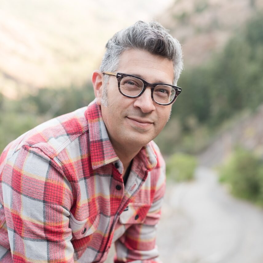
Michael Mejia is an Associate Professor in the Department of English at the University of Utah, where he teaches creative writing. He is also Editor-in-Chief of Western Humanities Review and co-founding editor of Ninebark Press . Mejia is the author of the novels TOKYO and Forgetfulness , with his work appearing in journals like AGNI , DIAGRAM , and Seneca Review . His creative practice bridges fiction, nonfiction, and visual media, interrogating narrative form and socio-cultural dynamics.
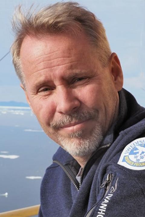
Martin Jakobsson is Professor of Marine Geology and Geophysics and Head of the Department of Geological Sciences at Stockholm University, with an affiliate Research Professor appointment at the Center for Coastal and Ocean Mapping (CCOM), University of New Hampshire. Education: Ph.D. in Geological Sciences, Stockholm University (2000). Thesis: "Mapping the Arctic Ocean: Bathymetry and Pleistocene Paleoceanography." His research spans Arctic Ocean glacial history, West Antarctic Ice Sheet dynamics, submarine glacial landforms, and acoustic geophysical seafloor mapping. With over one year of cumulative ship time, he has served as Co-Chief Scientist on eight international ocean expeditions, advancing methodologies in marine geophysical data acquisition and paleoenvironmental reconstruction. Honors: Academy Fellow of the Royal Swedish Academy of Sciences (2004-2009), funded by Knut and Alice Wallenberg Foundation Member of Royal Swedish Academy of Sciences (Class V for Geoscience, 2012) His research program is sustained through major fellowships including the Wallenberg Academy Fellowship, supporting extensive field campaigns in polar regions. As department head and Academy Vice President, he shapes institutional strategy while maintaining active oceanographic fieldwork. He leads multidisciplinary research teams conducting international expeditions, integrating geophysical mapping with paleoclimate analysis to investigate ice-sheet history and seafloor processes.
Martin Jakobsson is a Professor of Marine Geology and Geophysics at Stockholm University's Department of Geological Sciences. His career spans international research expeditions and leadership roles, including Dean of Earth Science (2021) and Head of Department (2012-2018). A key member of the Marine Geology group, he studies Arctic and Antarctic glacial history through sediment analysis and seafloor mapping. PhD from Stockholm University (2000) Academy Fellow, Royal Swedish Academy of Sciences (2004-2009) Professor II position at University Centre of Svalbard (2011-) His research focuses on marine geological archives to reconstruct glacial cycles, ice-ocean interactions, and bathymetric mapping. As GEBCO Vice-Chair (2013-2020), he led initiatives for global seabed mapping through the Seabed 2030 project. Recent publications reveal expertise in: Arctic Ocean paleocirculation Methane release from thawing permafrost Ice sheet sensitivity to oceanic warming High-resolution bathymetric analysis Scientific recognition includes: Election to Royal Swedish Academy of Sciences (2012) 1st Vice President, Royal Swedish Academy of Sciences (2016-2019) Membership in Norwegian Scientific Academy for Polar Research (2016) He leads international collaborations on polar research vessels, with over a year of cumulative ship time and multiple Co-Chief Scientist roles on Arctic expeditions.
Peter K. Kitanidis is a Professor in the Department of Civil and Environmental Engineering and the Institute for Computational and Mathematical Engineering at Stanford University . His research focuses on groundwater flow , hydrologic forecasting , and stochastic inverse modeling , with applications to pollutant remediation and CO₂ storage monitoring . Education : Diploma, National Technical University of Athens (1974) M.S., MIT (1976) Ph.D., MIT (1978) Research Interests : Groundwater modeling and contaminant transport Hydraulic tomography and aquifer characterization Stochastic methods for uncertainty quantification Bioremediation and enhanced in-situ pollutant decay Dilution and mixing processes in heterogeneous media Real-time river flow forecasting Scientific Awards : L.G. Straub Award (1979) W.L. Huber Research Prize (1994) ISI Highly Cited Researcher (2001) AGU Hydrologic Sciences Award (2011) ASCE Pioneers in Groundwater Lecturer (2011) Advising and Grants : Advised 20+ PhD and MS students (1978–2018) Principal investigator on NSF, EPA, and DOE-funded projects Developed software for groundwater data analysis and CO₂ monitoring Contributed to bioremediation protocols and hydraulic tomography algorithms Labs and Teams : Kitanidis Laboratory for groundwater crisis solutions Collaborated with Oak Ridge National Laboratory and Stanford Hydrogeology Group Mentored postdocs (2000–2017) in reactive transport and inverse modeling
Rahul Sarkar is a Postdoctoral Fellow at the University of California, Berkeley, affiliated with the Department of Mathematics . He was previously a Ph.D. student in the Institute for Computational and Mathematical Engineering (ICME) at Stanford University, graduating in 2022 under the advisement of Biondo Biondi and András Vasy. Research Interests : Quantum information theory, inverse problems, machine learning, microlocal analysis, and numerical methods for PDEs. Scientific Contributions : Developed novel quantum computing algorithms and numerical schemes for geophysical imaging, with applications in seismic tomography and quantum signal processing. Teaching : Taught courses at Stanford including Introduction to Quantum Computing and 3D Seismic Imaging , with roles as instructor and course assistant. Awards : Schlumberger Innovation Fellowship (2019-2020). His work bridges mathematical analysis and quantum computation , with a focus on solving real-world problems through interdisciplinary approaches. He has collaborated with institutions like IBM and Schlumberger to apply quantum algorithms to geoscience and financial optimization.
Tamara Munzner is a Professor of Computer Science at the University of British Columbia, with a confirmed email at tamara@cs.ubc.ca . Her research focuses on information visualization , visual analytics , and graph drawing , emphasizing practical design frameworks and theoretical foundations. Recent work explores visitor engagement with science museum exhibits large-scale data visualization challenges health informatics applications for chronic pain management advanced graph neural network visualization His publications in IEEE Transactions on Visualization and Computer Graphics and Eurographics conferences demonstrate her expertise in visual analytics. Scientific awards include the Best Panel Award at Euro Vis 2009 for her work on visualization education. Her research spans visualization design principles, dimensionality reduction techniques, and applications in genomic epidemiology and environmental sustainability.
Prof. Stefan Wiemer is the Director of the Swiss Seismological Service (SED) and holds the Chair of Seismology at ETH Zurich's Department of Earth and Planetary Science. He obtained a geophysics diploma from Ruhr University Bochum (1992) and a PhD from the University of Alaska Fairbanks (1997). His research focuses on earthquake processes, probabilistic hazard assessments, induced seismicity, and geothermal energy applications. He has published over 200 articles and supervised 30 PhD students, while also lecturing at the University of Bern. Key Roles: Member of ERC Grants Evaluation Panel (2015–present) Scientific Advisor to GFZ German Research Center for Geosciences (2021–present) President of Swiss Geophysical Commission Projects: Leader of Switzerland's national earthquake risk model Coordinator of EU-funded RISE (risk assessments) and DEEP (geothermal de-risking) projects Principal Investigator for ERC Synergy grant FEAR (BedrettoLab fault experiments) His research spans operational earthquake forecasting, CO2 storage monitoring, and the BedrettoLab underground experiments. He has won the Humboldt Foundation Fellowship (1997) and contributed to international initiatives like the Dutch Mining Effects Panel. Teaching includes ETH's Geophysics I course. Scientific contributions include developing seismic hazard models (ERM-CH23), real-time induced seismicity forecasting frameworks, and innovative techniques for fault dynamics analysis. His work integrates field data, laboratory experiments, and computational modeling to address both natural and human-induced seismic risks.
Richard Simon is an Associate Professor in the Department of Civil, Geological and Mining Engineering at Polytechnique Montréal. He holds leadership roles as Publications Director of his department and Administrative Director of the Institute for Research in Mining and Environment (IRME) UQAT-Polytechnique. His educational background includes a B.Eng. and M.Sc.A. from Polytechnique Montréal and a Ph.D. from McGill University. Dr. Simon teaches courses including Introduction to Mine Operations, Underground Mining, and Rock Mechanics I. His research focuses on rock mechanics, numerical modeling, mining engineering, and geotechnical applications in mining environments. His extensive publication record demonstrates consistent focus on numerical modeling of rock behavior, mine stability analysis, and backfill mechanics. Recent work emphasizes computational geomechanics applications in mining operations, including stress analysis in backfilled stopes, slope stability in open pits, and optimization of mining layouts. Environmental aspects of mining, particularly contaminant transport in fractured rock, also feature prominently. Dr. Simon has supervised 6 doctoral and 8 master's students working on topics ranging from numerical seismic assessment in mines to rock fracture mechanics. He secured significant research funding including $900,000 (2017) for a metals circular economy project and led three new IRME research initiatives (2015). He directs research activities at IRME UQAT-Polytechnique and collaborates extensively within the mining geomechanics research community. His expertise is regularly featured in media outlets including La Presse+ and Les Affaires.
Sibel Pamukcu is a Professor in the Department of Civil and Environmental Engineering at Lehigh University, affiliated with the P.C. Rossin College of Engineering and Applied Science. Her research focuses on electroremediation of soils and groundwater, advanced geo-materials, and sensor systems for subsurface monitoring. She has held leadership roles including interim Chair of Civil and Environmental Engineering and co-director of Lehigh’s ADVANCE grant. Pamukcu teaches courses in geotechnical and environmental engineering at both undergraduate and graduate levels. Education: Ph.D. in Civil Engineering, Louisiana State University M.S. in Civil Engineering, Louisiana State University B.S. in Civil Engineering, Bogazici University, Turkey Research Interests: Her work spans electrochemical methods for environmental detoxification, development of polymer-enhanced sands, and distributed sensor networks for real-time subsurface monitoring. Key focus areas include: In-situ destruction of contaminants in clay-rich soils Enhanced oil recovery via electric fields Wireless and fiber-optic sensor systems for hazard mitigation Grants & Awards: Principal investigator on over 60 grants from NSF, DOE, DOD, and others. Notable awards include the Alfred Noble Robinson Award (Lehigh University) and the ASCE Civil Engineering Foundation Grant Award. Her lab holds multiple patents on soil remediation techniques and polymer-coated sands. Advising & Service: Supervised 9 Ph.D. and 25+ M.S. students Appointed to Martindale Center faculty and Sigma Xi leadership Contributed to 50+ peer-reviewed articles and 100+ technical publications Labs & Teams: Leads interdisciplinary initiatives in electrokinetic remediation and underground sensing, collaborating with industry partners like Electric Power Research Institute and the Pennsylvania Department of Transportation.
Peter Wilf is a Professor in the Department of Geosciences at Pennsylvania State University's College of Earth & Mineral Sciences. His research focuses on fossil plants as indicators of past climates, biodiversity, and environmental disturbances from the latest Cretaceous through middle Eocene (~67-45 million years ago). Wilf leads significant research projects including the Origins of Southeast Asian Rainforests from Paleobotany and Machine Learning and the Patagonia Paleofloras Project. His research interests span paleobotany, paleoclimatology, plant-insect interactions, and biogeography, with emphasis on how deep-time data illuminate modern ecosystems and their responses to anthropogenic change. Wilf's work primarily focuses on the latest Cretaceous through middle Eocene, examining global disturbances including warming and cooling events, the end-Cretaceous mass extinction, and recovery periods. His research has significant implications for understanding climate change, biodiversity conservation, and ecosystem dynamics. Wilf's extensive publication record demonstrates consistent high-impact research across paleobotany, with recent work focusing on Southeast Asian rainforests, Patagonian paleofloras, and the connections between Gondwanan landmasses. His research integrates fieldwork in Patagonia and Southeast Asia with advanced analytical techniques, including machine learning applications for fossil leaf identification. Fellow, American Association for the Advancement of Science (AAAS) 2022 Wilson Award for Excellence in Research, Penn State College of Earth & Mineral Sciences 2022 Fellow, Paleontological Society 2017 Fellow, Geological Society of America 2016 Paul F. Robertson Research Breakthrough of the Year Award, Penn State College of Earth & Mineral Sciences 2016 George W. Atherton Award for Excellence in Teaching, Pennsylvania State University 2013 Wilf maintains an active research program with numerous NSF-funded projects and international collaborations. He leads a productive lab group conducting extensive fieldwork in Patagonia, Argentina, and Southeast Asia. His research has transformed understanding of Southern Hemisphere floras, the role of Patagonia in plant evolution, and connections between ancient and modern ecosystems across continents. Wilf's laboratory serves as a hub for paleobotanical research, bringing together students, postdocs, and international collaborators to study fossil plant collections from around the world. The lab integrates traditional paleobotanical methods with cutting-edge technologies including machine learning for fossil identification and advanced imaging techniques for detailed morphological analysis.
Carlos Torres-Verdín is a Professor and holds the Brian James Jennings Memorial Endowed Chair and Zarrow Centennial Professorship in Petroleum Engineering at The University of Texas at Austin's Hildebrand Department of Petroleum and Geosystems Engineering, within the Jackson School of Geosciences. He earned a B.S. in Geophysical Engineering from the National Polytechnic Institute of México (1983), an M.Sc. in Electrical Engineering from UT Austin (1985), and a Ph.D. in Engineering Geoscience from UC Berkeley (1991). His research focuses on petrophysical and geophysical characterization of subsurface regions using well logging, seismic, and multi-physics data. Key areas include borehole geophysics, rock physics, reservoir characterization, and hydraulic fracturing. He has received numerous accolades, including the 2020 Virgil Kauffman Gold Medal (SEG) and the 2017 Conrad Schlumberger Award (EAGE). His work integrates advanced numerical methods and machine learning to enhance reservoir evaluation and CO2 sequestration monitoring. Torres-Verdín teaches courses such as PGE 358 (Formation Evaluation) and directs the Formation Evaluation Joint Industry Research Consortium, fostering industry-academia collaboration. Awards & Honors 2020 Virgil Kauffman Gold Medal, SEG 2019 Anthony F. Lucas Gold Medal, SPE 2017 Conrad Schlumberger Award, EAGE 2017 Lockheed Martin Excellence in Engineering Teaching Award Research & Teaching His recent studies address challenges in unconventional reservoirs, fluid dynamics in nanoporous media, and real-time geosteering. He has published over 150 peer-reviewed articles, emphasizing innovation in inversion techniques, NMR applications, and reservoir simulation.
Anne H Schistad Solberg is a Professor in the Department of Informatics at the University of Oslo's Faculty of Mathematics and Natural Sciences. She leads research in digital signal processing and image analysis, with a focus on machine learning applications across multiple domains. As co-director of SFI Visual Intelligence, she oversees research on interpretable deep learning models, uncertainty quantification, contextual learning, and self-supervised learning approaches. Her research spans medical imaging (particularly cardiovascular ultrasound), environmental monitoring using satellite imagery, and seabed mapping with sonar technology. Professor Solberg's work demonstrates a consistent trajectory from foundational signal processing techniques to cutting-edge deep learning applications. Her recent publications show increasing specialization in medical image analysis, particularly in echocardiography enhancement and cardiac structure segmentation, while maintaining strong contributions to remote sensing and geophysical applications. She teaches several popular courses including IN2070, IN3310, and IN5400 (Machine Learning for Image Analysis), which is noted as the most popular master's/PhD course on deep learning at the University of Oslo. Professor Solberg serves as principal investigator for the Intelligent Cardiovascular Ultrasound Scanner (INCUS) project, collaborating with GE Vingmed Ultrasound to develop AI-enhanced cardiac imaging systems that improve diagnostic accuracy and productivity in echocardiography. Co-director of SFI Visual Intelligence research center Principal Investigator for the INCUS project (Intelligent Cardiovascular Ultrasound Scanner) Member of the Digital Signal Processing and Image Analysis (DSB) research group Member of the Strategic Research Initiative: Multimodal Medical Imaging and Image Analysis (MEDIMA) Her research group develops algorithms that address real-world challenges in medical diagnostics and environmental monitoring, with a particular emphasis on making deep learning models more interpretable and reliable for critical applications. The INCUS project, funded through User-driven Research-based Innovation (BIA), aims to reduce the time wasted during cardiac ultrasound examinations by implementing intelligent algorithms that learn from expert users and historical data.
Xiaozhuo Wei is a Postdoctoral Scholar Research Associate in Geophysics at the California Institute of Technology (Caltech), affiliated with the Division of Geological and Planetary Sciences and the Department of Geophysics. His research focuses on geophysical monitoring of volcanic and tectonic processes, employing advanced techniques like fiber-optic geodesy, seismic tomography, and machine learning. He specializes in studying seismicity associated with volcanic eruptions, magma dynamics, and slow slip events in subduction zones, with significant contributions to understanding the 2018 Kīlauea eruption and Iceland's Reykjanes Peninsula eruptions. Key affiliations: Caltech’s Geophysics Department, Division of Geological and Planetary Sciences Research tools: Distributed Acoustic Sensing (DAS), ambient noise tomography, and offshore seismic arrays Field areas: Kīlauea Volcano (Hawaii), Iceland’s Reykjanes Peninsula, and Alaska’s subduction zones Wei’s work integrates multidisciplinary approaches to investigate crustal deformation, magma storage, and seismic hazard assessment. He has contributed to improving earthquake catalogs using offshore data and analyzing post-eruption seismicity patterns. His recent studies explore the spatial-temporal evolution of volcanic systems and the mechanics of dike intrusions using high-resolution geophysical methods. His research emphasizes real-time monitoring of volcanic processes and has advanced understanding of how seismic velocity changes reflect magma movement. Collaborations involve deploying ocean-bottom seismometers and machine learning algorithms to detect slow slip events in subduction zones, enhancing earthquake prediction capabilities. Notable projects include the 2023–2024 Reykjanes eruptions study and the analysis of the 2018 Kīlauea eruption’s seismic aftermath. His work bridges observational seismology with theoretical models of volcanic and tectonic systems, contributing to both fundamental science and practical hazard mitigation strategies.
Allen Husker is a Research Professor of Geophysics at the California Institute of Technology (Caltech), affiliated with the Seismological Laboratory. He manages the Southern California Seismic Network (SCSN) and the Southern California Earthquake Data Center. Previously, he was a professor at the National Autonomous University of Mexico (UNAM), chairing the Seismology Department, and served as Station Manager for the Comprehensive Nuclear-Test-Ban Treaty Organization (CTBTO) seismic stations in Mexico. His academic journey includes a B.S. from the University of Washington (1998), an M.S. from UCLA (2003), and a Ph.D. from Caltech (2008). Research Interests : Husker focuses on geophysical observations of crustal structure, slow-slip events, and seismic network analysis. His work bridges subduction zones (e.g., Mexico) and transform boundaries (e.g., Southern California). He explores planetary seismology, comparing Earth with the Moon and Mars. Recent studies include DAS technology for moonquake detection and seismic monitoring in the Guerrero seismic gap. Publications Trends : His 2024 work emphasizes DAS applications, Mexico’s San Andreas Fault dynamics, and socio-technical aspects of earthquake early warning (EEW) in Mexico. Earlier research (2020s) delves into slow-slip mechanisms, crustal anisotropy, and fault system dynamics in Mexico. He also investigates moonquake behavior and lunar regolith effects. Awards : No explicit scientific awards listed. Advising & Grants : Advises graduate students like Guillermo González (UNAM) and Yuri Tamama (Caltech). Former students include Francesco Civilini (Research Space Scientist) and Jiuxun Yin (Research Geophysicist). Collaborates widely, including with Jennifer Jackson on lunar seismology. Labs/Teams : Leads the SCSN and collaborates with UNAM’s Seismology Department. Engaged with the CTBTO and international seismological networks.
Biondo Biondi is the Barney and Estelle Morris Professor of Geophysics at Stanford University, affiliated with the School of Earth Sciences. He leads the Stanford Exploration Project and holds roles such as Chair of the Geophysics Department (2019–2022) and Director of the Stanford Earth Imaging Project (1998–Present). His research focuses on seismic imaging algorithms, computational geophysics, and fiber-optic sensing technologies. He earned his Ph.D. (1990), M.S. (1987) in Geophysics from Stanford, and M.Sc. in Electrical Engineering from Politecnico di Milano (1984). Dr. Biondi's research emphasizes improving seismic data imaging through advanced computational methods. He pioneered urban seismic monitoring using preexisting telecommunication fibers, enabling cost-effective subsurface analysis. His work integrates machine learning and high-performance computing to address challenges in reservoir imaging, CO2 monitoring, and infrastructure health. Key research areas include distributed acoustic sensing (DAS), ambient noise tomography, and inverse theory applications. He has authored over 180 publications and received awards like the SEG Honorable Mention (2019, 2016, 2009) and the Distinguished Instructor Short Course (2007). His teaching includes courses like 3-D Seismic Imaging and Reflection Seismology, and he advises graduate students in geophysics and computational science. Collaborations span industry (e.g., Schlumberger, Saudi Aramco) and global institutions. Biondi’s administrative contributions include co-directing the Stanford Earth Sciences Algorithms and Architectures Initiative and serving on editorial boards like the SIAM Journal on Imaging Sciences. His lab’s innovations bridge geophysics with emerging technologies, advancing both academia and industry applications in energy, environment, and urban infrastructure.