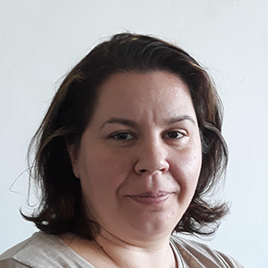
Dr. Cătălina CRISTEA serves as a Senior Lecturer at the Technical University of Civil Engineering Bucharest (UTCB), actively contributing to geospatial research through the Research Center in Spatial Geodesy, Photogrammetry, Remote Sensing and GIS (GEOS). Her expertise spans critical geospatial domains: Topo-geodetic process automation and application design GIS environment data processing and 3D modeling GNSS-based geodetic measurements and digital mapping Environmental change monitoring via satellite/airborne recordings Free software development for renewable resource management Dr. CRISTEA specializes in multidisciplinary geospatial solutions including geodetic data acquisition, CAD/GIS integration for forestry and earthquake analysis, and online digital model implementation. Her work emphasizes efficient workflow optimization through modern technologies. She actively contributes to the GEOS research center's mission in advancing spatial geodesy applications and environmental degradation studies.
Pavlo Kolodiy is an Associate Professor and Dean of the Faculty of Land Management and Tourism at Lviv National Agrarian University, where he has been employed since September 1998. He holds a PhD from the same institution and maintains an active research profile in geospatial sciences. His research focuses on: Land management and cadastral systems Remote sensing applications in agriculture Geodetic network protection Spatial planning and environmental monitoring Geomatics software development Recent publications (2020-2025) demonstrate a consistent focus on integrating remote sensing and geomatics for solving agricultural and environmental challenges. His work includes developing crop assessment models using multispectral imagery, analyzing mining terrain deformation, improving cadastral methods for disturbed lands, and advancing yield forecasting techniques.
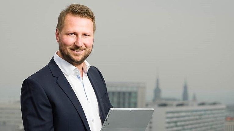
Robert Kaden is a Professor of Surveying and Geoinformatics at the University of Applied Sciences Erfurt, where he serves as Vice Dean of the Faculty of Business, Economics and Social Sciences and Head of the Geodetic Laboratory and Geodesign Center. His academic career spans teaching, research, and leadership roles focused on the integration of geospatial technologies with modern construction practices. Education: Doctorate in Geoinformatics, Technical University of Munich (2014) Master of Geodesy and Geoinformation Science, Technical University of Berlin (2009) Graduate Engineer in Surveying, Dresden University of Applied Sciences (2005) Surveyor qualification, BSZ Hans Erlwein Dresden (1999) Professor Kaden's research focuses on the intersection of geospatial technologies and digital construction methodologies. His work centers on Building Information Modeling (BIM), Geographic Information Systems (GIS), 3D city modeling, and their integration for urban planning and energy analysis. He has pioneered approaches for combining surveying precision with digital construction workflows, particularly in the areas of as-built modeling, geodetic coordinate systems within BIM environments, and energy demand estimation using semantic 3D city models. His publication record reveals a clear trajectory from foundational work in 3D city modeling toward increasingly sophisticated integration of BIM and GIS technologies. Recent publications emphasize practical applications in energy planning, virtual reality in landscape architecture, and AI-based decision support systems, reflecting the evolution of geospatial technologies from data representation toward intelligent analysis and decision-making tools. Scientific Awards: 2017 Geoinformatics Award from Runder Tisch GIS eV 2012 Oracle Spatial Excellence Award for Education and Research 2010 Harbert Book Prize from German Association for Surveying 2008 CATCON Gold Award from International Society for Photogrammetry and Remote Sensing As Academic Advisor and Head of the Geodetic Laboratory and Geodesign Center, Professor Kaden mentors students and leads research initiatives focused on practical applications of geospatial technologies. His professional activities include significant contributions to industry guidelines, particularly the 'Guide to Geodesy and BIM,' and leadership roles in professional associations including the Round Table GIS eV, German Society for Photogrammetry, and DVW – Society for Geodesy, Geoinformation and Land Management. His laboratory work centers on sensor-integrated solutions for construction surveying, BIM-GIS integration, and the development of standards for geospatial data exchange in the construction industry, positioning his team at the forefront of digital transformation in surveying and civil engineering practices.
Prof. Dr. Eng. Plamen Maldzhanski is a Professor in the Department of Photogrammetry and Cartography at the Faculty of Geodesy, University of Architecture, Civil Engineering and Geodesy (UACEG) in Sofia, Bulgaria. He maintains office P228 and holds reception hours on Wednesday from 12-13. His academic career spans several decades, with significant contributions to photogrammetry, digital image processing, and geospatial technologies. Education Engineer in Geodesy, Photogrammetry and Cartography (1985), UACEG-Sofia Computer Engineering (1993), Technical University of Sofia Doctor of Photogrammetry and Remote Sensing Methods (1998), UACEG-Sofia Professor of Photogrammetry and Remote Sensing Methods (2012), UACEG-Sofia Research Interests Prof. Maldzhanski's research spans multiple areas within photogrammetry and geospatial technologies. His primary focus is on developing advanced methods for image processing and 3D modeling. He has made significant contributions to both theoretical frameworks and practical applications of photogrammetric technologies, particularly in architectural documentation and cultural heritage preservation. His expertise encompasses: Analytical and digital photogrammetry Close-range photogrammetry and laser scanning 3D modeling of surfaces and architectural structures Digital image processing and analysis Integration of photogrammetric data with GIS systems Development of specialized software for geodetic applications Publication Trends Prof. Maldzhanski's publication record demonstrates a clear evolution from traditional photogrammetric methods toward digital and computational approaches. His recent work (2017-2023) focuses heavily on photorealistic modeling, close-range photogrammetry applications for cultural heritage documentation, and integration of modern technologies like Google Maps API with geospatial data. His publications reveal a strong emphasis on practical applications in architectural documentation, precision measurement, and digital preservation of cultural sites. Awards and Professional Recognition Member of the Union of Geodesists and Land Surveyors Licensed professional for cadastral work (License No. 157) Full design capability license from KIIP Academic Leadership and Grants Prof. Maldzhanski has held significant administrative positions including Vice-Dean for Academic Affairs at the Geodesy Faculty and Vice-Rector for International Cooperation and Postgraduate Qualification. He has participated in multiple research projects funded by academic and government institutions, focusing on satellite imagery applications, architectural photogrammetry for cultural heritage documentation, and development of spatial data infrastructure. His grant activities include: "Използване на космически снимки за целите на регионалното и териториално планиране" (2007) "Възможности за създаване и обновяване на навигационни карти" (2008) "Използване на архитектурната фотограметрия при документиране паметници на културата" (2009) "Академичен център 'Дистанционни изследвания и мобилна инфраструктура на пространствени данни'" (2009) Software Development and Technical Contributions Prof. Maldzhanski has developed several significant software packages that bridge theoretical photogrammetry with practical applications: "PHOTO" software package for analytical photo processing and digital mapping "Geodesy" software for geodetic tasks, network adjustment, and terrain modeling "TEST_RGO" program for testing geodetic measurements according to Regulation 19 of the Cadastre Agency
Silvia Katsarska-Filipova is an Associate Professor at the Department of Photogrammetry and Cartography within the Faculty of Geodesy at the University of Architecture, Civil Engineering and Geodesy (UACEG) in Sofia, Bulgaria. She holds a Doctor of Science degree in Photogrammetry and Remote Sensing Methods (2014) and a Master of Science in Geodesy from the same institution (1995-2000). Currently, she teaches courses including Unmanned Aerial Photogrammetry and Transformation and Interpretation of Space Images, and conducts exercises in Digital Photogrammetry, Close-range Photogrammetry and Laser Scanning. Doctor of Science in Photogrammetry and Remote Sensing Methods (2014) Master of Science in Geodesy, University of Architecture, Civil Engineering and Geodesy (1995-2000) Dr. Katsarska-Filipova's research focuses on digital photogrammetry, image processing, 3D modeling of surfaces and volumetric bodies, methods for obtaining and analyzing geospatial information, unmanned aerial systems for image capture and processing, applications of remote sensing, and GIS. Her work bridges theoretical advancements with practical applications in cultural heritage documentation, environmental monitoring, and urban planning. She has developed expertise in using drone technology for precise geospatial measurements and analysis, particularly for volume computations in quarries and other applications. Her recent publications (2022-2024) demonstrate a strong focus on integrating photogrammetry with remote sensing for diverse applications including urban heat island analysis, forest fire monitoring, water body assessment, and photovoltaic park efficiency evaluation. She has increasingly incorporated digital twin technology and multi-sensor approaches in her research, showing a progression from traditional photogrammetric techniques to more integrated, technology-driven solutions that combine close-range photogrammetry, laser scanning, and satellite imagery. Her work frequently involves practical applications in environmental monitoring and cultural heritage preservation. Dr. Katsarska-Filipova has supervised numerous diploma students on topics ranging from photogrammetric documentation of architectural heritage to analysis of burned territories using satellite imagery. She has served as Quality Manager for her department since 2017 and has participated in multiple research projects including 'Information platform for research and monitoring of the environment' (2018-2019), 'Use of multispectral and thermal images in analysis and assessment of energy efficiency' (2021-2022), 'Creation of 3D models of architectural objects based on hybrid technology for laser scanning' (2022-2023), and 'Digital geodetic twins in UACEG' (2023-2024). She is a member of the Union of Geodesists and Land Surveyors in Bulgaria and has received positive assessment from the Commission for the Attestation of the Academic Staff at the Faculty of Geodesy of UACEG (375.9 points) dated January 7, 2020. Her research has been widely cited internationally, particularly her 2016 work on volume computation of stockpiles using UAV measurements, which has become a reference in the field of drone-based surveying applications.
Rumyana Aneva serves as Chief Assistant Professor at the Faculty of Geodesy, University of Architecture, Civil Engineering and Geodesy (UACEG) in Sofia, specializing in the Department of Applied Geodesy. Her academic role encompasses teaching Engineering Geodesy and Geodesy/Vertical Planning across multiple specialties including Construction Management, LALP, and Geodesy degrees. Her research focuses on hydrographic measurement systems, reservoir sediment monitoring, and dam safety assessment. Key methodologies include bathymetric surveying, topographic curve derivation, and vertical deformation analysis for critical infrastructure. Recent work emphasizes automated geodetic control systems and precision in sediment profile measurement for dam management. Analysis of her 2012-2023 publications reveals consistent specialization in reservoir monitoring technologies, with increasing emphasis on software solutions for hydrographic data processing and standardized risk assessment protocols. Her work bridges theoretical geodesy with practical civil engineering applications in water resource management. Professional contributions include participation in 10+ national projects (2004-2016) on dam sediment studies and international initiatives like the EU's DAMSAFE program (2011-2013). She develops comprehensive educational materials including lecture courses, exercise sheets, and calendar plans for geodesy disciplines. Current responsibilities include reception hours through January 2025, demonstrating active academic engagement. Her work directly supports Bulgaria's infrastructure safety through precise geodetic applications in hydrographic and civil engineering contexts.
Prof. Giovanni FABBROCINO is a Full Professor at the Department of Biosciences and Territory of the University of Molise . His research focuses on structural engineering, heritage conservation, and structural health monitoring (SHM). He specializes in seismic analysis of historical buildings, vibration-based diagnostics, and the integration of digital technologies like BIM and virtual reality for infrastructure assessment. His work bridges civil engineering with cultural heritage preservation, emphasizing interdisciplinary methodologies. Key research areas include: Seismic retrofitting of historical structures Non-destructive testing of masonry and RC structures Operational modal analysis (OMA) for dynamic characterization Remote sensing applications in structural monitoring Digital twin development for heritage conservation He leads projects involving advanced materials testing (e.g., weathering steel analysis) and crowd-based technologies for cultural heritage documentation. His methodologies often combine experimental measurements with computational models to enhance infrastructure safety in seismic-prone regions. Current research trends include AI-driven permission models for Android systems and probabilistic frameworks for healthcare facility safety networks. Prof. FABBROCINO collaborates with institutions like the StreGa Laboratory , advancing multidisciplinary approaches to sustainable urban regeneration and disaster resilience. His work contributes to both academic discourse and practical solutions for safeguarding historical centers and strategic infrastructure.
Roelof Rietbroek is an Assistant Professor in the Department of Water Resources at the University of Twente, Faculty of Geo-Information Science and Earth Observation. His research lies at the intersection of Earth observation, remote sensing, and geosciences, with a strong focus on climate-related phenomena such as sea-level rise, drought, flooding, and terrestrial water storage dynamics. Assistant Professor, Department of Water Resources, University of Twente Active researcher in Earth and Planetary Sciences with expertise in satellite gravimetry (GRACE), GNSS, and coastal remote sensing Contributor to open science through datasets and software (e.g., pygtide, shxarray, geoslurp) Collaborates internationally on climate adaptation, coastal hazards, and sustainable geoscience education His research interests span Earth Observation and Remote Sensing , Climate Change , GNSS Geodesy , Gravimetry , Sea Level Rise , and Terrestrial Water Storage . He leverages satellite data and geodetic techniques to monitor and model environmental changes, particularly in coastal and hydrological systems. His work integrates physical geodesy with hydrology and climate science to understand the impacts of global change. The analysis of his recent publications reveals a consistent focus on using space-based observations to address pressing environmental challenges. His articles span topics from coastal morphodynamics at Terschelling to global GNSS velocity fields and drought detection via water storage anomalies. The interdisciplinary nature of his work bridges geodesy, hydrology, and climate science, with increasing emphasis on open data, reproducibility, and educational integration. Scientific contributions and recognitions include: Active contributor to high-impact journals such as Natural Hazards and Earth System Sciences and International Journal of Sustainability in Higher Education Creator and maintainer of open-source tools: pygtide , shxarray , and geoslurp ORCID: 0000-0001-5276-5943 h-index of 21 with over 3,300 citations (Scopus) Rietbroek advises through collaborative research and supervises data and software development for environmental applications. His work is supported by institutional affiliations and access to advanced geospatial infrastructure. He is involved in educational innovation, particularly in integrating sustainability into geoscience curricula. He leads or contributes to data management frameworks that enable large-scale, cloud-based geoscientific analysis. He is a key figure in the geodetic and hydrological remote sensing community, with active research in both observational techniques and their application to societal challenges like climate adaptation and water security.
Zhe Jia is a Research Assistant Professor at the Institute for Geophysics, Jackson School of Geosciences, The University of Texas at Austin. He holds a PhD from the California Institute of Technology (2016-2022) and prior degrees from the University of Science and Technology of China (BS 2009-2013, MS 2013-2016). His research focuses on earthquake mechanisms and hazards, using multi-geophysical data and modeling to study rupture dynamics across diverse tectonic settings, from shallow continental faults to subduction zones. Key interests include fault geometry effects, stress interactions, and fluid dynamics in controlling earthquake behavior. He employs advanced techniques such as moment tensor inversions, numerical modeling, and machine learning to analyze seismic and geodetic data. Notable contributions include discoveries of multi-fault rupture complexity in events like the 2019 Ridgecrest sequence and the 2023 Kahramanmaraş doublet. His work emphasizes integrating observations with structural models to improve seismic hazard assessments and tsunami prediction. Zhe’s research has been featured in high-impact journals like Science and Geophysical Research Letters. He actively mentors students and collaborates internationally. His professional service includes roles as a NSF proposal reviewer and session convener at AGU meetings. Teaching roles include lecturing in seismology and earthquake geodesy at Scripps Institution of Oceanography and the California Institute of Technology. Field experiments include nodal seismometer deployments in the Los Angeles Basin and active-source studies on the San Andreas Fault. His lab focuses on developing novel inversion tools (e.g., gCAPjoint software) and applying machine learning to seismic tomography.
Thomas Herring is Professor of Geophysics and Chair of the Program in Geophysics at MIT's Department of Earth, Atmospheric and Planetary Sciences (EAPS), where he has served since 1989 after six years as a Harvard research scientist. His pioneering work in millimeter-precision geodetic methods using GPS, VLBI, and InSAR addresses critical Earth surface deformation problems globally. Education: Bachelor's and Master's in Surveying, University of Queensland PhD in Earth and Planetary Sciences, MIT (1983) His research integrates geodesy with geophysics to study transient deformation after earthquakes, Earth rotation variations, and structural responses of skyscrapers (>350m) to seismic/thermal stresses. He develops advanced GNSS data processing techniques and investigates low-cost multi-GNSS systems ($700 units) as alternatives to expensive equipment (> $20K), while analyzing atmospheric impacts on positioning accuracy and non-steady deformation from earthquake stress buildup. Recent publications (2016-2018) demonstrate his focus on scalable geodetic solutions for plate boundary observatories and structural monitoring, revealing trends toward democratizing high-precision instrumentation through affordable technology while expanding applications to planetary interiors and natural hazards. Scientific Awards: Macelwane Medal, American Geophysical Union (1991) Bomford Prize, International Association of Geodesy (1995) Vening-Meinesz Medal, European Geophysical Union (2007) Fellow, American Association for the Advancement of Science (2013) Fellow, American Geophysical Union Fellow, International Association of Geodesy Fellow, European Geosciences Union Herring leads major geodetic initiatives including the GAMIT/GLOBK software suite and Plate Boundary Observatory networks, with administrative support from Joshua Kastorf and financial management by Christine Maglio. His work directly informs NASA advisory panels and international geodetic standards committees. His laboratory focuses on real-time GNSS data processing for earthquake response systems and structural health monitoring of tall buildings, utilizing both global networks and experimental low-cost sensor arrays to advance geophysical measurement capabilities.
Hyongki Lee is the Kaspar J. Willam Professor in the Department of Civil and Environmental Engineering at the University of Houston , where he has served as Professor since 2023. He previously held Associate Professor (2017-2023) and Assistant Professor (2011-2017) positions at the same institution. Dr. Lee directs the Geosensing Systems Engineering Graduate Program and specializes in spaceborne geodetic instruments for terrestrial water dynamics research. Ph.D. in Geodetic Science, Ohio State University, 2008 M.Sc. in Civil and Environmental Engineering (Geomatics & Remote Sensing), Yonsei University, 2002 B.Sc. in Civil and Environmental Engineering, Yonsei University, 2000 His research integrates satellite altimetry , SAR/InSAR , and GRACE data to quantify terrestrial water storage changes for water resource management , flood forecasting , and climate studies . Key projects include operational flood prediction systems for the Mekong Basin and glacier dynamics monitoring in Alaska. Recent work focuses on machine learning-enhanced flood modeling (2025) and multi-sensor water extent mapping (2024). His FIER framework enables rapid inundation forecasting via rotated EOF analysis. Kaspar J. Willam Professorship (2025) Cullen College of Engineering Professorship (2020-2024) ASCE EWRI Best Case Study Award (2021) NASA New Investigator Award (2014) Dr. Lee has supervised 15+ graduate students and postdoctoral researchers, including Tien Du and Chi-Hung Chang . His lab (NCALM) secures grants from NASA , NOAA , and NSF for remote sensing applications in vulnerable regions like the Mekong and Congo basins.
David T. Sandwell is a Professor of Geophysics at the Institute of Geophysics and Planetary Physics within Scripps Institution of Oceanography, University of California, San Diego. His research integrates satellite remote sensing, geodesy, and marine geophysics to study Earth's dynamic processes. Research Interests: Sandwell specializes in marine gravity anomaly mapping from satellite altimetry, predicted and measured seafloor topography, synthetic aperture radar interferometry (InSAR), thermal and mechanical structure of the oceanic lithosphere, geodynamic applications of satellite altimetry, and tectonics on Venus. His work bridges planetary science with terrestrial geophysics, focusing on crustal deformation, earthquake mechanics, and ocean basin evolution. He teaches courses including Introduction to Geodynamics, Satellite Remote Sensing, and Physics of Surfing. His recent publications demonstrate a strong trend toward high-resolution seafloor mapping, interseismic deformation analysis, and advanced InSAR techniques for earthquake cycle studies. Key themes include satellite-derived bathymetry, fault creep monitoring along major plate boundaries like the San Andreas Fault, and tectonic applications of gravity field recovery. His research increasingly incorporates multi-satellite data fusion and computational geophysics for modeling lithospheric behavior. Scientific Awards: While specific awards aren't detailed in the source material, Sandwell's extensive publication record (over 200 papers) and leadership in major projects like the SRTM15+ global bathymetry model reflect significant recognition in geophysics. Advising and Grants: Sandwell has advised 17 Ph.D. students since 1988, with recent graduates (2016-2023) focusing on seafloor geodesy, InSAR applications, and lithospheric mechanics. His research is supported by NASA, NSF, and USGS grants targeting satellite geodesy, earthquake cycle modeling, and marine gravity field recovery. Current projects include meter-scale seafloor deformation monitoring and absolute phase recovery in InSAR processing. Labs and Teams: He leads research within Scripps' Institute of Geophysics and Planetary Physics, collaborating with the GPlates development team for 3D tectonic visualization and contributing to NASA's Earth Surface and Interior focus area. His group develops open-source radar interferometry software (GMTSAR) and maintains global gravity and bathymetry databases used worldwide.
Hamza Alkhatib is a Senior Researcher at the Geodetic Institute within the Faculty of Civil Engineering and Geodetic Science at Leibniz University Hannover. His research focuses on advanced computational methods in geodetic data analysis, including Bayesian modeling, Monte Carlo simulations, uncertainty quantification, and filtering techniques for multi-sensor systems. He leads projects funded by DFG, BfG, and BMVI, addressing topics like hydrographic monitoring, cooperative sensor networks, and machine learning applications in geodesy. Alkhatib holds a PhD from the University of Bonn (2007) and a Habilitation from Leibniz University Hannover (2020). Education & Career : PhD (2007): University of Bonn, Dissertation on Monte Carlo methods for satellite gravity missions Habilitation (2020): Leibniz University Hannover, Advanced methods in geodetic data analysis Senior Research Staff since 2019 Research Interests : Bayesian inference and robust statistical methods Filtering algorithms (Kalman, Particle Filters) for dynamic systems Machine learning for geodetic point cloud analysis and damage detection Sensor fusion and multi-sensor positioning systems Hydrographic monitoring and marine infrastructure assessment Key Projects : DFG-funded adaptive robust adjustment of geodetic measurement processes Research Training Group GRK 2159 on dynamic sensor networks WaMUT project for hydrographic water change zone monitoring 3D HydroMapper for port infrastructure inspection Awards : DAAD Award for Outstanding Achievements (2000) Syrian Ministry of Academic Education Award (1998) Teaching : Teaches courses on geodetic data analysis, recursive state estimation, and machine learning applications at both bachelor and master levels.
Daniel Haugård Olesen is an Associate Professor at DTU Space, Technical University of Denmark, within the Department of Space Research and Technology, specializing in Geodesy and Earth Observation. He leads the GNSS research group, which focuses on advanced navigation technologies, including interference detection, precise positioning, and sensor fusion for drones and robots. Institution: Technical University of Denmark (DTU) School: DTU Space Department: Department of Space Research and Technology Research Division: Geodesy and Earth Observation (GEO) Role: Associate Professor and Head of GNSS Research Group His research interests span GNSS signal integrity, space weather impacts, RTK/PPP positioning, multi-sensor fusion, and applications in environmental monitoring using unmanned systems. He actively contributes to hydrological studies through drone-based river monitoring, leveraging LiDAR, sonar, radar, and GNSS-R techniques. The recent publication trends reflect a strong focus on applying UAS and GNSS technologies to solve real-world environmental challenges, particularly in river hydraulics, surface water dynamics, and soil moisture sensing. His work integrates space-based observation with autonomous platforms, emphasizing reliability, precision, and scalability. Keywords across articles include Earth Observation, Remote Sensing, Hydrology, Navigation, and Signal Processing, with specific subfields such as GNSS interference mitigation, Doppler radar velocimetry, and ionospheric scintillation analysis. Daniel Olesen supervises several PhD projects, indicating an active mentoring role in training next-generation researchers. Notable projects include GNSS-R from UAS, semi-autonomous navigation for river monitoring, and ionospheric effects on GNSS signals. While no specific scientific awards are listed in the provided text, his sustained research output and leadership in key projects suggest recognition within the scientific community. GNSS Reflectometry (GNSS-R) from Unmanned Aerial Systems (2024–2027) Semi-autonomous navigation of UAS for river monitoring (2023–2026) Ionospheric effects on GNSS signals (2020–2024) GNSS Jamming Detection and Localization (2019–2024) Relative positioning and attitude from UAVs (2017–2021) He leads the GNSS research group at DTU Space, which operates multiple state-of-the-art GNSS CORS networks and develops cutting-edge methods for reliable positioning in challenging environments. The team works at the intersection of geodesy, space science, and robotics, fostering interdisciplinary collaboration to advance autonomous navigation and Earth observation capabilities.
Prof. Dr.-Ing. Christian Clemen is a faculty member at the Faculty of Spatial Information at HTW Dresden. He specializes in BIM-GIS interoperability , 3D modeling , and digital twin technologies, with a focus on standardization and practical implementation. Active in ISO/TC 59/SC 13/JWG 14 (BIM-GIS) and chairs the DVW AK3 'BIM' (2023–2026). Leads projects like VideoBIM , ClimaLiftControl , and BIM4HEI (ERASMUS+/EU). Develops open-source tools such as IfcTerrain for BIM-GIS data conversion. His research explores topological analysis , point cloud registration , and automated construction monitoring . Recent publications address BIM standardization , terrain modeling , and collaborative workflows . He supervises PhD students like Enrico Romanschek and has mentored graduates such as Tim Kaiser. Teaching includes modules like 3D Modeling , Coordinate Reference Systems , and Building Information Modeling (BIM) across geomatics and green tech programs. He serves as an External Examiner at TU Dublin and contributes to Leitfaden Geodäsie und BIM (Version 3.0).