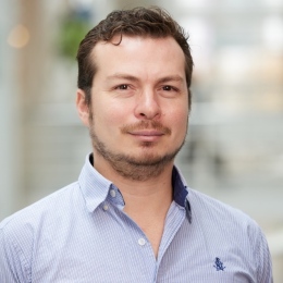
Michael Kuhn is an Adjunct Associate Professor at Curtin University's School of Earth and Planetary Sciences (EPS), part of the Faculty of Science and Engineering. He holds roles in the Office of the Provost and serves as Postgraduate Coordinator (Coursework). His research focuses on geodesy, hydrology, and climate science, with a strong emphasis on satellite data integration, groundwater modeling, and regional climate impacts. Kuhn's work spans topics including gravity field modeling, remote sensing applications, and geophysical data analysis. He has contributed to projects like the AUSHYDROID vertical datum model and studies on the Grand Ethiopian Renaissance Dam's environmental impacts. Kuhn's publications reflect interdisciplinary approaches, combining machine learning with geospatial data to address challenges in water resource management and climate variability. Education: PhD (Karlsruhe), Dip-Ing Affiliations: Office of the Provost, School of Earth and Planetary Sciences Research interests include geophysical modeling of crustal structures, climate-driven hydrological changes, and the application of advanced statistical techniques to environmental data. His work bridges geodetic science with practical applications in resource management and climate adaptation. Publications highlight contributions to understanding groundwater dynamics in Australia, remote sensing of agricultural droughts, and geodetic solutions for vertical datums. Collaborations with institutions like the German Research Center for Geosciences (GFZ) and international hydrological projects underscore his global academic network.
Joachim Jacobs is a Professor in Structural Geology and Tectonics at the Department of Earth Science, University of Bergen. His research focuses on orogenic systems, thermochronology, and continental margin evolution, particularly in Antarctica, Western Norway, East Africa, and the Arabian Plate. Key projects include the geodynamic evolution of Dronning Maud Land, Oman Ophiolite exhumation studies, and Caledonian orogenic processes. Education & Affiliations: No formal education timeline provided, but his work spans academic roles at the University of Bergen with collaborations across international institutions. Research Interests: Combines fieldwork, geochronology (U-Pb, 40Ar/39Ar), and thermochronometry (apatite fission track, (U-Th)/He) to investigate tectonic evolution. Current projects emphasize: Antarctic crustal architecture and Rodinia/Gondwana correlations Western Norway passive margin and Caledonian collapse Oman Ophiolite structural history Publications: Over 127 peer-reviewed articles since 1992, focusing on Proterozoic-Paleozoic orogens, thermochronological methods, and continental margin dynamics. Recent work includes Maud Belt accretionary processes (2025), Afro-Arabia thermochronology (2025), and Western Norway rifted margin thermal modeling (2024). Grants & Teams: Leads research groups in 'Geodynamics and Basin Studies' and collaborations with institutions like Saudi Geological Survey, German Research Foundation (DFG), and international Antarctic expeditions. Labs/Teams: Active in field campaigns in Antarctica, Oman, and Norway, coordinating with the Norwegian Polar Institute and international geochronology networks.
Associate Professor Jinling Wang is an academic at the University of New South Wales (UNSW), affiliated with the School of Civil Engineering and the Department of Civil Engineering. Her research focuses on geospatial mapping and navigation, including Global Navigation Satellite Systems (GNSS), Inertial Navigation Systems (INS), and multi-sensor integration for applications in autonomous vehicles and high-definition mapping. She has supervised 22 PhD and 6 Master’s students, seven of whom won prestigious international awards during their studies. Her awards include being named on the World’s Top 2% Scientists List from 2020 to 2024 and recognized as Australia’s Research Leader in 'Radar, Positioning, and Navigation' multiple times. She leads projects such as the UNSW Engineering Goldstar Award 2024 Research Grant and the UNSW-Tsinghua Collaborative Research Seed Project. Dr. Wang’s research trends emphasize ionospheric analysis, robust positioning algorithms, and sensor fusion for autonomous systems. Her articles span disciplines like atmospheric science, data science, and geomatics engineering, addressing challenges in GNSS reliability and real-time navigation integrity. Her advisory and grants section highlights her role in advancing autonomous vehicle technologies and HD mapping. She is part of research teams utilizing advanced facilities at UNSW’s Mark Wainwright Analytical Centre and collaborates on global navigation challenges.
Paweł Dąbrowski, PhD(Eng), is an Assistant Professor in the Department of Geodesy and Oceanography at Gdynia Maritime University (Faculty of Navigation). His expertise spans remote sensing, laser scanning, and satellite surveying , with a focus on point cloud processing for symmetrical objects and railway infrastructure analysis. He holds a PhD in Engineering from the University of Warmia and Mazury in Olsztyn (2009) and a postgraduate diploma in laser scanning from AGH University of Science and Technology. Awards: 2022 Minister of Science Scholarship, 2020 Polish Academy of Sciences Award, 2021 Minister of Infrastructure Team Award Key Projects: InnoSatTrack rail trajectory analysis, TU Delft collaboration on point cloud dissemination, Mariacka Basilica Gothic vault measurements His research combines geodetic methodologies with computational modeling to address challenges in structural analysis and spatial data interpretation. Current collaborations include work with Professor Roderik Lindenbergh at TU Delft, advancing the PCSE method for symmetry assessment.
Falk C Amelung is a Professor at the University of Miami's Rosenstiel School of Marine, Atmospheric, and Earth Science. His research focuses on crustal deformation processes using satellite Interferometric Synthetic Aperture Radar (InSAR), particularly studying active volcanoes, tectonic activity, glacial isostatic adjustment, and anthropogenic land subsidence. His work addresses volcanic hazards, groundwater management, and coastal subsidence, supported by grants from NASA, NSF, USGS, and DOE. He directs the University of Miami Geodesy Laboratory, advancing applications of InSAR in volcanic and tectonic monitoring. Research interests include deformation mechanisms at volcanoes like Galápagos, Anak Krakatau, and Kīlauea, as well as subsidence in regions like Delhi and Miami. He explores interactions between climate change, rainfall, and volcanic activity, and develops methods for improving InSAR data analysis. His team collaborates on global geohazard monitoring through initiatives like the Supersites Network. Publications highlight InSAR’s role in detecting magma movements, fault slip, and aquifer dynamics. Ongoing projects focus on optimizing deformation models and mitigating geohazards through integrated geodetic approaches. The lab also provides open-access data tools and participates in disaster-risk reduction efforts globally.
Joseph Shea is an Associate Professor in the Department of Geography, Earth and Environmental Sciences at the University of Northern British Columbia (UNBC), where he leads the Mountain Snow Hydrology (MOSH) Lab. He is affiliated with the NRES Graduate Program and teaches courses in geospatial analysis, earth observation, and mountain systems. Currently on sabbatical, he remains actively engaged in research and graduate supervision. PhD, University of British Columbia (2010) MSc, University of Calgary (2004) BSc, McMaster University (2001) His research focuses on snow, glaciers, and hydrology in mountain regions under climate change, using remote sensing, UAVs, and field measurements. He investigates snow water equivalent, glacier mass balance, and hydrological responses in the Himalayas, Canadian Rockies, and British Columbia. His work integrates geospatial technologies with environmental modeling to understand cryospheric changes. Recent publications highlight trends in UAV-based glacier mapping, debris-covered glacier dynamics, snowmelt timing from satellite data, and interdisciplinary studies on equity in science. His work spans glaciology, hydrology, climate change, and environmental geomatics, with increasing emphasis on open data and collaborative science. Scientific Awards: No awards listed in the provided text. Dr. Shea supervises MSc and PhD students in the NRES program and has advised multiple theses on snow, glaciers, and hydrology. He leads field projects in Nepal and Canada and collaborates on large-scale assessments such as The Canadian Mountain Assessment . His lab, MOSH Lab, emphasizes open-source tools and field-based research. Current projects include snowpack monitoring in the Robson Valley, glacier studies in Langtang, and UAV applications in cold regions.
Dr. Rachael Hurd is a Senior Lecturer in Spatial Sciences at the University of Tasmania's School of Geography, Planning, and Spatial Sciences. With over 20 years of academic experience, she serves as Deputy Head of School and Course Coordinator for the Graduate Diploma of Land Surveying. Her expertise spans glaciology, geodesy, and Antarctic spatial science research. Education: Completed undergraduate and postgraduate studies in Surveying and Spatial Sciences at the University of Tasmania (1991-2002), with her PhD focusing on glaciological applications of satellite positioning in Antarctica. Her postgraduate research involved large-scale fieldwork in East Antarctica, analyzing glacier dynamics using GPS and geophysical methods. Research Interests: Specializes in GPS/GNSS data analysis, ice sheet dynamics observation, and tropospheric water vapor detection. Her work integrates spatial technologies to address climate change impacts on polar environments, with a focus on the Amery Ice Shelf and Lambert Glacier Basin. Funded Projects: Participated in the Australian Antarctic Program Partnership (2019-2029), a $50M initiative involving multiple institutions to study Antarctic climate and marine ecosystems. Awards: No specific awards listed, but recognized for contributions to Antarctic spatial science through collaborative projects and institutional leadership roles. Teaching & Supervision: Coordinates surveying courses including KGG306, KGG546, and professional placement programs. Engages students in practical applications of geospatial technologies through coursework and fieldwork. Service: Serves on the Tasmanian Land Surveyors Accreditation Board and Tasmanian Spatial Information Council, promoting standards and spatial data initiatives.
James Foster is a Professor at the University of Stuttgart, affiliated with the Chair of Geodetic Spatial Methods within the Faculty 6: Aerospace Engineering and Geodesy. His research focuses on geodetic techniques applied to climate research, tsunami detection, and atmospheric water vapor analysis. He leads projects like ST3TART-FO, enhancing satellite altimetry validation, and develops ship-based GNSS networks for early tsunami warnings. Foster’s work integrates geophysical, oceanographic, and climatological insights to address global challenges like disaster mitigation and environmental monitoring. His contributions span over two decades, with significant publications in journals such as Journal of Geophysical Research and Geophysical Research Letters . He collaborates internationally on missions like Sentinel-3 and GRACE/GRACE-FO, emphasizing interdisciplinary approaches to Earth system science.
Laura Balangé is a doctoral researcher at the University of Stuttgart's Institute of Engineering Geodesy (IIGS), Faculty 6: Aerospace Engineering and Geodesy. She contributes to the Cluster of Excellence IntCDC through computational design and quality assurance research. Her work focuses on: Holistic Quality Modeling for sustainable construction Terrestrial Laser Scanning applications Coreless Filament Winding fabrication Modular Timber Shell structures Graded Concrete component monitoring Multi-Domain Co-Design frameworks Notable contributions include: 2025: Point cloud datasets for Biomimetic Shell construction 2024: Extended interrelation analysis in quality modeling 2023: Data normalization methods for co-design 2022: Production monitoring for fibrous structures 2021: Graded concrete component verification 2020: Foundational technical quality concepts She supervises academic works in: Geometric quality control Fiber cross-section analysis BIM modeling Neural network object detection Concrete positioning systems Timber fabrication quality Active in the IntCDC cluster, she collaborates with teams across architecture, engineering, and computational design domains.
Sarah Eberle-Blick is a Senior Lecturer at the Institute of Mathematics , Goethe University Frankfurt, Department of Computer Science and Mathematics. Her work bridges numerical methods, inverse problems, and wave propagation in elasticity. Research Focus : Numerical analysis of PDEs, monotonicity methods for inclusion detection, FEM-BEM coupling, multiscale seismic data processing. Key Contributions : DFG-funded projects on elastic wave reconstruction; development of stable integral formulations for acoustic and thermoelastic wave equations; implementation of 3D wave simulations. Article Trends : Recent papers emphasize inverse problems in linear elasticity, time-harmonic wave equations, and multiscale analysis using wavelets. Collaborative work spans geophysics, computational mechanics, and mathematical modeling. Projects : Includes monotonicity-based regularization, Lipschitz stability estimation, and FEM-BEM coupling with convolution quadrature. Contact: eberle@math.uni-frankfurt.de | Room 103, Institute of Mathematics, Frankfurt am Main, Germany.
Piotr Benduch, PhD, Eng., is a research and teaching assistant at the Department of Integrated Geodesy and Cartography within the Faculty of Mining Surveying and Environmental Engineering at AGH University of Science and Technology in Kraków. His academic role involves both research and educational activities focused on geodesy and cartography applications in mining and environmental contexts. Research interests include geodesy , cartography , mining surveying , and environmental engineering . His work likely involves spatial data analysis and integrated geodetic methods. Current affiliations: AGH University of Science and Technology Faculty of Mining Surveying and Environmental Engineering Department of Integrated Geodesy and Cartography Office location: Building C-4, 3rd floor, room 303. Contact: +48 12 617 22 67.
Per Knudsen is a Professor at the Department of Space Research and Technology within the Technical University of Denmark (DTU) . His work focuses on geodesy, Earth observation, and satellite altimetry, addressing critical climate science challenges such as sea-level rise, ice sheet dynamics, and ocean mass budget analysis. Research Interests Earth’s Gravity Field and Geoid Modeling Climate Change Impacts on Greenland and Antarctic Ice Sheets Integration of GNSS, Satellite Altimetry, and Tide Gauge Data Advanced Data Products for Ocean and Climate Monitoring Computational Methods in Geodetic Network Optimization Future Satellite Missions (SWOT, GOCE, CryoSat) Scientific Leadership includes supervising PhD projects on 3D Surface Displacements in Greenland Marine Geodesy using SWOT satellite data UAV-based Positioning Algorithms His publications (185) span oceanography, climate modeling, and geodetic measurement techniques, with recent emphasis on SWOT mission performance and GRACE-derived sea-level budgets.
Professor Matthias Braun is a distinguished academic in the field of physical geography, specializing in remote sensing and GIS applications for glaciology and polar research. He holds a professorship at the Institute of Geography at Friedrich-Alexander University Erlangen-Nuremberg (FAU), where he leads the Chair of Geography (Remote Sensing and GIS) and serves as Chairman of the Examination Board for B.Sc./M.Sc. Physical Geography and BA/MA Cultural Geography since 2022. His research focuses on monitoring glacier dynamics, ice sheet changes, and climate impacts in polar and mountainous regions using advanced remote sensing techniques. Professor Braun has held several significant leadership positions including Chairman of the International Doctoral Program 'Measuring and Modelling Mountain Glaciers in a Changing Climate' in the Bavarian Elite Network funded by the Bavarian Ministry of Science & Art since 2022, and Coordinator of the DFG SPP Antarctic Research since 2017. His academic journey includes an Associate Professor position at the University of Alaska Fairbanks (2010-2011) and extensive field experience leading multiple Arctic and Antarctic expeditions since 1994/95, with research stays in Alaska, South America, West & East Africa, Himalaya & Karakorum. His research interests span glaciology, remote sensing, geographic information systems, climate change impacts, land use change, polar regions, and high mountain environments. Professor Braun's work integrates microwave and optical remote sensing data from satellite and airborne platforms to derive geobiophysical parameters and their spatiotemporal variations. He employs advanced digital image processing, pattern recognition, SAR interferometry, and polarimetry techniques in his research. His laboratory maintains active participation in major research initiatives including the TanDEM-X and TanDEM-L Science Teams since 2010. Professor Braun's extensive publication record demonstrates a clear progression from foundational work on glacier monitoring to sophisticated applications of machine learning and deep learning for glacier feature extraction. His recent work focuses on calving front detection using SAR imagery, glacier velocity mapping, and integration of multi-sensor data for comprehensive glaciological analysis. Key research themes include glacier mass balance, ice sheet dynamics, supraglacial hydrology, and climate change impacts on cryospheric systems across diverse regions including Antarctica, Patagonia, the Himalayas, and the European Alps. Among his notable recognitions is the 2009 Science Award for Physical Geography from the Prof. Dr. Frithjof Voss Foundation for Geography and his Habilitation at the Mathematical-Natural Science Faculty of the University of Bonn in 2009. He serves as an Associate Editor for Frontiers in Earth Sciences – Cryospheric Sciences and reviews for numerous peer-reviewed journals. Professor Braun has mentored numerous doctoral students to completion, with recent graduates including Dr. Christian Sommer (2022), Dr. David Farias Barahona (2021), Dr. Stefan Lippl-Seifert (2020), and Dr. Peter Friedl (2019). Several students are currently completing their dissertations under his supervision. His research is supported by various funding mechanisms including the Bavarian Elite Network, DFG research programs, and international collaborations. He maintains strong connections with national and international research institutions including membership in the International Glaciological Society (IGS), German Society for Photogrammetry, Remote Sensing and Geoinformation (DGPF), German Society for Polar Research (DGP), and German Society for Geography (DGfG).
Hasan Faik Kara is an Associate Professor at Trakya University Faculty of Engineering , with a focus on earthquake engineering and wave propagation. His academic career spans roles at multiple institutions and includes significant contributions to seismic analysis of geological structures. Bachelor's, Master's, and PhD in Mechanical Engineering from Istanbul Technical University (2006-2014) Vice Dean of Trakya University Faculty of Architecture (2021-2024) Research Interests center on seismic wave behavior in heterogeneous media, including: SH-wave scattering in tunnels and hillsides Material discontinuities in fault zones Seismic response of sedimentary basins Dynamic stress analysis in functionally graded materials Publications demonstrate expertise in numerical modeling of earthquake-induced vibrations and analytical corrections to wave propagation approximations. His work bridges theoretical seismology and applied structural engineering.
Francisco J. Peña is a postdoctoral researcher working jointly at the Department of Physical Geography of Stockholm University and the Division of Software and Computer System (SCS) of KTH Royal Institute of Technology in Sweden. He is also a member of the Distributed Computing at KTH (DC@KTH) research group. Peña received his PhD from University College Cork in June 2019 and previously held a postdoctoral position at University College Dublin (2018-2020). His academic journey reflects a strong foundation in computational methods applied to geospatial analysis. His research program bridges artificial intelligence and environmental monitoring, with particular expertise in applying deep learning techniques to remote sensing data. Peña's work in computer vision and natural language processing contributes to innovative approaches for analyzing geospatial information, with applications in hydrological monitoring and wetland conservation. His interdisciplinary approach combines computer science methodologies with physical geography challenges. Peña is actively engaged with the Hydrogeodesy Lab, which specializes in using geodetic methods to measure hydrological quantities that conventional monitoring systems cannot capture. This research has significant implications for water resource management and climate change adaptation. His current DeepWetlands project represents a cutting-edge application of machine learning to monitor water extent changes in wetlands through integration of satellite imagery, radar data, and other space-based sensors. This work addresses critical environmental monitoring needs with advanced computational techniques.