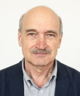
Ján HeftyView profile
Professor
Prof. Ján Hefty serves as Professor and Head of the Department of Global Geodesy and Geoinformatics at the Faculty of Civil Engineering, Slovak University of Technology in Bratislava, a position he has held since 2003. With continuous affiliation since 1975, he progressed from Observatory Assistant to full Professor in 2006 following his inaugural lecture on permanent GNSS monitoring for geodesy and geodynamics. His academic credentials include a Candidate of Sciences (PhD equivalent) in Geodesy and Cartography obtained in 1985 with research on Earth dynamics using astronomical measurements, followed by habilitation in 1995 leading to Associate Professorship. His scholarly journey reflects deep specialization in geodetic methodologies and Earth system science. Prof. Hefty's research spans geodetic astronomy (1975-2000), Earth rotation analysis (1980-1995), and modern geodynamics using GNSS since 1991. His current work focuses on high-frequency GPS analysis for seismic displacement detection, Central European geokinematic modeling, and troposphere/ionosphere studies. He established Slovakia's first permanent GPS station in Modra-Piesk and directs the Local Analytical Center of the European Permanent Network. His 110+ publications reveal evolving trends from optical astrometry to cutting-edge GNSS applications, with recent work emphasizing real-time geodesy for natural hazard monitoring and reference frame densification in Central Europe. The research consistently bridges theoretical geodesy with practical geodynamic applications. Prof. Hefty has co-led 25 research and grant projects including the Central European Regional Geodynamics Project (CERGOP) and European Permanent Network initiatives. His international collaborations include five research stays at the Paris Observatory's International Earth Rotation Service, focusing on astrometric Earth rotation determination and VLBI applications. He oversees critical geodetic infrastructure including the Modra-Piesk GPS station and Central European data analysis center, which continuously process observations from regional networks. His team's work supports reference frame realization, crustal deformation monitoring, and the integration of geodetic data with geophysical models across Central Europe.