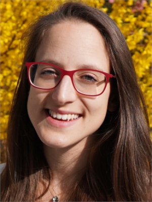
Dr. Laura Crocetti is a Lecturer at the Department of Civil, Environmental and Geomatic Engineering at ETH Zurich. She joined ETH Zurich in 2020 as a Ph.D. student and currently holds a postdoctoral researcher position (2025-present) while serving as faculty. Her research focuses on advanced applications of machine learning in space geodesy, including GNSS data analysis and geophysical pattern detection. Research Interests: Dr. Crocetti develops computational methods for analyzing GNSS time-series data, models environmental impacts on geodetic measurements, and creates data-driven pipelines for detecting anomalies in geophysical datasets. Her work bridges geodesy with AI methodologies. Education: Ph.D. in Space Geodesy, ETH Zurich (2020-2024) MSc in Geodesy and Geoinformation, TU Vienna (2016-2019) BSc in Geodesy and Geoinformatics, TU Vienna (2012-2016) Awards: Best Presentation at ETH IGP Doctoral Day (2022) Best Presentation at D-BAUG Research Day (2021) Early Adopter for Earth System Data Lab (2019) EC Student Grant for ESA Symposium (2019) Excellence Scholarship, TU Vienna (2018)
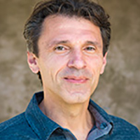
Prof. Dr. Eng. Yuri Tsanovski serves as Deputy Dean for Academic Affairs at the Faculty of Geodesy, University of Architecture, Civil Engineering and Geodesy (UACEG). He is affiliated with the Department of Higher Geodesy where he maintains Cabinet 500. His academic career spans multiple roles from Senior Assistant to current Associate Professor status. Dr. Tsanovski's research focuses on Engineering Geodesy, Cadastre, Hydrography, and GNSS technologies. His work includes significant Antarctic research participation through the 18th and 24th Bulgarian Antarctic Expeditions, contributing to geodetic surveying in extreme environments. His scientific interests bridge theoretical geodesy with practical applications in navigation systems and precision measurement. His publication portfolio demonstrates consistent advancement in GNSS technologies, evolving from foundational GPS concepts to specialized applications in kinematic positioning and precision measurements. The research trajectory shows increasing sophistication in handling complex geodetic problems, particularly in network alignment and satellite-based positioning systems. Dr. Tsanovski actively contributes to academic instruction through multiple lecture courses including Global Navigation Satellite Systems, Precise GPS Measurements, and Space Geodesy. His teaching materials reflect practical applications across both theoretical and hands-on components of geodetic education.
Jamie McCallum is the Radio Telescope Array Operations Manager at the School of Natural Sciences, Physics, University of Tasmania. He plays a key role in the AuScope VLBI project, which collaborates with Geoscience Australia to advance global geodetic measurements using radio telescopes. Role : Operations Manager for Australian VLBI array Collaborations : Geoscience Australia, International VLBI Service for Geodesy and Astrometry (IVS) Research Interests include: Geodetic applications of VLBI Radiotelescope calibration Earth orientation parameter determination Space ties between GNSS, SLR, and VLBI Southern hemisphere observational strategies High-resolution radio interferometry Research Output Trends show a focus on: Improving geodetic precision to millimeter levels Developing mixed-mode and dynamic VLBI scheduling Analyzing interstellar scintillation effects Aligning celestial and terrestrial reference frames Tracking black hole binary systems Supervision includes: Primary supervisor for Chin Chuan Lim's doctoral research (2018-2023) on dynamic VLBI operations Funded Projects totaling over $9 million from Geoscience Australia and Department of Industry initiatives to support: AuScope VLBI array operations (2013-2028) Yarragadee telescope safety protocols (2025) Global geodetic reference frame development
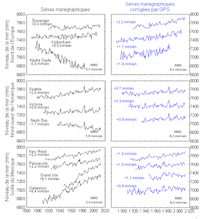
Guy Wöppelmann is a University Professor in the Earth Sciences department at La Rochelle University, specializing in geodesy and sea level research. He serves as a corresponding member of the BDL since 2022 and is affiliated with CNRS scientific institute INSU (CNU 35 research section). His work focuses on integrating space geodesy techniques with traditional sea level monitoring to understand coastal dynamics in the context of climate change. Professor Wöppelmann's research spans vertical land movements, space geodesy (particularly GNSS/GPS and InSAR), sea level monitoring, and tide gauge technologies. His work examines vertical displacements on Earth's surface at coastlines using space observation methods, analyzes century-long sea level evolution through historical tide gauge records, develops new sea level measurement technologies, and investigates climate signals in sea level records. His research provides critical insights for understanding relative sea level changes by separating vertical land motion from actual sea level rise. His publication record shows consistent focus on coastal geodesy, with recent work emphasizing continental-scale coastal subsidence analysis, integration of GPS with tide gauge measurements, historical sea level record extension, and the impacts of climate change on coastal zones. His research bridges technical geodesy with practical climate adaptation needs for coastal communities. Professor Wöppelmann actively supervises doctoral research, with eight PhD students having completed their theses under his guidance since 2004, covering topics from GNSS reflectometry to historical sea level analysis. His leadership extends to major international scientific initiatives that shape global sea level monitoring standards.
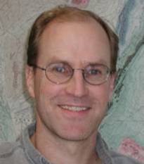
William E. Holt is a Professor in the Department of Earth and Space Sciences at Stony Brook University since 1991. He holds a B.S. from Northern Arizona University (1983), a Ph.D. from the University of Arizona (1989), and completed a postdoctoral fellowship at DSIR Geology and Geophysics in New Zealand (1989-1991). His research focuses on lithosphere dynamics, coupling with mantle convection, and modern geodetic techniques such as InSAR and GNSS for crustal deformation analysis. Key projects include: 3D geodynamic modeling of Southwestern North America's evolution since the Eocene Thermomechanical studies of the East African Rift System Lithospheric structure analysis using wave gradiometry and seismic data Research interests span tectonic-climate interactions, crustal strain patterns, and seismic properties derived from wavefield analysis. Collaborations include Weisen Shen, Troy Rasbury, and Ali Bahadori. Holt has advised numerous Ph.D. and postdoctoral researchers, contributing to over 150 publications. His work bridges geophysics, structural geology, and geodynamics, with implications for understanding seismic hazards, landscape evolution, and continental deformation processes.
Adrian Borsa is a Professor in the Department of Geophysics at the Scripps Institution of Oceanography, UC San Diego. His primary affiliations include the Institute of Geophysics and Planetary Physics (IGPP), where he conducts research in geodetic remote sensing and hydrogeophysical applications. He is actively involved in the NASA-ISRO SAR (NISAR) mission, contributing to validation efforts for solid Earth deformation studies. Research interests focus on elastic earth deformation due to crustal loading, remote sensing techniques for cryosphere monitoring, geodetic imaging of groundwater storage dynamics, and altimeter data validation. He develops advanced tools like BInSAR and GInSAR for processing InSAR and GPS data, and leads projects involving ICESat-2 altimetry for coastal erosion and Arctic DEM analysis. His work integrates geophysical observations with hydrological models to address water sustainability challenges. Recent articles highlight trends in hydrogeodesy applications for drought monitoring, atmospheric river impacts, and glacier calving events in Greenland. He emphasizes interdisciplinary approaches combining machine learning with geodetic data for environmental assessments. No scientific awards are explicitly listed, but his contributions to geodetic methodologies suggest significant recognition potential in the field. Adrian advises no formal students but collaborates extensively on grants related to NISAR mission development and hydrogeological monitoring networks. He is affiliated with the IGPP research team and contributes to labs focusing on geodetic instrumentation and data analysis platforms like OpenAltimetry.
David T. Sandwell is a Professor of Geophysics at the Institute of Geophysics and Planetary Physics within Scripps Institution of Oceanography, University of California, San Diego. His research integrates satellite remote sensing, geodesy, and marine geophysics to study Earth's dynamic processes. Research Interests: Sandwell specializes in marine gravity anomaly mapping from satellite altimetry, predicted and measured seafloor topography, synthetic aperture radar interferometry (InSAR), thermal and mechanical structure of the oceanic lithosphere, geodynamic applications of satellite altimetry, and tectonics on Venus. His work bridges planetary science with terrestrial geophysics, focusing on crustal deformation, earthquake mechanics, and ocean basin evolution. He teaches courses including Introduction to Geodynamics, Satellite Remote Sensing, and Physics of Surfing. His recent publications demonstrate a strong trend toward high-resolution seafloor mapping, interseismic deformation analysis, and advanced InSAR techniques for earthquake cycle studies. Key themes include satellite-derived bathymetry, fault creep monitoring along major plate boundaries like the San Andreas Fault, and tectonic applications of gravity field recovery. His research increasingly incorporates multi-satellite data fusion and computational geophysics for modeling lithospheric behavior. Scientific Awards: While specific awards aren't detailed in the source material, Sandwell's extensive publication record (over 200 papers) and leadership in major projects like the SRTM15+ global bathymetry model reflect significant recognition in geophysics. Advising and Grants: Sandwell has advised 17 Ph.D. students since 1988, with recent graduates (2016-2023) focusing on seafloor geodesy, InSAR applications, and lithospheric mechanics. His research is supported by NASA, NSF, and USGS grants targeting satellite geodesy, earthquake cycle modeling, and marine gravity field recovery. Current projects include meter-scale seafloor deformation monitoring and absolute phase recovery in InSAR processing. Labs and Teams: He leads research within Scripps' Institute of Geophysics and Planetary Physics, collaborating with the GPlates development team for 3D tectonic visualization and contributing to NASA's Earth Surface and Interior focus area. His group develops open-source radar interferometry software (GMTSAR) and maintains global gravity and bathymetry databases used worldwide.
Professor Szabolcs Rózsa serves as Dean of the Faculty of Civil Engineering and Head of the Department of Geodesy and Surveying at Budapest University of Technology and Economics . He coordinates the Geoinformatics Engineering MSc specialization and contributes to doctoral council activities. His research focuses on GNSS applications in Earth sciences, atmospheric monitoring, and structural engineering. Research Fields: GNSS Meteorology, Geodynamics, Sensor Fusion for Autonomous Vehicles, Structural Health Monitoring Projects: GeoSES (cross-border geohazard monitoring), INTRO (troposphere model integrity), TROPSY (tropospheric effects for navigation), COST ES1206 (GNSS tropospheric products for climate studies) His scientific publications cover tropospheric delay modeling, GNSS-based water vapor estimation, geodetic deformation analysis, and low-cost sensor applications. He has contributed to autonomous vehicle localization in urban environments and developed GNSS stream gauge techniques for hydrological monitoring. Awards: IAG Fellow (2007) Pro Scientia Golden Award (1999) Szádeczky-Kardoss Elemér Award (2012, 1999) Minister's Certificate of Recognition (2019) As a DSc (2023) and habilitation holder (2015), he advises students on topics like positioning in dynamic environments . His leadership roles in the Hungarian Academy of Sciences and international geodetic organizations further highlight his impact.
Juraj Papčo is a researcher at the Slovak University of Technology in Bratislava, affiliated with both the Department of Global Geodesy and Geoinformatics at the Faculty of Civil Engineering and the Department of Theoretical Geodesy. His work spans multiple institutions through collaborations with the European Space Agency, German Aerospace Center, and various international universities. Dr. Papčo's research focuses on advanced geodetic techniques, particularly satellite radar interferometry (InSAR) for monitoring ground deformations. His expertise encompasses Global Geodesy, Physical Geodesy, Satellite Navigation Systems, Gravimetry, and Geodynamics. He has made significant contributions to applying these methods for infrastructure monitoring, archaeological prospection, and environmental applications. His publication record shows consistent productivity since the early 2000s, with notable recent work on deformation-induced topographic effects in gravity measurements (2019) and multi-temporal InSAR techniques for structural health monitoring (2014). His research demonstrates a strong trend toward practical applications of geodetic science in solving real-world problems across diverse domains. Dr. Papčo has led multiple significant research projects including ESA Earth Observation Principal Investigator Project EOPI-9981 and DLR project LAN 1583. His international collaborations span Europe, Africa, and Asia, demonstrating the global relevance of his work in satellite-based deformation monitoring. As an educator, he teaches Global Geodesy, Geodynamics, and GIS in Building Sciences, while supervising practical exercises in Remote Sensing, Gravimetry, and field techniques. His research group operates the InSAR.space platform, supporting advanced deformation monitoring applications using satellite radar technology.
Prof. Ján Hefty serves as Professor and Head of the Department of Global Geodesy and Geoinformatics at the Faculty of Civil Engineering, Slovak University of Technology in Bratislava, a position he has held since 2003. With continuous affiliation since 1975, he progressed from Observatory Assistant to full Professor in 2006 following his inaugural lecture on permanent GNSS monitoring for geodesy and geodynamics. His academic credentials include a Candidate of Sciences (PhD equivalent) in Geodesy and Cartography obtained in 1985 with research on Earth dynamics using astronomical measurements, followed by habilitation in 1995 leading to Associate Professorship. His scholarly journey reflects deep specialization in geodetic methodologies and Earth system science. Prof. Hefty's research spans geodetic astronomy (1975-2000), Earth rotation analysis (1980-1995), and modern geodynamics using GNSS since 1991. His current work focuses on high-frequency GPS analysis for seismic displacement detection, Central European geokinematic modeling, and troposphere/ionosphere studies. He established Slovakia's first permanent GPS station in Modra-Piesk and directs the Local Analytical Center of the European Permanent Network. His 110+ publications reveal evolving trends from optical astrometry to cutting-edge GNSS applications, with recent work emphasizing real-time geodesy for natural hazard monitoring and reference frame densification in Central Europe. The research consistently bridges theoretical geodesy with practical geodynamic applications. Prof. Hefty has co-led 25 research and grant projects including the Central European Regional Geodynamics Project (CERGOP) and European Permanent Network initiatives. His international collaborations include five research stays at the Paris Observatory's International Earth Rotation Service, focusing on astrometric Earth rotation determination and VLBI applications. He oversees critical geodetic infrastructure including the Modra-Piesk GPS station and Central European data analysis center, which continuously process observations from regional networks. His team's work supports reference frame realization, crustal deformation monitoring, and the integration of geodetic data with geophysical models across Central Europe.
Mauro Soldati is a Full Professor in the Department of Chemical and Geological Sciences at the University of Modena and Reggio Emilia, specializing in Physical Geography and Geomorphology (GEOS-03/A). His research and teaching focus spans multiple areas including geomorphology, climate change impacts, geological hazards, and geoheritage. Based in Modena, Italy, he maintains an active research program with numerous publications in leading journals. Soldati's research interests include Physical Geography , Geomorphology , Climate Change , Landslides , Geological Hazards , Coastal Processes , Geoheritage , and Earth Surface Processes . His work demonstrates particular expertise in landslide dynamics, geomorphological risk assessment, and the application of remote sensing techniques to geomorphological problems. He has conducted extensive research in the Mediterranean region, particularly in the Northern Apennines and Maltese Islands. Analysis of his recent publications (2022-2025) reveals a strong focus on interdisciplinary research connecting geomorphology with climate change impacts, cultural heritage preservation, and risk assessment. His work integrates traditional field methods with advanced technologies like SAR interferometry, machine learning, and virtual reality applications. Key themes include landslide susceptibility mapping, coastal vulnerability assessment, glacial history reconstruction, and the development of new methodologies for geoheritage evaluation. Soldati has made significant contributions to understanding the relationships between geological processes and societal challenges, particularly through his work on landslides affecting cultural heritage sites, climate change impacts on coastal areas, and the geographical factors influencing pandemic spread. His research demonstrates a consistent commitment to applying geomorphological knowledge to practical problems of societal relevance. As an educator, Soldati teaches courses including 'Ecology and global changes' for the Master's Degree in Science Teaching and Communication and 'Geomorphology and climate change' for Geological Sciences students. His teaching emphasizes both theoretical knowledge and practical application of geomorphological concepts.
Alexis Hrysiewicz is a Lecturer/Assistant Professor at the School of Earth Sciences, University College Dublin. His research specializes in remote sensing applications for temperate peatlands, utilizing SAR and InSAR techniques to monitor carbon emissions, soil moisture, and ground displacements. He holds a PhD in Earth Sciences from Université Blaise Pascal, complemented by Bachelor's and Master's degrees from the same institution. Research Focus Dr. Hrysiewicz's work centers on developing scalable methods for peatland preservation and restoration. Key areas include: Integration of SAR/InSAR data with ecohydrological parameters to track peatland degradation Machine learning applications for enhancing InSAR coherence in infrastructure monitoring Open-source tool development (e.g., EZ-InSAR, EGMS-toolkit) for geospatial data processing Wildfire impact assessment on peatland ecosystems using radar remote sensing Publication Trends His recent articles (2019-2025) demonstrate a strong focus on geohazard monitoring, with recurring themes of InSAR validation, peatland dynamics, and volcanic crisis management. Over 70% of publications involve multi-institutional collaborations, emphasizing practical applications in climate resilience and infrastructure stability. Professional Engagement Dr. Hrysiewicz actively presents at conferences like the American Geophysical Union and Irish Earth Observation Symposium, with recent work on AI-enhanced peatland monitoring platforms. His research lacks explicit mentions of awards, advised students, or dedicated lab teams.
Prof. Andreas Wieser is a Full Professor of Geosensorics and Engineering Geodesy at ETH Zürich's Department of Civil, Environmental and Geomatic Engineering, leading the Institute of Geodesy and Photogrammetry. His work focuses on advanced measurement systems for high-precision positioning, navigation, and geodetic monitoring of infrastructure and natural environments. Notable contributions include parameter estimation methods, quality control frameworks, and sensor optimization for applications like avalanche monitoring, railway deformation analysis, and CERN's Futur Circular Collider project. Education: PhD in Surveying from TU Graz (2001), Thesis: 'Robust and fuzzy techniques for parameter estimation and quality assessment in GPS' Habilitation at TU Graz (2007), Thesis: 'GPS based velocity estimation and its application to an odometer' Postdoc at University of Calgary (2003-2004) Research Interests: Development of multi-spectral LiDAR systems for material probing and distance measurement Integration of sensor technologies for environmental monitoring (e.g., snow depth analysis, hydroelectric dam deformation) High-precision geodetic infrastructure for large-scale projects like CERN's FCC Algorithmic advancements in point cloud registration, radiometric calibration, and uncertainty quantification Honors: 2006 Karl-Rinner Award (Austrian Geodetic Commission) 2003 Erwin-Schrödinger Fellowship (Austrian Science Fund) 2002 Josef Krainer Sponsorship (State of Styria) Grants & Labs: Alpine Metrology Lab: Long-range TLS and permanent GNSS for geomonitoring Leadership on CERN FCC Geodesy project Development of Comb-based multispectral LiDAR systems His work bridges geomatics with engineering challenges, emphasizing practical implementations of advanced sensor technologies across civil infrastructure, environmental science, and heritage preservation.
Dr. Antonio José Gil Cruz is a Professor at the University of Jaén, Spain, specializing in geodesy and tectonic studies. His research focuses on active tectonics, crustal deformation analysis, and the application of advanced geodetic techniques such as GNSS and InSAR to understand seismic hazards and structural geology. He has conducted extensive fieldwork in regions like the Betic Cordillera, Alborán Sea, and Ecuador, contributing to the understanding of fault dynamics and crustal kinematics. Key research interests include: Integration of geodetic and geological data for seismic hazard assessment GNSS network development for monitoring active faults Remote sensing applications in civil engineering and environmental monitoring Low-cost GNSS solutions for precision agriculture His work bridges academic research with practical applications, including geomatics education and promoting scientific infrastructure in higher education. Collaborative projects like the RemoDams initiative highlight his expertise in satellite radar interferometry for infrastructure monitoring. Dr. Gil Cruz has published over 30 peer-reviewed articles since 1990, with recent emphasis on real-time positioning systems and multi-constellation GNSS applications in ecology and geophysics. His contributions to the Topo-Iberia GPS network exemplify his commitment to advancing geodetic infrastructure for both research and educational purposes.
Prof. Reha Metin Alkan is a Professor at the Department of Geomatics Engineering, Civil Engineering Faculty of Istanbul Technical University. He holds a PhD in Geodesy and Photogrammetry Engineering from the same institution. His research focuses on Land Management, GNSS Applications, Hydrographic Measurements, and Operations Research. He has contributed significantly to precise positioning techniques in polar regions and nuclear disaster risk assessment. Alkan has extensive administrative experience, including roles such as Department Head and Dean at various universities. He is affiliated with multiple professional organizations like the European Geosciences Union and the Turkish National Geodetic Commission. His work aligns with UN Sustainable Development Goals related to climate action and sustainable cities. His research emphasizes applications in Antarctica, nuclear emergency planning, and smart city technologies. He has supervised over 15 theses, with recent topics including renewable energy cadastres and AI-driven traffic sign detection. Alkan has received numerous awards, including Elsevier Recognized Awards and 'Man of the Year' recognitions from Corum News Newspaper. Education: B.Sc., M.Sc., and Ph.D. in Geodesy and Photogrammetry Engineering from Istanbul Technical University. Awards: Over 15 prestigious awards, including Best Paper and Reviewer Recognition. Projects: Led studies on Antarctic positioning and nuclear emergency shelters.