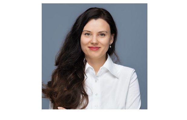
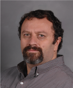
Katažyna Bogdzevič is a Professor at Mykolas Romeris University (MRU) Law School, specializing in Private International Law , European Law , Human Rights , and Environmental Law . She leads the MRU Human Rights LAB and contributes to the Environmental Management Research LAB, focusing on legal frameworks for ecosystem services, climate change mitigation, and stakeholder engagement. Key Research Themes: Integration of Private International Law with Environmental Law , analysis of legal conflicts in nature-based solutions, and name rights under international human rights conventions. Policy Engagement: Serves as advisor to Lithuania's Minister of Justice Ewelina Dobrowolska , emphasizing knowledge transfer to legislative and judicial practices. Email: roffice@mruni.eu
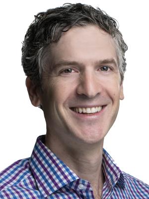
Dr Olatunji Johnson is a Lecturer in Statistics at The University of Manchester's Department of Mathematics. His research focuses on spatial and spatio-temporal statistics applied to global public health challenges, including tropical diseases like malaria and neglected tropical diseases (NTDs). He holds a PhD in Statistics and Epidemiology and has developed influential geostatistical methods and R packages (SDALGCP and MBGapp) for disease mapping and surveillance. Education: PhD in Statistics and Epidemiology (supervised by Prof. Peter Diggle). Research interests include model-based geostatistics, real-time health surveillance, and hybrid machine learning approaches for spatial data analysis. He is actively seeking PhD students interested in spatial statistics applications. Key Collaborations: Worked on projects in Kenya, Cameroon, Uganda, and Ethiopia, focusing on helminth control, air pollution impacts, and disease burden analyses. Part of the Statistical Advisory Unit and contributes to the UN Sustainable Development Goals through his work on health equity and disease elimination. Notable Projects: Developed methodologies for efficient survey design in NTD programs, air quality studies in African cities, and spatiotemporal modelling of pandemic risks. His work bridges statistical innovation with actionable public health policy.
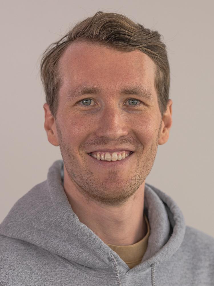
Hazem U. Abdelhady is a Postdoctoral Research Fellow at the University of Michigan's School for Environment and Sustainability (SEAS), jointly appointed with the Cooperative Institute for Great Lakes Research (CIGLR). He will join Texas A&M University's Department of Geography as an Assistant Professor in Fall 2025. His research focuses on coastal and hydrodynamic processes, leveraging machine learning, remote sensing, and physics-based modeling to address climate-driven challenges in lakes and coastal systems. Dr. Abdelhady holds a PhD from Purdue University in Hydraulics and Hydrology Engineering and Computational Engineering (2024), an MS in Irrigation and Hydraulics Engineering from Cairo University (2020), and a BS in Civil Engineering (2018). His postgraduate certificate in Geospatial Information Sciences underscores his expertise in spatial data analysis. His research interests include coastal hydrodynamics, physical limnology, and AI-driven environmental modeling. Key projects involve understanding shoreline changes in Lake Michigan, predicting ice cover dynamics, and developing tools for climate adaptation. The Aggie CIS Lab , launching at Texas A&M in Fall 2025, will further advance these efforts, bridging disciplines to enhance coastal resilience. Recent work highlights include studies on climate impacts on lake temperatures, machine learning applications for wave modeling, and automated shoreline detection algorithms. He actively recruits PhD students for Fall/Spring 2026 to investigate Great Lakes dynamics and resilience strategies. Collaborations span academic and governmental institutions, emphasizing interdisciplinary approaches to environmental challenges. His publications span high-impact journals and conferences, reflecting contributions to both theoretical and applied aspects of water resources engineering.
Dr. Yijing Li is a Senior Lecturer in Urban Informatics at King’s College London, Department of Informatics. She joined King’s in 2018 and previously held roles at the University of Warwick and China Executive Leadership Academy Pudong. Her research focuses on spatial analysis of urban crime, counter-terrorism strategies, climate change impacts on crime, and risk management using big data. She holds a PhD in Geography of Crime from the University of Cambridge and an MSc in Urban Ecology from Peking University. Her work integrates theories from sociology, criminology, and economics with quantitative and qualitative methods. Key research areas include crime patterns during pandemic lockdowns, One Belt One Road security strategies, and environmental sustainability assessments. She has authored over 30 publications, including studies on London’s crime dynamics, spatial disparities in crime data, and vegetation change modeling using remote sensing. Dr. Li is affiliated with the Centre for Urban Science and Progress (CUSP) London and the Computing Education Research Centre (CERC). She has supervised interdisciplinary projects on employability in data science programs and collaborated with organizations like Transport for London and Westminster City Council. Her recent work examines health resilience in European countries post-pandemic and employs Bayesian models to analyze crime patterns during lockdowns.
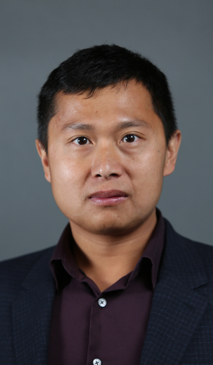
Kenan Li, Ph.D., is an Associate Professor in the Department of Epidemiology and Biostatistics at Saint Louis University’s College for Public Health and Social Justice. He joined SLU in August 2022 and teaches courses such as Statistical Learning, R for Spatial Analysis, and Environmental Determinants of Health. His research bridges data science, GIS, and public health, focusing on spatial computation, environmental exposures, and community resilience. Ph.D. in Environmental Sciences, Louisiana State University M.S. in Environmental Sciences, Louisiana State University B.S. in Environmental Sciences and Applied Mathematics, Nankai University, China Dr. Li’s research interests lie at the intersection of spatial computation, environmental health, and community resilience . He develops geo-AI frameworks , integrated geo-cyber-infrastructures , and biostatistics algorithms using big data, deep learning, and sensor data. His work emphasizes understanding human-environment interactions, urban sustainability, and health disparities. His recent publications from 2023 to 2015 reveal a strong trend in spatial modeling of population dynamics , machine learning for environmental exposure analysis , and resilience assessment in vulnerable coastal regions. He has pioneered methods like Dynamic Time Warping Self-Organizing Maps and Wavelet-based Shapelet Discovery to extract meaningful patterns from high-frequency sensor data. His scientific awards include the Taylor Geospatial Institute Seed Grant (2023) , the Saint Louis University 2023 Health Research Grant , and selection for the Scholarly Undergraduate Research Grants and Experiences . He has secured funding from NSF, NIH, USC Keck School of Medicine, and the US Army Corps of Engineers. Dr. Li has advised and collaborated on numerous research projects, particularly in interdisciplinary teams studying the Mississippi River Delta and urban health interventions. He has been involved in NIH/NIBIB-funded projects and led research on emergency management of trail systems in Los Angeles County. He is actively involved in building research labs and teams focused on spatial data science and public health analytics , having previously worked at USC’s Spatial Sciences Institute and Population and Public Health Sciences Department.
Humphrey Southall is Professor of Historical Geography at the University of Portsmouth, affiliated with the Faculty of Science & Health and the School of the Environment and Life Sciences. He has been a key figure in advancing digital historical geography through large-scale projects such as A Vision of Britain through Time and the Great Britain Historical GIS . University: University of Portsmouth Faculty: Faculty of Science & Health Department: School of the Environment and Life Sciences Academic Rank: Professor Education: Bachelor's Degree, University of Cambridge (1976) Special Student, Harvard University (1976–1977) PhD, University of Cambridge (awarded 1984) Humphrey Southall's research centers on historical geography, with a focus on geospatial data modeling, gazetteers, and historical GIS. His work explores the long-term impacts of locality on health inequalities, the North-South divide in Britain, and the political roles of travellers. He has pioneered methods for disambiguating historical place names and constructing digital gazetteers from old maps and census data. His interdisciplinary approach bridges geography, history, and data science, contributing to digital humanities and sustainable development goals related to health and inequality. His recent publications reveal a strong trend toward integrating historical data with modern GIS and ontologies. Themes include electoral analysis (e.g., Reform UK), climate-land use interactions, and the digitization of historical statistics. His work emphasizes data accessibility, public engagement, and the application of historical insights to contemporary policy challenges. Scientific Awards and Recognition: No specific awards listed in the provided text. Humphrey Southall has secured major research grants from the ESRC, AHRC, JISC, and the European Commission. He leads the DDME: Data Discovery Made Easy project, applying machine learning to social science databases. He has supervised PhD students and actively collaborates with researchers across disciplines. His public engagement includes media commentary on homelessness, air pollution, and elections via The Conversation and national press. Labs and Research Teams: Lead Principal Investigator, A Vision of Britain through Time (VoB) Lead, Great Britain Historical GIS (GBHGIS) Team Member, PastPlace and AOU Resources as a Pelagios GIF Resource Collaborator with Patrick Aucott, Chris Thomas, and others on biodiversity and health projects
Dr. Mojgan A. Jadidi serves as Associate Professor in the Teaching Stream and Director of Common Engineering & BSc Science within the Department of Civil Engineering at York University's Lassonde School of Engineering. A Professional Engineer (P.Eng) and founder of the GeoVA Lab, she leads research at the intersection of geospatial analytics, digital infrastructure, and innovative engineering education aligned with UN Sustainable Development Goals. Education: PhD in Geomatics, Université Laval (2014) MSc in Earthquake and Seismology Engineering, ROSE Center (Italy) & Université Joseph Fourier (France) BSc in Civil-Survey Engineering, Iranian University of Science and Technology Research Focus: Her pioneering work in Geospatial Visual Analytics spans 2D/3D environments, Building Information Modeling (BIM) and 3D GIS integration, and Spatial Quantum Computing applications for smart cities. She develops Infrastructure Digital Twins using sensor data fusion while revolutionizing engineering education through gamification and augmented/virtual reality pedagogies that transform complex spatial concepts into immersive learning experiences. Research Trends: Recent publications (2021-2023) demonstrate convergent innovation across three domains: (1) Building energy optimization through BIM-graph analytics, (2) Transportation safety via AI-driven situational awareness, and (3) Educational technology using VR sandboxes and visual-verbal comics. These works consistently integrate quantum computing principles and UN SDG frameworks to solve urban sustainability challenges. Scientific Recognition: ASEE Zone III Best Paper Award (2023) ASEE Saint Lawrence Best Research Paper & Poster (2022) 3D GeoInfo Conference Best Paper (2018) NSERC Postdoctoral Fellowship (2016) ESRI Student Award (2011) Erasmus Mundus Scholarship (2006) Research Leadership: As Associate Director of York's ESRI Center of Excellence, she manages multi-source funding from NSERC, Mitacs, and York University internal grants. Her professional service spans global organizations including ISPRS Commission IV (Secretary), IEEE Women in Engineering (Member), PEO Etobicoke (Chair), and buildingSMART Canada (Committee Member), driving standards for BIM and digital twin implementation in urban infrastructure. Lab Innovation: The GeoVA Lab develops cutting-edge tools including the TopoSurvey Game for immersive surveying education, PAN-Lassonde XR Sandbox for virtual lab experiences, and quantum computing frameworks for bike-sharing optimization, establishing new paradigms in spatial data interaction and engineering pedagogy.
Professor Damien Field is a leading academic in global soil security and soil education at the University of Sydney, serving as Director of the Sydney Institute of Agriculture and Chair of Division 4 in the International Union of Soil Science. He holds roles in the School of Life and Environmental Sciences and chairs the Sydney Southeast Asia Centre's Executive Research Training committee. His career includes research fellowships, academic leadership roles, and a Master of Education (Higher Education). Education: Bachelor of Science in Soil Science PhD in Soil Structure (Cotton Production) Master of Education (Higher Education) Research Interests: Integrating soil security with global sustainability, soil modeling, and education. His work spans soil functionality, agroecosystems, and community-driven research in Laos and Papua New Guinea. He advocates linking research with teaching, emphasizing real-world problem-solving through innovative curricula and field schools. Publications & Grants: Over 100 peer-reviewed articles, including books on global soil security and chapters on soil sensing. Key projects include soil mapping in Laos and cocoa sustainability in PNG, funded by ACIAR and GRDC. Collaborates with universities in Cambodia, Laos, Vietnam, and the USA. Awards: Vice Chancellor’s Award for Outstanding Mentorship (2016) Fellow of Soil Science Australia (2020) Principal Fellow Higher Education Academy (2020) Roles & Lab: Leads the Sydney Institute of Agriculture and coordinates international field schools with the National University of Laos. Advises postgraduate training and chairs soil education committees internationally.
Dr. Andrew Curtis is a Professor in the Department of Population and Quantitative Health Sciences at Case Western Reserve University's School of Medicine. He also holds a joint appointment in the Department of Anthropology, College of Arts and Sciences. His research focuses on spatial epidemiology, context-driven spatial data collection, and spatial confidentiality, with methodological expertise in geospatial data collection and analysis. He previously directed the WHO Collaborating Center for Remote Sensing and Public Health and has advised numerous public health agencies internationally. His work addresses health disparities at neighborhood scales, disaster response, and spatial syndromic surveillance. Dr. Curtis has mentored 10 PhD graduates now working in academia and public health sectors globally. Education includes a PhD in Geography from SUNY Buffalo (1995), MA in Geography from SUNY Buffalo (1991), and a BA from Portsmouth Polytechnic (1987). He has taught courses in GIS for health, medical geography, and global health. His advisory roles include collaborations with the CDC, Red Cross, and public health departments in Ohio and internationally. His research has been applied to cholera outbreaks, opioid overdose patterns, and pandemic response strategies. He co-edited a special issue on health geography and serves on the editorial board of the Annals of the Association of American Geographers. Dr. Curtis' spatial video methodologies have enabled fine-scale mapping in informal settlements, disaster zones, and conflict-affected areas. His recent work includes geospatial support for Ohio hospitals during the pandemic and energy vulnerability analysis. He emphasizes participatory research and context-enriched data collection to bridge gaps between health research and actionable policy.
Professor Stephen Willis is a faculty member at Durham University , serving as Director of Research in the Department of Biosciences. His work bridges climate change ecology, conservation biology, and species distribution modeling, with extensive collaborations across academic (Universities of York, Leeds, Copenhagen) and non-academic institutions (RSPB, BirdLife International, NERC). He employs spatially explicit models, GIS, and remote-sensed data to analyze environmental change impacts on ecosystems, biodiversity, and range shifts in native/invasive species. Continental-scale protected area networks Trans-Saharan migratory birds Alpine ungulate population dynamics Deer-biodiversity interactions His recent research (2025-2023) focuses on wildlife hunting practices in Southeast Asia, acoustic monitoring innovations for waders, bias mitigation in ecoacoustic studies, protected area expansion for migratory birds, and systematic conservation status mapping. Earlier projects (2022-2010) examined carbon stock modeling, vulture foraging ranges, malaria risk projections, and climate-phenology mismatches. Supervision : He currently mentors PhD students in biodiversity monitoring, climate adaptation, and wildlife ecology, while past advisees completed research on topics like vulture land-use patterns, Rift Valley bird distributions, and butterfly range shifts. Collaborative networks span 15+ institutions globally.
Damon P. Coppola is an Adjunct Assistant Professor at the School of Public Health , specializing in disaster management and emergency preparedness. His work bridges academic theory with practical application through publications and educational campaigns. Key Roles : Adjunct faculty, Author, Emergency Preparedness Educator Research Focus : Coppola’s research emphasizes global disaster management frameworks, risk communication, and climate change adaptation. His publications explore: Incident command systems in international contexts Technological and intentional hazards Humanitarian spending and stakeholder coordination Practical strategies for public and private sector preparedness Climate resilience and geospatial technologies Publications : His works span recent to historical analyses, including: The Path of Flames (2023) on wildfire response Introduction to Homeland Security (2020) on national security frameworks Communicating Emergency Preparedness (2017) on behavioral change campaigns Living with Climate Change (2017) on adaptation strategies
Kanchana Kariyawasam serves as Associate Professor in the Department of Accounting, Finance and Economics within Griffith University's Business School. Holding a PhD in IP Law from Griffith University, an LL.M (Advanced) in IP Law from The University of Queensland, and an LL.B (Hons) from the University of Colombo, she maintains active research affiliations with the Law Futures Centre (2009-2024) and Griffith Asia Institute (2019-present). Her research spans Intellectual Property Law with specialized focus on Copyright and Artificial Intelligence, IP and Right to Repair, Patent Law in Biotechnology, and Gender Equality in IP systems. Current projects examine AI-generated works, digital exhaustion doctrine, and NFT legality under Australian copyright frameworks, reflecting strong alignment with Sustainable Development Goals 4 (Quality Education) and 9 (Industry Innovation). Professor Kariyawasam's funded research portfolio includes significant projects such as the WIPO Study on Illegal Retransmission of Live Broadcasts (2023), Queensland Government Ewaste initiatives (2022), and Griffith University's Right to Repair Workshop (2020). Her publications demonstrate consistent output in high-impact journals including European Intellectual Property Review and International Journal of Law and Information Technology , with recent works analyzing AI copyright challenges, spatial data protection, and medical device repair rights. Deputy Vice-Chancellor's 2024 Student Experience of Teaching Survey Commendation Green Impact Gold Award Recipient (2023, Griffith Repair Cafe) Highly Commended Griffith Award for Excellence in Teaching (Large Classes) Two GBS teaching citations She currently supervises five doctoral candidates researching AI data privacy, patent law intersections, and agricultural IP issues, while having successfully completed supervision of four doctoral theses including works on female entrepreneurship and agribusiness marketing. As Coordinator of Griffith Repair Cafe and Steering Committee Member of Australian Repair Network, she bridges academic research with community engagement on repair rights and e-waste reduction.
Yves Marc Räth is a Ph.D. researcher at the ETH Zürich within the Department of Civil, Environmental, and Geomatic Engineering (D-BAUG). His work intersects urban morphology, historical settlement analysis, and network modeling. Education: MSc in Spatial Development and Infrastructure Systems (2018-2020), BSc in Geography (2015-2018) at University of Zurich Research focuses on urbanization patterns , settlement network evolution , and geospatial time series analysis . Key projects include the EMPHASES study on socio-ecological systems and HistoRiCH research on historical river landscapes. Recent publications analyze settlement archetypes through ResearchGate projects, with a 2025 Cities journal article identifying five distinct urban development pathways on the Swiss Plateau since 1899. His 2023 Scientific Reports study examines morphological homogeneity in small settlements near urban centers. Current affiliations include: Ph.D. Researcher at Institute for Spatial and Landscape Development Visiting Scholar at Urban Systems Lab, New York City (2024) Contributor to Swiss transport planning at INFRAS and EBP Technical expertise spans: Historical map digitization Building footprint analysis Commuter flow modeling Predictive urban archetypes
Leah Meisterlin is an Adjunct Associate Professor at The Cooper Union's Irwin S. Chanin School of Architecture, specializing in geospatial methodologies and urban history. Her work bridges cartography, spatial justice, and urban planning, with notable projects like Mapping Historical New York and Envisioning Seneca Village . She has held academic roles at Columbia University, Barnard College, and New York University, alongside research positions at the Temple Hoyne Buell Center and NYU's Center for Latino Adolescent and Family Health. Her research focuses on urban spatial analysis, historical GIS, and the intersection of technology with urban equity. Recent publications address 19th-century urban density patterns, spatial justice in zoning, and critical cartography. She leads Meisterlin Projects, a geospatial consultancy, and has contributed to exhibitions at MoMA and the Oslo Architecture Triennial. Teaching spans GIS, urban planning, and spatial justice, with courses at Columbia, Barnard, and Cooper Union. Her work emphasizes interdisciplinary methods, blending geography, architecture, and critical theory to address urban challenges.
Bohan Chen is a Postdoctoral Scholar Research Associate in the Department of Computing and Mathematical Sciences. Their work focuses on advancing graph-based machine learning techniques and their applications in environmental science, remote sensing, and AI-driven analysis. Research interests include graph neural networks, active learning strategies, hyperspectral image analysis, and knowledge graph integration. Notable contributions include the development of the GLL layer for neural networks, the CUSP permafrost dataset, and hybrid models for multispectral image processing. Key research trends span theoretical advancements in graph-based learning and practical applications such as environmental monitoring, SAR data analysis, and pandemic modeling. Their work bridges computational methodologies with real-world environmental and societal challenges. Advising and grants: No student advisees listed. Contributions include foundational research without explicit grant mentions in provided text. Labs/teams: No specific lab or team affiliations mentioned in the text.