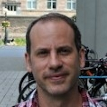
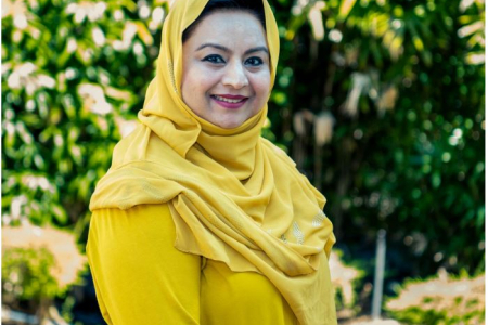
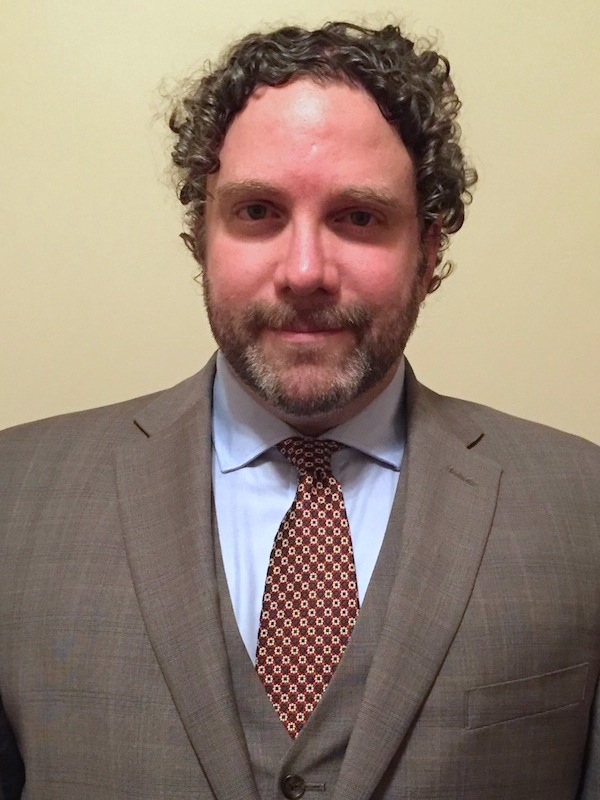
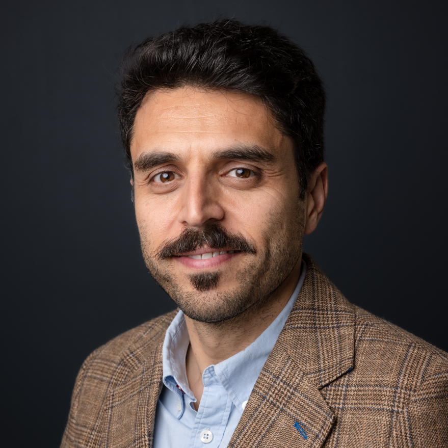
Prof. Dr. Thomas Brinkhoff is Chair of the Institute Board and Chair of Geoinformatics at Oldenburg University of Applied Sciences. He leads the Institute for Applied Photogrammetry and Geoinformatics (IAPG) and contributes to institutions like the Association for the Promotion of Geoinformatics in Northern Germany (GiN e.V.) and the Oldenburg Research and Development Institute for Computer Science (OFFIS e.V.). Education: Diploma in Computer Science (Informatik), Universität Bremen (1990) Doctorate in Computer Science (Dr. rer. nat.), Ludwig Maximilian University of Munich (1994) Brinkhoff's research spans geodatabase systems, spatiotemporal data processing, geosensor analytics, and location-based services. His work addresses Volunteered Geographic Information (VGI), web-based geospatial visualization, and mobile data integration, with applications in traffic management and forensic science. Recent projects include ProSaDi (Digital Provenance and Collection Research) and contributions to the Laboratory for optical 3D metrology . He has served on program committees for ACM SIGSPATIAL (2002-2019), AGILE conferences (2010-2025), and editorial boards of journals like GeoInformatica and TGIS. Notable Lectures: 2024: Forensic applications of tachograph data 2023: Geoinformatics in homicide investigations 2022: Spatiotemporal analysis for sustainability projects 2015: Open geodata standards at FOSSGIS 2014: Mobile sensor data processing
Dr Dominic McCafferty is a Senior Lecturer in Physiology, Ageing & Welfare at the University of Glasgow, based at the Scottish Centre for Ecology and the Natural Environment. He holds academic roles including Editor-in-Chief of the Journal of Thermal Biology and previously Ibis . His research focuses on thermal adaptation, behavioral thermoregulation, and urban wildlife ecology, particularly using thermal imaging techniques. He has a Ph.D. and BSc in Ecological Science from the University of Edinburgh (1989–1993 and 1985–1989). His work spans physiological studies in mammals, birds, and marine species, emphasizing conservation applications. Notable projects include habitat suitability modeling for urban water voles and thermal physiology studies in elephant seals. His educational background includes advanced studies in ecological science, complemented by post-doctoral research at institutions like the British Antarctic Survey (1993–1998). He has contributed to over 99 publications, advancing methodologies in non-invasive wildlife monitoring and ecological field studies. His editorial roles reflect expertise in thermal biology and avian science. McCafferty has led projects on carrion dynamics, stress physiology, and behavioral adaptations in diverse species, with a focus on applying findings to conservation challenges. Labs/Teams: Scottish Centre for Ecology and the Natural Environment (SCENE), part of the broader University of Glasgow's ecological research network. Collaborations include the Muséum National d’Histoire Naturelle in France and the National Trust for Scotland.
Kevin Manaugh is an Associate Professor at McGill University, specializing in Urban Planning with a focus on sustainable transportation and spatial justice. His research examines how decision-making processes in urban development balance environmental, economic, and social equity goals, particularly through transport systems. He holds a PhD in Urban Planning from McGill University (2013). His key research interests include integrating social equity into land use policies, analyzing accessibility impacts on socioeconomically diverse populations, and studying behavior change related to sustainable transportation. Current projects explore equitable transit accessibility, responses to local mobility policies, and health/well-being effects of sustainable transport choices. Manaugh has published extensively on transportation equity, urban form analysis, and GIS applications. His work bridges theoretical frameworks with practical policy implementation, emphasizing participatory approaches to urban planning. Notable contributions include studies on pandemic street reallocation equity and cycling infrastructure prioritization strategies. His research has been supported by interdisciplinary collaborations and applied to Canadian urban contexts. Despite prolific output, Manaugh maintains an active engagement with public discourse on urban mobility challenges and equitable urban futures.
Karsten Lambers is Professor of Digital and Computational Archaeology at the Faculty of Archaeology, Leiden University, where he leads research and teaching in the application of computational methods to archaeological data. His work integrates machine learning, remote sensing, text mining, and citizen science to advance archaeological prospection and heritage management. He is affiliated with the Department of Archaeological Sciences and plays key roles in research groups and university-wide initiatives such as SAILS and ARCHON. His research interests span Digital Archaeology , Machine Learning in Archaeology , Remote Sensing , Geoarchaeology , and Human-Environment Interaction . He investigates how computational tools can extract meaningful archaeological information from large datasets, including LiDAR imagery and excavation reports. His fieldwork spans Central Europe and Latin America, with a focus on prehistoric landscapes and cultural heritage. The analysis of his recent publications reveals a strong trend toward automated detection using deep learning (e.g., R-CNN, WODAN), named entity recognition in archaeological texts (e.g., ArcheoBERTje), and citizen science integration for data validation. His work bridges archaeology with computer science, geomatics, and environmental science, emphasizing interdisciplinary collaboration and methodological rigor. His scientific awards include: Best Thesis Award (University of Zurich, 2005) EUROPA NOSTRA Award (2020, 2022) Membership in the German Archaeological Institute (since 2022) Lambers actively supervises students and leads major research projects such as ABMA, EXALT, and Heritage Quest. He has secured substantial research funding and collaborates widely with computer scientists, geophysicists, and palaeoecologists. His teaching includes digital methods, modeling, and simulation, often linked to ongoing research. He has also contributed to open educational resources and digital textbooks in archaeology. He leads or participates in several research labs and teams, including the Digital Archaeology Research Group (which he chairs), the Heritage Quest citizen science project, and interdisciplinary teams focusing on alpine terraces and Iraqi prospection. His work emphasizes the integration of digital tools into practical archaeological workflows, advocating for complementary human-computer strategies.
Professor Haijiang Li is a Chair in BIM for Smart Engineering at Cardiff University's School of Engineering. His roles include leading the Computational Mechanics and Engineering AI Research Group, directing the BIM for Smart Engineering Centre, and overseeing the BIM MSc programme. He holds editorial roles for journals like Construction Innovation and Automation in Construction , and chairs the European Group of Intelligent Computing in Engineering (EG-ICE). Research focuses on smart computational engineering platforms integrating BIM, AI, and big data for sustainable infrastructure. Key areas include digital twins, disaster management, and resilient urban systems. He has secured £40M in research funding, including £9M as PI, and led over 70 research staff and students. Prof. Li is a Standards Committee Technical Executive at buildingSMART, driving international BIM standards. His work includes co-authoring a book on BIM standards across China, the US, and the UK. Awards include Fellowships from the British Computer Society (FBCS) and the Higher Education Academy (FHEA). His research outputs span over 250 publications, covering topics like AI-driven bridge maintenance, ontology-based decision-making, and energy-efficient urban systems. Collaborations with industry and global partners emphasize practical applications of BIM and smart technologies.
Dr. Farha Sattar is a Lecturer in Education (Mathematics) at the Faculty of Arts and Society, Charles Darwin University. With over thirty years of teaching experience in Mathematics, Science education, GIS, Remote Sensing, and e-Learning technologies at undergraduate and postgraduate levels, Dr. Sattar brings extensive expertise to her academic role. She holds a PhD in Geospatial Science from Charles Darwin University, focusing on Spatial Mathematical Modelling for 3D Gully Mapping and Erosion Quantification. Her educational background includes: PhD in Geospatial Science (Three Dimensional Gully Mapping and Erosion Quantification within a Geoinformatics Framework), Charles Darwin University (2012) Prior academic experience at several Asian and European universities Dr. Sattar's research spans multiple interdisciplinary fields with a strong focus on the intersection of education and technology. Her primary research interests include Mathematics Education, STEM Education, Geoscience Education, Spatial Mathematical Modelling, Drone Technology, Remote Sensing, Geographic Information Systems, and Innovative Pedagogies such as experiential learning and inquiry-based approaches. She has developed expertise in cognitive development, particularly in fostering critical and creative thinking skills through iSTEM approaches. An analysis of Dr. Sattar's recent publications reveals a consistent trajectory toward integrating emerging technologies like drones, augmented reality, and geospatial artificial intelligence into educational contexts. Her work demonstrates a progression from foundational geospatial research on erosion mapping to innovative applications in STEM education. Recent publications increasingly focus on drone technology for educational purposes, spatial data infrastructure for policy development, and computational thinking development through technology-enhanced learning. Dr. Sattar has received numerous accolades for her contributions to education and research: NT Science Week Awards – Inspired NT STEM Hero of the Year award (2021) Long Service Recognition Award (2023) Finalist, CDU Alumni Award (2023) Multiple Best Presentation Awards (2008, 2010, 2017) Australian College of Educators - 2021 College Medal Nominee As a supervisor, Dr. Sattar mentors postgraduate research students including Ayesha Farhan, who is working on "A Framework for Cognitive Development: Fostering Critical and Creative Thinking Skills, Using iSTEM Approach." She actively secures research funding through various projects such as "DBELaSTEM: Drone-Based Experiential Learning and STEM Education," "STEM_D & VR: Youth STEM Learning and Empowerment with Drones and VR," and "CodProg Drone Lab." Her research is supported by grants from NT Government projects and other external funding sources. Dr. Sattar leads the CodProg Drone Lab, an innovative research space exploring drone technology applications in education. She is a certified drone pilot and aeronautical radio operator, which enables her to bridge theoretical knowledge with practical applications. Her work with the "Flying Forward: Drones, STEM Equity, and Indigenous Empowerment" initiative demonstrates her commitment to community engagement and addressing educational disparities through technology.
Dr. Anthony Filippi is an Associate Professor and Director of Graduate Programs at Texas A&M University. His research focuses on remote sensing, geographic information systems (GIS), and machine learning applied to aquatic and terrestrial environments. He leads the Fluvial-GEOS Lab, studying riverine/floodplain systems using remote sensing and GIS technologies. Educational Background: Ph.D. in Geography, University of South Carolina (2003) M.S. in Geography, University of South Carolina B.A. in Geography, Kansas State University Research Interests: Imaging spectroscopy, hyperspectral remote sensing of rivers and coastal oceans, GIS-based modeling, data fusion, aquatic optics, and machine learning. His work addresses coastal ocean bathymetry estimation, floodplain dynamics, and applications in environmental monitoring, including hazardous waste site tracking and agricultural studies. Recent Research Trends: Recent publications highlight advancements in UAS-based image analysis, LSTM networks for floodplain classification, and environmental policy impacts on forest resources. His work integrates machine learning with remote sensing to improve ecological and geomorphological understanding. Labs/Teams: Director of the Fluvial-GEOS Lab, focusing on remote sensing and GIS applications in riverine environments.
Swiss Federal Institute of Technology in LausanneSwitzerland
Claudia R. Binder is Full Professor at EPFL's School of Architecture, Civil and Environmental Engineering, leading the Laboratory for Human-Environment Relations in Urban Systems (HERUS) since 2016. Previously, she held professorships at the University of Munich (2011-2016), University of Graz (2009-2011), and University of Zurich (2006-2009). She served as Dean of EPFL's ENAC School from 2020-2023 and holds advisory roles with Swiss federal institutions including the Mercator Foundation since 2024. Her academic foundation includes a Biochemistry degree and PhD in Environmental Sciences from ETH Zurich, followed by postdoctoral research at the University of Maryland. This interdisciplinary background underpins her research approach spanning natural and social sciences. Professor Binder's work centers on urban sustainability transitions, examining urban metabolism dynamics through systems science frameworks. She investigates energy-food-transport interdependencies in cities using transdisciplinary methods that integrate material flow analysis, spatial modeling, and socio-technical assessments. Her research particularly emphasizes regulatory mechanisms and transformation drivers in human-environment systems, with case studies across Swiss and global urban contexts. Recent publications reveal evolving focus from foundational urban metabolism studies toward actionable transition strategies. Her 2024-2025 work increasingly addresses social tipping dynamics, circular decarbonization, and spatially explicit waste management, demonstrating methodological innovation through geo-referenced material flow analysis and participatory backcasting frameworks. Key thematic clusters include energy innovation diffusion, plastic waste governance, and demand-side flexibility in residential systems. She actively mentors 7 current PhD candidates while supervising 11 graduates since 2018, with research spanning urban metabolism modeling, sustainability assessment, and transition governance. Her leadership extends to Swiss National Science Foundation committees and National Research Program 71 on energy consumption management. At EPFL, she directs the HERUS laboratory which develops the Sustainability Solution Space methodology for urban assessment. The lab operates at the intersection of data science, environmental engineering, and social theory, maintaining strong field connections in Switzerland, Indonesia, and Germany for empirical validation of transition models.
Associate Professor Mohsen Kalantari is a Geospatial Engineering academic at the University of New South Wales (UNSW) School of Civil and Environmental Engineering , with concurrent roles as co-founder of the startup Faramoon . His career spans roles at the University of Melbourne's Department of Infrastructure Engineering and Victorian government's land administration initiatives through DELWP. Education : PhD in Geomatics Engineering (2008, University of Melbourne), Master of GIS Engineering (2004), Bachelor of Surveying Engineering (2001) His research bridges geospatial engineering with construction automation , focusing on 3D cadastre , BIM-GIS integration , and smart cities . Recent publications show trends in underground land administration , digital twins , and LADM standard implementations . Scientific Awards : National educational recognition (2019), Victorian educational grants (2018), and prestigious fellowships (2012) As a supervisor , he guides PhD candidates in topics ranging from BIM for waste management to underground cadastral systems . His industry engagement includes partnerships with the United Nations , Open Geospatial Consortium , and Singapore Land Authority .
Fabio Miranda is an Assistant Professor at the Department of Computer Science, University of Illinois at Chicago (UIC) . His research bridges visualization , machine learning , data management , and computer graphics to enable interactive visual analysis of large-scale urban datasets . He has developed systems like UrbanRama (for VR navigation) and The Urban Toolkit (a grammar-based framework), which have been deployed in academia, industry, and government agencies. Education: Ph.D., Computer Science , New York University (2018) M.S., Computer Science , Pontifical Catholic University of Rio de Janeiro (2011) B.S., Computer Science , Federal University of Minas Gerais (2009) Research Interests center on urban visual analytics , 3D analytics , and machine learning for accessibility . His work addresses challenges like sunlight access , sidewalk quality assessment , and commuting flow modeling , often collaborating with urban planners, climate scientists, and occupational therapists. Scientific Recognition includes awards at IEEE VIS , SIBGRAPI , and SIGMOD . His research is funded by NSF , NIH , DOT , and DPI , with media coverage in The New York Times , The Economist , and Architectural Digest . Teaching includes courses like CS 524: Big Data Visualization and Analytics and CS 424: Visualization and Visual Analytics . He emphasizes web-based systems, dataflow frameworks, and interdisciplinary collaboration, with open positions for PhD , MSc , and undergraduate researchers .
Virginia Polytechnic Institute and State UniversityUnited States
Dr. Kevin Kochersberger is an Associate Professor in the Department of Mechanical Engineering at Virginia Tech , with a career spanning academic research, technical innovation, and educational leadership. His work focuses on autonomous aerial systems , robotic control , and applied aerodynamics , particularly through the Uncrewed Systems Laboratory . Kochersberger's research has pioneered UAV-based radiation detection , 3D terrain mapping , and low-resource drone applications , including establishing the African Drone and Data Academy in Malawi . Education: Ph.D., Mechanical Engineering, Virginia Tech (1994) M.S., Mechanical Engineering, Virginia Tech (1984) B.S., Mechanical Engineering, Virginia Tech (1983) A.S., Engineering Science, Jamestown Community College (1981) Kochersberger's publications demonstrate expertise in UAV path planning , smart material actuation , and radiation source localization , with over $9M in research funding. His scientific awards include AIAA Associate Fellow (2009) and Aviation Week Aerospace Laureate (2003). Notable projects involve helicopter-deployable robotic systems and urban canyon navigation without GPS. Recent articles highlight BVLOS drone simulators , 2.5D terrain mapping , and autonomous negative obstacle traversal , reflecting his focus on real-time adaptive control and heterogeneous robotic systems . He teaches Drone Technology and Flight Operations and Advanced Design Projects , emphasizing student-driven innovation and industry collaboration .
Tuuli Toivonen is a Professor of Geoinformatics at the Department of Geosciences and Geography, University of Helsinki. She leads the transdisciplinary Digital Geography Lab , which addresses human-scale spatial analytics for sustainable societies. She serves as Vice-Director of Geography Degree Programs (post-2022) and previously held the Director role (2020-2022). After receiving the ERC Consolidator Grant in 2022, she continues advancing open science through active memberships in HELSUS and URBARIA . PhD in Geography (University of Turku, 2006) Specialist Vocational Qualification in Leadership (2023) Life Member, Clare Hall, University of Cambridge (since 2021) Her research focuses on Human-Place Interactions through accessibility/mobility lenses, combining Open Data , Machine Learning , and Spatial Analytics . Key application areas include Urban Geography , Conservation Science , and Governance Policy . Recent publications address Dynamic Cities (2018), Social Media for Conservation (2019), and Environmental Exposure During Travel (2021). Her lab produces datasets like the Helsinki Region Travel Time Matrix series (2014-2023). Scientific Awards: European Open Data Champion (2017) Open Science Price (2017) University of Helsinki Geography Award (2018) She supervises Master's thesis work and serves as Opponent for doctoral defenses across Europe. Her teaching portfolio includes Advanced Geoinformatics and Digital Geographies courses.
Hiroyuki Iseki is Associate Professor of Urban Studies and Planning at University of Maryland's School of Architecture, Planning and Preservation, and Research Affiliate with the National Center for Smart Growth. His work examines interactions between transportation, land use, equity, and environmental sustainability. Research focuses on: Transit-oriented development impacts on firm location Equity in public transit finance Climate policy implementation in urban planning Active transportation infrastructure analysis Recent publications analyze post-pandemic transit demand shifts, campus multimodal conflicts, and bicycle accessibility modeling. Methodological strengths include spatial econometrics, GIS analysis, and longitudinal data approaches. Work increasingly addresses climate adaptation in transportation planning and EV charging grid impacts. Research contributes to urban policy through WMATA collaborations and Japanese municipal climate planning studies. Current PhD program directorship advances urban planning analytics training.
Anna Grigolon is an Assistant Professor at the University of Twente , Netherlands, affiliated with the Transport Engineering and Management Research Group . Her research focuses on sustainable urban mobility , user-centric transport solutions , and travel behavior analysis using tools like discrete choice modeling , spatial analysis , and social psychology theories . Research Interests : Sustainable Urban Mobility Accessibility Modeling Travel Behavior Discrete Choice and Latent Class Modeling Spatial Analysis and GIS Shared Micromobility and Mobility Hubs Equity in Transport Planning Article Trends : Anna’s recent work (2025–2024) emphasizes mobility justice , 15-minute city transitions, and equity in transport access , particularly for marginalized communities like São Paulo favelas. She integrates digital tools (e.g., serious games, kiosks) and space-time metrics to evaluate mobility solutions. Projects : She currently leads the SmartHubs project and contributes to DREAMS and R-map , focusing on smart, equitable mobility systems in Europe and Saudi Arabia.
Stephan Schmidt is an Associate Professor at Cornell University's College of Architecture, Art and Planning, affiliated with the Department of City and Regional Planning. His research bridges urban spatial patterns, planning institutions, and sustainability outcomes across Europe, sub-Saharan Africa, and China. Education: PhD in Urban Planning from Rutgers University MS in Landscape Architecture from the University of Washington His work examines: land-use policy evolution in Europe; urbanization dynamics in African cities; and polycentricity trends in Chinese metropolises. Recent studies focus on climate risk mitigation through urban form, including urban heat island effects and air pollution in German regions. Key trends in his 2024-2022 publications: comparative analysis of polycentric urban systems; GIS-based spatial pattern evaluation; and institutional impacts on sustainable development. Awards include Cornell's Global Strategic Collaboration Award and German Academic Exchange Service grants. Scientific Awards: Cornell Global Strategic Collaboration Award (2024) Cornell Center for Social Sciences Accelerated Research Grant (2024) German Academic Exchange Service (2019) Advising includes mentoring graduate students like Juan Fernandez, Justin Peng, and Hassan Yakubu on projects analyzing urban morphology. His lab investigates intersections between spatial patterns and environmental outcomes, including climate change adaptation in Tanzanian cities and park fragmentation in German metropolises.