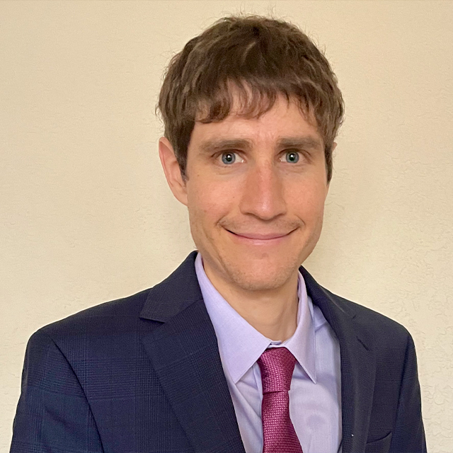
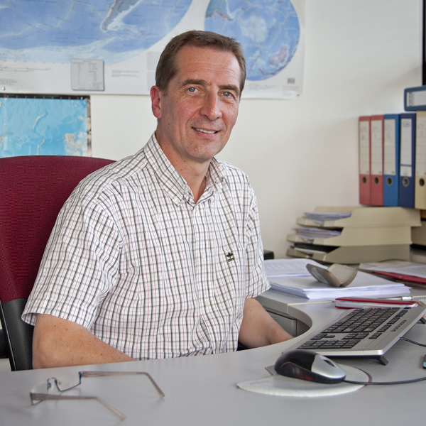
Prof. Dr. Irwin Yousept is a Full Professor of Mathematics at Universität Duisburg-Essen, leading the research group AG Optimal Control of Partial Differential Equations. His work focuses on the mathematical analysis and numerical solutions of electromagnetic problems, particularly in superconductivity and inverse problems. He holds a PhD from TU Berlin (2008) and has held academic positions at TU Darmstadt and TU Berlin. His research includes PDE-constrained optimization, numerical analysis, and applications in high-temperature superconductivity and electromagnetic shielding. Affiliations: Universität Duisburg-Essen, Fakultät für Mathematik Education: Diplom (2005), PhD (2008) in Mathematics from TU Berlin Research interests span Maxwell's equations, numerical methods for PDEs, and optimal control, with applications in superconductivity, electromagnetic shielding, and induction heating. He has authored over 40 publications and received awards including the Richard-von-Mises-Preis GAMM (2014). Current grants include DFG-funded projects on inverse problems and superconductivity.
Dr. Dibakar Ghosal is an Associate Professor in the Department of Earth Sciences at the Indian Institute of Technology Kanpur (IIT Kanpur). He leads the Crustal Imaging Laboratory (CIL) which is equipped with state-of-the-art seismic data acquisition setup and processing software for both land and marine seismic datasets. His research spans exploration seismology, tectonic studies, and algorithm development for subsurface imaging across diverse geological settings. Dr. Ghosal's educational background includes: PhD in Geophysics (2008-2013) from Institut de Physique du Globe de Paris (IPGP), France M.Sc. in Geophysics (2004-2006) from Indian Institute of Technology Kharagpur, India B.Sc. in Geology, Mathematics and Physics (2001-2004) from Jadavpur University, India His research focuses on three major themes: (1) Tectonic studies across Himalaya, Sumatra-Andaman, and Bay of Bengal using high-resolution seismic datasets; (2) Development of algorithms for petrophysical parameter estimation of hydrocarbon and ore reserves; and (3) Ambient Noise and earthquake data analysis. His work integrates field data acquisition, computational modeling, and advanced algorithm development to address fundamental questions in Earth sciences, with particular emphasis on crustal architecture and resource exploration. His recent publications demonstrate expertise in crustal imaging techniques, tectonic analysis of subduction zones, and algorithm development for seismic data processing. The research spans diverse geographical regions including the Himalayas, Sumatra-Andaman region, Bay of Bengal, and Southern Indian Ocean, with applications to hydrocarbon exploration, tectonic studies, and crustal architecture analysis. Dr. Ghosal has received several prestigious fellowships and awards: 2023: Scientific High Level Visiting Fellowship (SSHN) from French Institute in India (IFI) 2022: INSA visiting scientist fellowship 2019: Visiting Faculty at IPG Paris, France 2019: Visiting Faculty at NTU Singapore 2014-2015: Postdoctoral fellowship, Geocentrum, Uppsala University, Sweden 2008-2012: PhD fellowship, IPG Paris, France Dr. Ghosal actively mentors students and has supervised numerous PhD, MTech, and BS-MS students. His research is supported by multiple sponsored projects from DST-SERB, MoES, ONGC, and other funding agencies. He has successfully completed projects on topics including seismic imaging of the Himalayan foothills, gas hydrate reservoir modeling, and petrophysical property estimation. He leads the Crustal Imaging Laboratory (CIL) at IIT Kanpur, which conducts field work across various regions of India including the Himalayas and offshore areas. The laboratory is equipped with RAUs, 3C Tromino sensors, seismic thumpers, and advanced processing servers. He collaborates with national institutions including NIO Goa, IISER Pune, and NGRI, as well as international institutions such as IPG Paris, Uppsala University, and Texas A&M University.
Tieyuan Zhu is an Associate Professor in the Department of Geosciences at Pennsylvania State University, where he leads the Environmental Geophysics Group (EGG). His work focuses on advancing geophysical data resolution through seismic and ground-penetrating radar (GPR) methods to address environmental and energy challenges such as geohazards and CO2 sequestration. Research interests include: Near-surface and critical zone seismology Fiber optics seismology Wave physics (seismic, GPR) CO2 sequestration and geothermal exploration Permafrost degradation monitoring Martian subsurface water detection Recent publications emphasize distributed acoustic sensing (DAS), full-waveform inversion, and machine learning applications for subsurface imaging. His projects span urban geohazard monitoring, Arctic permafrost studies, and planetary geophysics. Scientific awards include the Karcher Award (2018) from the Society of Exploration Geophysicists. Collaborative efforts with institutions like NASA, NSF, and CMU highlight his impact on environmental hazard studies and carbon capture research.
Jack Montgomery is an Associate Professor of Civil and Environmental Engineering at Auburn University's College of Engineering, specializing in Geotechnical Engineering. He holds a Ph.D., M.S., and B.S. in Civil Engineering from the University of California-Davis and California Polytechnic State University. His research focuses on Geotechnical Earthquake Engineering, Landslides, Dam Engineering, Sinkholes, and Advanced Site Characterization. He has received the prestigious NSF CAREER award for his work on piping mechanisms in unsaturated soils. His projects include developing landslide warning systems for Alabama highways, studying liquefaction effects in earthquakes, and integrating geophysics into infrastructure assessments. He collaborates with agencies like ALDOT and the U.S. Nuclear Regulatory Commission on critical infrastructure resilience. His lab work includes centrifuge modeling, geotechnical reconnaissance, and advanced numerical simulations. Education: Ph.D. Civil Engineering, University of California-Davis M.S. Civil Engineering, University of California-Davis B.S. Civil Engineering, California Polytechnic State University Research emphasizes landslide prediction, dam stability, and seismic risk mitigation. Recent efforts include machine learning applications for foundation design and sinkhole tracking via media reports. Key Awards: NSF Faculty Early Career Development (CAREER) Program Award Advising and Grants: Collaborates with federal agencies on $1M NRC-funded advanced nuclear reactor research and leads Auburn’s geotechnical engineering outreach. His work appears in 20+ peer-reviewed articles and field investigations. Labs/Teams: Active in Auburn’s Advanced Structural Engineering Lab and Highway Research Center, contributing to Alabama’s transportation infrastructure resilience.
Michael Thorne is an Associate Professor in the Department of Geology & Geophysics at the University of Utah, where he has been faculty since July 2014. His research focuses on using seismology to investigate Earth's structure, with specialization in mapping seismic structure of the deep mantle and developing numerical techniques for seismic wave propagation modeling. He teaches courses in geophysics, the dynamic Earth, and seismology. Dr. Thorne's educational background includes: B.S. in Physics from Indiana University Bloomington (1991-1996) Ph.D. in Geological Sciences from Arizona State University (2000-2005) His primary research interests span global seismic wave propagation, Earth's deep interior structure, and the dynamics of the core-mantle boundary region. Dr. Thorne specializes in studying ultra-low velocity zones (ULVZs), D" discontinuity structure, and seismic array processing techniques. His work combines advanced waveform modeling with seismic observations to understand Earth's deep structure and dynamics, including connections between deep mantle features and surface geology. Dr. Thorne's recent publications demonstrate a consistent focus on ultra-low velocity zones at the core-mantle boundary, with increasing sophistication in modeling techniques. His work has evolved from basic detection of ULVZs to detailed characterization of their morphology, elastic properties, and potential origins. Recent papers incorporate advanced Bayesian inversion methods and multidimensional modeling to better understand these enigmatic features and their implications for Earth's thermal and chemical evolution. Dr. Thorne actively mentors graduate students through thesis research courses and has secured numerous research grants to support his work. His current projects include: "Mapping the Lateral Variability of Groundwater Input into the Great Salt Lake Using Electrical Methods" (2024-2025) "NSFGEO-NERC: Advancing Capabilities to Model Ultra-Low Velocity Zone Properties Through Full Waveform Bayesian Inversion" (2024-2027) "The Future of Glaciers Using a Novel, Interdisciplinary Approach" (2024-2026) "Global Search for D Discontinuity Structure" (2022-2026) His research group utilizes advanced computational methods and collaborates with institutions worldwide to investigate Earth's deep interior structure using seismic observations and modeling.
Prof. Heiner Igel is a Professor at the Department of Earth and Environmental Sciences, Ludwig-Maximilians-Universität (LMU) München. His research focuses on seismology, planetary geophysics, and structural health monitoring, leveraging advanced numerical methods and sensor technologies. He leads projects involving multi-component seismic measurements, seismic wave modeling, and planetary exploration instruments. Key research areas include rotational ground motion analysis, nonlinear seismic wave propagation, and subsurface imaging for Earth and planetary bodies. His work integrates cutting-edge numerical techniques like discontinuous Galerkin methods and Markov Chain Monte Carlo sampling for earthquake dynamics and material parameter inversion. Prof. Igel’s contributions include the NEPOS project for planetary seismic networks and collaborations with instruments like ROMY (Ring Laser Gyroscope). His studies span bridge monitoring, lunar subsurface exploration, and environmental seismology, emphasizing interdisciplinary applications of geophysical data.
Dr. David E. Lumley is the Cecil & Ida Green Endowed Chair in Geophysics and Professor of Earth Sciences & Physics at the University of Texas at Dallas (UTD), serving as Department Head since 2021. He holds a PhD from Stanford University (1995), MSc and BSc from the University of British Columbia (1989/1986). His research focuses on wavefield inversion methodologies for 4D time-lapse seismology, subsurface imaging, and applications to CO2 sequestration, induced seismicity, and planetary geodynamics. Lumley directs UTD's Seismic Imaging & Inversion Lab and previously led the Center for Energy Geoscience at University of Western Australia (2009-2017). Education: PhD in Geophysics, Stanford University (1995) MSc in Geophysics & Astronomy, UBC (1989) BSc (Hons) in Geophysics & Astronomy, UBC (1986) Research Interests: Pioneering 4D time-lapse seismology, seismic full-waveform inversion (FWI), ambient noise imaging, and applications to energy transition challenges. Current projects include monitoring Yellowstone's magmatic system, CO2 storage validation, and induced seismicity characterization. Combines HPC, AI, and geostatistical methods to solve inverse problems in exploration geophysics and environmental monitoring. Awards: SEG's J. Clarence Karcher Award (1996), 8 Best Paper Awards, Distinguished Lecturer for AAPG/SEG/SPE, and SEG Endowed Scholarships. Named SEG's first 'Pioneer of Geophysics' in 2005. Grants: Over $135M in competitive funding from NSF, DOE, DOD, and international agencies. Active in industry partnerships through ventures like 4th Wave Imaging (acquired by Fugro, 2007). Labs/Teams: Leads Seismic Imaging & Inversion Lab at UTD, collaborating with global networks in Australia, Europe, and industry consortia. Co-developer of seismic inversion software tools used in energy and environmental sectors.
Colin G. Farquharson is a Professor in the Department of Earth Sciences at Memorial University of Newfoundland. His career spans roles including Assistant Professor (2008-2018), Associate Professor (2014-2018), and full Professor since 2018. He holds a Ph.D. in Geophysics from the University of British Columbia (1995) and a B.Sc. (Honours) in Geophysics from the University of Edinburgh (1990). His research focuses on forward modeling and inversion of geophysical electromagnetic data, particularly surface geometry inversion (SGI), meshfree methods for unstructured grids, and joint inversion techniques. Key projects include SGI for hydrothermal vent systems, 3D EM modeling for mineral exploration, and computational methods on unstructured tetrahedral meshes. His work addresses challenges in uranium exploration, subsurface imaging, and geological interface reconstruction. Publications emphasize advancements in electromagnetic theory, inversion algorithms, and applications in mineral and hydrocarbon exploration. Notable collaborations include work with Peter Lelièvre on surface-based inversion and stochastic optimization. Research groups include the CAG Group and FacetModeller team, focusing on integrating geological models with geophysical data. Awards and recognitions are not explicitly listed, but his extensive contributions to geophysical methodology and exploration geophysics are well-documented. He advises numerous graduate students and leads projects funded by NSERC, industry partnerships, and international collaborations.
Kami Mohammadi is an Assistant Professor in the Civil & Environmental Engineering department at the University of Utah , with an adjunct appointment in Geology & Geophysics . Holding a PhD from Georgia Institute of Technology and postdoctoral experience at Caltech, Mohammadi specializes in seismic wave propagation, basin effects, and computational geotechnical modeling. Education PhD (2015), Civil and Environmental Engineering - Geotechnical Engineering, Georgia Institute of Technology MS (2012), Geotechnical Engineering with minor in Applied Mathematics, Georgia Institute of Technology MS (2006), Civil Engineering, University of Tehran BS (2003), Civil Engineering, Chamran University of Ahvaz Their research focuses on: 3D seismic wave propagation in heterogeneous media Basin effects on earthquake amplification Hybrid physics-informed machine learning models Finite element/discrete element modeling of geotechnical systems Ground motion prediction and hazard analysis Hydraulic fracturing in fractured rock Recent work integrates full-waveform inversion with neural networks for subsurface imaging. Mohammadi teaches graduate courses in geotechnical engineering, soil dynamics, and earthquake engineering, with a focus on computational methods and laboratory practices. Current grants include: EXTERNAL GRANT OR CONTRACT (2024-2030): Integration of computational and experimental analyses for earthquake amplification EXTERNAL GRANT OR CONTRACT (2024-2029): 3D site effect modeling at LANL EXTERNAL GRANT OR CONTRACT (2021-2024): Various seismic projects Professional activities include community outreach through engineering education presentations.
Dr. Daniel Trugman is an Assistant Professor in the Department of Geological Sciences and Engineering at the University of Nevada, Reno (UNR), affiliated with the Mackay School of Earth Sciences and Engineering. He holds a BS in Geophysics from Stanford University and MS/PhD in Earth Sciences from Scripps Institution of Oceanography at UC San Diego. Previously, he was a Richard P. Feynman Postdoctoral Fellow at Los Alamos National Laboratory (2018–2020) and an Assistant Professor at the University of Texas at Austin (2020–2022). His research focuses on earthquake rupture processes, seismic hazards, and leveraging machine learning and big data in seismology. He leads projects at the Nevada Seismological Laboratory, investigating Nevada seismicity, fault interactions, and earthquake early warning systems. Education: • Ph.D., Earth Sciences, UC San Diego (2017) • M.S., Earth Sciences, UC San Diego (2015) • B.S., Geophysics, Stanford University (2013) Research interests include: Nevada seismicity and tectonics Earthquake source properties (stress drop, radiated energy) Seismic hazard analysis Machine learning for glacier dynamics and seismic monitoring Induced seismicity and fracking impacts Awards: Charles F. Richter Early Career Award (2023) Mousel-Feltner Award for Research Excellence (2023) His work integrates high-fidelity physical modeling with data-driven techniques, including studies on glacier basal sliding, ground motion prediction, and fault network complexity. He teaches courses on Python for Earth Sciences and earthquake engineering. Labs/Teams: Active member of the Nevada Seismological Laboratory and collaborates with the Southern California Earthquake Center (SCEC) and USGS.
Jeannot Trampert is a Professor of Geophysics at Utrecht University since 2004. He has held leadership roles such as Head of the Department of Earth Sciences (2015–present) and Research Director of the same department (2009–2015). His research spans inverse theory, seismic tomography, wave propagation, and seismic data processing, with a focus on anisotropy, density imaging, and pattern recognition techniques. Education Habilitation (2001), Strasbourg University, Dissertation: Understanding and interpreting seismic tomography PhD (1990), Strasbourg University, Dissertation: Borehole seismology and tomography , Supervisor: Michel Cara Research Interests Full waveform inversion and inverse theory Seismic tomography (uncertainty analysis and thermo-chemical interpretation) Wave propagation in complex media Advanced seismic data processing using pattern recognition Seismic interferometry Scientific Awards Elected member of The Royal Netherlands Academy of Arts and Sciences (2018) Elected member of Academia Europaea (2016) ERC Advanced grant, EU (2012) Dutch National Science Foundation (NWO) top-grant (2010) Marie Curie Fellowship (1990) Teaching and Supervision Trampert has taught foundational and advanced courses at Utrecht University since 1990, including Data Processing and Inverse Theory , Thermodynamics and Internal Structure of the Earth , and Applied Geophysics . He supervises 5 PhD students, 3 postdocs, and 2 undergraduate projects annually.
Dr. Sheng Wang is a Researcher at ETH Zurich's Institute of Geophysics within the Department of Earth and Planetary Sciences (D-EAPS). He holds an ETH Fellowship and specializes in global correlation wavefield techniques to explore planetary and Earth interiors. His work bridges seismology, wave physics, and planetary science. Dr. Wang earned his Ph.D. from the Research School of Earth Sciences (RSES) at the Australian National University (ANU) in 2022. He has received prestigious awards, including the AGU SEDI Award (2022), Mertz Fellowship (2024), and Robert Hill Memorial Prize (2023). His research focuses on coda-correlation tomography, inter-source correlations, and planetary core imaging. Notable achievements include ARC Discovery Project grants for gravitational-wave-based earthquake early warning systems and Swiss Polar Institute funding for icequake studies. His work has been featured in Nature Astronomy and recognized multiple times by AGU Editors' Highlights. Dr. Wang's contributions span theoretical advancements and practical applications in seismology, with a focus on advancing global seismic monitoring and planetary interior imaging. He maintains active collaborations across institutions and is affiliated with ETH Zurich's Seismology and Wave Physics professorship.
Henk Keers is an Associate Professor at the Department of Geosciences of the University of Bergen (UiB). His research focuses on geophysical modeling, seismology, and ocean acoustics, with contributions to seismic wave analysis, teleseismic tomography, and educational innovations in sedimentology. He actively collaborates on projects such as SEDucate, promoting active learning in geoscience education. Key research themes include: Body wave modeling for regional seismology Acoustic inversion techniques for ocean turbulence Tomographic imaging of crustal structures Development of efficient numerical methods for geophysical problems Recent work includes presentations at events like the AdriaArray Workshop (2023) and Nordic Seismology Seminar (2022) , addressing topics such as elastic isotropic modeling and waveform inversion. His research has been funded by institutions including the Research Council of Norway.
M.Sc. Divya Shyam Singh is a researcher at the Technical University of Munich (TUM), affiliated with the Chair of Computing in Civil and Building Engineering. Her academic focus lies in the Simulation in Applied Mechanics group, where she conducts research on physics-based structural health monitoring. She is actively involved in teaching and supervising theses in the context of Building Information Modeling (BIM) and computational engineering. Research Focus Deep physics-based structural health monitoring Integration of BIM and simulation technologies Computational modeling for civil engineering applications Thesis Supervision Supervised thesis on 'Frequency-domain Full Waveform Inversion in Non-destructive Testing' (2025) by Amin Hajri Laboratory Engagement Works within the Simulation in Applied Mechanics research group at TUM, which is part of a broader network of labs including the BIM-Lab and Robotic Fabrication Lab.
Professor Jan Vanderborght serves as Director of the Agrosphere Institute (IBG-3) at Forschungszentrum Jülich, Germany, while maintaining a professorship in Soil Physics at KU Leuven, Belgium. His research focuses on fundamental soil physical processes with direct applications in agricultural and environmental management. His educational background includes an MSc (1993) and PhD (1997) in Bio-engineering from KU Leuven, followed by post-doctoral research at ETH Zurich (1998-1999). Vanderborght's research centers on solute transport in soils, pesticide fate modeling, hydrogeophysics, soil evaporation processes, and plant water/nutrient uptake mechanisms. His work bridges fundamental soil physics with practical agricultural applications, particularly in irrigation management and contaminant transport. His recent publications reveal strong focus on advanced soil moisture monitoring techniques, root water uptake modeling, and the application of digital twin technology (SWIM²) for precision agriculture. The research spans multiple scales from pore-level processes to field-scale hydrological modeling. As an editorial leader in the field, Vanderborght serves as Co-Editor of Vadose Zone Journal and Associate Editor for both Journal of Hydrology and SOIL, reflecting his significant contributions to soil and water science literature. His research group develops innovative approaches combining field measurements, advanced imaging techniques (like MRI and GPR), and sophisticated modeling frameworks to address critical challenges in soil-water-plant systems, particularly under changing climate conditions.