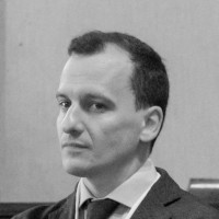
Volker BöderView profile
Professor
Volker Böder was a Professor of Practical Geodesy and Hydrography at the Department of Geomatics at HafenCity University Hamburg (HCU), serving from 2006 until his tragic death in 2012. His academic journey included a Diplom in Surveying Engineering from Leibniz University Hannover (1994), a PhD in Geodesy (2002), and extensive professional experience in hydrographic positioning and sensor integration. He specialized in precision GPS applications, multi-sensor systems for hydrographic surveys, and international educational initiatives like the VASSIVIERE Erasmus program. His research focused on optimizing hydrographic sensor networks, real-time positioning, and integrating terrestrial LiDAR with underwater systems. He held leadership roles at HCU, including heading the Hydrography department and serving on academic committees. Böder was also actively involved in professional societies such as the German Hydrographic Society and the German Society for Surveying. His legacy includes pioneering work in sensor fusion for marine environments and contributions to certified hydrographic education programs. Education: Diplom in Surveying Engineering (1994), Leibniz University Hannover PhD in Geodesy (2002), Leibniz University Hannover Research Interests: Precision positioning, hydrographic multi-sensor systems, GPS/INS integration, international survey education, and marine geomatics. Awards: Best Presentation Awards at ION GPS conferences (2001 and 2000). Administration: Led HCU's Hydrography unit, chaired examination committees, and contributed to curriculum reforms. His untimely passing in 2012 left a significant void in hydrographic research and academia, with colleagues mourning his dedication and expertise.