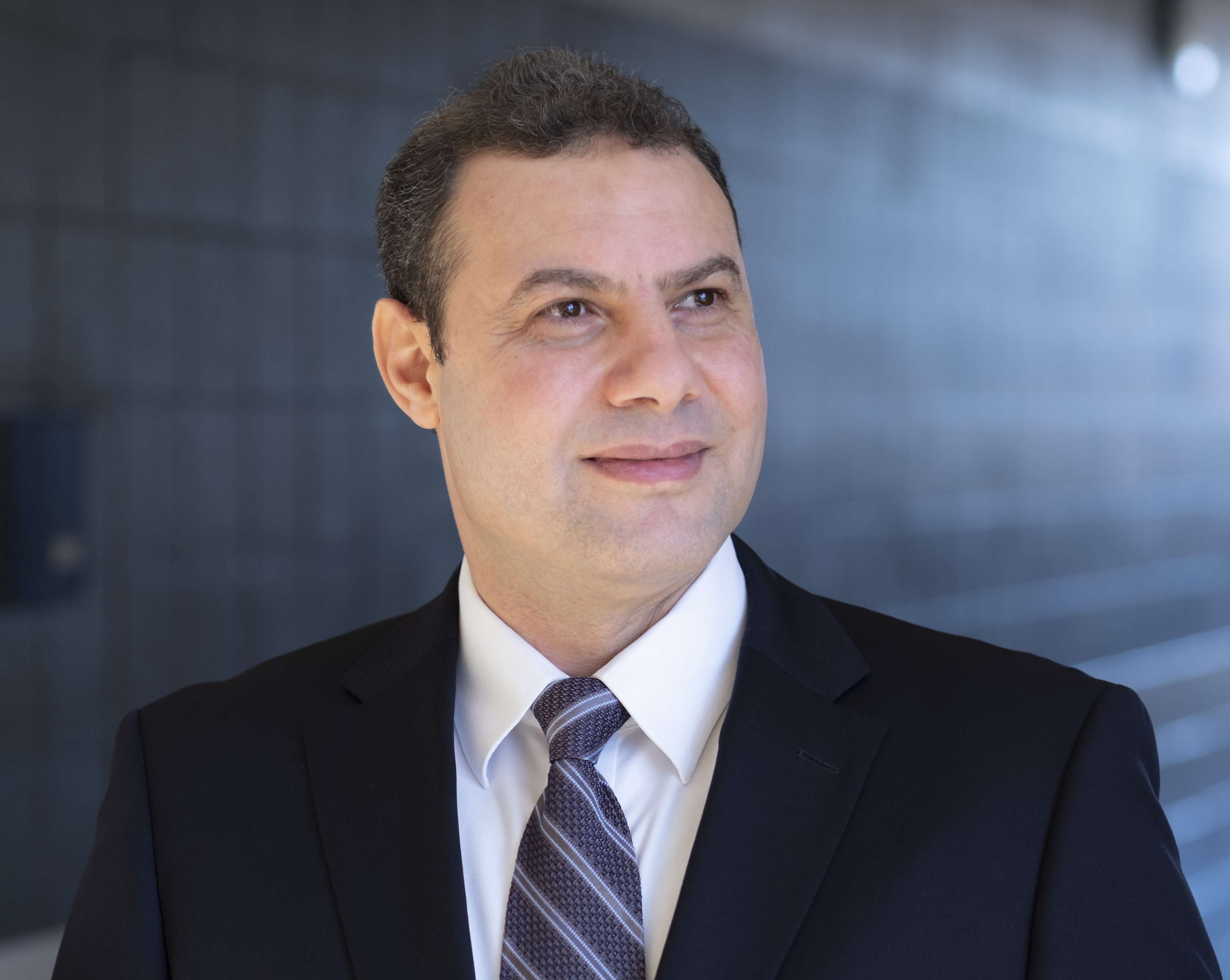
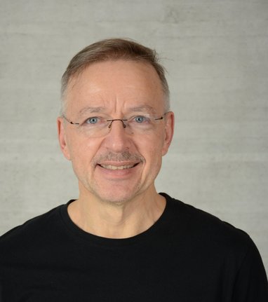
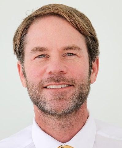
Dr. Xiaoye Liu is a Senior Lecturer in the School of Surveying and Built Environment at the University of Southern Queensland, specializing in Surveying and Spatial Science. Their research focuses on spatial data quality, remote sensing applications, and geospatial technologies for environmental and disaster management. Dr. Liu holds a PhD from Monash University, preceded by a MAppIT from Monash, and degrees from Wuhan University. Education: Bachelor of Engineering (BEng), Wuhan University Master of Engineering (MEng), Wuhan University Master of Applied Information Technology (MAppIT), Monash University Doctor of Philosophy (PhD), Monash University Research interests include LiDAR data analysis, crowdsourced data credibility assessment, and spatial modeling for environmental conservation and disaster response. Dr. Liu’s work bridges GIS applications with ecological monitoring, particularly in rainforest ecosystems and wildlife habitat studies. Research Trends in Publications: Recent work emphasizes crowdsourced data quality (VGI/CSD), LiDAR-derived environmental modeling, and machine learning applications in spatial science. Key themes include geospatial data fusion, disaster management automation via SDI, and biodiversity tracking through spatial analytics. Advising and grants information is not explicitly detailed in the provided data. Dr. Liu’s contributions include collaborations on projects such as bilby habitat modeling and Hendra disease spatial epidemiology.
Simon Hoermann is a researcher with extensive contributions to virtual reality, human-computer interaction, and immersive technology applications. His work spans disciplines including rehabilitation, education, and emergency response training through serious games and XR systems. Affiliation: University of Otago Research interests focus on: Virtual reality for motor rehabilitation Collaborative human-agent interaction in immersive environments Passive haptic feedback systems Serious games for education and therapy Recent publications include 15 articles (2017-2025) examining: VR psychotherapy environments with virtual supporters XR for firefighter training and volcanic hazard education Large language model ethics and bias mitigation Biomechanical locomotion interfaces Avatar-based collaboration systems Hoermann contributes to: Systematic reviews in VR rehabilitation Design frameworks for prosocial XR applications Human factors analysis in immersive training
Dr. Rupert Legg is a Postdoctoral Researcher at the Department of Physical Geography and Landscape Ecology, Leibniz University Hannover. His work focuses on interdisciplinary research in landscape ecology, health geography, and environmental psychology. He investigates human-nature interactions in contexts like climate change and urbanization, using both quantitative and qualitative methods to assess urban landscapes' impact on health and well-being. Education: PhD in Sustainable Futures (2023), University of Technology Sydney BSc (Honours I) in Geosciences (2017), University of Sydney Research Interests: Environmental justice in the Anthropocene Urban microclimate regulation via blue/green infrastructure Allergenic pollen impacts on mental health Legal frameworks for environmental contamination Recent Projects: Strategies for urban heat resilience using nature-based solutions (EU-funded) Monitoring allergenic pollen in urban parks Key Awards: Green Talents Award (2022) for Sustainable Development Grants & Teams: Member of Digital Landscape Ecology Group Co-lead on EU-funded climate adaptation projects Labs/Teams: Active in the Digital Landscape Ecology Group, focusing on integrating spatial data with human health metrics.
Cathryn Pearce is a Senior Lecturer in History at the University of Portsmouth, affiliated with the School of Area Studies, Sociology, History, Politics, and Literature. She holds a PhD from the Greenwich Maritime Institute and has taught at institutions including the University of Alaska Anchorage and University of Greenwich. Her research focuses on the social, cultural, and environmental history of coastal communities, shipwrecks, and wrecking practices in the UK and Atlantic Archipelago. She leads the Centre for Port Cities and Maritime Cultures and teaches on the MA Naval History programme. Key research areas include the socio-cultural impacts of shipwrecks, environmental history of wrecking, and the role of organizations like the Shipwrecked Mariners Society. She has explored topics such as 18th-19th century Coastguards, maritime charity growth, and the legacy of Royal Navy voyages. Her book Cornish Wrecking, 1700-1860 pioneered studies on wrecking narratives. Professional roles include former Chair of the British Commission for Maritime History and Vice-President of the Society for Nautical Research. Her work informs media projects, including BBC documentaries and historical adaptations like Poldark . She actively supervises PhD students focusing on naval history, coastal communities, and knowledge exchange in maritime contexts. Labs/Teams: Centre for Port Cities and Maritime Cultures, History Research Group, Centre for European and International Studies Research.
Ari Happonen is an Associate Professor at LUT University's School of Engineering Sciences in Lappeenranta, Finland, with a research focus spanning Computer networks and communications , Operations research , Information Systems , Computer Science , and Technology management . His work demonstrates interdisciplinary expertise through collaborations with institutions across 15 countries. Recent publications highlight his contributions to AI applications in environmental monitoring (2025) Generative AI for educational frameworks (2025) Wind energy system design (2024) Gender inclusivity in technical education (2024) Smart waste management solutions (2024) Contact: Ari.Happonen@lut.fi
Paul Rosen is an Associate Professor at the University of South Florida within the Department of Computer Science and Engineering. His research focuses on computer graphics, visualization, and geometric modeling, with significant contributions in camera models, 3D rendering, and interactive visualization techniques. Academic Rank: Associate Professor Affiliation: University of South Florida, Department of Computer Science and Engineering Research Areas: Computer Graphics, 3D Visualization, Geometric Modeling, Image Processing, Human-Computer Interaction. His publications span topics including Bézier curves, nonpinhole camera approximations, and volumetric display perception studies. While he collaborates with institutions like Purdue University (CGVLab), he is currently an active faculty member at USF, not part-time, retired, or former staff.
Reda Amer serves as Associate Professor in the Department of Computer Science at the University of Missouri–St. Louis (UMSL) within the College of Arts and Sciences, and directs the UMSL Geospatial Collaborative. His interdisciplinary work bridges computer science with environmental geoscience through advanced geospatial technologies. His academic credentials include: Ph.D. in Geophysics, Saint Louis University (2011) Graduate Certificate in Advanced Remote Sensing and GIS, Saint Louis University (2011) MS in Remote Sensing, Al-Azhar University, Cairo, Egypt (2005) BS in Geology, Al-Azhar University, Cairo, Egypt (2000) Dr. Amer's research centers on Remote Sensing, Geographic Information Science, and Climate Change adaptation, with emphasis on community resilience in vulnerable coastal regions. He develops computational methods for environmental monitoring, particularly using LiDAR and satellite data to model subsidence, flood risks, and land degradation. His work integrates machine learning with geospatial analysis to address pressing challenges in deltaic systems and arid environments. Analysis of his 2019-2025 publications reveals strong focus on Gulf Coast subsidence monitoring through LiDAR/InSAR fusion, expanding into machine learning-driven flood mapping and port resilience. His research spans environmental geoscience, disaster response, and sustainable resource management across coastal Louisiana, Texas, and arid regions including Egypt and the Arabian Shield. No scientific awards were documented in the provided materials. Information regarding student advising and research grants was not included in the source documentation. As Director of the UMSL Geospatial Collaborative, Dr. Amer leads interdisciplinary teams advancing geospatial research applications for environmental challenges, fostering partnerships across computer science, earth sciences, and civil engineering disciplines.
Prof. Dr.-Ing. Franz-Josef Behr serves as Senior Professor of Geospatial Information at Stuttgart University of Applied Sciences, specializing in Spatial Data Infrastructure (SDI), Standards, Open Source solutions, data modelling, and disaster mapping. His academic leadership includes serving as Study Dean for the Master Programme Photogrammetry and Geoinformatics (2009-2022) and founding the internationally recognized AGSE conference series focused on geoinformatics for societal and environmental challenges. Behr's research centers on geospatial interoperability, with expertise spanning SDI implementation, OGC standards evolution, and open source geospatial technologies. His work bridges theoretical frameworks with practical applications in disaster management, urban planning, and international development, particularly through capacity-building initiatives in Indonesia and India. Current investigations examine OpenStreetMap integration for official cadastres and modern API-based service architectures replacing traditional OGC web services. Recent publications reveal strong trends toward practical implementations of open standards in governmental systems, UAV data processing for developing nations, and disaster response applications. His work consistently emphasizes interoperability, open data principles, and technology transfer to address real-world challenges in geospatial information management. Scientific recognition includes: Best Poster Award at ISPRS Conference, Prague (2016) Academic leadership extends globally through roles as Co-chair of the ICA Commission on SDI and Standards (2017-2023), membership in ISO/TC 211 standards committees, and service on Kerala's Digital University Board of Studies. He has significantly advanced geospatial education through the AGSE conference network spanning 12 countries and numerous international workshops. As founder and chair of the AGSE conference series since 2009, Behr has cultivated a global network connecting academia, government, and industry across India, Peru, Kenya, Malaysia, Germany, Iran, Namibia, and Nepal. This initiative specifically focuses on applying geoinformatics to societal challenges including disaster management, sustainable development, and environmental monitoring through practical open-source implementations.
Lars Bernard is Full Professor for Geoinformatics at the Faculty of Environmental Sciences, Technische Universität Dresden since 2015. He also holds the position of Chief Digitalization and Information Management Officer (CDIO) at TU Dresden since 2020 and serves as member of the TUD Rectorate. PhD in Geoinformatics (University of Münster, 2001) Diploma in Physical Geography (University of Münster, 1995) His research focuses on (Geo-)Information Infrastructures , Distributed Geoprocessing , and Smart Environmental Monitoring . He has extensive experience in developing geospatial standards through roles in AGILE, EuroSDR, and INSPIRE initiatives. His publications demonstrate a consistent emphasis on: Metadata provision and data quality frameworks Interoperability solutions for geospatial systems Climate information service architectures User-driven provenance mechanisms As co-chair of RFII (2020-) and spokesperson for NFDI4Earth (2019-), he leads major German research data initiatives. He has advised numerous students and coordinated TU Dresden's Master Geoinformation Technologies program until 2018. Current leadership roles include serving on scientific editorial boards for Environmental Modelling & Software and International Journal of Spatial Data Infrastructures Research .
Robb Moss is a Professor in the Civil and Environmental Engineering Department at California Polytechnic State University (Cal Poly), specializing in geotechnical earthquake engineering, engineering seismology, and geohazard mitigation. His work spans seismic soil liquefaction, fault rupture, and risk analysis for natural hazards, with projects spanning 15+ countries and participation in nine earthquake reconnaissance missions. Ph.D., University of California Berkeley, Geotechnical Earthquake Engineering M.S., Utah State University, Geotechnical Engineering B.S., North Carolina State University, Civil Engineering Research focuses on soil mechanics, reliability analysis, and liquefaction mitigation. Recent work addresses fault displacement hazards, slope stability, and hydraulic structure performance during earthquakes, particularly in Türkiye (2023), Chile (2010, 2019), and Japan (2011). Articles emphasize probabilistic modeling, geomechanical simulations, and post-disaster assessments. His academic contributions include developing unified liquefaction assessment frameworks (2018–2022), shake-table testing of seismic interactions (2011–2013), and debris flow models integrating shear stiffness (2019–2022). Current projects highlight fault displacement resilience (2024) and optical fiber sensing for earthquake reconnaissance (2025).
Dr. Devon Payne-Sturges is a tenured Professor of Environmental Health Sciences at the University of Michigan School of Public Health. She directs a multidisciplinary research portfolio that confronts environmental health disparities, focusing on cumulative risk assessment, children’s environmental health, and the health of migrant farmworkers. Recognized with the 2024 Environmental Health Career Award by the American Public Health Association’s Environment Section, she integrates systems modeling with community-engaged research to inform equitable policy solutions. Education: Dr.P.H., Environmental Health Sciences, Johns Hopkins University Bloomberg School of Public Health, 2002 M.P.H., Environmental Health Sciences, Johns Hopkins University Bloomberg School of Public Health, 1997 M.Engr., Environmental Engineering, University of Virginia, 1990 B.S., Civil Engineering, University of Virginia, 1989 Research Interests: Dr. Payne-Sturges advances three interlocking themes. First, she develops cumulative risk methods that integrate non-chemical stressors such as structural racism into regulatory frameworks like the Toxic Substances Control Act (TSCA). Second, she applies system-dynamics tools to uncover how social and environmental drivers combine to shape children’s neurodevelopmental outcomes, working with community partners in Cleveland and the national Project TENDR consortium. Third, through the NIH-funded RESPIRAR project, she examines how historical and contemporary institutional policies affect respiratory health among migrant seasonal farmworkers, translating findings into policies that improve living and working conditions. Across more than 120 peer-reviewed publications, her recent work (2023-2025) clusters around four domains: (1) methodological innovation in cumulative risk and evidence-to-decision frameworks; (2) empirical studies quantifying disparities in exposures to endocrine-disrupting chemicals such as phthalates and bisphenols; (3) intervention research evaluating behavioral, clinical, and policy strategies to reduce toxic exposures; and (4) large-scale epidemiological and cohort studies linking air pollution, heat events, and disaster exposure to neurodevelopment, mental health, and educational outcomes in children and adolescents. Awards & Honors: 2024 Environmental Health Career Award, APHA Environment Section Runner-up, 2023 Best Paper Award (Policy Analysis), Environmental Science & Technology Funding & Collaborations: Her research has been continuously funded by the National Institute of Environmental Health Sciences (NIEHS), the Environmental Defense Fund, the Minnesota Pollution Control Agency, and the University of Michigan Vice President for Research. She leads transdisciplinary teams that partner with community organizations, state agencies, and international scholars to co-produce knowledge and translate science into equitable policy. Laboratory & Teams: Dr. Payne-Sturges directs the RESPIRAR Project (respirarproject.org), a multi-site investigation of migrant farmworker respiratory health, and collaborates closely with the University of Michigan’s Global Public Health and Environmental Health Sciences departments. She fosters transdisciplinary training environments that integrate engineering, epidemiology, policy analysis, and community engagement.
Dr David Megson-Smith serves as a Hot Robotics Research Fellow at the Interface Analysis Centre, University of Bristol, specializing in the application of advanced robotics and imaging systems for environmental and nuclear challenges. His work bridges engineering solutions with critical ecological and radioactive waste management contexts. Educated with an MPhys from the University of Bath, his research spans radioactive waste characterization, coral reef monitoring, and autonomous radiation mapping. Key projects include developing low-cost hyperspectral imaging for reef conservation and robotic systems for legacy uranium mine analysis, emphasizing scalable, field-deployable technologies for hazardous environments. His recent publications reveal a strong interdisciplinary trend integrating robotics, photogrammetry, and radiation detection. These works demonstrate innovative approaches to environmental monitoring in high-risk settings like radioactive waste sites and fragile marine ecosystems, with emphasis on real-time data acquisition and cost-effective sensor networks. Award highlights include: Paper of Note & Superior Paper Rating (2022) for coral reef imaging research Dr Megson-Smith has supervised one research project and maintains active collaborations across nuclear engineering and marine science domains. His work involves international partnerships, including projects in Arizona uranium mines and coral reef restoration initiatives, though specific grant details remain unspecified in available records. He operates within the Interface Analysis Centre's research ecosystem, contributing to Bristol's Materials & Devices research theme. His current projects indicate ongoing development of autonomous robotic platforms for environmental characterization in extreme conditions.
Andreas Braun is a Senior Lecturer at the Department of Geography, University of Tübingen, Germany. He leads lectures and courses on physical geography, geospatial methods, and remote sensing applications. Currently serving since January 2022, his academic responsibilities include teaching, thesis supervision, and research in geoinformatics with a focus on humanitarian response applications. PhD in Geography (2014-2019), University of Tübingen Baden-Württemberg Certificate in University Didactics (2015-2017) Professional experience at Stuttgart's Land Surveying Office (2013) His research bridges geospatial technologies with humanitarian applications, emphasizing remote sensing for environmental monitoring in refugee camps, urban structure analysis, and climate change adaptation. Key areas include SAR data utilization, geosimulation for landscape dynamics, and machine learning applications in geospatial projects. Scientific publications span topics like urban heat island effects in Vietnam, refugee camp monitoring using satellite imagery, and landscape change modeling. His work appears in journals such as IEEE Journal of Selected Topics in Applied Earth Observations , Remote Sensing , and Journal of Flood Risk Management . Teaching activities cover physical geography methods, GIS, remote sensing, and applied geoinformatics for both B.Sc. and M.Sc. programs. He supervises interdisciplinary projects connecting geography with social sciences, focusing on urban planning, climate adaptation, and environmental justice.
Blake Walker is a Professor of Digital Geography/Cultural Geography at the Institute of Geography, Friedrich Alexander University Erlangen-Nuremberg (FAU), where he has held his position since September 2019. His academic journey includes previous roles as a Visiting Researcher (2018-2019) and Visiting Lecturer (2017-2018) at the Geographical Institute, Humboldt University of Berlin. He earned his PhD in Geography from Simon Fraser University, Vancouver, Canada in 2017, following an MSc in Geography from the same institution in 2013 and a Professional Specialization in Population Health Data Analysis from the University of Victoria in 2015. His research spans several interconnected domains within geography, with a particular focus on the intersection of digital methods, health, and social issues. His work in digital geography employs innovative approaches to analyze spatial phenomena through critical GIS and remote sensing methodologies. In health geography, he investigates the relationship between environmental factors and health outcomes, particularly examining how urban green spaces impact mental wellbeing and how socioeconomic factors influence disease risk. His research on violence employs spatial analysis to understand patterns of interpersonal violence and injury, while his work in digital humanities explores how cultural narratives are represented in digital media, particularly video games. His recent publications demonstrate a consistent focus on applying spatial analysis techniques to pressing social and health issues, with an increasing emphasis on digital methods and critical approaches to geospatial data. His work often involves interdisciplinary collaboration across geography, public health, computer science, and social sciences. Professor Walker leads or participates in several research projects including REKKE (Resilience through Cultural Landscapes in Climate Change), VIBRANCE (Violence in Brazil: Analysis of Community Environments), STAGE (Spatial Transcoding of Artificial Geographical Environments), DigiDEM, and PURE SPACE (Prospective Urban and Rural Epidemiology: Spatial Analysis of Cardiovascular Environments). He teaches courses in Cultural Geography GIS/Critical Geoinformatics and Remote Sensing, Digital Geographies, Cultural Geography seminars on globalization and socioeconomics, Quantitative and Qualitative Methodology and applied (spatial) statistics, and Field Seminars on Space and Identities.
Professor David Proverbs serves as Associate Pro Vice-Chancellor for Enterprise and Business Innovation at De Montfort University within the Faculty of Arts, Design and Humanities and School of Arts, Design and Architecture. A globally recognized expert, he pioneered flood recovery methodologies adopted by governments and institutions worldwide, with significant influence on UK Climate Change Policy and national strategies across Brazil, China, Nigeria, Peru, and the UK. Education: BSc (Hons) PG Cert-Ed PhD MBA PFHEA FCIOB FRICS His research centers on flood risk management , specializing in resilience engineering, adaptation strategies, recovery frameworks, and economic impact mitigation. As Editor-in-Chief for the Journal of Flood Risk Management and International Journal of Building Pathology and Adaptation, he drives scholarly discourse while maintaining extensive international networks with academics and practitioners across six continents. Analysis of his 2023-2025 publications reveals dominant trends in urban flood resilience modeling (GIS, multi-criteria analysis), cross-border case studies in developing economies, and innovative social dimensions like emotional appeal in water conservation. Key geographic focus areas include the Pearl River Delta, Guangdong Province, and Caribbean flood zones. Scientific Awards: Visiting Professor, Auckland University of Technology (2009-2010) Visiting Professor, University of the West of England (2014-ongoing) Visiting Professor, Santa Catarina State University (UDESC) (2017-ongoing) Visiting Professor, Xiamen University of Technology (2018-ongoing) Visiting Professor, Massey University (2023-2026) Professor Proverbs actively supervises PhD candidates including Olutayo Ekundayo, while securing over £700k in competitive research funding from Environment Agency (£115k), RICS (£40k), DEFRA (£105k), Brazilian National Council (£30k), and British Council (£45k). His projects emphasize community-driven flood innovation, property-level adaptation, and international capacity building through workshops and knowledge transfer. He leads research within DMU's Institute of Sustainable Futures and Institute of Architecture, directing global initiatives like the Environment Agency's Trent Regional Flood Committee and international flood risk workshops. His dual editorial leadership positions cement his status as a field-defining authority in flood resilience science.