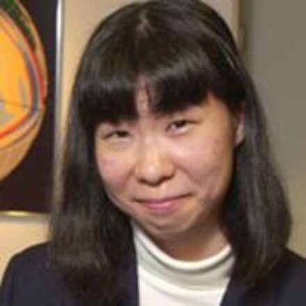
Miaki Ishii is a Professor of Earth and Planetary Sciences at Harvard University, affiliated with the Department of Earth and Planetary Sciences. She leads the Harvard Seismology Group and has held academic roles at Harvard since 2006, progressing from Assistant to Associate Professor and then Full Professor. Education: Ph.D. in Geophysics (2003), Harvard University Hon.B.Sc. in Physics (1998), University of Toronto Research Interests: Ishii specializes in seismic imaging of Earth's internal structure, including the mantle and core. Her work focuses on earthquake mechanisms, signal processing, and theoretical seismology. She uses seismic data to study rupture dynamics, subduction zone processes, and free oscillations of the Earth. Key Contributions: Notable projects include analyzing the 2011 Tohoku-Oki earthquake rupture, developing the DigitSeis software for analog seismogram digitization, and studying inner core anisotropy using normal mode splitting. Her research integrates high-performance computing and waveform inversion techniques. Awards: James B. Macelwane Medal (2009) Kavli Fellow (2012) Charles F. Richter Award (2008) Alice Wilson Award (2004) Labs/Teams: Directs the Harvard Seismology Group, collaborating internationally on seismic networks like Hi-net and USArray. Her work bridges computational seismology with observational geophysics.
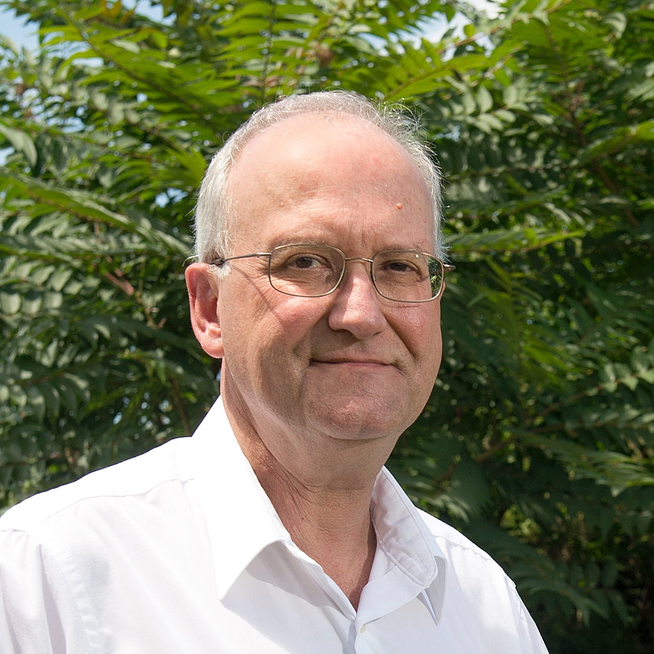
Martin C. Chapman serves as Research Professor of Geophysics in Virginia Tech's College of Science, Department of Geosciences. He directs the Virginia Tech Seismological Observatory (VTSO), operating from a Cold War-era fallout shelter near the Virginia Tech Executive Airport. His research integrates observational seismology with earthquake hazard mitigation in plate-interior regions, particularly eastern North America. His educational background includes: Ph.D. in Geophysics, Virginia Tech (1998) M.S. in Geophysics, Virginia Tech (1979) B.S. in Geophysics, Virginia Tech (1977) Chapman's primary research focuses on plate-interior seismicity/tectonics and strong-motion seismology. He combines field observations from the VTSO network with global strong-motion data to investigate earthquake causes and wave propagation characteristics. Recent work emphasizes induced seismicity from aquifer recharge and wastewater injection, site amplification effects in sedimentary basins, and development of seismic monitoring networks for risk reduction in eastern North America. Analysis of his 2022-2025 publications reveals concentrated research on injection-induced seismicity in Virginia's Hampton Roads region, sediment thickness mapping of Atlantic/Gulf Coastal Plains for ground motion prediction, and advanced characterization of historical earthquakes (1886 Charleston) and recent sequences (2024 New Jersey, 2020 Sparta). His methodology integrates dense seismic arrays, machine learning detection algorithms, and geospatial analysis to refine hazard models. His scientific recognition includes: Jesuit Seismological Association Award for Contributions to Observational Seismology (2016) As VTSO director, Chapman oversees seismic monitoring across Virginia and leads the Hampton Roads Seismic Network initiative. His work involves significant collaboration with the US Geological Survey on coastal plain amplification studies and regional seismic hazard workshops. Current projects focus on optimizing earthquake detection during aquifer recharge operations and developing site-specific amplification models for eastern US infrastructure. Chapman's laboratory operations center on the VTSO's network of seismic stations, utilizing advanced techniques including reverse vertical seismic profiling and dense array backprojection imaging. His team's recent field deployments target induced seismicity monitoring in Southeast Virginia and detailed characterization of the Central Virginia Seismic Zone.
Keith D. Koper is a Professor in the Department of Geology & Geophysics at the University of Utah and serves as Director of the University of Utah Seismograph Stations (UUSS). He is also the editor-in-chief of The Seismic Record . His work integrates academic research with operational seismic monitoring and public safety initiatives across Utah and the Intermountain West. Education: PhD in Geophysics, Washington University, 1998 BA in Math, Geology, and ISP, Northwestern University, 1993 Dr. Koper's research focuses on array seismology, forensic seismology, deep Earth structure (especially the inner core), earthquake rupture imaging, ambient seismic noise, and seismic hazards in the Intermountain West, including mining-induced and urban earthquakes. His work combines observational seismology with advanced signal processing and machine learning techniques to improve detection, discrimination, and imaging capabilities. He has led or contributed to major projects involving the Wasatch Front, Yellowstone, and regional seismic networks. His recent research emphasizes machine learning for earthquake detection, high-resolution relocation of aftershock sequences (e.g., Magna 2020, Bluffdale 2019), microseism generation in lakes, and fine-scale imaging of the Earth's inner core using seismic reflections. His studies often involve interdisciplinary collaboration, particularly with mining engineering and geodesy. Dr. Koper's research has been consistently funded by federal and state agencies, including the National Science Foundation (NSF), U.S. Geological Survey (USGS), Department of Energy (DOE), Air Force Research Laboratory (AFRL), and the Utah Department of Public Safety. His publications reflect a strong trend toward integrating computational methods with traditional seismological analysis to tackle complex problems in both natural and induced seismicity. Scientific Service and Leadership: Editor-in-Chief, The Seismic Record Director, University of Utah Seismograph Stations Secretary, U.S. Air Force Seismic Review Panel Former Chair and Vice-Chair, Utah Seismic Safety Commission Dr. Koper mentors graduate students in seismology and geophysics, including recent advisees Sean Hutchings and Alysha Armstrong. His research group actively engages in both fundamental and applied seismological research, with strong ties to national labs such as Sandia. The group is involved in deploying portable seismic arrays, analyzing large datasets, and developing new algorithms for event detection and classification. The University of Utah Seismograph Stations, under his leadership, plays a critical role in monitoring seismicity in Utah and Yellowstone, producing real-time earthquake information, ShakeMaps, and public outreach materials. The station also contributes to national and international efforts in nuclear test monitoring and volcanic hazard assessment.
Professor Atilla Ansal is a distinguished academic in Civil Engineering at Özyeğin University's School of Engineering, where he has served as a full-time professor since March 2012 and previously as the Founding Chair of the Civil Engineering Department from 2012-2019. With an extensive career spanning over five decades, Professor Ansal has held prominent positions at Istanbul Technical University, Bogaziçi University's Kandilli Observatory and Earthquake Research Institute, and has served as a visiting professor at numerous international institutions including Northwestern University, University of California, and Tokyo University. Northwestern University, 1978 (Doctorate) Civil Engineering, Istanbul Technical University, 1969 (Master's) Civil Engineering, Istanbul Technical University, 1969 (Bachelor's) Professor Ansal's research focuses on Earthquake Geotechnical Engineering, Soil Dynamics, Seismic Hazard Analysis, Landslide hazard analysis, Seismic Microzonation, and Laboratory and In-Situ Testing of Soil Properties. His work has significantly advanced our understanding of soil behavior under seismic loading, site response analysis, and seismic microzonation methodologies. His research has direct applications in urban planning, earthquake risk mitigation, and performance-based seismic design. Professor Ansal has pioneered approaches to site-specific earthquake characterization and developed methodologies for seismic microzonation that have been implemented in numerous Turkish cities and adopted internationally. His extensive publication record demonstrates consistent contributions to earthquake engineering, with recent work focusing on probabilistic seismic microzonation, 2D basin effects, site-specific response analysis, and performance-based design approaches. His research shows a clear evolution from fundamental soil behavior studies to practical applications in urban risk assessment and mitigation. 7th Prof.N.Ambraseys Lecturer (2024), European Association for Earthquake Engineering 15th Nonveiller Lecturer (2017), Croatian Geotechnical Society Third Prof.Dr. Rıfat Yarar Lecturer (2015), Turkish Civil Engineers Association Third Ord.Prof.Dr. Hamdi Peynircioglu Lecturer (1988) Professor Ansal has advised 15 PhD students and 27 Master's students, shaping the next generation of earthquake engineers. His leadership extends to editorial roles as Editor-in-Chief of the Springer journal 'Bulletin of Earthquake Engineering' since 2002 and Editor-in-Chief for the Springer book series on 'Geotechnical, Geological and Earthquake Engineering'. He served as Secretary General (1994-2014), President (2014-2018), and Vice President (2018-2022) of the European Association for Earthquake Engineering, significantly influencing the field internationally. His work has been supported by numerous grants from Turkish government agencies, international organizations including UNESCO, and collaborative research projects across Europe. Professor Ansal has been instrumental in establishing geotechnical monitoring systems in Istanbul, including vertical arrays for site response analysis. His leadership in the 'Earthquake Master Plan for Istanbul' and 'Seismic Microzonation for Municipalities' projects has created critical infrastructure for earthquake risk management in Turkey's most populous city. His work with GeoIst, Geotechnical Earthquake Engineering and Consultancy Inc. has translated academic research into practical engineering solutions for seismic risk mitigation.
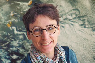
Dr. Gaël Kermarrec is a researcher at the Boundary Layer Meteorology Group , part of the Institute of Meteorology and Climatology within the Faculty of Mathematics and Physics at Leibniz University Hannover . His work focuses on atmospheric turbulence, GNSS applications, and remote sensing for environmental monitoring. Boundary layer meteorology Turbulence theory GNSS signal processing Terrestrial laser scanning Climate change impacts Geodetic time series analysis His research integrates advanced mathematical models like LR B-splines and Matérn covariance with large eddy simulations to study: Atmospheric turbulence effects on optical/GNSS signals Hydrospheric mass loading Deformation analysis of terrain/port infrastructure Climatic sea-level changes Machine learning for remote sensing The 15 most recent articles (2025-2023) demonstrate his focus on: GNSS-based turbulence detection AI-enhanced climate mapping Advanced surface approximation techniques Multi-sensor data fusion Stochastic modeling of geodetic observations Environmental impacts on optical measurements He has developed tools like the Klimascanner QGIS plugin for urban climate resilience and contributes to: Understanding atmospheric scale lengths Improving TLS/GNSS deformation monitoring Analyzing hydrospheric changes Wavefront modeling Ionospheric corrections
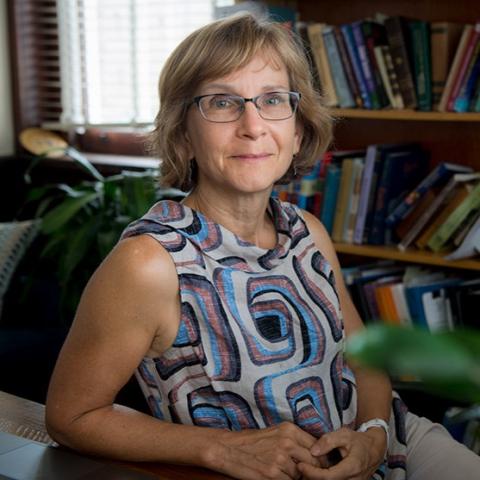
Cynthia Ebinger is a Professor in the Department of Earth and Environmental Sciences at Tulane University, affiliated with the School of Science & Engineering. She holds the Marshall-Heape Chair and previously served at the University of Rochester and as an Adjunct Professor at Royal Holloway, University of London. Her research focuses on geophysics, rift systems, seismic monitoring, volcanoes, and plate tectonics in West Africa and East Africa, particularly the Turkana Depression and East African Rift. She has conducted fieldwork in Ecuador, Peru, Kenya, Uganda, Ethiopia, and Australia. Education : Ph.D., MIT/WHOI, Joint Program in Oceanography, Marine Geology & Geophysics (1988) M.A., MIT, Geophysics (1986) B.S., Duke University, Geology (1982) Research Interests : Dr. Ebinger investigates continental rifting mechanisms, magmatic processes, seismic anisotropy, and volcanic systems. Her work integrates geophysical methods (e.g., InSAR, receiver functions) to study deformation in regions like the East African Rift and Gulf of Mexico passive margin. She emphasizes understanding crustal dynamics, lithosphere modification, and the interplay between tectonics and surface processes. Publications : Her recent work addresses rift linkage mechanics, crustal anisotropy variations, and volcanic deformation (e.g., Nyiragongo eruption). Key themes include seismic imaging of rift zones, subsidence patterns in coastal Louisiana, and mantle lithosphere interactions. Awards : American Geophysical Union Distinguished Lecturer (2023-2024) NASEM Jefferson Science Fellow (2022-2023) Woollard Award (2021) Tulane Honors Professor of the Year (2021) Grants & Collaborations : Leads projects funded by NSF and international collaborations, focusing on Turkana Depression geodynamics, Gulf of Mexico subsidence, and volcanic monitoring in East Africa. Active in education initiatives to strengthen quantitative geophysics training. Labs/Teams : Core member of the Tulane Earth Sciences group and collaborates with global networks (e.g., Project TRAILS in East Africa). Engages in field-based research and satellite geodesy applications.
David Eaton is a Professor and former NSERC/Chevron Industrial Research Chair in Microseismic System Dynamics at the University of Calgary's Department of Geoscience. He holds a PhD in Geophysics from the University of Calgary (1992) and has published the textbook 'Passive Seismic Monitoring of Induced Seismicity'. Educational Background: PhD Geophysics, University of Calgary, 1992 MSc Geophysics, University of Calgary, 1988 BSc Geology and Physics, Queen's University, 1984 His research focuses on induced seismicity characterization, microseismic monitoring technology development, distributed acoustic sensing applications, physics-informed machine learning approaches, and lithospheric structure analysis. Current projects investigate earthquake triggering mechanisms during hydraulic fracturing and geothermal energy development. Publications show consistent focus on induced seismicity source characterization, monitoring methodologies, and geophysical applications for energy resource development. Recent work integrates machine learning with seismic monitoring to understand geological controls on induced seismicity. Scientific Awards: NSERC Synergy Award for Innovation (2020) J. Tuzo Wilson Medal, Canadian Geophysical Union (2020) CSEG Distinguished Lecturer (2019) Schulich School of Engineering Distinguished Collaborator (2019) University of Calgary Great Supervisor Award (2016) He leads the CREATE-REDEVELOP program training future leaders in responsible resource development and directs the microseismic research laboratory.
Steven Constable is a Professor of Geophysics at the Institute of Geophysics and Planetary Physics (IGPP) within the Scripps Institution of Oceanography at UC San Diego. He specializes in electrical conductivity studies of Earth’s crust and mantle, seafloor instrumentation development, and geophysical data analysis. His research focuses on understanding tectonic processes, subduction zone dynamics, and marine geohazards through electromagnetic methods. Education: B.S., University of Western Australia Ph.D., Australian National University Research Interests: Electrical conductivity of crust and mantle Seafloor instrumentation development Magnetotelluric and controlled-source electromagnetic (CSEM) methods Subduction zone fluid dynamics CO 2 sequestration monitoring Mid-ocean ridge magmatism Grants & Collaborations: NSF-NERC Collaborative Research: Magnetotelluric imaging of plume-ridge interactions (Galapagos) Magnetotelluric Investigation of the Salton Trough (MIST) Experiment PI-LAB Experiment at the Equatorial Mid-Atlantic Ridge Labs & Teams: He leads the Marine Electromagnetics Lab , developing cutting-edge instrumentation for marine geophysical surveys. His team collaborates globally on projects ranging from Arctic permafrost assessment to subduction zone imaging.
Matthew J. Cracknell is a Senior Lecturer in Geodata Analytics at the University of Tasmania's School of Natural Sciences, specializing in Earth Sciences. He holds a PhD in Computational Geophysics (2014) and BSc (Hons) in Geophysics (2009), both from the University of Tasmania. His research integrates geoscience with machine learning to address challenges in mineral exploration, environmental remediation, and sustainable resource management. Key focuses include automated detection of geological features in drillcore imagery, decarbonization of energy systems via ore deposit discovery, and legacy mine waste characterization. Cracknell leads the CODES Research Program 6 (Geophysics and Computational Geosciences) and Module 2 of the AMIRA P1249 project. He has secured significant industry and government funding, including projects with Boliden AB, Anglo American, and the Tasmanian Government. His work emphasizes collaboration with mining partners and agencies like Geoscience Australia and Mineral Resources Tasmania. Teaching roles include developing courses on the mining value chain, climate resilience, and geodata analytics. As Graduate Research Coordinator, he promotes HDR student well-being and supervises over 20 doctoral and masters students. Awards include the 2019 Oz Minerals Explorer Challenge Prize. Key affiliations include the International Association for Mathematical Geosciences, Australian Society of Exploration Geophysicists (Tasmanian Branch Secretary), and Geological Society of Australia.
Dr. Thomas Goebel is an Assistant Professor at the Center for Earthquake Research and Information (CERI), University of Memphis. He holds a PhD from the University of Southern California (2013). His research focuses on induced seismicity, fault structure, and earthquake source processes, integrating rock mechanics, seismology, and hydrogeology. Key projects include studies on fault roughness effects, aftershock clustering, and induced seismicity mitigation. He leads the Earthquake Physics Group (EPG), comprising 1 PostDoc and 5 graduate students, and collaborates internationally on volcano monitoring and geothermal energy projects. Dr. Goebel has received the 2023 Tigers Ascending to Excellence Award. Education: PhD in Earth Sciences, University of Southern California, 2013. Research interests emphasize interdisciplinary approaches to understanding stress storage/release in the crust, earthquake size prediction, and fault responses to fluid perturbations. His work bridges laboratory experiments, numerical modeling, and statistical analyses to address fundamental seismological questions. Recent publications highlight contributions to induced seismicity spatial footprints, laboratory-based aftershock dynamics, and volcano-seismic network development. He actively mentors students, with recent accolades including NSF internships and travel awards. Labs/Teams: Earthquake Physics Group (EPG) at CERI, collaborating with institutions in France, El Salvador, and the U.S. on projects like volcanic seismic networks and fault hydrology studies.
Professor Martin Van Kranendonk is the Head of School at the School of Earth and Planetary Sciences (EPS), part of Curtin University's Faculty of Science and Engineering. He holds a portfolio role in the Office of the Provost. His research focuses on early Earth history, astrobiology, and the geological processes that shaped microbial life. He leads investigations into ancient stromatolites, hydrothermal systems, and the environmental conditions conducive to life’s origins. Van Kranendonk’s work spans over four decades, with a strong emphasis on the Pilbara Craton and other Archaean-Proterozoic terrains. His studies integrate geochemistry, sedimentology, and geobiology to unravel the co-evolution of life and Earth’s systems. He collaborates globally, contributing to Mars sample return mission planning and astrobiological studies of extraterrestrial environments. Key research themes include: 1) Early Earth geochemical and tectonic evolution; 2) Microbial biosignatures in ancient rocks; 3) Hydrothermal systems as life’s incubators; and 4) Planetary habitability. His publications emphasize interdisciplinary approaches, linking field geology with cutting-edge analytical techniques. Recent articles highlight advancements in understanding prebiotic chemistry, mantle evolution, and microbial adaptation in extreme environments. While no awards are explicitly listed, his contributions have significantly impacted astrobiology and Archaean geology. He oversees research teams and advises projects at Curtin’s EPS, fostering collaborations across disciplines. Van Kranendonk’s work has implications for both Earth science and planetary exploration, bridging the gap between ancient terrestrial records and future space missions.
Douglas Dreger is a Professor in the Department of Earth and Planetary Science at the University of California, Berkeley. His research focuses on seismic source analysis, wave propagation, Earth structure, and geophysical inverse problems. He primarily uses waveform data to investigate earthquake mechanics, stress orientations, and fluid-faulting interactions. Email: dreger@seismo.berkeley.edu His work spans diverse tectonic and geothermal environments, including the Ridgecrest earthquake sequence, Mendocino Triple Junction, North Korean nuclear tests, and The Geysers geothermal field. Recent studies examine graviquake hypotheses, long-period volcanic tremors, and stress drop validation through advanced inversion techniques. Dreger's publications reveal a strong emphasis on moment tensor inversion, fault geometry modeling, and seismic hazard assessment. He has contributed to understanding earthquake rupture heterogeneity, coseismic deformation, and 3D seismic simulations for hazard scenarios.
Professor Patrice Rey is a faculty member at the School of Geosciences, The University of Sydney. He holds the rank of Professor and specializes in geodynamics, tectonics, and landscape evolution. With an international career spanning 12 institutions across three continents, his research focuses on continental rifting, mantle dynamics, metamorphic processes, and the interplay between climate and tectonics. Notable projects include studies on Australia’s geological history, the formation of precious opal, and the dynamics of early Earth geodynamics. His work bridges field geology, numerical modeling, and geophysical analysis. Key research themes include gravitational collapse in cratons, the role of isostasy in fold belt evolution, and the impact of dynamic topography on sedimentary systems. He has contributed to interdisciplinary projects such as the Perseverance Mars mission, highlighting connections between Earth’s geology and Martian surface processes. Recent publications emphasize continental crust evolution, landscape dynamics, and the integration of virtual reality tools in geological education. He leads research teams funded by grants like the Australian Research Council (DP22 and LP20 projects), focusing on mineral systems and Proterozoic rift basins. His media presence includes BBC documentaries and NOVA series, showcasing his expertise in continental evolution and planetary geology.
Eva Enkelmann is an Associate Professor at the University of Calgary's Department of Earth, Energy, and Environment. She leads research on orogenic systems evolution using geo- and thermochronology methods. Educational Background: PhD Geology, TU Bergakademie Freiberg, 2005 MSc Geology and Paleontology, University of Freiberg, 2001 Her research examines mountain belt evolution across spatial scales, focusing on interactions between tectonic forces and surface processes. She specializes in multi-method dating of mineral grains and thermochronologic method development. Current projects include geothermal potential assessment in the Liard Basin (NWT), Cu-porphyry exploration in British Columbia, and rock exhumation studies in Yukon. Recent publications focus on methodological advances in detrital thermochronology, including laser ablation (U-Th-Sm)/He dating, zircon triple-dating, and novel data analysis techniques for complex thermal histories. Scientific Awards: Fellow, Geological Society of America (2022) Outstanding Achievements Award, Faculty of Science, University of Calgary (2023) She teaches courses on global tectonics, structural geology, and field methods, including the Canadian Cordillera Field School.
Brandon Schmandt is a Professor in the Department of Earth, Environmental and Planetary Sciences at Rice University, where he leads research using seismology to investigate Earth systems. His work integrates interdisciplinary approaches, data science, and numerical modeling to study tectonic processes, magmatic systems, and environmental interactions. His educational background includes a PhD in Geological Sciences from the University of Oregon (2011) and a BA in Environmental Studies from Warren Wilson College (2006). Dr. Schmandt's research focuses on seismology, tectonics, volcanology, and surface processes , with emphasis on seismic imaging of subsurface structures. His group employs innovative time-series analysis and field projects to resolve geologic history and contemporary Earth dynamics, particularly examining fault zones, magmatic reservoirs, and deep convective processes. Key methodologies include dense seismic arrays and machine learning applications. Analysis of his recent publications (2023-2025) reveals dominant trends in seismic event discrimination (earthquakes vs. explosions), magmatic system imaging (Yellowstone, Cascades), and global mantle structure studies. There is strong emphasis on induced seismicity, machine learning applications, and high-resolution imaging of Earth's discontinuities using dense arrays. His distinguished honors include: Aki Award of the AGU Seismology Section GSA Donath Medal AGU Macelwane Medal Body Dr. Schmandt directs an active research group conducting field projects across diverse settings including the Raton Basin, Yellowstone, Antarctica, and the Caribbean. While specific student advisees and grant details aren't provided in available materials, his group's work involves collaborative data collection, advanced computational modeling, and development of novel seismic analysis techniques applicable to both natural and anthropogenic seismic sources. The research program maintains focus on magmatic systems beneath volcanic regions, induced seismicity mechanisms, and global mantle structure using dense node arrays and interdisciplinary approaches to address fundamental questions in Earth dynamics.