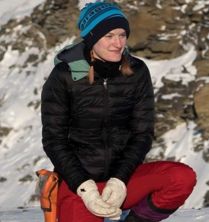
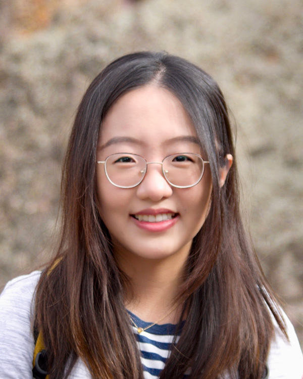
Dr. Emma "Mickey" MacKie is an Assistant Professor in the Department of Geological Sciences at the University of Florida. Her research focuses on glaciology, geophysics, and geostatistics, with an emphasis on understanding subglacial environments beneath ice sheets. She leads the Gator Glaciology lab, which develops machine learning tools and geostatistical methods to study ice dynamics and subglacial topography. MacKie holds a Ph.D. in Geophysics from Stanford University (2021). Her work addresses challenges in ice sheet modeling, including uncertainties in subglacial topography and hydrology. Recent projects include Bedmap3 datasets, stochastic simulations of ice sheet evolution, and analysis of Antarctic calving events using extreme value theory. Her research highlights include advancing geostatistical techniques for subglacial modeling, analyzing multi-decadal radar data, and investigating climate impacts on ice sheets. She collaborates on FAIR data initiatives and has contributed to software tools like GStatSim for geostatistical simulations. MacKie actively engages in Antarctic and Greenland fieldwork, emphasizing interdisciplinary approaches to glaciological challenges.
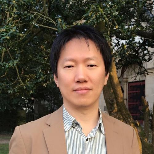
Prof. Yi Ma is a Chair Professor at the Institute for Communication Systems (ICS) and the Home of the 6G Innovation Centre (6GIC) at the University of Surrey. He holds a Professorial rank in the School of Computer Science and Electronic Engineering. His research focuses on semantic/effective communication, machine learning for RF and physical layer design, MIMO technology, and opportunistic networking. Current PhD students include Yupeng Zheng, Ashkan Jafari, Zohre M. Bakhsh, and Mehdi Tafazolli. Research interests span scalable quantum-based wireless communications, distributed hybrid beamforming, and satellite communication systems. Recent publications highlight advancements in SA-MIMO, non-uniform quantization, and distributed MIMO-LEO networks. Prof. Ma teaches courses such as EEEM017 and EEE3006, and serves as an EEE examination officer. His work integrates theoretical contributions with practical applications, emphasizing future wireless systems and sensing technologies. Collaborations with industry and academia, including projects on 6G innovation, underscore his commitment to cutting-edge research.
Lachlan Grose is a Research Fellow at Monash University's School of Earth Atmosphere and Environment, specializing in advanced geological and geophysical modeling. His work focuses on integrating machine learning, 3D structural analysis, and geophysical inversion techniques to address challenges in subsurface resource management and tectonic understanding. Key projects include the Three-dimensional Bayesian Modelling of Geological and Geophysical data (ARC-funded) and development of the LoopStructural software, a time-aware 3D geological modeling platform. Grose also contributes to industry collaborations like the AMIRA P1249 project on ore body knowledge modeling. Research interests span structural geology, igneous intrusion modeling, FAIR data principles, and geophysical inversion methods. He has led efforts to improve usability of Loop3D and pioneered machine learning applications for geological structure imaging. Leading developer of LoopStructural (open-source 3D modeling framework) Primary investigator on usability improvements for geoscientific workflows Recipient of ARC and industry grants totaling over AUD 3M Supervises PhD candidates focusing on interdisciplinary geoscience problems Recent publications emphasize transdimensional inversion methods, FAIR data integration, and application of machine learning to geophysical datasets. His work bridges academic research with industrial subsurface resource challenges.
Tim Reston is a Professor of Geology and Head of the Geosystem Research Group at the University of Birmingham's School of Geography, Earth and Environmental Sciences. He serves as Head of School and Natural Sciences Tutor. His research focuses on applying geophysics to tectonic problems, particularly rifted continental margins and slow-spreading mid-ocean ridges, with expertise in seismic imaging, detachment tectonics, and mantle serpentinization. Reston holds a BA in Geology from the University of Cambridge (1983), an MSc in Geophysics from the University of Oxford (1984), and a PhD in Geophysics from the University of London (1988). Education: BA Geology, University of Cambridge (1983) MSc Geophysics, University of Oxford (1984) PhD Geophysics, University of London (1988) Research Interests: Reston’s work emphasizes the integration of geophysical methods to study tectonic processes. His research explores the seismic structure of continental margins, the mechanics of detachment faulting, and the role of mantle serpentinization in shaping crustal architecture. He has contributed to understanding the dynamics of mid-ocean ridges, particularly at ultraslow-spreading segments like the Mid-Atlantic Ridge, and the interplay between magmatism and serpentinization in crustal evolution. Publications: His recent work spans subduction zone dynamics, mid-ocean ridge tectonics, and continental margin evolution. Key themes include the use of high-resolution seismic imaging to map crustal structures and the application of geophysical models to unravel tectonic processes. Labs/Teams: Leads the Geosystem Research Group, which investigates Earth system processes through interdisciplinary geophysical and geological approaches.
Greg Wilson is an Associate Professor in the College of Earth, Ocean, and Atmospheric Sciences (CEOAS) at Oregon State University, where he leads the Wilson Nearshore Research Group within the Coastal Imaging Laboratory (CIL). His research centers on the physics of nearshore coastal processes, including wave dynamics, sediment transport, and current systems, utilizing observational tools and probabilistic modeling approaches. Wilson specializes in acoustic remote sensing, data assimilation for bathymetry inversion, and rip current forecasting, with applications extending from beaches to rivers and inlets. His work emphasizes field measurements using Argus beach cameras, UAVs, and novel instrumentation to address coastal hazards and morphological changes through statistical and numerical frameworks. Analysis of his 2024-2025 publications reveals a pronounced focus on rocky shore dynamics, wave runup prediction on composite beaches, and innovative marine-bird-based environmental monitoring. These studies integrate multiscale remote sensing, field experiments, and modeling to tackle challenges in nearshore circulation, sediment transport, and wave energy dissipation. No scientific awards were mentioned in the provided text. Wilson actively recruits graduate and undergraduate researchers for projects involving surf zone modeling, data assimilation, and coastal hazard prediction. His collaborations with coastal engineers indicate applied research translating into practical coastal management solutions, though specific grant details were not provided. As part of the CIL, he utilizes advanced technologies including Argus imagery, marine radar, and biologging to study nearshore processes, with recent work emphasizing rocky shore environments and infragravity wave interactions.
Dr. Christopher K. Zahm is a Research Scientist at the Bureau of Economic Geology, The University of Texas at Austin. He holds a Ph.D. in Geology from Colorado School of Mines (2002), an M.S. in Geology from UT Austin (1998), and a B.S. in Geology from University of Wisconsin-Madison (1993). His professional experience includes roles as a Structural Geologist at ConocoPhillips (2002–2006), Geologic Consultant at iReservoir (2000–2002), and Adjunct Professor at Colorado School of Mines (2001). Zahm specializes in reservoir characterization, flow modeling in fractured systems, and porosity-permeability evolution. His research integrates field observations, geomechanical modeling, and advanced analytical techniques to address challenges in carbonate reservoirs, fault zone dynamics, and unconventional resource recovery. Key research focuses include: Stratal architecture and deformation in carbonate platforms Fracture network characterization using outcrop analogs and geophysical data Geomechanical properties of reservoir rocks (e.g., Austin Chalk Group) Impact of structural heterogeneity on reservoir compartmentalization Zahm is actively involved in consortia such as the Advanced Energy Consortium (AEC) and Fracture Research and Application Consortium (FRAC). His work has contributed to understanding basement-rooted faults in the Permian Basin, mechanical stratigraphy of anticlines, and the application of machine learning in carbonate reservoir classification. He has authored/co-authored over 50 peer-reviewed publications, emphasizing integration of field, lab, and subsurface data for reservoir optimization. Notable contributions include pioneering studies on fracture prediction using sequence stratigraphy in fault damage zones and quantitative analysis of rock strength in Gulf Coast carbonates. Zahm's expertise bridges academia and industry, with direct applications to oil and gas exploration, CO2 sequestration, and groundwater flow modeling.
Daniel Calvete Manrique is an Associate Professor at the School of Telecommunications and Aerospace Engineering (EETAC) of the Polytechnic University of Catalonia (UPC), where he holds a position in the Department of Physics. His academic journey includes a Degree in Physics from the University of Barcelona (1995) and a PhD in Physics from UPC (1999), focusing on morphological stability models. He conducted postdoctoral research at Utrecht University’s Institute for Marine and Atmospheric Research (1999–2002) and joined UPC’s Ramón y Cajal Program (2003–2008) before becoming an Associate Professor in 2008. His research interests center on coastal morphodynamics, including sedimentary patterns on continental shelves, linear stability analysis, and dynamics of shoreface-connected ridges, crescentic bars, and beach cusps. He leads the DF-GeoTech group, which explores fluid dynamics and geophysical applications. Key contributions include numerical models for coastal evolution, bathymetric inversion techniques (e.g., UBathy), and studies on sediment transport mechanisms under wave and tidal influences. His work integrates field data and numerical simulations to address coastal resilience, climate adaptation, and anthropogenic impacts. Collaborations span institutions like Utrecht University and the Catalan Institute of Water Research. He has authored over 200 publications, focusing on coastal processes, sediment dynamics, and geophysical fluid modeling.
Scott White is a Professor in the Department of Earth Ocean and Environment at the University of South Carolina's College of Arts and Sciences, specializing in marine geology and geophysics. His research focuses on revealing patterns and processes in underwater environments from deep seafloors to wetlands. Research interests span coastal processes, geophysics, seismology, volcanology, oceanography, tectonics, and marine geology, with particular emphasis on submarine volcanic processes, coastal geomorphology, and groundwater interactions. Recent publications demonstrate strong focus on machine learning applications in seafloor mapping and advanced geomorphological analysis techniques. Award recognition is currently not detailed in available records. Laboratory resources include marine geology equipment and computational modeling capabilities within the School of Earth, Ocean and Environment.
Dr. Atsuhiro Muto is an Associate Professor and Department Vice Chair in the Department of Earth and Environmental Science at Temple University's College of Science and Technology. His research focuses on polar geophysics and glaciology, particularly investigating changes in polar ice sheets and glaciers. Key areas include subglacial conditions beneath the Antarctic and Greenland Ice Sheets, using geophysical and remote sensing data, and reconstructing past temperature changes in Antarctica via borehole thermometry. He teaches courses in remote sensing, glaciology, and physical geology. Research Interests: Dr. Muto's work combines field-based geophysical surveys with remote sensing technologies to study ice dynamics, subglacial environments, and climatic impacts on polar regions. His team explores how basal conditions influence ice flow, glacier stability, and responses to warming climates. Recent projects include studies on Thwaites Glacier in Antarctica and the NE Greenland Ice Stream. Publications: His recent work highlights advancements in subglacial mapping, ice shelf stability analysis, and the interplay between tectonics and glacial systems. Collaborations involve advanced tools like multibeam sonar and autonomous underwater vehicles for sub-ice exploration. Advising & Labs: Dr. Muto advises PhD student Louise Borthwick (winner of an Outstanding TA Award) and seeks new students. His lab is part of the Polar Geophysics and Glaciology research group at Temple, emphasizing interdisciplinary approaches to understanding Earth's cryosphere. Contacts: Located at 317B Beury Hall, Dr. Muto can be reached via email (amuto@temple.edu) or phone (+1-215-204-3699).
Lijing Wang is an Assistant Professor at the University of Connecticut, specializing in geostatistics and hydrogeology. Her research focuses on integrating hydrologic modeling with multiscale datasets to explore watershed and aquifer dynamics, quantifying uncertainties through machine learning and Bayesian methods. She co-authored the textbook Data Science for the Geosciences , emphasizing data science education for geoscientists. Education: Ph.D. in Geological Sciences from Stanford University (with a minor in Computer Science) and B.S. in Space Physics and Applied Mathematics from Peking University. Her research interests include subsurface heterogeneity, snow dynamics in mountainous regions, and climate impacts on hydrology. She develops advanced statistical and computational tools for geophysical inversion and uncertainty quantification. Her work also explores the application of surrogate models for environmental decision-making under climate change scenarios. Key contributions include the GStatSim software package for geostatistical analysis and collaborations on Antarctic ice shelf bathymetry modeling. Her research bridges geoscience and data science, addressing challenges in mineral exploration, groundwater contamination, and climate resilience.
Jaehoon Jung is a Researcher and guest researcher at the University of Bonn's Photogrammetry department under the Institute of Geodesy and Geoinformation (IGG). He holds a PhD in Civil & Environmental Engineering from Yonsei University (2014) and previously served as a researcher there. His work focuses on automating 3D as-built modeling using LiDAR and 3D scanning data, with emphasis on BIM, SLAM, and remote sensing for biomass estimation. He has also explored solar energy potential in agricultural and highway environments. Research Interests: Building Information Modeling (BIM) 3D Point Cloud Processing LiDAR Applications SLAM Algorithms Remote Sensing for Environmental Monitoring Publications highlight advancements in bathymetry algorithms, wildfire damage detection via UAS, and automated road marking analysis from LiDAR data. His work bridges geomatics, computer vision, and civil engineering. Awards include the KICEM Outstanding Research Award (2013) and Forest IT Best Student Paper (2011) .
Rodrigo Ezeta Aparicio is a Researcher in the Physics of Fluids department at the University of Twente's Faculty of Science and Technology. His work focuses on experimental and computational fluid dynamics with emphasis on turbulent flow systems. His primary research interests span Fluid Dynamics , Turbulence , and Multiphase Flows , particularly in Taylor-Couette configurations. Key specialties include drag reduction mechanisms, boiling phenomena, and secondary flow control through surface roughness modulation. His fingerprint analysis confirms dominant expertise in Turbulence Physics (100%) , with significant contributions to Couette Flow (56%), Drag Reduction (55%), and Bubbles (50%). Recent publications (2020-2025) reveal a strong trend toward boiling liquid dynamics and bubbly drag reduction in high-Reynolds-number systems. His 2025 work on cryogenic wave impacts and 2021 study on catastrophic phase inversion demonstrate cutting-edge exploration of multiphase turbulence extremes. The consistent focus on Taylor-Couette systems across 60% of outputs establishes this as his core experimental platform. Scientific recognition includes: Scopus h-index of 7 with 98 total citations 11 peer-reviewed research outputs (2018-2025) Dataset creation for multiphase flow research Collaborative activity shows extensive work with D. Lohse, C. Sun, and S.G. Huisman across 5 publications. While no formal advising roles are documented, his involvement in PhD thesis supervision (e.g., 2025 boiling liquid impact study) indicates mentorship capacity. Current projects appear centered on rotational flow optimization and phase-change dynamics in industrial applications.
Prof. Dr. Neslihan Ocakoğlu Gökaşan is a Professor at Istanbul Technical University's Department of Geophysical Engineering, Faculty of Mines, specializing in Marine Geology and Geophysics. Her research focuses on tectonic evolution, seismic stratigraphy, and climate change impacts on coastal systems. Education: PhD in Geophysical Engineering, Istanbul Technical University (2000-2004) MSc in Geophysical Engineering, Istanbul Technical University (1993-1997) BSc in Geophysical Engineering, Istanbul Technical University (1989-1993) Her investigations employ seismic reflection, multibeam bathymetry, and geomorphic analysis to study Black Sea shelf dynamics, Western Anatolian neotectonics, and gas hydrate systems. Recent work examines submarine hydrothermal systems and earthquake-triggered deformation patterns. Research emphases include: geophysical imaging of sedimentary basins, river-seafloor morphodynamics in the Black Sea, fault-controlled fluid flow systems in the Tyrrhenian Sea, and rapid submergence events along Turkish coastlines. Awards: Best Poster Presentation (Selcuk University, 2016) Prof. Dr. Dr. Önder Öztunalı Earth Sciences Award (Istanbul Culture University, 2006) She has supervised multiple doctoral candidates on projects involving 3D velocity modeling, seismic tomography, and active tectonics. Current grants focus on Southern Black Sea shelf investigations using multibeam bathymetry and reflection seismology. Directs laboratory facilities for seismic data processing and marine geophysical surveys. Collaborates internationally on Mediterranean tectonic studies and Antarctic ice sheet research through ITU Polar Research Center.
Octavio Castillo Reyes is a full-time Professor at the Department of Computer Architecture, Polytechnic University of Catalonia (UPC), and an Associate Researcher at the Barcelona Supercomputing Center (BSC) within the Wave Phenomena Group. He holds a PhD in Computer Architecture from UPC (2017) with an international distinction for his thesis on HPC-based electromagnetic geophysical modeling. His research focuses on high-performance numerical methods for geophysical applications, particularly in electromagnetic modeling and inversion using parallel computing frameworks. Education: PhD in Computer Architecture (UPC, 2017), M.Sc. in Networks and Telecommunications (UAV, 2011), B.Sc. in Computational Systems Engineering (ITSX, 2007). Research Interests: HPC algorithms, geoelectromagnetic modeling, parallel programming, edge finite element methods, and applications in geothermal energy and reservoir characterization. He leads the development of the PETGEM code, an open-source HPC tool for 3D CSEM modeling used in geophysical studies. His work bridges computational science and geophysics, emphasizing scalability and efficiency in supercomputing environments. Publications and Projects: Over 20 peer-reviewed articles, 60+ conference presentations, and multiple funded projects (e.g., Collinder Venture Builder Programme , AIR: Air for European Resilience ). His recent work addresses groundwater imaging, metallic infrastructure challenges, and renewable energy applications. Awards: JCC2015-BSC Prize for 'Your Thesis in Three Minutes,' National System of Researchers (CONACyT, Level I), and UPC's Excellence Cum Laude PhD Award. He is a member of the Mexican Supercomputing Network and certified by ANECA/AQU for teaching excellence.
Merrick Haller is a Professor in the School of Civil and Construction Engineering at Oregon State University, College of Engineering. He holds a joint appointment and is actively involved in coastal and ocean engineering research and education. His work is centered at the interface of remote sensing and coastal dynamics, with strong institutional support and collaboration across multiple agencies. Education: Ph.D., Civil Engineering, University of Delaware, 1999 M.C.E., Civil Engineering, University of Delaware, 1996 B.S., Earth & Atmospheric Sciences (Geophysics), Purdue University, 1993 Professor Haller’s research focuses on developing and applying remote sensing tools—particularly X-band marine radar—to study coastal ocean processes. His primary interests include nearshore remote sensing, wave transformation, rip currents, sediment transport, wave-current interaction, and hazardous waves at navigational inlets. His teaching encompasses hydraulics, wave mechanics, and coastal engineering. He previously coordinated the coastal and ocean program (2003–2010) and served as associate head of the School for seven years. The trends in his research, as reflected in recent and representative publications, emphasize real-time monitoring, data assimilation, and predictive modeling using radar and optical systems. Key themes include bathymetry estimation (e.g., cBathy), wave forecasting for wave energy applications, and submesoscale frontal dynamics. His work integrates field deployments, laboratory experiments, and numerical modeling, often in collaboration with NOAA, ONR, and USACE. Scientific Awards: 2007 Editors' Citation for Excellence in Refereeing, Journal of Geophysical Research-Oceans 2002 Editors' Citation for Excellence in Refereeing, Journal of Geophysical Research-Oceans Professor Haller leads the Haller Research Group and has advised numerous Ph.D. and M.S. students, many of whom have pursued careers in coastal engineering, government agencies, and academia. His research has been funded by the Office of Naval Research, Department of Energy, National Science Foundation, NOAA, Sea Grant, and the U.S. Army Corps of Engineers. He is a key contributor to major projects such as DARLA and NANOOS, involving radar deployments at New River Inlet, Cape Disappointment, and Yaquina Bay. He also collaborates with the Coastal Imaging Laboratory and the University of Washington’s Applied Physics Laboratory. Labs and Research Teams: He is affiliated with the Haller Research Group, the Nearshore Remote Sensing Group, and the DARLA project team. His group operates the Wave Imaging Marine Radar (WIMR) system and contributes to the National Marine Renewable Energy Center (now Pacific Marine Energy Center). Field sites include the Columbia River mouth, Newport, and New River Inlet, where radar and camera systems are deployed for coastal monitoring.