Hao Liu is a researcher affiliated with institutions like Chinese Academy of Sciences , Beihang University , and Stanford University . His work spans Computer Science , Artificial Intelligence , and Robotics . Key affiliations: National Space Science Center (Beijing), School of Astronautics (Beihang), Key Laboratory of Pervasive Computing (Tsinghua) Research interests include Machine Learning , Image Processing , Graph Neural Networks , and Wireless Communication Optimization His recent publications focus on: Advanced control systems for fuzzy models Medical imaging via hyperspectral analysis Transformer-based approaches in NLP and vision Quantum-safe and edge computing protocols
Bert Wouters is an Associate Professor at Utrecht University's Faculty of Science, affiliated with the Department of Dynamics Meteorology. He specializes in satellite-based observations of polar ice sheets and climate dynamics, with a part-time appointment since joining the Institute for Marine and Atmospheric Research (IMAU) in 2015. His work focuses on global glacier mass loss, ice-sheet interactions with climate change, and sea-level rise contributions. Research interests span glaciology, satellite geodesy, and climate modeling. Key themes include: Quantifying ice-sheet mass balance using GRACE/GRACE-FO and ICESat-2 data Analyzing surface melt processes on Antarctic ice shelves Assessing impacts of Arctic warming on glacier dynamics Developing machine learning methods for remote sensing of cryospheric changes Publications emphasize Antarctic and Greenland ice-sheet vulnerabilities, with recurring themes of satellite validation, meltwater hydrology, and decadal climate variability. Research consistently integrates field data, climate models, and novel remote sensing techniques. Wouters leads projects like Future Deltas (water/climate interactions) and Eratosthenes (glacier topography via shadow motion analysis). He collaborates with international teams on IPCC-relevant assessments and edits for The Cryosphere .
Dr. Nicholas Kevlahan is a Professor in the Department of Mathematics and Statistics at McMaster University. He holds a BSc in Physics from the University of British Columbia (1985–1989), a PhD in Applied Mathematics from the University of Cambridge (1990–1994), and completed a Marie Curie postdoctoral fellowship at École Normale Supérieure in Paris (1998). He has held visiting positions at institutions including Université Grenoble-Alpes, INRIA, and the University of Cambridge. His research focuses on advanced computational and mathematical methods for fluid dynamics, including the development of the WAVETRISK code for adaptive climate modelling, data assimilation techniques, fluid-structure interaction, and compressive sampling. His work integrates interdisciplinary approaches across applied mathematics, geophysics, and engineering. Key research areas include geophysical fluid dynamics, numerical analysis, partial differential equations, and wavelet-based methods. He has published extensively on topics such as ocean circulation models, turbulence simulation, and adaptive numerical methods. Dr. Kevlahan teaches courses in numerical methods, differential equations, asymptotic analysis, and mathematical physics. He mentors a diverse group of PhD, MSc, and BSc students in his active research laboratory.
Alexander Kurapov holds a Courtesy Appointment at Oregon State University within the College of Earth, Ocean, and Atmospheric Sciences, Department of Oceanography. He is actively engaged in research involving ocean modeling and data assimilation, with a focus on coastal and shelf processes along the U.S. West Coast and the Bering Sea. His research interests span oceanic data assimilation, coastal ocean modeling, wind-driven circulation, internal tides, shelf mixing, and nearshore flows. These areas are central to understanding coastal dynamics, climate variability, and improving ocean forecasting systems. The recent publications highlight a strong trend in high-resolution numerical modeling, variational and ensemble data assimilation techniques, and analysis of coastal and shelf-scale processes. Topics include internal tide dynamics, sea level variability, glider data integration, and wave-current interactions, primarily in the Pacific Northwest and Bering Sea regions. The work demonstrates consistent application of advanced modeling frameworks to real-world oceanographic problems. Alexander Kurapov has collaborated extensively with leading oceanographers at Oregon State University and beyond, contributing to major projects such as the US Integrated Ocean Observing System (IOOS). While no formal awards are listed, his body of work reflects significant contributions to coastal ocean science. He has advised or collaborated with numerous researchers, though specific students are not named. His work often involves model development, observational integration, and participation in multi-institutional efforts. Kurapov’s research is supported through collaborative grants and institutional resources, though specific funding sources are not detailed in the text. His work is closely tied to modeling teams at Oregon State University, particularly those involved in coastal ocean forecasting, data assimilation, and nearshore dynamics. He contributes to systems like the West Coast Ocean Forecast System (WCOFS) and participates in regional observational-modeling initiatives.
James Kaihatu is a Professor in the Civil & Environmental Engineering department at Texas A&M University's College of Engineering, serving as Division Head of Environmental, Water Resources, & Coastal Engineering. His research focuses on surface wave dynamics, tsunami inundation, contaminant transport, and coastal flooding impacts. Ph.D., Civil Engineering, University of Delaware (1994) M.S., Civil Engineering, University of California, Berkeley (1987) B.S., Civil Engineering, California State Polytechnic University (1986) His work spans computational modeling, laboratory experiments (NHERI Directional Wave Basin, Oregon State University), and field studies post-hurricanes (Ike, Michael, Dorian, Ian). Funded by NSF, ONR, NOAA, and EPA, he explores data assimilation techniques for bathymetry inversion and environmental monitoring. Current projects include Galveston Bay wetland erosion analysis and post-disaster field surveys in hurricane-affected regions.
Suzanne Carbotte is the Bruce C. Heezen/Lamont Research Professor at Columbia University's Lamont-Doherty Earth Observatory. Her research focuses on marine geophysics, seismology, and subduction zone processes, with a particular emphasis on the Cascadia Subduction Zone, Mid-Ocean Ridges, and volcanic systems like Axial Seamount. She has led expeditions in the Pacific and Atlantic Oceans, including nearshore studies in New York. Education: BSc (University of Toronto), MSc (Queen's University), PhD (University of California Santa Barbara). Key Projects: CASIE21 seismic imaging experiment, cyberinfrastructure development for marine geoscience data. Recent Focus: Structural segmentation of Cascadia's megathrust, subduction zone fluid dynamics, and crustal melt transport at mid-ocean ridges. Her research integrates seismic tomography, wide-angle reflection/transmission data, and multibeam bathymetry to understand tectonic processes. She collaborates on global initiatives like the Global Multi-Resolution Topography synthesis and manages data repositories for the Rolling Deck to Repository (R2R) program. Recent publications highlight advances in imaging subduction zone structures, magma systems at mid-ocean ridges, and improving tsunami hazard models through integrated geophysical observations.
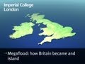
Professor Jenny Collier is a Professor of Marine Geophysics at Imperial College London's Department of Earth Science & Engineering within the Faculty of Engineering. She holds affiliations with the Dynamic Earth research group, Earth Observation Network, Earth and Planets, Geodynamics: Core to Surface, Hazards, and Marine and Coastal Environments. Her research focuses on mantle plumes, continental breakup, subduction zone processes, and the solid Earth water cycle, with notable contributions to understanding volcanic margin formation and catastrophic megaflood events in the English Channel. Collier has led expeditions using seismic imaging, sidescan sonar, and multibeam bathymetry to investigate oceanic crust structure and tectonic evolution. Education: PhD in Geophysics, University of Cambridge (1986-89) MSc in Geology, University of Durham (1985-86) Research Interests: Collier's work integrates geophysical field data and numerical modeling to study continental rifting, magmatism at volcanic margins, and fluid dynamics in subduction zones. Key projects include the VOILA initiative examining volatile recycling in the Lesser Antilles and the English Channel megaflood hypothesis. She investigates seaward-dipping reflectors, crustal accretion mechanisms, and the role of mantle plumes in continental breakup. Advising & Grants: Supervises PhD students and postdocs through grants from UK research councils. Recent projects include NERC-funded studies on South Atlantic magmatism and Imperial College studentships exploring marine geophysics. She advises on competitive fellowship applications and has secured funding for ocean-bottom seismometer deployments in the Caribbean. Labs & Teams: Core member of the Geodynamics: Core to Surface research group at Imperial. Collaborates with institutions like ION-GXT (South Atlantic studies) and NAG-TEC (North Atlantic research). Active in the Earth Observation Network and Grantham Institute for climate-related geohazards.
Associate Professor Mitchell Harley is a leading expert in coastal erosion and hazards at the University of New South Wales (UNSW) , specifically within the Faculty of Engineering and School of Civil and Environmental Engineering . His work combines innovative technologies like CoastSnap (a global citizen science initiative) and CoastSat (satellite imagery analysis) to advance coastal monitoring and forecasting. Education: BEng (Environmental) and BSc (Oceanography/Meteorology) from UNSW (2004), PhD in Civil Engineering (2009) Supervision: Currently mentoring 7 PhD/MPhil students in areas like AI for rip current detection and satellite shoreline modeling Research Focus: Coastal erosion mechanisms, real-time hazard forecasting, and climate change impacts on shorelines. Key technologies include smartphone-based monitoring , satellite remote sensing , and machine learning . Recent Publications (2022-2025) demonstrate expertise in: Multi-decadal shoreline prediction Wave climate downscaling Citizen science applications AI for coastal safety ENSO-driven erosion patterns High-resolution satellite monitoring Scientific Recognition: CoastSnap: UN Ocean Decade Action Scientia Associate Professorship Collaborations: Leads initiatives like the Narrabeen-Collaroy Beach Survey Program (50-year dataset) and Coastal Imaging Research Network . Advises on national Coastal Storm Hazard Warning Systems .
Hennes Alexander Hajduk is a Research Fellow at the University of Oslo's Section for Meteorology and Oceanography, part of the Department of Geosciences. He holds a PhD in Applied Mathematics from TU Dortmund University (2022). His work focuses on physical oceanography, numerical methods for fluid dynamics, and the influence of bottom topography on ocean flows. He develops property-preserving numerical schemes for conservation laws and shallow-water equations, with applications in geophysics and computational fluid dynamics. Education: PhD in Applied Mathematics (TU Dortmund University, 2022). Research Interests: Physical Oceanography: Investigating jet formation in stratified fluids and topographic effects on oceanic flows. Numerical Methods: Specializing in algebraic flux correction schemes, discontinuous Galerkin methods, and entropy-stable algorithms. Geophysical Modeling: Developing tools like FESTUNG for DG-based simulations in MATLAB/Octave. His publications emphasize stability, accuracy, and computational efficiency in simulating complex fluid systems. He collaborates on projects such as The Rough Ocean Research Group, advancing understanding of fluid dynamics in geophysical contexts. Affiliations: Section for Meteorology and Oceanography, University of Oslo Rough Ocean Research Group
Carmen Gaina is a Professor at the Centre for Planetary Habitability, University of Oslo , specializing in tectonics, geophysics, and Arctic studies. Her research spans mantle dynamics, oceanic basin evolution, paleoclimate reconstruction, and lithospheric modeling. Recent publications focus on Arctic ocean bathymetry, lithosphere-asthenosphere interactions, and plume-induced subduction processes. She leads projects like DYPOLE (dynamics of polar basins), HOTMUD (hydrothermal systems), and SUBITOP (Arctic tectonics), often using multi-disciplinary approaches including seismic tomography and satellite gravity inversion. Scientific awards : No explicit awards listed in the provided text.
Laurent Ailleres is a Senior Lecturer at Monash University's School of Earth Atmosphere and Environment. He holds a role as a Senior Research Fellow in the School of Geosciences. His research focuses on tectonics, structural geology, 3D geological modeling, and integration of geophysical datasets. Key projects include three-dimensional Bayesian modeling of geological/geophysical data (ARC-funded), ore body modeling (AMIRA P1249), and improving usability of Loop3D software (Auscope). Research Interests: Laurent's work spans tectonic boundaries, structural analysis using aeromagnetic data, 3D multi-scale modeling, and geophysical inversion techniques. He emphasizes combining geological and geophysical datasets to advance mineral exploration and crustal architecture understanding. Recent Articles: His 2022 work on Paleoproterozoic gold events in West Africa and 2021 studies on automated geological mapping and LoopStructural software showcase his contributions to 3D modeling and geophysical integration. Articles often address fault modeling, structural overprinting, and igneous intrusion analysis. Grants & Collaborations: Leads multiple ARC, CRC, and industry-funded projects. Collaborations span institutions globally, focusing on mineral systems, crustal dynamics, and open-source geoscience tools. Labs/Teams: Central to the Loop Project team developing LoopStructural software. Engaged with international research networks for 3D geological modeling applications.
Naonori Ueda is a Research Professor and Deputy Director at RIKEN Center for Advanced Intelligence Project. He also serves as a Visiting Fellow at NTT Communication Science Laboratories, Research Supervisor for Mathematical Information Platform at Japan Science and Technology Agency (JST), and Visiting Professor at Kobe University's Graduate School of System Informatics. His distinguished career spans academia, government research institutions, and industry collaboration, with significant contributions to advancing artificial intelligence and machine learning applications across multiple scientific domains. Dr. Ueda's research interests focus on the intersection of machine learning, artificial intelligence, and physical sciences. He specializes in physics-informed deep learning approaches that integrate governing physical equations with neural network architectures. His work spans geophysical data analysis, remote sensing applications, computational seismology, and environmental monitoring systems. He has pioneered methods for crustal deformation modeling, earthquake prediction, tsunami inundation forecasting, and satellite imagery analysis using advanced machine learning techniques. His research demonstrates how AI can solve complex scientific problems by bridging the gap between data-driven approaches and physical domain knowledge. His publication record reveals a strong trend toward applying machine learning to solve real-world geophysical and environmental challenges. His recent work shows increasing sophistication in physics-informed neural networks that incorporate domain-specific knowledge into deep learning architectures. The publications span high-impact journals like Nature Communications, demonstrating the interdisciplinary significance of his work. His research consistently focuses on practical applications of AI for disaster prevention, environmental monitoring, and scientific discovery. Fellow of IEICE (Institute of Electronics Information and Communication Engineers) Member of Japan Prize field review committee Selection Committee Member for Brilliant Female Research Award (The Jun Ashida Award) Member of Kyoto Prize Selection Committee Dr. Ueda has secured substantial research funding through multiple government-sponsored projects including RIKEN Pioneering Project 'Prediction Science,' JST AIP Acceleration Research projects on weather prediction and drug discovery, and AMED-funded medical research initiatives. His leadership extends to serving as Sub-project Director for Japan's Moonshot R&D Project. He actively mentors researchers through his roles at RIKEN, NTT, and various academic institutions, fostering the next generation of AI scientists. As Deputy Director of RIKEN Center for Advanced Intelligence Project, Dr. Ueda leads one of Japan's premier AI research initiatives. He also serves on the Advisory Board of Kobe University's Mathematical and Data Science Center and Kyoto University's Graduate School of Informatics. His leadership extends to coordinating the AI Seminar at Osaka Industrial Association and supervising the Keihanna 'Edison Society' at the International Institute for Advanced Studies, demonstrating his commitment to bridging academic research with industrial applications.
Konstantin Reeck is a Scientist specializing in Marine Geodynamics at GEOMAR Helmholtz Centre for Ocean Research Kiel, working within Research Division 4: Dynamics of the Ocean Floor. His research focuses on marine electromagnetic methods for seafloor exploration, particularly for detecting and characterizing seafloor massive sulfides and other marine resources. His primary research interests include: Marine Geophysics Marine Electromagnetics Controlled Source Electromagnetics Magnetotellurics Downhole Logging Seafloor Massive Sulfides exploration Reeck's work demonstrates a strong focus on developing and applying electromagnetic methods to marine geological settings. His research spans from instrument development (like the MARTEMIS system) to field applications across various ocean regions including the Mediterranean, Mid-Atlantic Ridge, Arctic Ocean, and Papua New Guinea. He has developed techniques to improve the detection of buried mineral deposits and gas hydrates through the integration of multiple geophysical methods. His recent publications show increasing sophistication in joint inversion approaches combining electromagnetic, seismic, and resistivity data for comprehensive subsurface characterization. Dr. Reeck has participated in numerous research expeditions including DY190 HYDROMOX (Santorini), SO299 DYNAMET (Papua New Guinea), SO277 OMAX (Malta), and others dating back to 2012, demonstrating his active role in international marine research collaborations and field operations across diverse geological settings worldwide.
Jan De Rydt is an Associate Professor at the Geography and Environmental Sciences Department within the Faculty of Engineering and Environmental Science at Northumbria University. He is also a UKRI Future Leaders Fellow (2022-2026), focusing on polar glaciology and oceanography. His research explores ice sheet dynamics, climate interactions, and sea level rise projections using numerical models like Úa and coupled ice-ocean frameworks. Education: PhD in Theoretical Physics (KU Leuven, Belgium) MSc in Physics (KU Leuven) MPhil in Geography Studies (University of Cambridge) Research Interests: The team addresses ice flow uncertainties through three key challenges: initial state estimation, parameter structural problems, and boundary forcing impacts. Projects include OCEAN:ICE (EU Horizon Europe) to reduce Antarctic freshwater flux uncertainties. Recent work focuses on Antarctic ice shelf stability, ocean-ice coupling, and ensemble forecasting until 2300. Advising & Grants: Supervises researchers Brad Reed, Jo Zanker, Qing Qin, and Sam Hartharn-Evans. Leads UKRI and EU-funded projects addressing ice sheet modeling uncertainties and climate scenario projections. Labs/Teams: Involved in the Marine Ice Sheet–Ocean Model Intercomparison Project (MISOMIP2) and collaborative ice-ocean modeling initiatives using tools like Úa-MITgcm.
Takumi Ueda is a Professor at Waseda University 's School of Creative Science and Engineering , affiliated with the Waseda Research Institute for Science and Engineering (2024-2026). He holds a Ph.D. in Geophysics (2007) from the University of Utah and an M.Eng. in Electrical Exploration (2002) from Waseda University. Education: Ph.D. (Geophysics) - University of Utah (2007) M.Eng. (Engineering) - Waseda University (2002) B.Eng. (Science and Engineering) - Waseda University (2000) His research focuses on Exploration Geophysics and Electromagnetic (EM) Methods , particularly for marine and UAV-based geophysical surveys . Key contributions include: Developing drone-borne EM systems for buried object detection Advancing 3D holographic imaging techniques in marine CSEM Optimizing continuous wavelet transforms for MT data processing Innovating vertical electrode configurations for sub-seafloor resistivity sensing His 15 most recent publications (2006-2023) demonstrate expertise in electromagnetic exploration , inverse problem solving , and UAV applications for geophysical monitoring. Collaborative work spans institutions including the National Institute of Advanced Industrial Science and Technology (2002-2017) and the University of Utah . Professional engagements include: Leadership roles in the Physical Exploration Society (2010-present) Membership in the Society of Exploration Geophysicists and Japan Society of Computational Methods in Engineering Participation in technical committees for CCS monitoring and geophysical software development