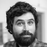
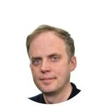
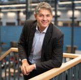
Mark van der Meijde is a Full Professor of Geophysics at the University of Twente, leading the Department of Earth Systems Analysis (ITC-ESA). His research focuses on Earth structure imaging through satellite geophysical sensors, with expertise in crustal dynamics, seismic methods, and geohazard analysis. He holds an MSc from Utrecht University and a PhD from ETH Zurich. Research interests include satellite geophysics integration, seismic imaging, and applications in resource exploration and disaster risk reduction. Key contributions include the ECM24 global crust model and studies on crustal composition in Africa and the Mediterranean. He has supervised 14 academic works and contributed to datasets on geothermal manifestations and landslide monitoring. Notable awards include the 2017 ECIU European award for Innovation in Teaching and Learning. His work aligns with UN Sustainable Development Goals related to climate action and clean energy. Recent activities include organizing the NEEDS conference and presenting on crustal imaging techniques. Labs/Teams: Active in the Earth Systems Analysis department at ITC, leading projects on seismic tomography, unmanned geophysical sensing, and global crustal modeling.
Hugo Ledoux is an academic affiliated with the Faculty of Architecture and the Built Environment at Delft University of Technology, specializing in Urban Data Science. His research focuses on 3D geospatial modeling, including CityGML standards, terrain analysis, and automated reconstruction of urban structures. He has contributed to projects like the DeltaDTM coastal terrain model and the cjdb database solution for CityGML. Education: Not explicitly detailed in text, but inferred through academic roles and publications. Research interests emphasize 3D geoinformation systems, remote sensing applications, and urban data science. His work addresses challenges in 3D city models, building reconstruction, and geospatial validation tools like Val3dity. Recent efforts include improving global terrain models using ICESat-2 and GEDI lidar data. Publications span automated building reconstruction workflows, terrain accuracy assessments, and semantic-guided facade modeling. Awards include the Best Presentation at 3DGeoInfo 2020 and the U.V. Helava Award for Best Paper in 2011. Ledoux has supervised 4 academic works and actively participates in conferences, editorial activities, and open-source software development for geospatial applications. Labs/Teams: Involved in TU Delft’s 3D geoinformation research, contributing to tools like 3dfier and CityJSON for 3D data interoperability.
Professor Tobias Blanke is a leading scholar at the University of Amsterdam and the Institute for Logic, Language, and Computation , with additional affiliation as Visiting Professor of Social and Cultural Informatics at King’s College London. His work bridges artificial intelligence and humanities disciplines. PhD in Computer Science and Political Philosophy Director of DARIAH (2012–2016) Head of Digital Humanities Department at KCL (2016–2019) Blanke’s research focuses on artificial intelligence and big data applications within the human sciences, emphasizing ethical implications such as: Predictive policing systems Algorithmic othering Platform monopolization Computational genealogy XML retrieval frameworks His recent publications demonstrate increasing interdisciplinary collaboration in digital humanities , with key partnerships at the Open Data Institute , TacticalTech , and British Library . While no formal awards are listed in available materials, his leadership in infrastructural projects like the European Holocaust Research Infrastructure highlights significant contributions to the field. Blanke maintains active teaching and research roles, leading initiatives like the International Artificial Intelligence PhD Academy courses for social sciences. His technical expertise spans: XML retrieval systems NoSQL database applications Algorithmic governmentality Digital publishing frameworks
Bram Droppers is a Researcher and ICT developer at the Department of Physical Geography, Utrecht University. His work focuses on modeling hydrological systems to address water scarcity, climate adaptation, and sustainable agriculture. He holds a PhD in Earth and Environmental Sciences from Wageningen University (2022), with prior degrees from the same institution (BSc 2014, MSc 2017). His research emphasizes large-scale hydrological models like PCR-GLOBWB and VIC, integrating them with agricultural models and applying deep learning techniques to improve accuracy and computational efficiency. His expertise spans Human Impact on Global Water Systems, Integrated Water Management, and Climate Modeling. Key themes include the interplay between socio-economic factors, climate change, and water resources. He has developed frameworks to assess water constraints on crop production and pioneered high-resolution global hydrological modeling approaches. Recent work explores deep-learning surrogates for process-based models to enhance scalability. Publications highlight analyses of water scarcity hotspots in Pakistan, California, and global basins, alongside model improvements for irrigation management and lake system dynamics. His research supports Sustainable Development Goals, particularly in balancing agricultural productivity with ecosystem protection. Current projects aim to refine global hydrological models for hyper-resolution applications and multi-model ensemble approaches. Bram’s career includes roles as ICT Manager and developer, ensuring technical infrastructure supports his research. He has secured grants through Wageningen’s WIMEK institute and collaborates internationally on initiatives like the ISIMIP Lake Sector. His work bridges computational innovation with environmental sustainability, addressing critical water challenges at planetary scales.
A. Bozzon is a Full Professor at Delft University of Technology, affiliated with the Department of Web Information Systems under the Faculty of Electrical Engineering, Mathematics and Computer Science. His research focuses on Human-Centered Artificial Intelligence (HCAI), emphasizing ethical AI, human-AI interaction, and societal implications. He has authored over 240 publications and secured 8 notable awards, including Best Paper Awards at CHI 2023 and 2025. Affiliations : Delft University of Technology Research Interests : AI ethics, human-AI collaboration, algorithmic fairness, and sustainable design. His work bridges technical innovation with social impact, addressing topics like mental health diagnostic tools, automation adoption in organizations, and greenspace accessibility. Key contributions include datasets on adverse drug reactions and AI-driven urban analysis. Collaborations span global institutions, reflecting his interdisciplinary approach. Awards : Best Paper Award at CHI 2023 Best Paper Award at CHI 2025 CTwalk Map: Best Demo Award (2024) Supervised 14 academic works, fostering next-generation researchers in HCAI. Active in policy discussions around AI governance and has pioneered tools like Amalur for FAIR data integration.
Michael H. Nagenborg is an Associate Professor in Philosophy specializing in the ethical dimensions of emerging technologies. His research bridges philosophy with practical applications in artificial intelligence, robotics, and geo-intelligence systems. His primary research interests include: Ethical frameworks for AI and robotics Philosophy of technology and empirical philosophy Geo-intelligence ethics and algorithmic fairness Drone data ethics and harm prevention Urban technology ethics and smart city applications Analysis of his recent publications reveals a growing focus on bridging empirical philosophy with design practices, particularly in geo-intelligence and AI ethics. His work increasingly addresses accountability, fairness, and harm prevention in technological applications, with notable contributions to algorithmic fairness through causality and drone data ethics. Dr. Nagenborg has an active research profile with 69 publications since 2004, showing increased productivity in recent years. His work demonstrates strong interdisciplinary connections between philosophy, computer science, and urban studies.
Derya Demirtas serves as Associate Professor at the University of Twente within the Center for Healthcare Operations Improvement & Research (CHOIR), Digital Society Institute, and TechMed Centre. Her academic home resides in the Department of Industrial Engineering and Business Information Systems under the Faculty of Engineering Technology. Education: BSc in Industrial Engineering & Computer Engineering, Middle East Technical University (2008) MMath in Combinatorics & Optimization, University of Waterloo (2010) PhD in Industrial Engineering, University of Toronto (2016) Dr. Demirtas specializes in applying operations research and optimization techniques to healthcare and humanitarian challenges. Her work integrates spatial data analytics with facility location theory to solve critical problems including emergency response systems, radiotherapy optimization, and disaster recovery logistics. Current research focuses on data-driven decision frameworks that address uncertainty in both demand patterns and resource availability. Her publication portfolio reveals strong emphasis on healthcare operations, with recent work exploring wearable technology for cardiac arrest detection, machine learning applications for nursing burnout prediction, and optimization models for emergency medical services. These contributions demonstrate consistent focus on translating theoretical operations research into life-saving practical implementations. Scientific Recognition: NWO Veni Talent Grant (2019) American Heart Association Young Investigator Award (2015) INFORMS Public Sector OR Best Paper Competition (2nd place, 2012) Best Poster Award, National Association of EMS Physicians (2016) Dr. Demirtas actively shapes academic discourse through editorial roles including Associate Editor for Health Care Management Science and Area Editor for Health Systems. Her supervision portfolio includes four PhD candidates working on defibrillator placement, South African hospital processes, clinical chemistry optimization, and radiotherapy logistics. Current research projects involve collaborations with UMC Amsterdam, HartslagNu, Dutch Heart Foundation, and Georgia Tech, focusing on improving cardiac arrest response systems and healthcare operations across multiple continents. Her laboratory work centers around the CHOIR research group which develops optimization frameworks for healthcare operations, with particular emphasis on emergency response systems and resource allocation under uncertainty. The TechMed Centre affiliation enables cross-disciplinary collaboration between engineering, medical, and data science experts to translate research into clinical practice.
Mitko Veta is an Associate Professor in the Department of Biomedical Engineering at Eindhoven University of Technology (TU/e), specializing in medical image analysis. His research focuses on developing deep learning methods for histopathology image analysis to enhance diagnostic accuracy and reduce pathologist workload. He leads the Medical Image Analysis group, contributing to automated quantitative tools for pathology reporting and treatment planning. Academic Background: Veta earned his M.Sc. in Electrical Engineering from Ss. Cyril and Methodius University (Macedonia, 2009), followed by a Ph.D. in histopathology image analysis at University Medical Center Utrecht (2014). He joined TU/e as a postdoc in 2014 and became an assistant professor in 2016, advancing to his current role in 2021. Research Interests: His work spans histopathology image analysis, deep learning, domain adaptation, and applications in oncology (e.g., breast cancer, melanoma). He develops algorithms for mitosis detection, tumor-infiltrating lymphocyte assessment, and AI-driven clinical decision support. Key contributions include the MIDOG++ dataset and the LYSTO benchmark. Projects: He co-leads the Spectralligence AI project (2021–2024), focusing on AI-driven medical imaging solutions. His research addresses clinical challenges like myocardial scar quantification and checkpoint inhibitor treatment outcomes. Teaching: Veta teaches courses such as Machine Learning in Medical Imaging and Biology and AI for Medical Image Analysis , emphasizing practical applications of AI in healthcare.
Jeroen Grift is a Researcher in the Department of Earth Observation Science, specializing in geospatial methodologies for cadastral boundary delineation and agricultural monitoring. Earth Observation Remote Sensing Geographic Information Systems (GIS) Land Administration Spatial Data Analysis Geospatial Artificial Intelligence (AI) Grift's recent work focuses on creating benchmark datasets like CadastreVision and AI4SmallFarms . These resources leverage multi-resolution earth observation imagery and deep learning algorithms to address challenges in cadastral mapping and crop field delineation. His research emphasizes improving spatial resolution, accuracy, and automation in geospatial data analysis, with applications for land rights and smallholder farming systems in Southeast Asia.
Nandika Tsendbazar is an Assistant Professor at the Department of Geo-information Science and Remote Sensing at Wageningen University & Research. She leads research in land cover mapping, remote sensing applications, and environmental monitoring. Her work focuses on global land cover dynamics, satellite time series analysis, and geospatial data integration for sustainability challenges. Research Interests: Land Cover Mapping & Change Detection Remote Sensing of Ecosystems Drone Technology Integration Urban-Rural Environmental Inequality GIS Applications in Conservation Recent Articles Highlight: Her 2025 study on Peruvian Amazon drone mapping and 2024 global land cover validation work demonstrate her expertise in advancing geospatial techniques for environmental analysis. Ongoing projects include Mongolian grassland resilience and Ramsar wetland monitoring. Advising: Supervises PhD research on tree diversity monitoring, Mongolian grasslands, and crop anomaly detection through remote sensing. Active in 13+ research projects with international collaborators. Labs/Teams: Member of the Laboratory of Geo-information Science and Remote Sensing, contributing to global land cover products like Copernicus and ESA WorldCover initiatives.
Albrecht H. Weerts is a Professor specializing in Hydrology and Environmental Hydraulics at Deltares, an independent research institute in the Netherlands, since July 2002. His work focuses on advancing hydrological modeling, flood forecasting, and climate change impacts. He leads multiple interdisciplinary projects addressing water resource challenges globally. Research Interests: - Hydrological modeling and data assimilation - Flood forecasting systems - Climate change impacts on water systems - Remote sensing applications in hydrology - Soil-water dynamics and catchment processes Recent Work Trends: His publications emphasize innovative methods for improving hydrological model accuracy, integrating machine learning for reservoir management, and applying advanced Kalman filters for real-time data assimilation. Recent studies also highlight applications in Thailand, the Rhine Basin, and the Tugela River. Advising & Projects: - Supervising 5 active PhD candidates focusing on flood forecasting, groundwater dynamics, and plastic transport modeling - Leading projects on climate scenario modeling, digital twin technologies, and agricultural water management Labs/Teams: Core contributor to Deltares' hydrological research teams, collaborating with institutions like Wageningen University and the University of Twente. Active in open-source hydrological modeling frameworks such as wflow_sbm.
Sytze de Bruin is an associate professor in Geographical Information Science at Wageningen University & Research, affiliated with the Laboratory of Geo-information Science and Remote Sensing. He holds an MSc in Soil Science and a PhD in Geo-information Science from Wageningen University. Previously, he worked as an applied soil scientist in Central America (Costa Rica and Nicaragua) before returning to the Netherlands. His research focuses on spatial and temporal analysis, uncertainty quantification, precision agriculture, and geostatistical methods. Key areas include data acquisition, spatio-temporal interpolation, and the application of GIS in environmental and agricultural contexts. He has contributed to over 100 publications and serves on the editorial boards of the International Journal of Geographical Information Science and Spatial Statistics . Recent work includes projects like Fields2Cover (optimizing agricultural paths to reduce soil compaction) and Smart Emission 2 (citizen science for air quality monitoring). His expertise spans spatial analysis, remote sensing, and quantitative methods, with applications in land degradation assessment and precision agriculture. Teaching responsibilities include courses on spatial modeling, remote sensing integration, and MSc thesis supervision in geo-information science. His lab emphasizes translating data into actionable geo-information through interdisciplinary approaches.
Hans van der Kwast is an academic affiliated with IHE Delft Institute for Water Education since 2012. He previously worked as a researcher at the Flemish Institute for Technological Research (VITO) between 2007 and 2012, focusing on spatial dynamic environmental modeling. His teaching emphasizes Free and Open Source Software (FOSS) and open data for professionals in the Global South, fostering innovative entrepreneurship. At IHE Delft, he coordinates eLearning support for partners and leads research on spatial data infrastructure (SDI), Citizen Observatories, and remote sensing for water productivity. He is a QGIS Certified Lecturer, developing OpenCourseWare, online courses, and training programs in GIS, remote sensing, and hydrological modeling. He initiated the GIS OpenCourseWare platform and authored the book QGIS for Hydrological Applications . He contributes actively to the QGIS and FOSS4G communities, serves on the Dutch QGIS User Group board, and developed the PCRaster Tools plugin for QGIS. His YouTube channel, with over 17k subscribers, provides tutorial videos on GIS and remote sensing. His research spans water resource management, climate change impacts, and environmental modeling, with a focus on tropical regions. He has collaborated on projects addressing nitrogen dynamics in rivers, floodplain inundation mapping, and uncertainty analysis in remote sensing-derived evapotranspiration estimates. Van der Kwast’s work integrates technology and education to enhance capacity building in water management, particularly leveraging open data and collaborative platforms. His contributions bridge academic research with practical training, emphasizing sustainability and innovation in developing contexts.
Sanneke Kloppenburg is a Researcher in the Department of Environmental Policy at Wageningen University. She holds a PhD in Sociology from the University of Amsterdam (2013) and has conducted postdoctoral research at Wageningen University (2015–2018) and Maastricht University UNU-MERIT (2014–2015). Her research focuses on digital technologies’ implications for sustainability transitions in energy, mobility, and food systems. She examines platformization, blockchain, and datafication’s societal impacts, emphasizing equity and environmental governance. Key projects include the ShaRepair initiative for circular economy practices, StoRE (energy storage in households), and JustRES (social justice in renewable energy strategies). She co-leads the DigiMetis network, exploring digitalization’s societal implications in agrifood, natural resources, and circular economies. Kloppenburg teaches courses on environmental sociology, smart environments, and advanced social theory, integrating practice theory with digital sociology. Her work bridges academic and applied contexts, addressing ethical and governance challenges in emerging technologies. Recent publications explore topics like circular consumption rebound effects, digital twins in environmental governance, and blockchain applications in food systems.
R. Van de Plas is a Researcher at Delft University of Technology (TU Delft) , leading the Team Raf Van de Plas . His work bridges Mass Spectrometry Imaging , data analysis , and chemical imaging applications in biomedical and cultural heritage domains. Recent contributions include molecular atlases of human kidney tissues , advanced MALDI imaging matrices , and automated data workflows for multimodal imaging. His research emphasizes high-resolution spatial analysis , reproducibility in computational methods , and interdisciplinary collaboration with institutions like Vanderbilt University Medical Center and the University of Antwerp. Current projects focus on preserving full spectral data and integrating multiplexed imaging modalities for cellular and tissue-level studies. Outputs include open datasets on platforms like 4TU.ResearchData .