
About
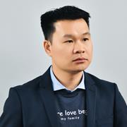
Dr. Trung Nguyen is a Research Fellow in Remote Sensing of Fire at RMIT University’s School of Science, specializing in Mathematical and Geospatial Sciences. He is a core member of the Remote Sensing Research Group, focusing on advancing remote sensing technologies for environmental applications, including forest ecosystem dynamics, wildfire research, and geospatial frameworks integrating LiDAR and satellite data. His work emphasizes GeoAI techniques like machine learning and deep learning to analyze forest vertical fuel structures and carbon cycle implications.
- Affiliations: RMIT University, School of Science
- Key Roles: Postdoctoral Researcher, Remote Sensing Research Group Member
Research Interests: Forest monitoring, wildfire dynamics, land-use planning, biodiversity conservation, and agricultural innovation. His methodologies include airborne (ALS), terrestrial (TLS), and spaceborne LiDAR (e.g., GEDI), alongside multi-sensor satellite data (e.g., Landsat, Sentinel).
Trung has held non-academic roles as a Natural Resource Expert at the International Centre for Environmental Management (ICEM) and a Senior Data Analyst at the Victorian Department of Environment, Land, Water and Planning. His research contributes to UN Sustainable Development Goals 13 (Climate Action), 15 (Life on Land), and 17 (Partnerships for the Goals).
Find Trung Nguyen elsewhere
Related Searches
You Might Also Like
 Ilia ParshakovQueen's University at Kingston · Research Fellow
 Dirk PflugmacherHumboldt University · Researcher
 Matthew ClarkSonoma State University · Professor
 Nicolò CamarrettaUniversity of Göttingen · Researcher
 Iosif VorovenciiTransilvania University of Brasov · Professor
 Hankui ZhangSouth Dakota State University · Associate Professor